
Interstate 80 (I-80) is a vital artery for travel across the United States, particularly its northernmost stretch through California. This transcontinental highway connects the San Francisco Bay Area to the Great Salt Lake Desert in Utah, serving as a critical route for commuters, commercial trucking, and long-distance travelers. Given its importance, understanding the current status of I-80, especially regarding closures, is paramount for anyone planning a journey. This article delves into the factors that can lead to I-80 closures in California, how to find real-time information, and what alternatives exist when the main route is impassable.

Understanding I-80 Closures in California
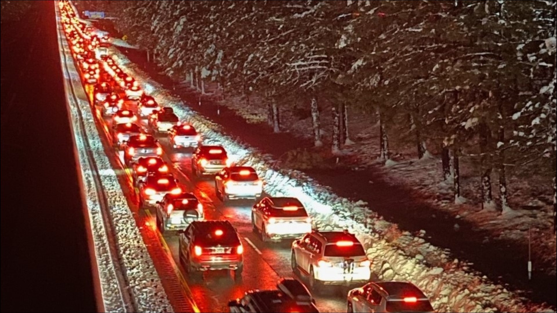
Closures on I-80 in California are typically dictated by severe weather conditions, especially during the winter months. The Sierra Nevada mountain range, which I-80 traverses, is prone to heavy snowfall, icy conditions, and high winds, creating hazardous driving environments. Beyond meteorological events, accidents, construction, and emergency situations can also necessitate temporary or extended closures.
Winter Weather Impacts
The mountainous sections of I-80, particularly between Sacramento and the Nevada border, are most susceptible to winter weather-related closures. Snowstorms can blanket the highway with several feet of snow, making it impassable for even well-equipped vehicles. Icy conditions, often exacerbated by freezing rain or rapid temperature drops, can create treacherous driving surfaces, leading to chain control requirements or complete road closures for safety. Caltrans, the California Department of Transportation, plays a crucial role in monitoring these conditions and implementing necessary measures.
Road Conditions and Advisories
Caltrans utilizes a sophisticated network of sensors, weather stations, and patrols to monitor highway conditions. When hazardous weather is forecast or present, they issue advisories that can range from reduced speed limits and chain requirements to full closures. Chain controls are particularly common on I-80 during winter. Drivers may be required to install tire chains on their vehicles to maintain traction. The specific type of chain requirement (R1, R2, or R3) dictates the level of restriction, with R3 typically meaning all vehicles, including 4x4s, must use chains or face being prohibited from entering the affected section. Understanding these advisories is essential for safe travel.
Accidents and Construction
While less frequent than weather-related disruptions, significant accidents or ongoing construction projects can also lead to I-80 closures. Major incidents involving multiple vehicles or hazardous materials require extensive cleanup and investigation, often resulting in prolonged closures. Similarly, large-scale construction or maintenance projects, such as bridge repairs or repaving, may necessitate lane closures or full weekend closures to expedite work and minimize long-term disruption. Caltrans aims to schedule major construction during periods of lower traffic volume, but unforeseen circumstances can always arise.
How to Find Real-Time I-80 Closure Information
Staying informed about the current status of I-80 is critical for travelers. Fortunately, several reliable resources provide up-to-the-minute information. Proactive checking of these resources before and during your trip can prevent unexpected delays and ensure a safer journey.
Caltrans QuickMap
The most authoritative source for real-time road conditions in California is the Caltrans QuickMap. This online platform and mobile application provides a comprehensive overview of traffic, incidents, lane closures, and construction projects on state highways, including I-80. Users can view a map interface that color-codes different traffic conditions and displays icons for specific incidents or closures. QuickMap also allows users to select specific routes and receive alerts for events along their planned journey. It is an indispensable tool for anyone traveling on California highways.
Other Official Sources
In addition to Caltrans QuickMap, other official sources can offer valuable information. Local news stations often report on significant closures, especially those affecting major routes like I-80. Radio traffic reports, particularly during peak commute times, can also provide updates. For those traveling to or from Nevada, the Nevada Department of Transportation (NDOT) website offers similar real-time information for highways within that state.
Social Media and Traveler Apps
Many travelers also rely on social media platforms and dedicated travel applications for quick updates. Following Caltrans on platforms like Twitter can provide immediate notifications about significant events. Apps like Waze and Google Maps often integrate real-time traffic data and user-reported incidents, which can include road closures and delays on I-80. While these platforms are excellent supplements, it’s always advisable to cross-reference information with official sources like Caltrans QuickMap for the most accurate and verified details.
Navigating I-80 Closures: Detours and Alternatives
When I-80 is closed in California, travelers face the challenge of finding alternative routes. The availability and suitability of detours depend heavily on the location and nature of the closure. Planning for potential detours in advance can significantly ease the stress of encountering an unexpected road closure.
State Routes and Local Roads
Depending on the specific closure point, several state routes and local roads can serve as detours. For instance, if a closure occurs in the Sierra Nevada, alternatives might include State Route 50 (SR 50), which also crosses the Sierra Nevada but typically at a slightly lower elevation and with different weather susceptibilities. Other, more winding local roads may be available, but these are often slower, less maintained, and not suitable for large vehicles or during adverse weather. It is crucial to consult a reliable GPS or mapping service that incorporates current traffic data when selecting a detour.
Planning Ahead for Potential Closures
For travelers undertaking long-distance journeys on I-80, especially during the winter months, it is prudent to build flexibility into their travel plans. This might involve allocating extra time for the journey, having alternative route options mapped out, and checking road conditions frequently before departing and at regular intervals during the trip. If a significant closure is anticipated or in effect, considering postponing the trip or altering the itinerary to avoid the affected section of I-80 might be the safest and most efficient course of action.
Impact on Commercial Travel
The closure of I-80 has a substantial impact on commercial trucking and freight transportation. As a primary east-west corridor, I-80 is essential for moving goods across the country. Closures can lead to significant delays, increased fuel costs due to longer routes, and potential disruptions to supply chains. Trucking companies and logistics providers closely monitor I-80 conditions and often have contingency plans in place to reroute shipments when necessary. This underscores the economic importance of maintaining the operational status of this key highway.
Alternatives and Considerations for Bay Area Commuters
For residents of the San Francisco Bay Area who rely on I-80 for their daily commute, closures can cause significant disruption. Understanding the typical causes of these disruptions and having alternative commuting strategies is beneficial.
Morning and Evening Commutes
During typical commute hours, even partial lane closures or accidents on I-80 can lead to severe traffic congestion, extending travel times significantly. Caltrans often implements ramp metering and variable speed limits to manage traffic flow, but these measures have limitations during major incidents. For commuters, staying updated via real-time traffic apps and radio reports is essential for making informed decisions about departure times or alternative routes.
Public Transportation Options
The Bay Area offers a robust public transportation network that can serve as a viable alternative to driving on I-80, especially during periods of significant congestion or closure. Agencies like BART (Bay Area Rapid Transit) provide rail service across the Bay Bridge and connect various East Bay communities with San Francisco. Other options include AC Transit buses and ferry services, which can bypass road traffic entirely. Exploring these public transit alternatives can often be more reliable and less stressful than navigating the unpredictable traffic on I-80.

Long-Term Planning and Future Projects
Caltrans and regional transportation agencies are continuously working on projects to improve the reliability and capacity of I-80. These can include expanding lanes, upgrading infrastructure, and implementing intelligent transportation systems. While these projects are designed to enhance the long-term travel experience, they can sometimes lead to temporary disruptions, including construction-related closures. Staying informed about upcoming projects and their potential impact is part of long-term travel planning for those who frequently use I-80. The ongoing efforts to improve this vital corridor aim to mitigate future closure-related issues and enhance overall travel efficiency and safety.
LifeOutOfTheBox is a participant in the Amazon Services LLC Associates Program, an affiliate advertising program designed to provide a means for sites to earn advertising fees by advertising and linking to Amazon.com. Amazon, the Amazon logo, AmazonSupply, and the AmazonSupply logo are trademarks of Amazon.com, Inc. or its affiliates. As an Amazon Associate we earn affiliate commissions from qualifying purchases.