
Planning a road trip through the vast and scenic landscapes of South Dakota requires careful preparation, and understanding current road conditions is paramount. Whether you’re aiming for the majestic peaks of the Black Hills or the iconic monuments of the Badlands, knowing about any road closures can prevent significant delays and ensure a smoother journey. This guide will help you navigate the resources available to check for real-time road status across the state, focusing on official sources and key areas to monitor.
Understanding South Dakota’s Road Network
South Dakota boasts an extensive network of roads, from major interstates like I-90 and I-29 to numerous state highways and county roads that wind through its diverse geography. The condition of these routes can be influenced by a variety of factors, including weather, construction, and special events.

Seasonal Influences on Road Conditions
The climate in South Dakota presents unique challenges for road maintenance.
Winter Weather and Road Closures
During the winter months, from roughly November through March, snow and ice are the primary culprits behind road closures. Heavy snowfall can lead to impassable conditions, especially on rural routes and higher elevation roads. Ice accumulation can make even well-maintained highways treacherous. The South Dakota Department of Transportation (SDDOT) actively monitors weather patterns and deploys snowplows and de-icing crews. However, safety always takes precedence, and closures are implemented when conditions warrant. Routes in the Black Hills, such as sections of US Highway 16A or the Iron Mountain Road, are particularly susceptible to temporary closures due to snow.
Spring Thaw and Construction
As winter recedes, the spring thaw can lead to another set of issues. Saturated ground can weaken roadbeds, sometimes resulting in temporary closures of less-traveled routes to prevent damage. More significantly, spring and summer mark the peak season for road construction and maintenance projects across the state. To improve infrastructure, resurfacing, bridge work, and other repairs are undertaken. These projects often necessitate lane closures, detours, or even full closures of certain roads for extended periods.
Summer and Fall Travel Considerations
While summer and fall generally offer more stable road conditions, it’s not uncommon for unexpected closures to occur due to flash floods, particularly in the western part of the state near the Missouri River or after intense thunderstorms. Large events, such as the Sturgis Motorcycle Rally in August, can also lead to temporary traffic restrictions or closures on specific routes surrounding Sturgis and throughout the Black Hills.
Official Sources for Road Closure Information
The most reliable and up-to-date information regarding road closures in South Dakota comes directly from official channels. Staying informed requires knowing where to look.
South Dakota Department of Transportation (SDDOT)
The SDDOT is the primary authority responsible for the state’s highway system. They provide comprehensive tools and resources for travelers.
SDDOT 511 Traveler Information System
The cornerstone of real-time road information in South Dakota is the 511 Traveler Information System. This system is designed to give travelers the information they need to make informed decisions before and during their trips.
- Website Access: The SDDOT 511 website offers an interactive map displaying current road conditions, construction zones, and reported closures. You can zoom in on specific areas of interest, such as Rapid City, Sioux Falls, or national parks like Wind Cave National Park or Custer State Park.
- Mobile App: For convenience on the go, the SDDOT often provides a mobile application that mirrors the website’s functionality, allowing you to check conditions from your smartphone.
- Phone Information: Travelers can also dial “511” from within South Dakota to access an automated phone system providing current road and weather alerts. For calls outside the state, the number is typically 1-866-MYSD511.
Specific Information Provided by SDDOT 511
The 511 system typically provides:
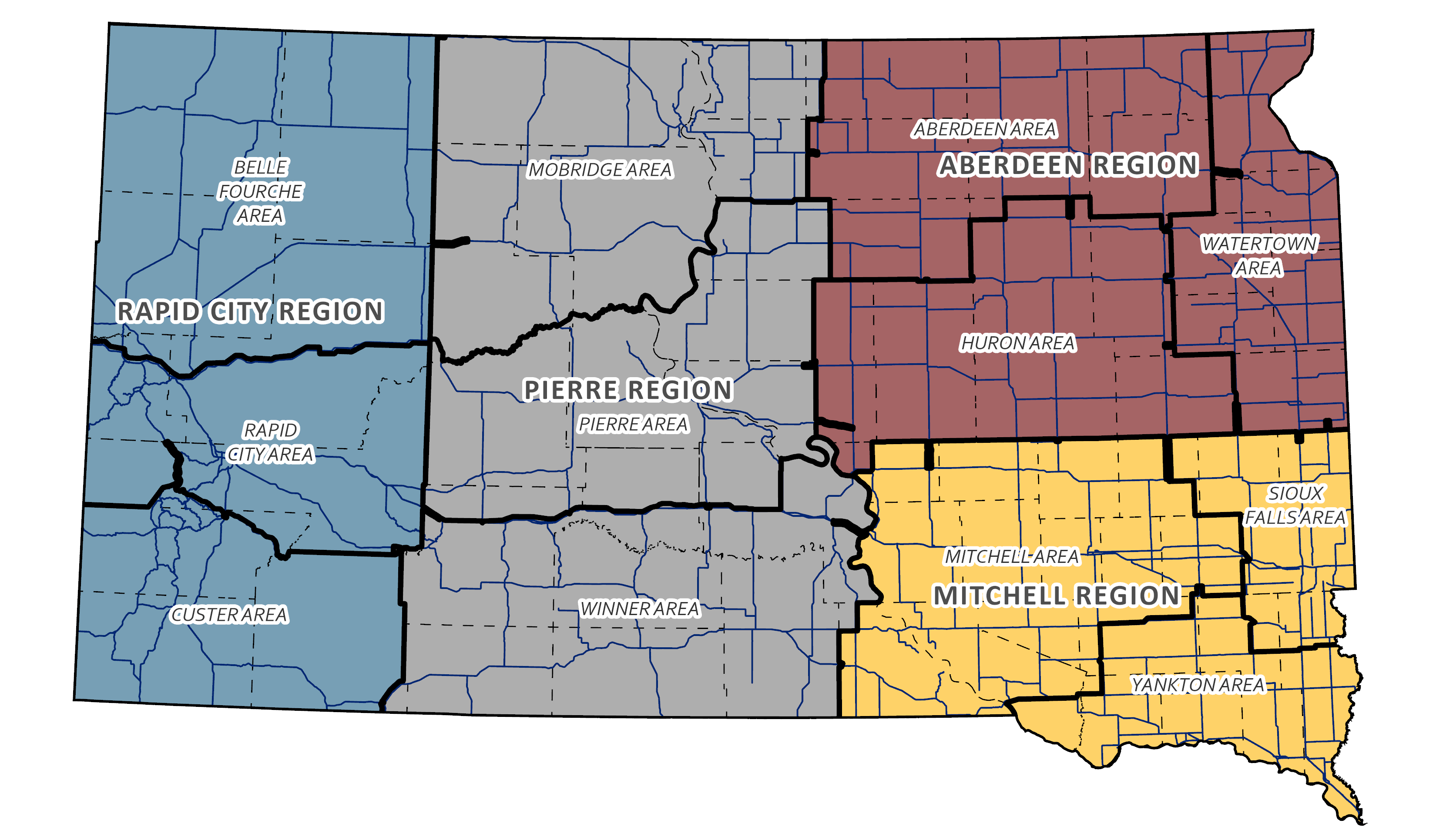
- Active Closures: Clearly marked locations where roads are completely shut down.
- Lane Restrictions: Information about ongoing construction where lanes are closed or reduced.
- Detours: Suggested alternative routes around closed sections.
- Travel Advisories: Warnings about hazardous conditions such as ice, snow, fog, or high winds.
- Winter Road Conditions: Color-coded maps indicating the status of highways (e.g., green for clear, yellow for wet or icy, red for closed).
- Construction Updates: Details on planned and ongoing projects that might affect travel times.
Local Law Enforcement and Emergency Services
In addition to the state transportation department, local authorities play a crucial role in managing and reporting road closures, especially for smaller county roads or in specific municipalities.
- County Sheriff’s Offices: For rural areas and county roads, the local county sheriff’s office may have the most immediate information on closures due to localized weather events or emergencies.
- Municipal Police Departments: City police departments will have information regarding closures within their city limits, which might be due to events, accidents, or localized utility work.
While less centralized than the SDDOT, checking the websites or social media feeds of these local entities can provide granular details for specific towns and regions.
Monitoring Key Travel Corridors and Attractions
When planning a trip to popular destinations in South Dakota, it’s wise to pay special attention to the routes leading to them.
Interstate 90 and Interstate 29
As the primary east-west and north-south arteries, I-90 and I-29 are generally well-maintained and are the first to be cleared after winter storms. However, during severe weather events, even these major interstates can be temporarily closed to traffic for safety. Travelers heading to or from cities like Sioux Falls (on I-90 and I-29), Mitchell, or Chamberlain should always check 511 before departing.
Routes through the Black Hills
The Black Hills region is a major tourist draw, and its network of scenic byways and highways can be affected by weather and seasonal closures.
- Needles Highway (SD 87): This iconic route, part of the Peter Norbeck National Scenic Byway, is typically closed from November through April due to snow and ice.
- Iron Mountain Road (US 16A): Similar to Needles Highway, this route with its distinctive tunnels and pigtail bridges can face winter closures.
- Badlands National Park and Badlands Loop Road (SD 240): While main roads are usually open, unpaved roads within the park can become impassable after rain. The Badlands Loop Road itself is generally maintained year-round, but extreme weather can cause temporary issues.
- Custer State Park: Many of the park’s internal roads, especially those at higher elevations, are subject to seasonal closures. It’s always advisable to check the Custer State Park website or call their office for the most current information.
Roads near the Missouri River
The Missouri River and its surrounding lakes, such as Lake Oahe and Lake Sharpe, are popular for recreation. Roads leading to boat ramps and campgrounds can sometimes be affected by high water levels or flash flooding, particularly after heavy rains.
Planning Your Trip with Road Conditions in Mind
Being proactive about checking road closures can significantly enhance your travel experience in South Dakota.
Pre-Trip Preparation
- Check Before You Leave: Before embarking on your journey, make it a habit to visit the SDDOT 511 website or use the mobile app. Do this not only before you leave home but also before starting any significant leg of your trip within the state.
- Have a Backup Plan: If your intended route is closed, having an alternative in mind can save you time and frustration. Familiarize yourself with parallel routes or major arteries that can serve as detours.
- Pack Accordingly: If traveling during winter, ensure your vehicle is equipped for winter driving with good tires, an emergency kit, and extra supplies.

During Your Trip
- Stay Updated: If you’re on a longer road trip, check 511 daily, or even multiple times a day, especially if traveling through areas known for unpredictable weather.
- Heed Warning Signs: Always obey posted signs regarding road closures, speed limits, and hazardous conditions. They are there for your safety.
- Communicate Your Itinerary: Let someone know your planned route and expected arrival times, especially if traveling in remote areas.
By leveraging the resources provided by the South Dakota Department of Transportation and staying informed about potential disruptions, you can ensure your exploration of the Mount Rushmore State is as smooth and enjoyable as possible, allowing you to fully appreciate its natural beauty and iconic landmarks.
LifeOutOfTheBox is a participant in the Amazon Services LLC Associates Program, an affiliate advertising program designed to provide a means for sites to earn advertising fees by advertising and linking to Amazon.com. Amazon, the Amazon logo, AmazonSupply, and the AmazonSupply logo are trademarks of Amazon.com, Inc. or its affiliates. As an Amazon Associate we earn affiliate commissions from qualifying purchases.