
The approach of a tropical storm or hurricane towards Florida is a significant concern for residents, visitors, and businesses alike. Understanding the timing, intensity, and potential impact of these weather systems is crucial for preparedness and safety. This guide aims to provide clarity on how storm information is disseminated and what factors influence a storm’s trajectory towards the Sunshine State.
Understanding Tropical Weather Systems
Tropical cyclones, which include tropical depressions, tropical storms, and hurricanes, are powerful weather phenomena characterized by rotating winds and heavy rainfall. They form over warm ocean waters and draw energy from these conditions. The intensity of these storms is classified using scales such as the Saffir-Simpson Hurricane Wind Scale, which categorizes hurricanes from Category 1 (least severe) to Category 5 (most devastating) based on sustained wind speeds.

Formation and Early Detection
The genesis of a tropical cyclone typically begins with a cluster of thunderstorms over tropical or subtropical waters. As these storms organize and develop, they can evolve into a tropical depression, then a tropical storm (marked by sustained winds of 39 mph or higher and given a name), and eventually, if conditions permit, a hurricane (with sustained winds of 74 mph or higher).
The National Hurricane Center (NHC) plays a pivotal role in monitoring these systems. Using a network of satellites, aircraft reconnaissance, buoys, and weather models, the NHC tracks the development and movement of tropical disturbances across the Atlantic and Eastern Pacific basins. Early advisories are issued as soon as a system shows potential for organization and development, providing crucial lead time for coastal communities.
Factors Influencing Storm Tracks
Predicting the exact path of a tropical storm or hurricane is a complex science, influenced by a multitude of atmospheric factors. Several key elements dictate whether a storm will head towards Florida and what its eventual landfall location might be.
- Steering Currents: The most significant influence on a storm’s track is the large-scale wind patterns in the atmosphere. These “steering currents” act like a river, guiding the storm’s movement. High-pressure systems (like the Bermuda-Azores High) and low-pressure troughs can create these currents. If a ridge of high pressure is strong to the north of a storm, it can deflect it westward, potentially towards the United States. Conversely, a strong trough digging southward can pull a storm northward or northeastward.
- Intensity: A storm’s intensity can also affect its track. Stronger hurricanes tend to move more erratically, while weaker storms are more susceptible to steering currents.
- Land Interaction: When a storm approaches land, its interaction with the coastline and topography can alter its path and intensity. Coastal landforms can create frictional effects that weaken a storm, while bays and inlets might channel its energy.
- Ocean Temperatures: While not directly steering a storm, warm ocean waters provide the fuel for its intensification. This can influence how strong a storm becomes, which, in turn, can indirectly affect its track.
Monitoring and Forecasting Storms Heading to Florida
The NHC provides a continuous stream of information regarding tropical cyclones. For those in or planning to visit Florida, staying informed about these advisories is paramount.
The Role of the National Hurricane Center
The NHC issues several types of advisories:
- Tropical Weather Outlooks: These are issued regularly during hurricane season (June 1 to November 30) to highlight areas where tropical cyclone formation is possible within the next 48 hours or 5 days.
- Tropical Storm and Hurricane Watches: A Watch is issued when conditions are possible within a specified area within 48 hours. This is the time to start making preparations.
- Tropical Storm and Hurricane Warnings: A Warning is issued when conditions are expected within a specified area within 36 hours. This is when evacuation orders may be issued, and immediate action is critical.
These advisories are disseminated through various channels, including the NHC website, NOAA Weather Radio, local news media, and emergency management agencies.
Cone of Uncertainty
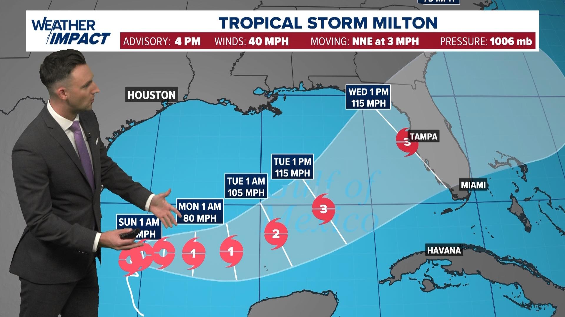
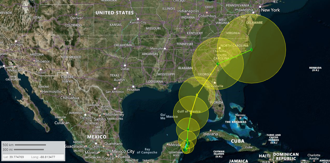
One of the most important graphics provided by the NHC is the “Cone of Uncertainty.” This graphical representation shows the probable track of the center of a tropical cyclone. It depicts the average track error over the past 10 years for the forecast intensity and the potential area where the center of the storm could track.
It’s crucial to understand that the cone does not indicate the area where the storm’s impacts (wind, rain, storm surge) will be felt. The dangerous effects of a tropical storm or hurricane can extend hundreds of miles from the center. Therefore, residents and visitors in areas well outside the cone should still prepare for potential impacts.
Model Guidance and Forecast Evolution
Meteorologists use a suite of computer models to forecast a storm’s track. These models, such as the GFS (Global Forecast System), the ECMWF (European Centre for Medium-Range Weather Forecasts), and the HWRF (Hurricane Weather Research and Forecasting model), process vast amounts of atmospheric data to simulate future weather patterns.
The NHC analyzes the output from multiple models, looking for consensus and divergence. As a storm approaches, more data becomes available, and the forecast becomes more refined. Forecasts are updated every few hours, so it’s essential to monitor the latest advisories. A storm’s path can change significantly in a matter of hours, especially in the initial stages of its development or when interacting with other weather systems.
Preparing for a Storm in Florida
When a storm is projected to hit Florida, timely and effective preparation is key to ensuring safety and minimizing damage.
Evacuation Zones and Orders
Many coastal areas in Florida are designated as evacuation zones based on their vulnerability to storm surge, a potentially deadly rise in sea level associated with hurricanes. If an evacuation order is issued for your area, it must be taken seriously. These orders are not discretionary and are designed to protect lives. Familiarize yourself with your local evacuation zone and the designated evacuation routes before hurricane season begins.
Emergency Supply Kits
A well-stocked emergency supply kit is essential. It should include items to sustain you and your family for at least 72 hours.
- Water: One gallon per person per day.
- Food: Non-perishable items like canned goods, energy bars, and dried fruits.
- First-aid kit: Including any necessary prescription medications.
- Flashlight and batteries:
- Radio: Battery-powered or hand-crank NOAA Weather Radio.
- Multi-tool:
- Sanitation items: Wet wipes, garbage bags, and plastic ties.
- Wrench or pliers: To turn off utilities.
- Whistle: To signal for help.
- Local maps:
- Cell phone with chargers and a backup battery:
- Cash: ATMs may not work if power is out.
Securing Your Property
For those who are not under an evacuation order, securing your home is critical.
- Windows and Doors: Board up windows with plywood or install storm shutters. Secure any doors, including garage doors.
- Outdoor Items: Bring inside or securely tie down any loose outdoor items such as patio furniture, trash cans, bicycles, and decorations. These can become dangerous projectiles in high winds.
- Trees and Landscaping: Trim dead or weak branches from trees. Secure any large potted plants.
- Utilities: Know how to shut off gas and electricity if necessary, but only do so if instructed by authorities or if there is a clear danger.
- Generator Safety: If you have a generator, ensure it is properly maintained and operated outdoors, away from windows and doors, to prevent carbon monoxide poisoning.
What to Do If You Are Visiting Florida During Storm Season
For tourists and visitors in Florida during hurricane season, the preparation steps are similar but require a different approach.
Staying Informed While Traveling
If you are staying in a hotel or resort, such as the Disney’s Grand Floridian Resort & Spa or the Fontainebleau Miami Beach, your accommodation will likely have established hurricane preparedness plans. These may include procedures for guest safety, potential evacuations, and communication protocols.
- Monitor Local News: Pay close attention to local news channels, radio stations, and the NHC website for the latest storm information.
- Hotel Communication: Stay in contact with your hotel or resort management for any updates or instructions. They will be your primary source of information regarding on-site safety measures and potential disruptions to services or activities.
- Emergency Plans: If you are traveling with family or a group, establish a communication plan and a meeting point in case you are separated.
Travel Disruptions and Cancellations
Storms can significantly impact travel plans. Airports like Miami International Airport and Orlando International Airport may experience flight cancellations or delays. Cruise lines operating out of ports such as Port Everglades may alter itineraries or cancel sailings.
- Airline and Cruise Line Policies: Familiarize yourself with the cancellation and rebooking policies of your airline or cruise line well in advance.
- Travel Insurance: Consider purchasing travel insurance that covers weather-related cancellations and disruptions.
- Flexibility: Be prepared for potential changes to your itinerary and maintain flexibility in your plans.
Understanding Storm Surge and Inland Flooding
Even if you are not in a coastal area, inland flooding can be a significant threat. Storms can bring torrential rainfall that overwhelms drainage systems, leading to dangerous flood conditions.
- Low-Lying Areas: Be aware of your surroundings, especially if you are in a low-lying area. Avoid driving or walking through flooded streets, as even a few inches of moving water can be extremely dangerous.
- Storm Surge Risk: If your accommodation is near the coast, be aware of the potential for storm surge. Follow any evacuation orders issued by local authorities promptly. Attractions like Everglades National Park can be particularly vulnerable to flooding and storm surge.
By understanding the forecasting process, staying informed, and taking proactive preparedness measures, both residents and visitors can navigate the challenges posed by tropical weather systems in Florida more safely and effectively.
LifeOutOfTheBox is a participant in the Amazon Services LLC Associates Program, an affiliate advertising program designed to provide a means for sites to earn advertising fees by advertising and linking to Amazon.com. Amazon, the Amazon logo, AmazonSupply, and the AmazonSupply logo are trademarks of Amazon.com, Inc. or its affiliates. As an Amazon Associate we earn affiliate commissions from qualifying purchases.