
The Geological Myth and the Reality of River Flow
The Mississippi River, the lifeblood of the United States, is often the subject of tall tales, regional legends, and geographical misconceptions. Among the most persistent questions is whether this colossal waterway—or perhaps its ancient precursor—ever flowed in the opposite direction. To understand the geography of North America, one must look deep into the geological record, where the Earth’s crust tells a story of massive upheaval, continental rifts, and tectonic shifts that defy our human sense of permanence.
Tectonic Rifts and Ancient Basins
Long before the current drainage patterns of the continent were established, the interior of North America looked vastly different. During the Precambrian era, approximately 1.1 billion years ago, a colossal geological feature known as the Midcontinent Rift System began to tear the continent apart. This was a massive scar in the Earth’s crust that stretched from present-day Lake Superior down through the center of the country.
While this rift failed to break the continent into two separate landmasses, it created a massive, low-lying basin. This basin fundamentally dictated where water could flow for millions of years. However, this early history involves oceanic inlets and internal seas rather than the consolidated flow of a river as we know it today. The idea that a single, massive river flowed “North” during this period is a misunderstanding of how fluid dynamics interact with an active, shifting crust.

Understanding Drainage Basins
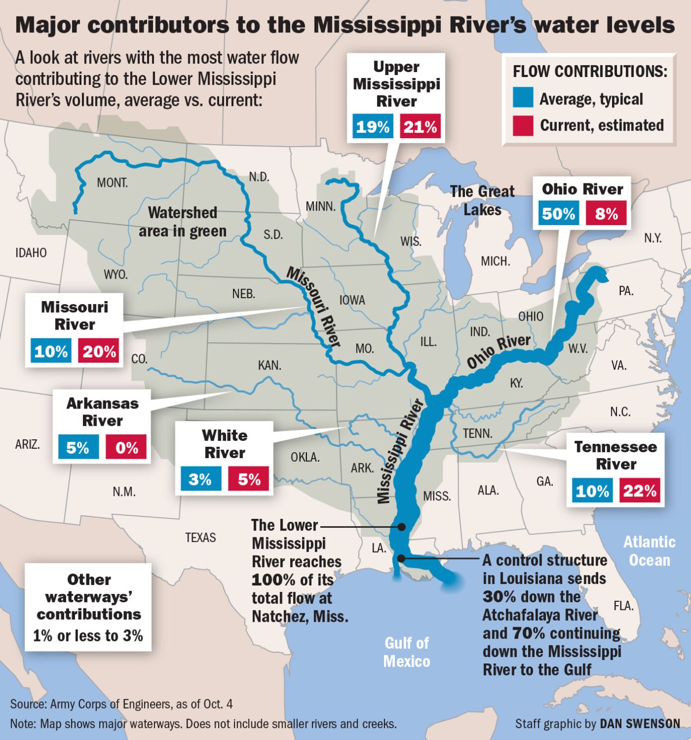
To address the myth, we must clarify what defines a river’s direction. A river flows from a higher elevation to a lower elevation, almost always dictated by the regional slope of the land. In the case of the Mississippi River Basin, the land slopes gently from the Appalachian Mountains in the east and the Rocky Mountains in the west toward the Gulf of Mexico.
There is no scientific evidence that the Mississippi River, in its current geological iteration, ever flowed toward the north. The elevation profile has consistently favored a southward trajectory for millions of years, particularly since the last major uplift of the Western interior. When people ask if the river flowed north, they are often conflating geological timescales with specific, localized flooding events or the temporary reversal of flow caused by seismic activity.
The 1811–1812 New Madrid Earthquakes: A Temporary Reversal
While the river has not flowed north as a matter of natural course, there is one famous, well-documented exception that gives some credence to the legends. Between December 1811 and February 1812, a series of massive earthquakes struck near New Madrid, Missouri. These were among the most powerful seismic events ever recorded in North America.
The Land Deformation
The New Madrid Seismic Zone is a unique feature of the continent’s geology—a failed rift deep underground that periodically releases stress. When the ground shifted during these massive quakes, it caused the land to heave, sink, and tilt. In a rare phenomenon known as crustal warping, the ground actually rose underneath the riverbed.
For a brief, chaotic window of time, the uplift of the riverbed caused the water of the Mississippi River to stop its southward journey and, in several locations, surge backward. Witnesses of the time reported the river appearing to flow upstream, creating massive waves, vortexes, and waterfalls that drowned the landscape.
Permanent Alterations to the Landscape
This temporary reversal led to the creation of Reelfoot Lake in Tennessee. As the land buckled and dropped, the river diverted, flooding a massive forest and creating a shallow, cypress-filled lake that remains a stunning natural landmark today. While the river eventually resumed its path toward the Gulf of Mexico, the event solidified the “river flowing north” legend in the cultural memory of those living along the Mississippi River Delta.
Glacial Influence and the Ancestral Mississippi
Before the modern Mississippi was fully formed, the Ice Age played a massive role in shaping the northern flow of water in the region. The Laurentide Ice Sheet, which covered much of Canada and the northern United States, acted as a giant barrier.
The Role of Glacial Lakes
When the massive glaciers began to retreat, they left behind gargantuan bodies of water, such as Glacial Lake Agassiz. This lake was larger than all of the modern Great Lakes combined. Because the massive weight of the ice had depressed the Earth’s crust, the water in the north did not have an outlet to the south.
Instead, much of the meltwater from these glacial regions flowed through the Red River of the North, which indeed flows north into Hudson Bay. Many historians and geography enthusiasts mistakenly attribute the flow of the Red River to the Mississippi, leading to the confusion regarding the primary river’s orientation.
Meltwater Channels
As the ice continued to melt, the drainage channels were constantly in flux. Sometimes water from the interior would flow east toward the Saint Lawrence River, and other times it was forced south. The “Mississippi” as we know it today is essentially the successor to these glacial drainage systems, having captured the majority of the continent’s internal runoff once the ice sheet finally receded and the crust began its slow, steady process of glacial isostatic adjustment—essentially “bouncing back” to its original elevation.
Cultural Significance and Geographical Legacy
The fascination with the idea that the Mississippi could flow north speaks to our collective desire to see nature as something that can be defied or overturned. The Mississippi River is more than just a body of water; it is a historical, economic, and cultural backbone of the country.
A Natural Wonder of the World
Today, travelers from around the globe visit landmarks like the Gateway Arch in St. Louis to look out over this mighty, south-flowing artery. The river sustains biodiversity, provides transit for massive cargo ships, and serves as a major recreation hub for cities like New Orleans, Memphis, and Minneapolis.
Understanding the true path of the river enhances the experience of visiting these sites. Whether exploring the Headwaters of the Mississippi at Itasca State Park in Minnesota or taking a steamboat tour through the bayous, the reality of the river’s southward trek is a testament to the persistent pull of gravity and the geological stability that has allowed human civilization to thrive along its banks.

The Lesson of the Land
While myths are often rooted in a grain of truth—in this case, the seismic upheaval of the 19th century and the complex glacial drainage of the past—they serve to remind us that the landscape is dynamic. The Earth beneath us is not static, and even the most “fixed” features of our geography, such as the Father of Waters, have histories defined by change. By studying the geological past, we appreciate the river not just as it is today, but as a living, breathing component of the North American continent that has endured the forces of rifting, earthquakes, and ice to remain the vital, southward-flowing wonder it is today.
LifeOutOfTheBox is a participant in the Amazon Services LLC Associates Program, an affiliate advertising program designed to provide a means for sites to earn advertising fees by advertising and linking to Amazon.com. Amazon, the Amazon logo, AmazonSupply, and the AmazonSupply logo are trademarks of Amazon.com, Inc. or its affiliates. As an Amazon Associate we earn affiliate commissions from qualifying purchases.