
Determining the distance to Nevada requires more than a simple look at a roadmap; it involves understanding the vast, rugged geography of the American West. As the seventh-largest state in the United States, Nevada occupies a unique position in the Great Basin, offering a diverse terrain that ranges from high-altitude alpine forests to stark, mesmerizing desert basins. Whether you are driving from a major coastal hub or embarking on a cross-country road trip, the journey to this state is defined by long stretches of scenic highways, hidden desert gems, and the anticipation of arriving in a land of neon lights and ancient geological wonders.
Calculating the Journey: Routes and Road Miles
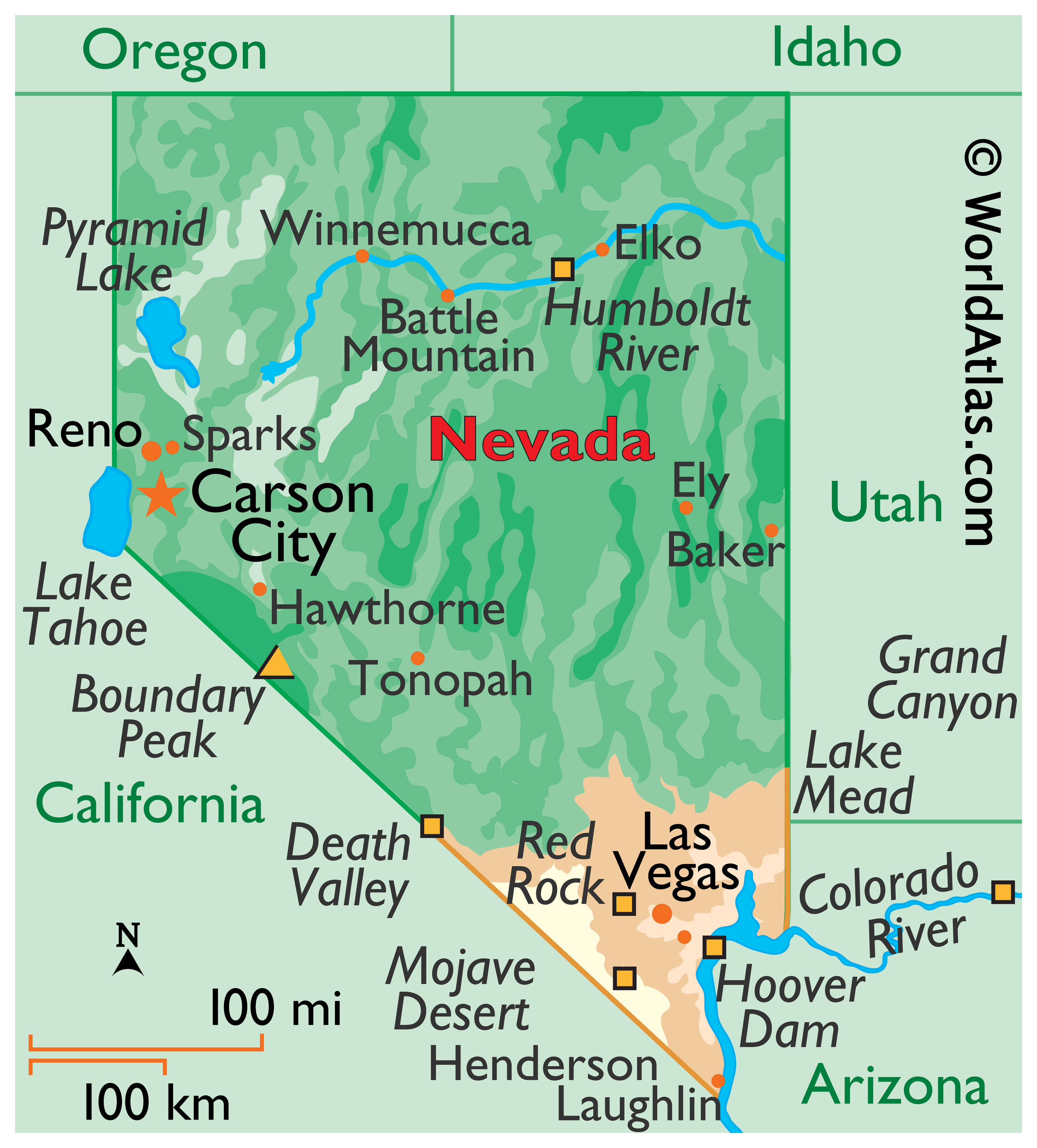
When planning a trip, the “how far” question is subjective based on your point of origin. Geography plays a significant role in travel time, as the state is landlocked by California, Oregon, Idaho, Utah, and Arizona.
Driving from the Pacific Coast
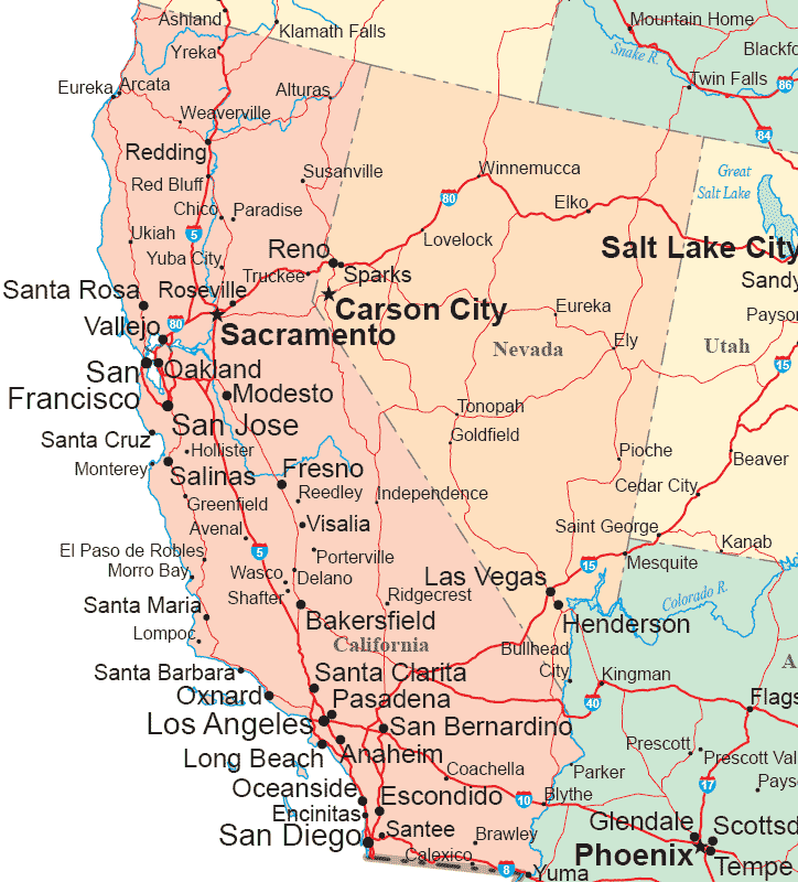
For travelers departing from Los Angeles, the trek to Las Vegas is a rite of passage. Covering approximately 270 miles via Interstate 15, the drive typically takes between four to five hours, depending on traffic through the Inland Empire. For those heading toward the northern part of the state, such as Reno or Lake Tahoe, the journey from the San Francisco Bay Area spans roughly 220 miles. This route takes you over the dramatic peaks of the Sierra Nevada mountains, transforming the experience from a coastal commute into a high-elevation alpine adventure.
Transcontinental and Regional Transit
For those crossing from the East or the Midwest, distance is measured in days rather than hours. Navigating through the Rocky Mountains or the expansive plains of Nevada’s neighbors requires careful logistical planning. Most travelers aiming for the heart of the state will find themselves traversing Interstate 80, a historic corridor that follows the path of the original pioneers. Regardless of your starting point, distance in this region is secondary to the quality of the drive, as the infrastructure is designed to accommodate those seeking the freedom of the open road.
Navigating the Geography of the Great Basin
Once you cross the state line, the definition of “distance” changes. Nevada is an immense expanse where towns are often separated by hours of driving, and the landscape shifts rapidly between distinct ecological zones.
Understanding the Vast Open Spaces
The state is characterized by “basin and range” topography. As you travel, you will find yourself driving through long, flat valleys framed by steep, rugged mountain ranges. This unique geography means that while two points might look close on a map, the actual driving distance can be quite long, as highways must wind around these natural formations. If you are venturing toward Great Basin National Park, prepare for a drive that takes you far from the bustle of major urban centers and into the quiet, starlit reaches of the eastern frontier.
The Role of Desert Travel Safety
Because of the distances involved, travel in this region requires a high level of preparedness. Many stretches of road—such as those traversing the Black Rock Desert—offer limited services. It is essential to monitor fuel levels, tire pressure, and water supplies. “How far” is not just a measurement of space, but a calculation of endurance and capability. Local advice often suggests topping off your fuel tank in major hubs like Elko or Winnemucca before setting out into the more remote sectors of the state.
Strategic Travel Hubs and Destination Entry Points
The state features specific “gateways” that serve as the primary entry points for millions of visitors annually. Each hub offers a different perspective on the distance required to reach your ultimate destination.
Southern Gateways
Las Vegas serves as the primary southern anchor. For international travelers and those flying in, Harry Reid International Airport acts as the central node. From this point, the distance to surrounding natural attractions like Red Rock Canyon National Conservation Area or Valley of Fire State Park is remarkably short, often under an hour of driving. This concentration of amenities allows travelers to balance the high-energy environment of the Las Vegas Strip with the profound silence of the desert in a single day.
Northern and Western Gateways
In the north, Reno-Tahoe International Airport facilitates access to the high desert and mountain regions. If your goal is to experience the vibrant arts and culinary scene of Reno, or the pristine waters of Lake Tahoe, the distance from the airport is minimal. This area acts as a gateway to the Truckee Meadows, offering a blend of modern city living and proximity to outdoor recreational sites that are world-renowned for their beauty.
Maximizing the Experience: The Road Trip Philosophy
The journey into this unique state is often as important as the destination itself. By shifting the focus from the total mileage to the experience of the travel, the perception of distance transforms.
Embracing the “Loneliest Road”
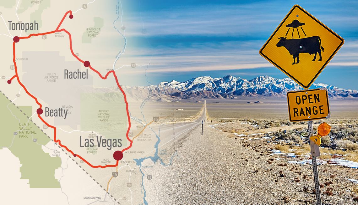
One of the most famous driving routes is U.S. Route 50, frequently dubbed “The Loneliest Road in America.” This route connects the eastern and western borders of the state, passing through small mining towns and historical sites. While the distance across this path is substantial, it provides an unfiltered look at the heritage of the state. Travelers find that the “length” of the journey is filled with discoveries, including hot springs, ghost towns, and vistas that define the American West.
Scenic Considerations and Seasonal Changes
It is also vital to consider the time of year when calculating your distance and travel time. During the winter months, mountain passes in the northern regions may require snow tires or chains, which can add hours to your journey. Conversely, the intense summer heat in the southern desert basins necessitates travel during cooler hours, such as early morning or late evening.
Ultimately, determining how far it is to Nevada is a personal endeavor. Whether you are seeking the glitz of a world-class resort, the intellectual history of a mining town, or the raw, untamed beauty of the high desert, the distance remains a relative concept. By planning your route with a focus on the landscape, the historical significance of the roads, and the specific gateways provided, you ensure that the time spent traveling becomes a meaningful chapter of your adventure. The vastness of the state is not an obstacle to be overcome, but a feature of the experience—an invitation to slow down, explore the horizon, and discover what lies across the next ridge.
LifeOutOfTheBox is a participant in the Amazon Services LLC Associates Program, an affiliate advertising program designed to provide a means for sites to earn advertising fees by advertising and linking to Amazon.com. Amazon, the Amazon logo, AmazonSupply, and the AmazonSupply logo are trademarks of Amazon.com, Inc. or its affiliates. As an Amazon Associate we earn affiliate commissions from qualifying purchases.