
When travelers and outdoor enthusiasts set their sights on Oklahoma, they are often drawn to the shimmering expanse of Lake Eufaula. As the largest capacity lake in the state, this massive body of water is a cornerstone of the regional landscape. While visitors often marvel at the 102,000 acres of surface area or the hundreds of miles of scenic shoreline, a more pragmatic question frequently arises for boaters, anglers, and swimmers alike: How deep is it, and what lies beneath the surface?
Understanding the Bathymetry of Lake Eufaula
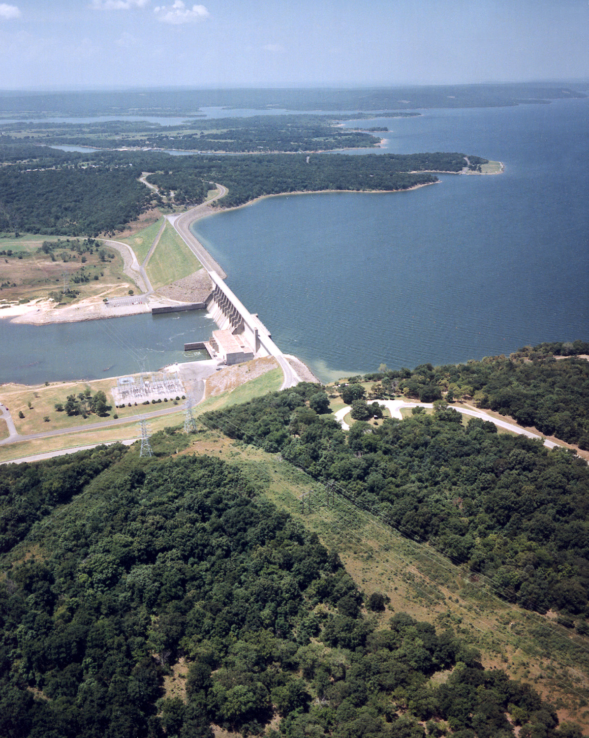
To understand the depth of Lake Eufaula, one must first appreciate its origins. Formed by the impoundment of the Canadian River by the Eufaula Dam, the lake is a masterpiece of civil engineering designed primarily for flood control, hydroelectric power, and water supply. Because it is a reservoir, its depth is rarely static.
Maximum and Average Depths
At its absolute deepest point, near the Eufaula Dam, the lake can reach depths of approximately 90 to 100 feet when at a full power pool. However, these figures are deceptive if one assumes the entire lake mimics this depth. On average, much of the lake maintains a depth of 20 to 30 feet. The floor of the lake is characterized by a series of dramatic drop-offs, sunken river channels, and shallower flats that make it a complex environment for navigation.
The Influence of Seasonal Fluctuations
Because the lake serves a functional purpose in managing the Canadian River basin, the water levels fluctuate significantly throughout the year. During the spring rainy season, the United States Army Corps of Engineers may manage higher inflows, leading to rising water levels that submerge varying amounts of shoreline. Conversely, during drier summer months or planned drawdowns, the water level can drop several feet, revealing submerged stumps and rocky outcrops that were previously hidden beneath the surface.
Navigating the Submerged Landscape
For those who use Lake Eufaula for recreation, understanding the bottom topography is essential for safety and success. The lake bottom is not a uniform basin; rather, it is a flooded landscape that includes former forests, roadbeds, and riverbeds.
The Channel Systems
The primary depth of the lake is dictated by the original paths of the Canadian River, the North Canadian River, and the Deep Fork River. These ancient channels run deep and serve as the aquatic highways for fish populations. Anglers often use sonar equipment to locate the edges of these channels, where the depth drops abruptly from 10 feet to 40 feet, creating ideal ambush points for predators like largemouth bass and crappie.
Obstructions and Underwater Features
Beyond the channels, the shallow areas of the lake are peppered with “timber”—the remains of trees that were not fully cleared before the reservoir was filled in the 1960s. While these provide excellent habitat for fish, they represent a significant hazard for boaters. Navigating the lake requires more than just a general idea of depth; it requires a respect for the hidden geography that can change depth by several feet in a matter of yards.
Recreational Implications of Lake Depth
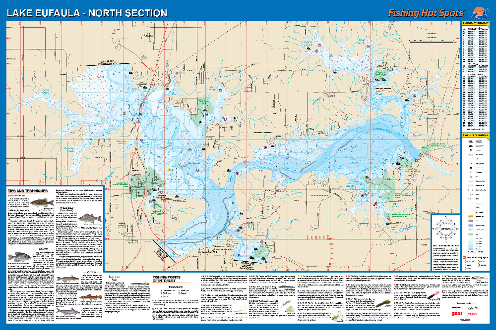
The varying depth of Lake Eufaula plays a major role in how visitors experience the McIntosh County region. From professional bass tournaments to family-friendly beach days, the water level dictates the rhythm of life on the lake.
Impact on Boating and Water Sports
Boaters heading out from Eufaula Cove Marina should always keep a close eye on their depth finders. In the open water of the main basin, the depths are generally safe for large vessels. However, venturing into the smaller coves or toward the Arrowhead State Park region requires vigilance. The shifting sandbars—frequent occurrences due to the silt deposits from the rivers—can create sudden shallow patches that are not always marked on older paper maps.
Swimming and Shoreline Accessibility
The depth directly influences the quality of the beaches found around Lake Eufaula. At Lake Eufaula State Park, the shoreline is meticulously maintained to provide safe, gradual entry points into the water. In these designated swimming areas, the slope of the lake floor is gentle, allowing families with children to wade out a fair distance without encountering deep water. This contrast between the deep, channel-heavy center and the shallow, sandy perimeters is what makes the lake so versatile for different types of tourists.
A Historical Perspective on the Reservoir
The creation of Lake Eufaula transformed the local geography permanently. Before the construction of the Eufaula Dam was completed in 1964, the area was a combination of agricultural land and river valleys.
The Submerged History
When the gates of the dam were closed, thousands of acres of land were surrendered to the water. This means that at the bottom of the lake, in those areas that reach significant depths, there are remnants of old bridges, foundations of homesteads, and historical roads. Divers and local historians have long been fascinated by the “ghosts” of the valley hidden beneath the depths. These underwater structures have become artificial reefs, contributing to the rich biodiversity of the lake.
Conservation and Management
The United States Army Corps of Engineers works tirelessly to monitor the bathymetry and water quality of the reservoir. Siltation—the accumulation of sediment brought in by the Canadian River—is a natural process that slowly changes the depth of the lake over time. Managing this sediment is crucial for maintaining the deep-water channels that allow for commercial and recreational navigation, ensuring that Lake Eufaula remains a viable destination for generations to come.

Planning Your Visit Based on Depth
If you are planning a trip to Oklahoma to experience the grandeur of this landmark, consider how the water depth might affect your itinerary.
- For Anglers: If you are chasing deep-water species, aim for trips during periods when the water level is stable, allowing you to consistently fish the 30-to-50-foot ledges near the dam.
- For Boaters: Always consult the current daily water level reports provided by the United States Army Corps of Engineers before setting sail. A difference of three feet can be the difference between clearing a shallow obstruction and hitting one.
- For Families: Stay within the buoyed swimming areas at parks like Arrowhead State Park or Lake Eufaula State Park. These areas are designed to provide the safest possible depth profiles for recreational swimming.
Ultimately, Lake Eufaula is much more than just a number on a depth gauge. It is a dynamic, living ecosystem that changes with the seasons and the weather. Whether you are peering down into the depths from a boat in the middle of the channel or enjoying the shallow waters of a sandy beach, the lake offers a vast, multi-dimensional experience for everyone who visits McIntosh County. By respecting the complexities of its depth and the power of the Canadian River, you can ensure a safe and memorable adventure in one of the most significant landmarks in Oklahoma.
LifeOutOfTheBox is a participant in the Amazon Services LLC Associates Program, an affiliate advertising program designed to provide a means for sites to earn advertising fees by advertising and linking to Amazon.com. Amazon, the Amazon logo, AmazonSupply, and the AmazonSupply logo are trademarks of Amazon.com, Inc. or its affiliates. As an Amazon Associate we earn affiliate commissions from qualifying purchases.