
The Oklahoma Panhandle is one of the most distinctive geographic features in the United States. Often overlooked by travelers rushing across the Great Plains, this narrow strip of land represents a unique collision of history, geology, and frontier culture. When people ask about the dimensions of this curious appendage of Oklahoma, they are usually surprised by the sheer scale of the landscape.
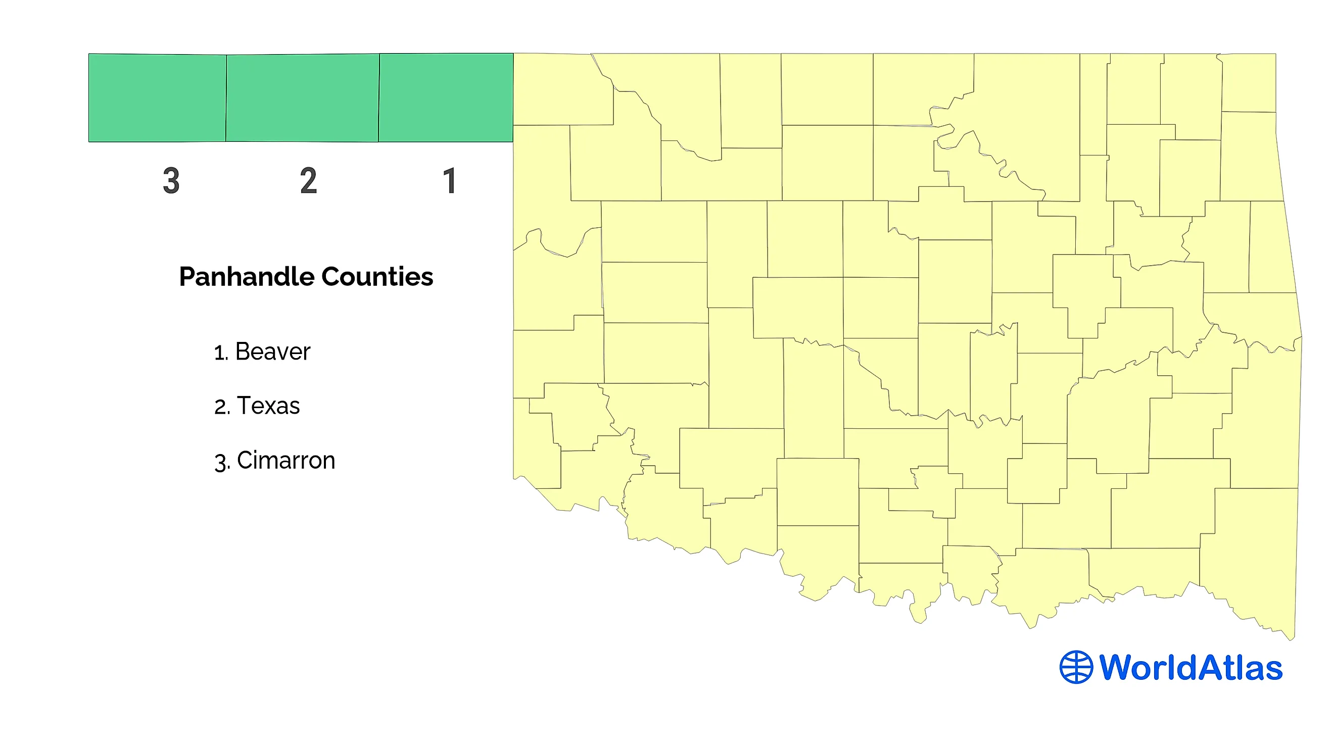
Measuring approximately 166 miles in length from east to west and a uniform 34 miles in width from north to south, the panhandle occupies a total area of about 5,600 square miles. While its width may seem constant on a map, the experience of traversing this expanse reveals a diverse topography that transitions from arid shortgrass prairies to the rugged, red-rock canyons of the mesa country.

The Geographic Boundaries of the High Plains
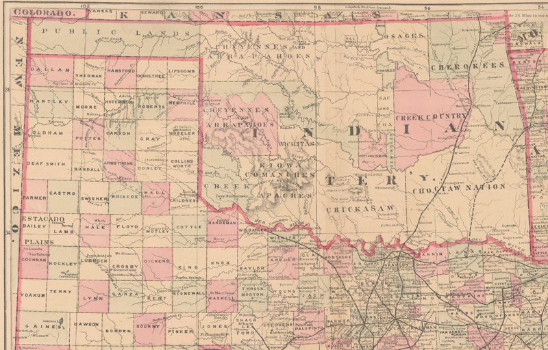
The precise width of the Oklahoma Panhandle is a byproduct of 19th-century political compromises. Bordered by Colorado and New Mexico to the west, Kansas to the north, and Texas to the south, the region exists as a remnant of the Missouri Compromise. Because Texas was a slave state, it could not extend its northern border above the 36°30′ parallel. Consequently, the land strip was left unorganized, eventually becoming known as “No Man’s Land” before being incorporated into the Oklahoma Territory.
Understanding the 34-Mile Span
The uniform 34-mile width creates a unique travel corridor. Unlike regions with sprawling metropolitan outskirts, the panhandle’s width dictates a specific rhythm of life. You are never more than a short drive from the northern or southern borders, creating an environment where the sky dominates the horizon. This sense of openness is exactly what draws landscape photographers and travelers seeking solitude to the region.
The Influence of Elevation
The elevation in the Oklahoma Panhandle rises steadily as you travel from east to west. While the panhandle maintains its 34-mile width, the physical landscape changes significantly. Starting near Beaver County in the east, the terrain is characterized by rolling plains. By the time you reach Cimarron County in the west, you are firmly planted in the high-altitude landscape of the Black Mesa, the highest point in the entire state of Oklahoma.
Landmarks and the Cultural Landscape
Despite its narrow footprint, the Oklahoma Panhandle is dense with geological history and natural wonders. Travelers who take the time to drive the length of the panhandle will find that the limited width allows for easy access to several critical landmarks that define the identity of the region.
Black Mesa Nature Preserve
Located at the far western tip, the Black Mesa Nature Preserve is the crown jewel of the area. Named for the layer of black volcanic rock that caps the mesa, this area offers a dramatic contrast to the flat plains of the east. Visitors flock here to hike the trails, observe rare wildlife, and experience the solitude of a landscape that feels unchanged by time. The Black Mesa provides a panoramic view of three different states, illustrating just how narrow the territory really is.
Historic Town Sites
Towns like Boise City, Guymon, and Hooker serve as the cultural anchors of the panhandle. These communities retain a classic small-town Americana vibe. The distance between these towns, constrained by the 34-mile width, has fostered a close-knit, self-reliant culture that persists today. Guymon, the largest city in the region, serves as the economic hub, proving that even in a narrow stretch of land, industry and community can flourish.
Exploring the High Plains Wilderness
The appeal of the Oklahoma Panhandle lies in its vastness. Even within a width of 34 miles, the sense of scale is overwhelming. It is a place where the horizon lines are etched sharply against the sky, and the weather moves across the land in visible, dramatic patterns.
Why Travel the Panhandle?
Traveling through this region is a lesson in patience and perspective. Because the area is not heavily commercialized, it offers a rare opportunity to see the United States without the noise of modern tourism. From the Optima National Wildlife Refuge to the winding banks of the Beaver River, there is a quiet beauty here for those who know where to look.
Practical Tips for the Road
- Prepare for Distances: Even though the Oklahoma Panhandle is only 34 miles wide, it is 166 miles long. Ensure your fuel tank is full before leaving Guymon or Boise City.
- Respect the Land: Much of the land is private property. Stick to marked trails and public access points like the Black Mesa State Park.
- Check the Weather: The weather in the Great Plains can shift rapidly. High winds are common, and summer temperatures can be intense.
- Photography: The light here is exceptional, especially during the “golden hour.” The lack of tall buildings or dense foliage means the sun illuminates the landscape with unparalleled clarity.
The Legacy of the Panhandle
The Oklahoma Panhandle is far more than just a geographic curiosity defined by a 34-mile width. It is a historical testament to the expansion of the American West. It stands as a bridge between the humid, forested east and the arid, mountainous west.
Whether you are an avid hiker looking to stand atop the Black Mesa, a history buff interested in the formation of the Oklahoma Territory, or a road-tripper simply looking for a new perspective on the United States, this strip of land offers a unique, profound experience. It reminds us that geography is not merely a set of lines on a map; it is a living, breathing component of our cultural heritage. The next time you find yourself crossing the Great Plains, do not pass by this remarkable region. Instead, take the time to explore the 34 miles of width and the 166 miles of history that make the Oklahoma Panhandle one of the most interesting corners of the nation.
LifeOutOfTheBox is a participant in the Amazon Services LLC Associates Program, an affiliate advertising program designed to provide a means for sites to earn advertising fees by advertising and linking to Amazon.com. Amazon, the Amazon logo, AmazonSupply, and the AmazonSupply logo are trademarks of Amazon.com, Inc. or its affiliates. As an Amazon Associate we earn affiliate commissions from qualifying purchases.