
Positioned firmly in the heart of the United States of America, Oklahoma serves as a geographic and cultural bridge between the American South and the Great Plains. Often referred to as part of the “Sooner State,” its location is pivotal to understanding the broader layout of the nation. For travelers looking to traverse the country, identifying where this state sits on the map is the first step toward exploring its unique terrain, history, and vibrant local culture.
Geographic Coordinates and Regional Positioning
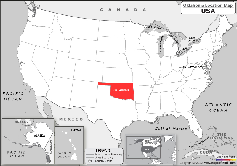
When looking at a map of the United States, Oklahoma is located in the South Central region. It is bordered by six states, making it a crossroads for those traveling across the country. To the north lies Kansas, while to the south, the state shares a massive border with the expansive state of Texas. To the east, you will find Missouri and Arkansas, and to the west, it borders New Mexico and a small portion of Colorado.

The Intersection of Diverse Landscapes
The state’s location is defined by its transition zones. As you move from the eastern borders toward the west, the landscape shifts dramatically from lush, forested hills to high, arid plains. This transition makes the region a fascinating study for geography enthusiasts. In the east, the Ozark Mountains and the Ouachita Mountains provide a rugged, green backdrop that feels vastly different from the rolling prairie grass and sandstone bluffs found in the western reaches of the state.
Central Location for Logistics and Travel
Because of its central placement, Oklahoma is a common stop for cross-country road trippers. Major thoroughfares, including historic Route 66, cut directly through the center of the state, connecting major urban hubs like Oklahoma City and Tulsa to the rest of the country. This central position ensures that no matter where you are traveling from within the lower 48 states, the state acts as a convenient gateway between the coasts.
Key Cities and Their Place on the Map
Understanding the map of Oklahoma requires looking at the concentration of its population centers. Most of the state’s activity is anchored by two major metropolitan areas that define the heartbeat of the region.
Oklahoma City: The State Capital
Located squarely in the central part of the state, Oklahoma City serves as the primary hub for government, commerce, and culture. Its central location allows it to draw influences from both the agricultural traditions of the west and the industrial and commercial energy of the east. For visitors, this city is often the starting point for exploring the rest of the state.
Tulsa: The Eastern Gateway
Tulsa is situated in the northeastern portion of the state, nestled along the Arkansas River. Known for its rich oil history and Art Deco architecture, Tulsa represents the more temperate, hilly side of the state. Its proximity to Grand Lake and the Ozark Mountains makes it a premier destination for outdoor enthusiasts.
Smaller Hubs of Cultural Significance
Beyond the big two, towns like Norman and Stillwater serve as critical points on the map for those interested in collegiate culture and research. Norman, located just south of Oklahoma City, is home to the University of Oklahoma, while Stillwater stands as a beacon for those visiting Oklahoma State University.
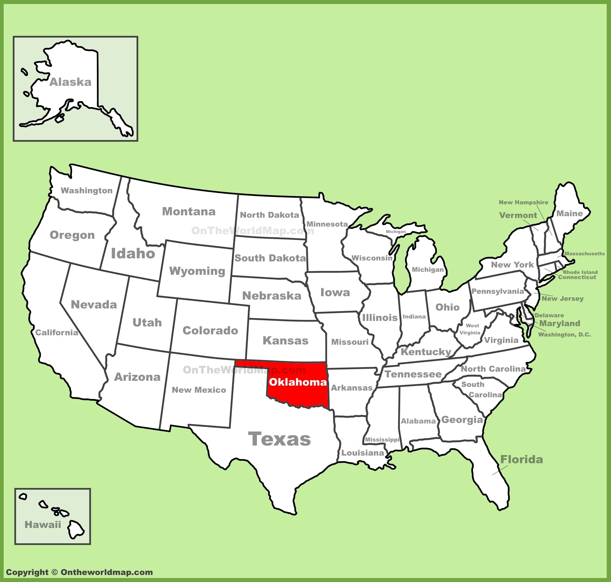
Exploring the Natural Landmarks
When you locate Oklahoma on a map, you are looking at more than just a political boundary. You are looking at a state defined by unique natural wonders that attract tourists from across the globe.
The Wichita Mountains Wildlife Refuge
In the southwestern part of the state, the Wichita Mountains Wildlife Refuge stands as one of the most prominent natural landmarks. These ancient granite mountains rise suddenly from the flat plains, offering incredible hiking, rock climbing, and wildlife viewing opportunities, including free-roaming bison and prairie dogs.
The Tallgrass Prairie Preserve
Located in the northern regions near Pawhuska, the Tallgrass Prairie Preserve is one of the largest protected areas of tallgrass prairie left in the world. It is a stunning visual representation of what much of the central United States looked like before significant settlement. For nature lovers, this is a must-see location that anchors the northern part of the map.
The Cultural Significance of the Location
The map of Oklahoma tells a complex story of human history and migration. Often referred to as “Native America,” the state has a unique designation regarding the history of indigenous peoples.
Native American Heritage
With dozens of federally recognized Native American tribes residing within the state, the map of Oklahoma is heavily influenced by tribal jurisdictions and cultural centers. Destinations like Tahlequah, the capital of the Cherokee Nation, provide deep insights into the history and ongoing influence of indigenous cultures on the state’s development.
The Intersection of Frontiers
The historical significance of the “Land Run of 1889” and the state’s status as a former Indian Territory adds layers of meaning to its physical location. For the modern tourist, this history is visible in museums and cultural centers that dot the landscape, particularly in Oklahoma City and across the eastern portions of the state.
Planning Your Journey Within the State
Knowing where Oklahoma is on the map is merely the first step. Once you arrive, navigating the state requires understanding that the “central” nature of the state applies to travel times as well. Because of its location in the middle of the country, it serves as an excellent anchor point for extended road trips.
Road Trip Accessibility
Whether you are headed from Chicago to Los Angeles or traversing from Dallas to Kansas City, the state is strategically positioned to provide excellent stopping points. The infrastructure connecting the major cities is robust, allowing for efficient transit while offering opportunities to detour into the smaller towns that make up the rural fabric of the region.
When to Visit
The state’s central climate means it experiences distinct seasons. Spring brings vibrant wildflower blooms across the prairies, while autumn provides a beautiful, mild climate perfect for hiking in the Ouachita Mountains. Regardless of when you choose to map out your trip, the central location ensures that you are never too far from the unique attractions that make Oklahoma a distinct and memorable destination within the United States.
LifeOutOfTheBox is a participant in the Amazon Services LLC Associates Program, an affiliate advertising program designed to provide a means for sites to earn advertising fees by advertising and linking to Amazon.com. Amazon, the Amazon logo, AmazonSupply, and the AmazonSupply logo are trademarks of Amazon.com, Inc. or its affiliates. As an Amazon Associate we earn affiliate commissions from qualifying purchases.