
For anyone planning a trip to the Golden State, understanding the current wildfire situation in California is paramount. California’s diverse landscapes, from its iconic forests to sprawling wildlands, are susceptible to wildfires, particularly during the hotter, drier months. While these events can be devastating, staying informed allows travelers to make safe, responsible, and enjoyable travel decisions. This guide aims to provide a comprehensive overview for navigating travel in California during fire season, emphasizing how to locate current fires, assess their impact, and ensure a seamless journey.
Understanding California’s Wildfire Landscape for Travelers
Wildfires are a natural, albeit increasingly intense, part of California’s ecosystem. For travelers, awareness begins with understanding the patterns and geographical vulnerabilities that characterize the state’s fire activity. This knowledge is crucial for proactive trip planning and ensures personal safety while exploring its numerous attractions.
The Seasonal Nature of Wildfires
Wildfire season in California typically runs from late spring through late autumn, often peaking in August, September, and October. Factors such as prolonged droughts, high temperatures, and strong Santa Ana or Diablo winds significantly exacerbate fire risk during these months. Travelers should be particularly vigilant if planning visits during this period. While fire incidents can occur year-round, the severity and spread potential are highest when conditions are dry and windy. Understanding this seasonality helps travelers anticipate potential disruptions and factor them into their itineraries, whether they’re exploring the majestic Yosemite National Park, the bustling streets of Los Angeles, or the serene beaches of Santa Barbara.
Key Fire-Prone Regions to Monitor
Certain areas of California are historically more susceptible to wildfires due to vegetation, topography, and weather patterns. These include:
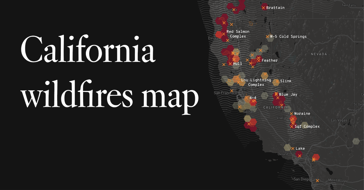
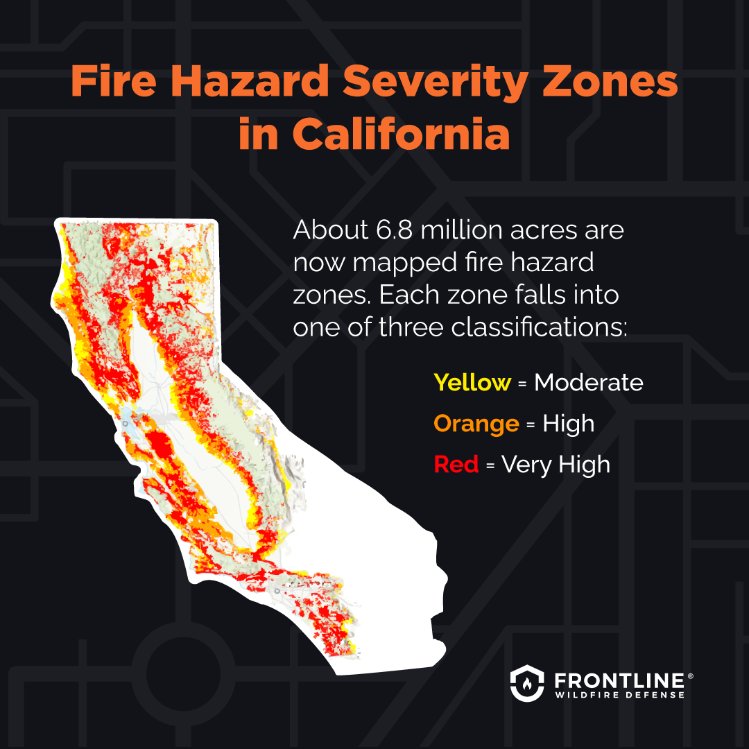
- Forest and Mountainous Regions: The Sierra Nevada mountain range, encompassing national parks like Yosemite National Park, Sequoia National Park, and Kings Canyon National Park, is frequently impacted. Similarly, areas around Lake Tahoe and the forested regions of Northern California (e.g., near Redwood National Park) are vulnerable.
- Coastal and Chaparral Areas: Regions with dense chaparral vegetation, particularly in Southern California (e.g., parts of Ventura County, Orange County, and San Diego County), are prone to fast-moving brush fires, often driven by the notorious Santa Ana winds. The hills surrounding Los Angeles and Malibu are also frequently affected.
- Wine Country: The renowned Napa Valley and Sonoma County in Northern California, while famous for their vineyards, have experienced significant fires, particularly in the autumn.
- Desert Edges: Even areas bordering deserts, such as the fringes of Palm Springs or near Joshua Tree National Park, can experience fires, albeit less frequently than forested regions.
Travelers planning to visit these regions should always check current conditions, especially during peak fire season.
Real-Time Information: Your Essential Travel Companion
In a dynamic situation like a wildfire event, access to real-time, accurate information is indispensable. For travelers, this means knowing which resources to trust and how to interpret the data to make informed decisions about their journey.
Utilizing Official Fire Tracking Resources
Several official channels provide up-to-the-minute information on fire locations, containment, and evacuation orders. Travelers should prioritize these sources:
- CalFire Incident Page: The California Department of Forestry and Fire Protection (CalFire) maintains an active incident page that lists all major ongoing wildfires, their size, containment percentage, and general location. This is often the most comprehensive and up-to-date source for statewide fire activity.
- Local Sheriff’s and Fire Department Websites/Social Media: For specific, localized information, including evacuation routes and warnings for particular towns or neighborhoods, local agency websites (e.g., Los Angeles County Fire Department, San Francisco Fire Department) and their official social media accounts are invaluable.
- National Forest Service Alerts: If your travel plans include national forests (e.g., Shasta-Trinity National Forest, Angeles National Forest), check the respective U.S. Forest Service websites for specific closures, fire restrictions, and alerts.
- Mapping Tools: Interactive maps provided by government agencies or reputable news organizations often overlay fire perimeters with road closures and evacuation zones, offering a clear visual understanding of affected areas.
Before heading out, especially if driving through potentially affected regions, dedicate time to checking these resources.
Interpreting Air Quality and Evacuation Orders
Beyond fire location, understanding the secondary impacts, like air quality, is vital for traveler health. Smoke from wildfires can travel hundreds of miles, affecting air quality far from the actual blaze.
- Air Quality Monitoring: Websites like AirNow.gov provide real-time Air Quality Index (AQI) readings. Travelers with respiratory conditions, or those planning strenuous outdoor activities, should monitor AQI carefully. Poor air quality can necessitate changes to outdoor plans, even if a fire is not directly nearby.
- Evacuation Orders and Warnings: These are critical. An “Evacuation Order” means you must leave immediately. An “Evacuation Warning” means a fire is a potential threat, and you should prepare to leave quickly if conditions worsen. Always heed these orders. Do not rely on outdated GPS routes if an area is under an evacuation order or has road closures due to fire. Check Caltrans or local traffic apps for current road conditions. Never try to drive through an active fire zone or ignored barricades.
Navigating Travel During Fire Season: Safety First
Traveling through California during fire season demands flexibility and a strong focus on safety. Even if your direct destination isn’t threatened, nearby fires can cause diversions, cancellations, and reduced air quality.
Adapting Your Itinerary and Exploring Alternatives
Flexibility is key. If a wildfire impacts your planned destination or route, be prepared to adjust.
- Have Backup Plans: Before you leave, identify alternative destinations or routes. For example, if your visit to Yosemite National Park is impacted, consider Kings Canyon National Park or a coastal alternative like Big Sur (checking its accessibility, of course).
- Communicate with Providers: Contact hotels, tour operators, and rental car companies in advance to inquire about fire impacts or potential cancellations. Many businesses in affected areas offer flexible booking policies during fire season.
- Consider Timing: If possible, consider postponing trips to highly fire-prone areas until after the peak season, typically November onwards.
- Stay Informed on Road Closures: Caltrans (California Department of Transportation) provides real-time updates on road closures. A fire far from your destination could still block essential arteries, requiring significant detours.
Essential Safety Precautions for Travelers
Beyond staying informed, travelers can take proactive steps to ensure their safety and contribute to fire prevention.
- Fire-Safe Practices: If camping or hiking, adhere strictly to all fire restrictions. This includes respecting burn bans, using designated campsites, and properly extinguishing campfires. Always “know before you go” regarding campfire regulations in any specific park or forest.
- Emergency Kit: Carry an emergency kit in your vehicle, especially if driving through rural or remote areas. This should include water, non-perishable food, a first-aid kit, a flashlight, and a full tank of gas.
- Communication: Ensure your phone is charged, and have a portable charger. In areas with limited cell service, inform someone of your itinerary.
- Evacuation Plan: Familiarize yourself with local evacuation procedures for your accommodation and planned activities. Know multiple routes out of an area if possible.
- Stay Hydrated and Monitor Health: Smoke exposure can be dangerous. Stay hydrated, and if air quality is poor, limit outdoor activity, especially for children, the elderly, or those with respiratory issues. Consider wearing an N95 mask if air quality is severely impacted.
Impact on Popular California Destinations
Wildfires can have varying effects across California’s diverse regions, altering travel experiences from San Francisco to San Diego.
Northern California: Redwood Forests and Wine Country
In Northern California, areas like Mendocino County and Humboldt County, home to majestic redwood forests, can see closures of parks and hiking trails due to fire activity or smoke. The renowned Napa Valley and Sonoma County wine regions have experienced significant fire damage in past years, leading to temporary winery closures, evacuations, and adverse air quality. Travelers should check with specific wineries and park authorities for status updates. Even if not directly threatened, the experience of tasting wine or hiking through groves can be diminished by smoky skies.
Central California: National Parks and Coastal Escapes
Central California is home to several iconic national parks, including Yosemite National Park, Sequoia National Park, and Kings Canyon National Park. These areas are frequently impacted by fires, leading to park closures, road blocks within the parks, and significant smoke. Travelers planning to hike or camp must consult park websites for current conditions, fire restrictions, and potential closures. Further south, the scenic Highway 1 along the Big Sur coastline, while less prone to large-scale forest fires, can be affected by smaller brush fires or mudslides following fires, causing temporary closures and limiting access to viewpoints and trails.
Southern California: Beaches, Deserts, and Urban Hubs
Southern California, with its dense population centers and wildland-urban interface, often sees fires threatening homes and businesses, particularly in the hills surrounding Los Angeles, Orange County, and San Diego. While beachfront areas are rarely directly threatened by fire, smoke plumes can drift considerable distances, affecting air quality at popular spots like Santa Monica or Laguna Beach. Desert destinations like Palm Springs or Joshua Tree National Park can also experience fires, especially in chaparral areas leading into the desert, impacting access and air quality for outdoor enthusiasts. Major urban centers like Los Angeles and San Francisco are generally safe from direct fire threat within city limits, but surrounding areas and the resulting smoke can affect travel to and from the cities, as well as outdoor activities.
Responsible Tourism in Fire-Affected Areas
As a traveler, your actions can play a significant role both in preventing new fires and in supporting communities recovering from their impact. Responsible tourism during fire season is about both safety and solidarity.
Supporting Local Communities Post-Fire
After a wildfire, local communities face the arduous task of rebuilding and recovering. Travelers can contribute meaningfully to these efforts:
- Visit When Safe: Once an area is declared safe and open for visitors, consider planning a trip. Tourism dollars are vital for economic recovery, helping businesses get back on their feet. Ensure you are visiting safely and respecting any ongoing recovery efforts.
- Patronize Local Businesses: Dine at local restaurants, shop at local stores, and stay at local accommodations. Your spending directly supports the community and helps them bounce back.
- Volunteer (If Applicable and Organized): In some cases, organized volunteer opportunities may arise for those who wish to offer direct assistance. Always go through official channels rather than self-deploying.
- Respect the Landscape: Understand that the landscape might have changed. Trails might be re-routed, or certain natural areas might be closed for regeneration. Respect these changes and follow all signage.

Practicing Fire-Safe Outdoor Ethics
Prevention is always better than cure. Every traveler has a responsibility to minimize fire risk.
- “One Less Spark, One Less Wildfire”: This motto from CalFire encapsulates the core principle. Be meticulous about anything that can cause a spark.
- Vehicles: Ensure your vehicle is properly maintained, with no dragging chains or exposed catalytic converters that can spark dry grass. Always park on paved or barren surfaces, never on dry grass.
- Smoking: Never discard cigarettes or any smoking material outside a vehicle or anywhere other than an appropriate receptacle. Better yet, avoid smoking outdoors during fire season.
- Equipment: Be cautious with any outdoor equipment that generates heat or sparks, such as generators or chainsaws, and ensure spark arresters are in place and functioning.
- Campfires: If campfires are allowed, build them only in designated fire rings, keep them small, never leave them unattended, and drown them completely with water until cold to the touch before leaving.
Traveling through California is an incredible experience, and with informed planning and responsible practices, it can remain so even during wildfire season. By knowing where to find current fire information, understanding the risks, and adopting a flexible, safety-first approach, travelers can continue to explore the stunning beauty of the Golden State with peace of mind.
LifeOutOfTheBox is a participant in the Amazon Services LLC Associates Program, an affiliate advertising program designed to provide a means for sites to earn advertising fees by advertising and linking to Amazon.com. Amazon, the Amazon logo, AmazonSupply, and the AmazonSupply logo are trademarks of Amazon.com, Inc. or its affiliates. As an Amazon Associate we earn affiliate commissions from qualifying purchases.