
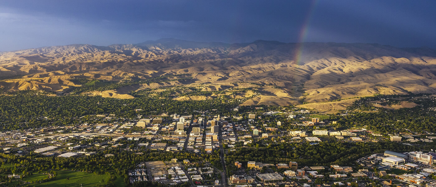
Understanding the physical geography of a city is essential for grasping its identity, climate, and recreational opportunities. For Boise, the capital city of Idaho, elevation is not just a statistical figure; it is a defining characteristic that shapes everything from the local weather patterns to the intensity of outdoor adventures. Nestled in the Treasure Valley, Boise sits at an average elevation of 2,730 feet (832 meters) above sea level. This positioning places it firmly within a high-desert environment, buffered by the majestic Rocky Mountains to the north and the expansive Snake River Plain to the south.
The Geography of the Treasure Valley: A High-Desert Basin
The elevation of Boise varies slightly depending on where you stand within the city limits. While the downtown core sits at approximately 2,704 feet, the terrain rises steadily as you move toward the northeastern edges of the city. This geographic layout is a result of the city’s location on the “bench”—a series of plateaus created by ancient geological shifts and the erosive power of the Boise River.
The Exact Elevation and Its Geographic Context
When comparing Boise to other major cities in the United States, its elevation is moderate but significant. It is considerably higher than coastal cities like Seattle or Portland, yet it sits lower than the “Mile High City” of Denver. This mid-range altitude is part of what makes the Pacific Northwest interior so unique. The 2,730-foot baseline provides a temperate gateway to the much higher alpine regions just a short drive away.
The city is strategically located at the base of the Boise Foothills, which serve as the immediate transition zone between the valley floor and the towering peaks of the Boise National Forest. This change in elevation occurs rapidly; within just a few miles, one can ascend from the urban sprawl to ridges exceeding 5,000 feet.
The Impact of the Boise River on the Valley’s Layout
The Boise River is the lifeblood of the region and a primary architect of its topography. Flowing from the mountains through the heart of the city, the river has carved out a lush riparian corridor that sits at the lowest elevation points of the metropolitan area. This area is home to the Boise River Greenbelt, a 25-mile long park system that offers a flat, scenic route through the city.
The river’s presence ensures that despite the high-desert elevation, the city maintains a “City of Trees” reputation. The water table supported by the river allows for a canopy of cottonwoods and maples that contrast sharply with the sagebrush-covered hillsides that rise above the valley floor.
Iconic Natural Landmarks and Rising Peaks
To truly understand the elevation of Boise, one must look upward toward the landmarks that define its skyline. The city is flanked by geological formations that offer both historical significance and breathtaking vantage points.
Table Rock: The City’s Most Famous Vista
One cannot discuss the elevation of this region without mentioning Table Rock. Rising to an elevation of approximately 3,629 feet, this plateau towers nearly 900 feet above the downtown area. It is characterized by its flat, sandstone top and a giant illuminated cross that has become a controversial yet permanent fixture of the landscape.
From the top of Table Rock, visitors get a literal bird’s-eye view of how Boise is cradled within the Treasure Valley. To the west, the view stretches across Meridian and Nampa, while to the north, the Boise Foothills roll away toward the higher mountains. The climb to the summit is a rite of passage for residents and a favorite for those looking to experience the dramatic shift in elevation firsthand.
Shafer Butte and Bogus Basin
For those seeking even higher ground, the journey continues up Bogus Basin Road to Shafer Butte. This is the highest point in the Boise Ridge mountains, reaching an impressive elevation of 7,582 feet. Nestled on its slopes is Bogus Basin, a non-profit mountain recreation area that serves as the city’s primary destination for skiing, snowboarding, and summer mountain biking.

The sheer difference in elevation between downtown Boise (2,730 feet) and Shafer Butte (7,582 feet) creates a unique environmental dichotomy. While it may be a sunny 60-degree day in the city, the peaks of Bogus Basin often remain covered in snow, showcasing the dramatic impact of vertical gain over a relatively short distance.
How Elevation Shapes the Climate and Lifestyle
The moderate elevation of Boise creates a specific set of climatic conditions known as a semi-arid, Mediterranean-influenced climate. Because the city is shielded by the Owyhee Mountains to the southwest and the Sawtooth Mountains further north, it experiences what is known as a “rain shadow” effect.
The High Desert Climate and Seasonal Shifts
At 2,730 feet, the air is thinner and drier than at sea level. This results in low humidity year-round, which makes the summer heat more bearable and the winter cold feel “crisper.” However, the elevation also means that the sun’s rays are more intense. Visitors to Camel’s Back Park or Hull’s Gulch Reserve often find themselves needing more hydration and sun protection than they might expect.
Winter at this elevation brings a phenomenon known as an atmospheric inversion. Cold air becomes trapped on the valley floor, while warmer air sits atop the mountains. During these periods, Boise may be shrouded in fog and chilly temperatures, while those at the higher elevation of Bogus Basin enjoy clear skies and sunshine.
Physical Activities and Altitude Adjustment
For athletes and outdoor enthusiasts, the elevation of Boise provides an excellent environment for “live high, train high” scenarios. While 2,730 feet is not high enough to cause typical altitude sickness for most people, it is enough to affect cardiovascular performance for those arriving from sea-level locations.
The Military Reserve Park and the surrounding trail systems offer varying degrees of vertical gain, allowing hikers and runners to test their endurance across different elevation tiers. The rapid access to the Lucky Peak State Park, which sits slightly higher than the city, provides additional opportunities for high-altitude water sports and recreation.
Geological Origins: The Formation of the Landscape
The current elevation and topography of Boise are the results of millions of years of volcanic activity and tectonic shifts. The city sits on the edge of the Snake River Plain, a massive volcanic province that was created as the North American tectonic plate moved over a hotspot (the same one currently under Yellowstone National Park).
Volcanic Roots and the Bench
Much of the higher ground in Boise, particularly the “Bench” neighborhoods, is composed of basalt and sedimentary layers left behind by ancient lakes and volcanic flows. These geological “benches” represent different historical levels of the Boise River and the ancient Lake Idaho.
The distinctive look of the Boise Foothills is also a product of these forces. The sandy soil and rolling nature of the hills are remnants of the shoreline of Lake Idaho, which once covered much of the region millions of years ago. As the lake drained and the river cut deeper into the landscape, the current elevation levels were established.
The Evolution of the City Layout
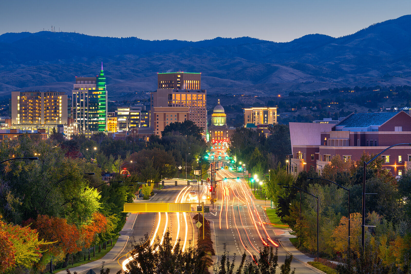
When the city was first founded, its elevation and proximity to the Boise River were chosen for practical reasons. The site provided a natural sheltered area with plenty of water and timber—rare commodities in the high desert of Idaho.
As the city grew, developers began to build upward onto the benches and into the foothills. This has led to a tiered city structure where the views and the micro-climates can vary significantly from one neighborhood to the next. Today, the elevation remains a key factor in urban planning, especially regarding water management and the preservation of the open spaces in the Boise Foothills.
In summary, the elevation of Boise is far more than just a number on a map. At 2,730 feet, it is the foundation of the city’s unique high-desert character. It dictates the flora that grows in the Idaho Botanical Garden, the weather that residents prepare for, and the types of adventures found at landmarks like Table Rock and Bogus Basin. Whether you are exploring the low-lying riverbanks or the high mountain peaks, the elevation is an ever-present force in the Treasure Valley.
LifeOutOfTheBox is a participant in the Amazon Services LLC Associates Program, an affiliate advertising program designed to provide a means for sites to earn advertising fees by advertising and linking to Amazon.com. Amazon, the Amazon logo, AmazonSupply, and the AmazonSupply logo are trademarks of Amazon.com, Inc. or its affiliates. As an Amazon Associate we earn affiliate commissions from qualifying purchases.