
The natural landscape of the United States is punctuated by numerous geological wonders, but few possess the raw power and historical resonance of Shoshone Falls. Often referred to as the “Niagara of the West,” this monumental waterfall is a cornerstone of the Idaho wilderness. For those seeking to locate this landmark, it is situated on the Snake River in the southern portion of the state, specifically within the city limits of Twin Falls. As one of the largest natural waterfalls in North America, it stands at a height of 212 feet—taller than the famous Niagara Falls in New York—and spans a breathtaking width of 900 feet.
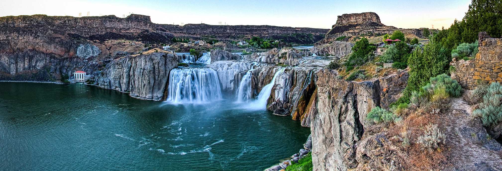
Understanding the location of Shoshone Falls requires an appreciation for the Magic Valley, a fertile agricultural region carved out by the relentless forces of water and time. This landmark is not merely a destination for sightseers but a testament to the transformative power of the Snake River Canyon.
Defining the Location: The Heart of the Snake River
To find Shoshone Falls, one must travel to the south-central part of Idaho. The falls are tucked into the deep, basalt-lined chasm of the Snake River, a waterway that originates in Wyoming near Yellowstone National Park and winds its way through the Pacific Northwest.
The City of Twin Falls and Its Surroundings
The falls are located approximately five miles east of downtown Twin Falls. This city serves as the primary hub for visitors, offering a gateway to the broader Twin Falls County. The site is managed by the City of Twin Falls, which maintains the Shoshone Falls Park, providing structured viewing platforms, picnic areas, and hiking trails that allow visitors to experience the landmark from various elevations. Its proximity to the city makes it one of the most accessible major waterfalls in the country, contrasting with more remote wilderness areas in the Rocky Mountains.
Navigating the Magic Valley Region
The broader region, known as the Magic Valley, is characterized by its dramatic contrast between lush irrigated farmland and the arid, rugged desert of the Snake River Plain. Shoshone Falls acts as a literal and metaphorical centerpiece for this landscape. It is situated about 130 miles southeast of Boise, the state capital, and roughly 220 miles north of Salt Lake City, Utah. This central location makes it a pivotal stop for those traveling across the Great Basin or toward the Pacific Ocean.
The Geological Marvel: Nature’s Architect at Work
The location of Shoshone Falls is no accident of geography; it is the result of cataclysmic events that occurred thousands of years ago. The architecture of the falls is defined by the hard volcanic rock that resists the erosive power of the river, creating the sheer drop that captivates thousands of visitors annually.
The Legacy of the Bonneville Flood
The most significant event in the creation of the falls was the Bonneville Flood, which occurred approximately 14,500 years ago. During the last ice age, the prehistoric Lake Bonneville—a massive body of water that covered much of present-day Utah—breached its natural dam at Red Rock Pass. The resulting flood was one of the largest in Earth’s history, sending a wall of water crashing through the Snake River valley. This immense force scoured the Snake River Canyon and carved the dramatic precipice that we now recognize as Shoshone Falls.
Comparing the Niagara of the West
While Niagara Falls is often the standard for grandeur in the United States, Shoshone Falls holds its own in terms of sheer scale. At 212 feet, it drops further than its eastern counterpart. The geology of the two sites differs significantly; while Niagara Falls sits on limestone and shale, Shoshone Falls is framed by dark, imposing basalt. This volcanic rock provides a stark, dramatic backdrop to the white foam of the rushing water, emphasizing the ruggedness of the Idaho landscape.
Historical and Cultural Context of the Landmark
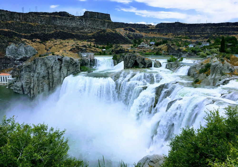
The location of Shoshone Falls has held deep significance for humans long before it became a point of interest on a modern map. Its history is woven into the tapestry of indigenous cultures and the expansion of the American frontier.
The Indigenous Shoshone-Bannock Heritage
The falls are named after the Shoshone people, who, along with the Bannock tribes, have inhabited the region for millennia. For the Shoshone-Bannock Tribes, the falls were more than just a beautiful site; they were a vital resource. The falls acted as a natural barrier for migrating salmon, making the waters below the falls a primary fishing ground. Because salmon could not leap over the 212-foot drop, the area downstream became a central gathering point for tribal communities to harvest fish, trade, and maintain cultural traditions.
Early Western Exploration and Tourism
As European-American explorers moved westward along the Oregon Trail, Shoshone Falls became a noted landmark. While the main trail passed slightly to the south to avoid the deep canyon, many travelers made the detour to witness the “Great Shoshone Falls.” By the late 19th century, the site began to develop as a tourist destination. Early entrepreneurs recognized its potential, and it was once considered for status as a national park, similar to Yellowstone National Park or the Grand Canyon. Although it ultimately remained under local and state oversight, its reputation as a world-class landmark was firmly established by the early 1900s.
Exploring the Landscape: Features and Wildlife
The area surrounding Shoshone Falls is an ecological treasure trove. The deep canyon provides a unique microclimate that supports a variety of flora and fauna, distinct from the surrounding desert plateau.
The Ecosystem of the Snake River Canyon
The canyon walls, composed of layers of volcanic rhyolite and basalt, provide nesting sites for various birds of prey. It is common to see Golden Eagles and Peregrine Falcons soaring above the falls. The mist generated by the massive water drop creates a localized zone of high humidity, allowing for the growth of lush vegetation that clings to the cliffs. Downstream, the Snake River continues its journey through the canyon, supporting diverse aquatic life, though the falls themselves remain the definitive boundary for various fish species.
Recreational Integration with Nature
Near the main falls, the Dierkes Lake area offers a different perspective on the local geography. Dierkes Lake is a popular spot for swimming, rock climbing, and hiking, situated just above the falls. The park system integrates the natural landmark with accessible recreation, allowing visitors to walk along the rim of the Snake River Canyon for miles. These trails offer panoramic views of the water’s descent and the intricate rock formations carved by the ancient Bonneville Flood.
Planning the Visit: What to Expect at the Falls
The appearance of Shoshone Falls can change dramatically depending on the time of year and human intervention. Understanding these dynamics is essential for anyone planning to visit this Idaho landmark.
Seasonal Fluctuations and Flow Rates
One of the most unique aspects of Shoshone Falls is the impact of the Milner Dam, located upstream. The Snake River is a working river, and its waters are heavily diverted for irrigation in the Magic Valley. Consequently, the flow over the falls is strongest in the spring, typically from March through June, as snowmelt from the Rocky Mountains swells the river. During the late summer and autumn, the flow may be significantly reduced to a trickle as water is diverted to support the region’s vast potato and dairy farms. Visitors often seek the “spring runoff” to witness the falls in their full, thunderous glory.

The Perrine Bridge and Local Infrastructure
A visit to Shoshone Falls is often paired with a stop at the Perrine Bridge. Located just a few miles downstream, this bridge is another iconic landmark of Twin Falls. Standing 486 feet above the river, it is a world-renowned site for BASE jumping. The bridge provides an excellent vantage point for viewing the Snake River Canyon and understanding the scale of the gorge that leads to the falls. Additionally, the nearby Buzz Langdon Visitor Center offers historical exhibits regarding the canyon, including the famous 1974 attempt by Evel Knievel to jump the canyon in a steam-powered rocket.
In summary, the question “Where is Shoshone Falls Idaho?” leads to a destination that is far more than a simple coordinate on a map. It is a place where geological history, indigenous culture, and modern engineering converge. Whether viewed during the roaring spring peak or the quiet late-summer thaws, Shoshone Falls remains a definitive landmark of the American West, embodying the wild and untamed spirit of the Idaho landscape.
LifeOutOfTheBox is a participant in the Amazon Services LLC Associates Program, an affiliate advertising program designed to provide a means for sites to earn advertising fees by advertising and linking to Amazon.com. Amazon, the Amazon logo, AmazonSupply, and the AmazonSupply logo are trademarks of Amazon.com, Inc. or its affiliates. As an Amazon Associate we earn affiliate commissions from qualifying purchases.