
When travelers contemplate the vast expanse of the United States, the state of Kansas often emerges as the symbolic and literal heart of the nation. Located in the Midwest, this state is frequently defined by its golden wheat fields, sprawling prairies, and endless horizons. However, for those planning a visit, the question “How far to Kansas?” is rarely just about mileage. It is a question of logistics, geography, and the diverse modes of transportation that connect the bustling coastal metropolises to the serene landscapes of the Great Plains.
Understanding the distance to Kansas requires an appreciation for its central position. Bordered by Nebraska to the north, Missouri to the east, Oklahoma to the south, and Colorado to the west, Kansas serves as the ultimate crossroads. Whether you are embarking on a cross-country road trip or searching for the most efficient flight path, reaching this destination is an exercise in exploring the American interior.
Measuring the Distance: Getting to the Heart of the Sunflower State
The physical distance to Kansas varies significantly depending on your point of origin. Because the state is roughly 400 miles wide and 210 miles long, your specific destination within the state—be it the urban energy of Wichita or the historic charm of Dodge City—will dictate the length of your journey.
Regional Proximity and Driving Times
For those located in neighboring states, Kansas is often just a short drive away. From Kansas City, Missouri, the state line is virtually non-existent, as the metropolitan area straddles both states. Residents of Oklahoma City find themselves approximately 160 miles south of the Kansas border, a trip that typically takes under three hours via Interstate 35.
From the west, the drive from Denver to the western edge of Kansas is roughly 170 miles. However, reaching the state capital, Topeka, from Colorado requires a more substantial commitment of about 540 miles, highlighting the sheer scale of the High Plains. To the north, Omaha sits about 180 miles from the Kansas border, making it an easy weekend destination for those in Nebraska.
Transcontinental Routes and Highway Infrastructure
If you are traveling from the coasts, the distance becomes more formidable. From New York City, the journey to central Kansas is approximately 1,300 miles, requiring at least 20 hours of driving time. From Los Angeles, the distance is even greater, stretching nearly 1,500 miles across the deserts of the Southwest and the Rocky Mountains.
The primary artery for east-west travel is Interstate 70, which bisects the state. This highway is a lifeline for travelers, offering a direct path through major cities like Lawrence, Topeka, Salina, and Hays. For north-south travel, Interstate 35 connects Kansas to the Gulf of Mexico and the [Great Lakes](https://lifeoutofthebox.com/great- lakes) region, ensuring that no matter which direction you are coming from, the state is accessible via well-maintained infrastructure.
Air Travel Logistics: Navigating Major Hubs and Regional Gates
While the romanticism of the road trip is synonymous with Kansas, many travelers prefer the speed of aviation. Determining “how far” in terms of flight hours provides a different perspective on the state’s accessibility.
Wichita Dwight D. Eisenhower National Airport
The largest and busiest airport in the state is the Wichita Dwight D. Eisenhower National Airport. Located in the southern part of the state, this airport serves as the primary gateway for those visiting the “Air Capital of the World.” Direct flights are available from major hubs like Dallas Fort Worth International Airport, Chicago O’Hare International Airport, and Denver International Airport.
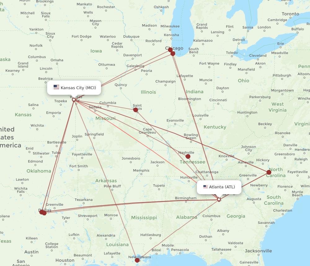
Flight times to Wichita are relatively short from within the central United States, often taking between 60 to 90 minutes. For those coming from Atlanta or Seattle, flight durations range from three to five hours, making the state surprisingly reachable for business travelers and tourists alike.
Kansas City International Airport and Northern Access
While technically located in Missouri, the Kansas City International Airport is the most convenient option for travelers heading to northeast Kansas. It provides easy access to the University of Kansas in Lawrence and the state offices in Topeka.
For travelers looking to visit more remote areas, such as the Manhattan area or Garden City, regional airports like the Manhattan Regional Airport and the Garden City Regional Airport offer connecting flights. These smaller hubs drastically reduce the “distance” for those whose final destination lies deep within the rural landscapes of the state.
The Iconic American Road Trip: Scenic Routes into Kansas
For many, the distance to Kansas is best measured by the sights seen along the way. The state is home to some of the most underrated scenic drives in the country, turning a long journey into an immersive travel experience.
Traveling via I-70: The Great Plains Connector
Interstate 70 is the most common route into the state, but savvy travelers know to look beyond the asphalt. Entering from the east, you pass through the rolling hills of the Missouri River valley before the landscape opens up into the vast prairies. Along this route, travelers can stop at the Eisenhower Presidential Library in Abilene, which offers a profound look into the life of the 34th President.
As you head west, the distance is punctuated by landmarks like the Catherin’s Byzantine style churches and the Sternberg Museum of Natural History in Hays. The transition from the humid east to the semi-arid west is a physical sensation, as the air thins and the sky seems to grow larger.
Exploring the Flint Hills National Scenic Byway
If you are coming from the south or north, a detour through the Flint Hills is essential. The Flint Hills National Scenic Byway stretches along K-177, offering views of the last remaining stands of tallgrass prairie in the world. Reaching the Tallgrass Prairie National Preserve near Strong City makes every mile driven feel worthwhile.
For those following the historic Route 66, a tiny 13-mile segment of the “Mother Road” clips the southeastern corner of Kansas. Passing through Galena and Baxter Springs, this short distance provides a nostalgic glimpse into the history of American automobile travel.
Planning Your Arrival: Seasonal Considerations and Travel Tips
The perceived distance to Kansas can change based on the time of year and the weather conditions. The state experiences four distinct seasons, each of which affects travel times and safety.
Timing Your Visit for Optimal Weather
Spring in Kansas is beautiful, with wildflowers blooming across the Flint Hills, but it is also the peak of storm season. Travelers should monitor the National Weather Service for updates on thunderstorms or potential tornadoes, which can occasionally cause travel delays.
Summer is prime time for road trips, though temperatures can frequently exceed 90 degrees Fahrenheit. If you are driving long distances across the state, ensuring your vehicle’s cooling system is in top shape is vital. Conversely, winter can bring sudden snowstorms and icy conditions, particularly in the western regions near Goodland and Colby. During these months, “how far” becomes a matter of road safety and visibility.
Navigating the Vastness: Internal Distances
Once you have arrived in the state, the internal distances remain significant. For instance, driving from the eastern border at Kansas City to the western border at Kanorado takes approximately six hours without stops. Travelers should plan their fuel stops carefully, especially when venturing off the main interstates into more rural counties.
While the distances may seem daunting to some, the infrastructure in Kansas is designed for efficiency. The Kansas Turnpike, which runs from Kansas City through Wichita to the Oklahoma border, is widely considered one of the best-maintained toll roads in the country, making the miles fly by.
Landmarks and Destinations: Why the Distance is Worth It
The ultimate answer to “How far to Kansas?” is often “just far enough to escape the noise.” The state offers a unique blend of natural wonders and cultural landmarks that provide a high reward for the effort of travel.
Natural Wonders and Geological Marvels
In the western part of the state, the Monument Rocks, also known as the Chalk Pyramids, rise unexpectedly from the plains. These towering sedimentary formations are a testament to the ancient inland sea that once covered the region. Similarly, Castle Rock offers a rugged, moon-like landscape that feels worlds away from the lush greenery of the Missouri River to the east.
Cultural and Historical Anchors
In Hutchinson, travelers find Strataca, an underground salt museum located 650 feet below the surface. Nearby, the Cosmosphere houses one of the most significant collections of space artifacts in the world, including the Apollo 13 command module.
In Wichita, the iconic Keeper of the Plains statue stands at the confluence of the Big Arkansas River and the Little Arkansas River. This 44-foot Cor-Ten steel sculpture is a powerful tribute to the Native American tribes that first inhabited this land.
Whether you are visiting the Boot Hill Museum to relive the Wild West or touring Kansas State University in Manhattan, the distance to Kansas is a bridge to a richer understanding of the American story. It is a journey that takes you through the heart of the country, revealing that while the miles may be many, the destination is truly one of a kind.
LifeOutOfTheBox is a participant in the Amazon Services LLC Associates Program, an affiliate advertising program designed to provide a means for sites to earn advertising fees by advertising and linking to Amazon.com. Amazon, the Amazon logo, AmazonSupply, and the AmazonSupply logo are trademarks of Amazon.com, Inc. or its affiliates. As an Amazon Associate we earn affiliate commissions from qualifying purchases.