
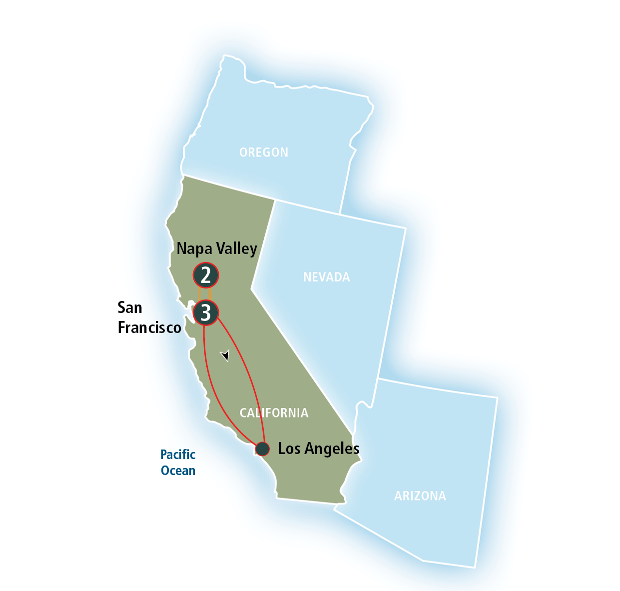
The journey from the sprawling metropolis of Los Angeles to the rolling vineyards of Napa Valley is a classic California expedition. Spanning a significant portion of the Golden State, this trip transitions travelers from the glitz of Hollywood to the world-renowned wine estates of Northern California. While the physical distance is roughly 400 miles, the “travel distance” varies significantly depending on your chosen mode of transportation and your appetite for scenic detours. Whether you are planning a rapid transit for a weekend getaway or a leisurely road trip along the coast, understanding the logistics of this transit is essential for a seamless experience.
Navigating the Distance: Driving from Southern to Northern California
Driving is perhaps the most popular way to reach Napa Valley from Los Angeles. It offers the flexibility to carry home crates of Cabernet Sauvignon and the freedom to explore the smaller towns of St Helena and Calistoga at your own pace.
The Direct Route: Interstate 5
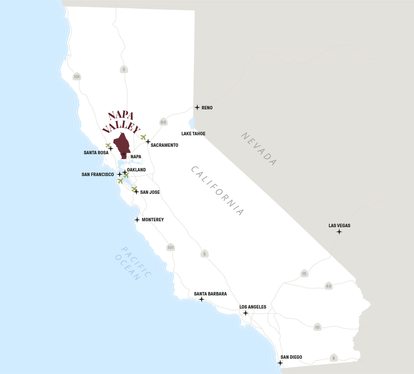
If efficiency is your primary concern, Interstate 5 (the I-5) is the most direct artery connecting Southern California to the north. This route covers approximately 380 to 400 miles and typically takes between six and seven hours, depending on the notorious Los Angeles traffic. The drive through the Central Valley is characterized by vast agricultural fields and straight, flat highways. While it lacks the dramatic vistas of the coast, it is the fastest way to get your tires onto the soil of Napa County. Most travelers using this route will bypass San Francisco entirely, heading through Sacramento or cutting across via Highway 12.
The Scenic Alternative: US-101
For those who believe the journey is as important as the destination, US-101 offers a more visually stimulating experience. This route adds roughly an hour or two to the total travel time but rewards drivers with views of the Santa Ynez Mountains and the rolling hills of the Central Coast. Following the US-101 allows for easy breaks in charming locales like Santa Barbara and San Luis Obispo. As you approach the San Francisco Bay Area, the road merges into the heart of Northern California, eventually leading you across the Richmond-San Rafael Bridge or through the city of San Francisco itself.
The Ultimate Road Trip: Highway 1
While technically the “longest” way to get there, Highway 1 (the Pacific Coast Highway) is the gold standard for California travel. If you choose this path, the distance in miles remains similar, but the “time distance” expands to two or three days. This route hugs the Pacific Ocean, winding through the cliffs of Big Sur and the cypress groves of Monterey. While it is not a practical choice for someone in a rush, it is the premier choice for travelers looking to experience the full ecological diversity of the West Coast before arriving in the serene atmosphere of Yountville.
Alternative Transportation: Flights and Public Transit
For many, the six-hour drive is a deterrent. Fortunately, the California corridor is one of the most well-served flight paths in the United States.
Flying into San Francisco or Oakland
The most common strategy for air travel is to fly from Los Angeles International Airport (LAX) to either San Francisco International Airport (SFO) or Oakland International Airport (OAK). The flight time itself is a mere 1 hour and 15 minutes. From San Francisco International Airport, Napa Valley is approximately 60 miles north. However, travelers should account for the time spent navigating the airport and the potential for heavy traffic on the Bay Bridge. Renting a car at the airport is highly recommended, as Napa Valley is spread out and difficult to navigate via public transit alone.
Regional Airport Options
For a more boutique experience, travelers can look for flights into Charles M Schulz-Sonoma County Airport (STS) in Santa Rosa. While flights from Los Angeles International Airport or Burbank Airport to Santa Rosa are less frequent, this airport lands you significantly closer to the vineyards, often within a 30-minute drive of the northern Napa Valley towns. Another option is Sacramento International Airport (SMF), which offers a relatively stress-free drive into the valley from the east, avoiding the heavy congestion of the San Francisco Bay Area.
Rail and Bus Logistics
While there is no direct high-speed rail from Los Angeles to Napa Valley, the Amtrak Coast Starlight provides a stunningly beautiful, albeit slow, alternative. The train runs from Union Station in Los Angeles up to Oakland or Martinez. From the Martinez Station, passengers can connect to the Amtrak Thruway Bus, which drops off in the city of Napa. This is an excellent choice for those who wish to avoid the stress of driving and enjoy the changing landscapes of California from the comfort of a lounge car.
Essential Stops: Breaking Up the Long Journey
If you decide to drive, the 400-mile stretch offers several opportunities to experience the “best of” California. Breaking up the journey ensures you arrive in Napa Valley refreshed and ready for tasting.
Exploring the Central Coast
About halfway between Los Angeles and Napa Valley lies Paso Robles. This is a strategic and thematic stop, as Paso Robles is a premier wine destination in its own right. It serves as a fantastic “warm-up” for the Napa Valley experience. Further south, the Santa Barbara coastline offers the Stearns Wharf and the Funk Zone, providing a Mediterranean-style break with fresh seafood and local art.
Natural Landmarks and Historic Detours
For those taking the US-101, a quick detour to Hearst Castle in San Simeon is a must-see for history and architecture enthusiasts. If you are traveling the Interstate 5, your options for scenic beauty are more limited, but a stop at the Tejon Pass provides a dramatic look at the Tehachapi Mountains. Regardless of the route, the transition from the arid landscapes of the Tejon Ranch to the lush greenery of the Mayacamas Mountains is one of the most striking geographical shifts in the state.
Practical Considerations for Your Napa Valley Adventure
Traveling such a distance requires a bit of foresight regarding timing and local logistics once you arrive in Northern California.
Best Times to Travel
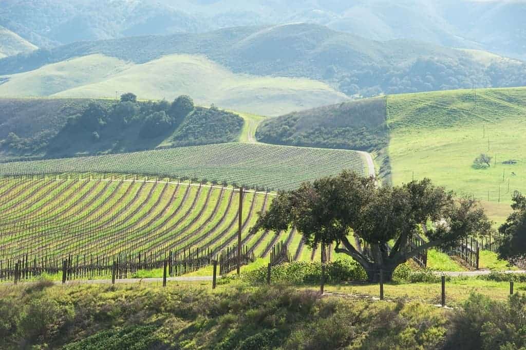
Timing your departure from Los Angeles is critical. Leaving during the morning rush hour can add two hours to your trip before you even leave Los Angeles County. Ideally, a pre-dawn departure or a late-morning start (after 10:00 AM) is best. Seasonally, the drive is most beautiful in the spring when the California hills are vibrant green. However, if you are traveling during “Mustard Season” (late winter), you will be greeted by blankets of yellow flowers throughout the Napa Valley floor.
Navigating Upon Arrival
Once you have crossed the Carquinez Bridge and entered the valley, the geography becomes quite simple. The valley is roughly 30 miles long and 5 miles wide, primarily served by two main roads: Highway 29 and the Silverado Trail. While Highway 29 is the main commercial artery through Napa, Yountville, and St Helena, the Silverado Trail offers a more peaceful, scenic drive along the eastern edge of the valley. Knowing the distance between these towns—usually only 10 to 15 minutes apart—helps in planning your daily travel itinerary.
The distance from Los Angeles to Napa Valley is more than just a measurement of miles; it is a transition between two distinct lifestyles. Whether you choose the speed of a flight into San Francisco International Airport or the epic scale of a road trip via Big Sur, the journey sets the stage for the sophistication and relaxation that awaits in California’s premier wine region. By planning for traffic, choosing the right route for your schedule, and perhaps making a stop in Paso Robles along the way, you can turn the long distance into an integral part of your Napa Valley experience.
LifeOutOfTheBox is a participant in the Amazon Services LLC Associates Program, an affiliate advertising program designed to provide a means for sites to earn advertising fees by advertising and linking to Amazon.com. Amazon, the Amazon logo, AmazonSupply, and the AmazonSupply logo are trademarks of Amazon.com, Inc. or its affiliates. As an Amazon Associate we earn affiliate commissions from qualifying purchases.