
Traveling between Colorado Springs and Cripple Creek offers a captivating journey through some of Colorado’s most stunning landscapes and rich historical sites. Understanding the distance and travel considerations is paramount for planning an efficient and enjoyable trip, whether you’re seeking a day trip filled with adventure or a multi-day exploration of the Pikes Peak region. This guide provides comprehensive insights into the journey, ensuring your travel experience is as seamless and memorable as the destinations themselves.
The Scenic Drive: Distance, Time, and Routes
The distance between Colorado Springs and Cripple Creek is relatively short, making it an ideal candidate for a half-day or full-day excursion. However, the exact distance and travel time can vary significantly depending on the chosen route and current road conditions. The journey typically covers between 45 and 55 miles, with driving times ranging from approximately one hour to one hour and thirty minutes without significant stops or traffic.

The Most Common and Recommended Route
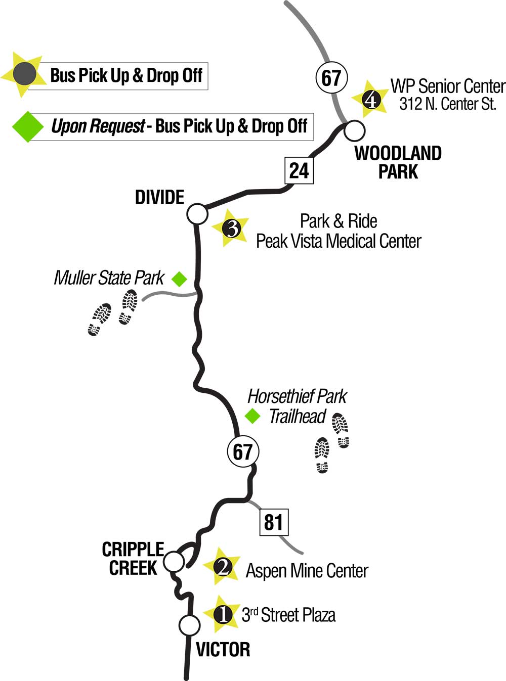
The primary and most frequently used route from Colorado Springs to Cripple Creek involves heading west on U.S. Highway 24 and then turning south onto Colorado State Highway 67. This path offers a well-maintained, paved road that navigates through increasingly scenic terrain as you ascend into the mountains.
- Starting in Colorado Springs: Begin by accessing U.S. Highway 24 West. If you’re coming from downtown Colorado Springs, you’ll pass through several smaller communities and gradually gain elevation.
- The Divide: The turn-off onto Colorado State Highway 67 is typically around the town of Divide. This junction is clearly marked and signals your transition into the heart of the Pikes Peak region’s mining country.
- Ascending to Cripple Creek: The stretch of Highway 67 from Divide to Cripple Creek is known for its winding roads and dramatic elevation changes, offering breathtaking views of the surrounding mountains and valleys. This section requires careful driving, especially during winter months when conditions can be challenging.
Alternative, More Picturesque Paths
For those seeking a more adventurous and historically immersive experience, an alternative route exists, though it is not recommended for all vehicles or all times of the year due to its unpaved and sometimes rugged nature.
- Gold Camp Road: The historic Gold Camp Road offers a unique journey, tracing the paths of old mining railroads. Portions of this road are unpaved, narrow, and include tunnels carved directly through the mountainside. It’s an incredibly scenic drive, providing unparalleled views and a genuine sense of stepping back in time. However, it requires a vehicle with good ground clearance, especially after inclement weather, and is best undertaken during daylight hours in fair weather conditions. It’s also important to note that parts of Gold Camp Road may be closed or impassable depending on current conditions, so checking local advisories before attempting this route is crucial. This route typically adds significant time to the journey due to lower speed limits and challenging terrain.
Planning Your Journey: Modes of Transport and Considerations
Choosing the right mode of transport and understanding logistical considerations can significantly enhance your travel experience between Colorado Springs and Cripple Creek.
Driving Yourself
Driving your own vehicle or a rental car is by far the most popular and flexible option. It allows for spontaneous stops at scenic overlooks, hiking trails, or charming small towns along the way.
- Vehicle Preparation: Ensure your vehicle is in good condition, especially if you plan to travel during winter. The mountain roads can be steep and winding, and unexpected weather changes are common. Check tire pressure, fluid levels, and ensure your brakes are in excellent working order.
- Fuel: While there are gas stations in both Colorado Springs and Cripple Creek, and some scattered along Highway 24, it’s wise to fill up before departing, particularly if you’re taking a less-traveled route or planning extensive exploration.
- Navigation: While cellular service is generally reliable on Highway 24 and Highway 67, it can be spotty in more remote sections or on Gold Camp Road. Downloading offline maps is a prudent backup.
Ride-Sharing and Taxis
While possible, ride-sharing services like Uber or Lyft and traditional taxis might be less practical or more expensive for a one-way trip to Cripple Creek, especially if you intend to return. Availability of drivers in Cripple Creek for a return journey can also be limited. This option is best considered for specific circumstances or if other transport is unavailable. Some private shuttle services might operate between the two locations, especially catering to casino visitors, so it’s worth inquiring with local tour operators or your accommodation.
Public Transportation
Direct public transportation between Colorado Springs and Cripple Creek is generally not available. The best way to travel remains by private vehicle.
What to Expect Along the Way
The journey is an integral part of the travel experience, especially when navigating Colorado’s unique terrain. Understanding the conditions and potential points of interest can help you embrace the adventure.
Road Conditions and Elevations
The elevation gain from Colorado Springs (approximately 6,035 feet) to Cripple Creek (around 9,494 feet) is significant. This means travelers will experience winding roads, steep ascents, and descents.
- Weather Variability: Mountain weather can change rapidly. Clear skies can quickly give way to rain, snow, or fog, especially outside of peak summer months. Always check the weather forecast for both Colorado Springs and Cripple Creek before you depart.
- Driving in Winter: During winter (typically October to May), snow and ice are common. Colorado chain laws may be in effect, requiring specific tire types (M+S rated, or mud and snow tires) or snow chains on certain mountain passes. Always be prepared for slick conditions, reduced visibility, and slower travel speeds.
- Altitude Sickness: For those unaccustomed to high altitudes, the elevation change can sometimes cause mild altitude sickness symptoms such as headaches, nausea, or dizziness. Staying hydrated, avoiding strenuous activity immediately upon arrival, and taking it easy are recommended.
Points of Interest En Route
The drive itself offers several opportunities for exploration and enjoyment.
- Pikes Peak Views: As you ascend, particularly on Highway 24 and Highway 67, you’ll be treated to stunning vistas of Pikes Peak and the surrounding Front Range.
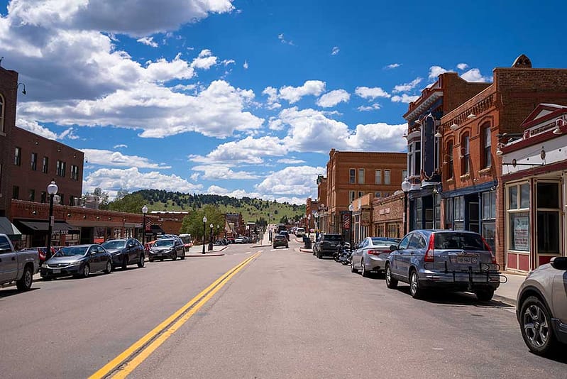
- Small Towns: Towns like Manitou Springs (just west of Colorado Springs) and Victor (near Cripple Creek) offer charming historic districts, unique shops, and dining options. Victor, in particular, retains much of its original mining-town character and is worth a stop for its historic buildings and rich past.
- Wildlife Viewing: Keep an eye out for local wildlife, including deer, elk, and various bird species, especially in the more forested and less populated areas of the drive.
Making the Most of Your Trip to Cripple Creek
Beyond merely reaching your destination, consider how the travel journey integrates into a broader experience of the Pikes Peak region.
Combining Destinations
The close proximity of Cripple Creek to other attractions makes it easy to combine visits.
- Pikes Peak Highway or Cog Railway: Many travelers combine a trip to Cripple Creek with an ascent of Pikes Peak, either via the Pikes Peak Highway or the Broadmoor Manitou and Pikes Peak Cog Railway.
- Garden of the Gods: Located just outside Colorado Springs, Garden of the Gods is a magnificent park with towering red rock formations and is a natural starting or ending point for a mountain journey.
- Royal Gorge Bridge & Park: A bit further south, the Royal Gorge Bridge & Park offers another thrilling attraction, providing a different perspective on Colorado’s dramatic landscapes.
Essential Travel Tips
- Start Early: Particularly for day trips, leaving Colorado Springs early allows ample time to enjoy the scenic drive, explore Cripple Creek, and return before dusk, which can be beneficial for navigating mountain roads.
- Dress in Layers: Mountain weather is notoriously unpredictable. Dressing in layers ensures comfort no matter the temperature fluctuations.
- Stay Hydrated: Drinking plenty of water helps combat the effects of altitude and keeps you feeling refreshed.
- Inform Others: If venturing onto less-traveled routes like Gold Camp Road, inform someone of your itinerary and expected return time.
The journey from Colorado Springs to Cripple Creek is more than just a drive; it’s an opportunity to experience the breathtaking beauty and rich history of the Colorado mountains. With proper planning and an adventurous spirit, your travel between these two unique destinations will be a highlight of your Colorado exploration.
LifeOutOfTheBox is a participant in the Amazon Services LLC Associates Program, an affiliate advertising program designed to provide a means for sites to earn advertising fees by advertising and linking to Amazon.com. Amazon, the Amazon logo, AmazonSupply, and the AmazonSupply logo are trademarks of Amazon.com, Inc. or its affiliates. As an Amazon Associate we earn affiliate commissions from qualifying purchases.