
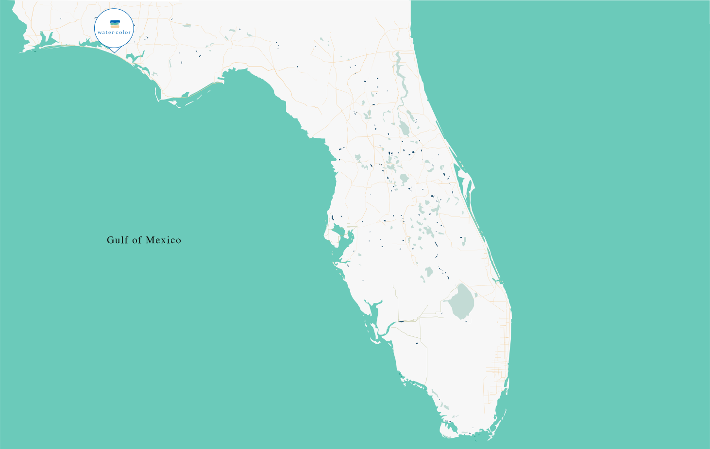
To find Watercolor, one must look toward the shimmering expanse of the Florida Panhandle, specifically within the stretch of coastline known as the Emerald Coast. This master-planned community is situated in South Walton along County Road 30A, a legendary scenic highway that hugs the Gulf of Mexico. Nestled between the celebrated town of Seaside to the east and the rugged natural beauty of Grayton Beach to the west, Watercolor occupies a premier piece of real estate that balances resort-style luxury with deep environmental preservation.
Pinpointing Watercolor on the Florida Panhandle
Watercolor is located within Walton County, a region of Northwest Florida that has transformed from a hidden gem into one of the most sought-after travel destinations in the United States. Geographically, it sits approximately midway between Destin and Panama City Beach. While those neighboring cities are known for high-rise skylines and bustling neon strips, Watercolor and its 30A counterparts offer a strictly regulated, low-density alternative characterized by New Urbanism and architectural harmony.
The 30A Corridor
The specific location of Watercolor is defined by Highway 30A. This 24-mile corridor is home to a string of distinct “beach towns,” each with its own personality. Watercolor serves as a central anchor for this route. Its placement allows travelers to enjoy a walkable and bikeable lifestyle where the boundaries between the town and the surrounding nature are intentionally blurred. Unlike many coastal developments that prioritize pavement and parking lots, the location of Watercolor was chosen to maximize contact with the unique ecosystems of the Florida coast.
Proximity to Major Hubs
While Watercolor feels like a secluded escape, it is strategically positioned for easy regional access. It is located about 30 miles west of Panama City Beach and roughly 25 miles east of Destin. For those traveling from Tallahassee, the state capital, the drive is approximately two and a half hours to the west. This placement ensures that while visitors are immersed in a quiet, upscale environment, the logistical conveniences of larger metropolitan areas are never more than a short drive away.
The Landscape and Natural Borders of Watercolor
What truly defines where Watercolor is located is its relationship with water—not just the ocean, but the rare freshwater systems that define the region. The community is built around Western Lake, one of the largest coastal dune lakes in the world. These lakes are geological rarities found in only a few places globally, including Australia, New Zealand, and Madagascar.
Western Lake and the Coastal Dunes
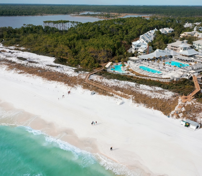
Western Lake serves as the northern and western boundary for much of the Watercolor property. This 100-acre lake creates a dramatic backdrop of brackish water, where pine forests meet the white sand dunes. The presence of Western Lake means that Watercolor is not just a “beach town” but a “lake town” as well. This dual identity is a core part of its geography, providing a transition zone between the salty breezes of the Gulf of Mexico and the quiet, still waters of the interior.
The Gulf of Mexico Shoreline
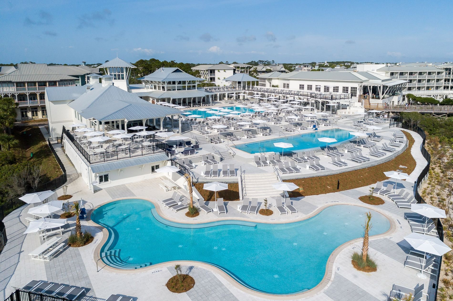
To the south, Watercolor is bordered by the sugar-white sands of the Emerald Coast. The sand here is composed almost entirely of fine-grained Appalachian quartz, which remains cool to the touch even under the intense Florida sun. The town’s southern edge is marked by the Watercolor Beach Club, a central gathering point that overlooks the turquoise waters. The geography here is characterized by high primary dunes that protect the interior architecture from the elements while providing elevated views of the horizon.
Point Washington State Forest
Bordering the community to the north is the sprawling Point Washington State Forest. This massive conservation area covers over 15,000 acres and provides a massive green buffer that keeps Watercolor from feeling like a standard suburban development. The forest is home to sandhills, cypress swamps, and wet prairies, offering miles of trails for hiking and off-road biking. This northern border ensures that the community remains nestled within a permanent natural landscape, preventing urban sprawl from encroaching on the quietude of the town.
Accessibility: Reaching the Heart of 30A
Understanding where Watercolor is also involves knowing how to get there. Because of its location in the Florida “big bend” area, it is accessible via several major transportation routes, making it a favorite for both road-trippers from the Southeast and air travelers from across the North America.
Traveling by Air
The most convenient gateway for air travelers is the Northwest Florida Beaches International Airport, located in Panama City. The airport is approximately a 45-minute drive from Watercolor. This modern facility handles major carriers and offers direct flights from hubs like Atlanta, Dallas, and Nashville.
Alternatively, the Destin-Fort Walton Beach Airport is located about an hour to the west. This airport serves a wide range of regional airlines and is a popular choice for those coming from the Midwest. For private aviation, the Destin Executive Airport provides a closer landing strip for smaller craft.
Driving Routes
For those driving, Watercolor is easily reached via Interstate 10, the primary east-west artery across North Florida. Travelers typically exit at DeFuniak Springs and head south on US Highway 331. This route takes drivers across the Clyde B. Wells Bridge, offering a stunning introductory view of the Choctawhatchee Bay before intersecting with Highway 98 and finally County Road 30A.
Neighboring Communities and Regional Connectivity
The location of Watercolor is significant because of its proximity to other famous 30A landmarks. The area is designed for exploration, and the short distances between towns encourage visitors to venture beyond the Watercolor gates.
Seaside: The Next-Door Neighbor
Immediately to the east of Watercolor lies Seaside, the town famous for being the filming location of The Truman Show. The transition between the two is almost seamless; one can walk or bike from the Watercolor Inn to the Seaside Amphitheater in minutes. While Seaside is more compact and centered around a bustling commercial square, Watercolor is more spread out, with expansive parks and residential districts.
Grayton Beach State Park
Just to the west is Grayton Beach State Park, consistently ranked as one of the best beaches in the United States. This park provides a rugged contrast to the manicured lawns of Watercolor. Its proximity allows Watercolor visitors easy access to miles of untouched coastline and the famous “ghost forests” of dead cedar trees standing in the sand.
Santa Rosa Beach
The broader area encompassing Watercolor is often referred to collectively as Santa Rosa Beach. This is the primary postal designation for the region. Within a ten-mile radius, visitors can reach other distinct neighborhoods like Blue Mountain Beach, known for its high elevation, and Alys Beach, known for its stark white Bermudan architecture.
Defining the Watercolor Travel Experience
Where Watercolor is matters because its physical location dictates the type of experiences available to travelers. It is a destination defined by its parks, its bridges, and its connection to the water.
Cerulean Park and Public Spaces
At the heart of the community is Cerulean Park, a linear park that serves as the town’s central nervous system. It is a beautifully landscaped green space with water features and lush vegetation that leads directly toward the beach. The location of the town’s amenities—from the Marina Park amphitheater to the various neighborhood pools—is designed to be accessible via the extensive network of walking paths and wooden bridges that crisscross the property.
The Western Lake Bridge
One of the most iconic landmarks within the town is the Watercolor Bridge that crosses Western Lake. This bridge connects the main phases of the development and offers one of the best sunset viewing spots in South Walton. It marks the transition from the beach-centric southern side of the community to the more wooded, tranquil northern sections.
A Sanctuary on the Emerald Coast
Ultimately, the answer to “Where is Watercolor Florida?” is more than just a set of coordinates in Walton County. It is a destination situated at the intersection of luxury and nature. By occupying the land between the Gulf of Mexico and Western Lake, and bordering both Seaside and Point Washington State Forest, Watercolor holds a unique geographical position that offers travelers the very best of the Florida coastline. Whether arriving by car from the American South or flying into Northwest Florida Beaches International Airport, visitors find themselves in a place where the geography itself is the main attraction.
LifeOutOfTheBox is a participant in the Amazon Services LLC Associates Program, an affiliate advertising program designed to provide a means for sites to earn advertising fees by advertising and linking to Amazon.com. Amazon, the Amazon logo, AmazonSupply, and the AmazonSupply logo are trademarks of Amazon.com, Inc. or its affiliates. As an Amazon Associate we earn affiliate commissions from qualifying purchases.