
Nestled in the heart of Orange County, Winter Park stands as one of the most prestigious and historically rich destinations in Florida. Often described as a sophisticated oasis, this city is situated just a few miles north of the bustling Downtown Orlando area. While many travelers associate Central Florida primarily with sprawling theme parks and modern entertainment complexes, the geographic placement of this city offers a distinctively different atmosphere, characterized by brick-lined streets, ancient oak canopies, and a series of interconnected lakes.
Understanding the location of this destination requires looking at its proximity to the greater metropolitan landscape. It serves as a northern anchor to the Orlando metro area, providing a refined retreat that feels worlds away from the neon lights of the tourist corridors, yet remains strategically accessible to every major attraction in the region.

Geographic Context: The Heart of Central Florida
The city is positioned at approximately 28.59 degrees North latitude and 81.35 degrees West longitude. This puts it in the subtropical center of the peninsula, a region defined by its flat terrain, lush vegetation, and abundance of freshwater bodies. To the north, it shares borders with the city of Maitland, while the eastern boundary is adjacent to the community of Goldenrod and University of Central Florida territory. To the west lies Eatonville, one of the oldest African-American incorporated municipalities in the United States.
Regional Coordinates and Neighboring Cities
The physical footprint of the city covers roughly 10 square miles, much of which is occupied by water or preserved green space. Travelers coming from Downtown Orlando will find the city center just six miles to the north, typically reached via a short drive through the Ivanhoe Village or College Park neighborhoods. Its northern neighbor, Maitland, blends seamlessly into its residential outskirts, while Casselberry lies just a bit further to the northeast.
The location is uniquely “landlocked” in the center of the state, roughly midway between the Atlantic Ocean and the Gulf of Mexico. This central positioning makes it an ideal base for travelers who wish to explore both coasts while enjoying the inland amenities of a high-end suburban environment.
Distance from Major Hubs
For those arriving by air, Orlando International Airport is the primary gateway, located approximately 15 miles south of the city. Depending on traffic, the commute from the airport takes between 25 and 40 minutes, primarily utilizing the Florida State Road 436 (also known as Semoran Boulevard) or the Interstate 4 corridor.
Additionally, Orlando Sanford International Airport is located about 18 miles to the north in Sanford, providing another convenient entry point for domestic and international travelers. The city’s location roughly equidistant from these two major airports ensures that visitors have multiple logistical options for arrival.
The Urban Topography: Districts and Neighborhoods
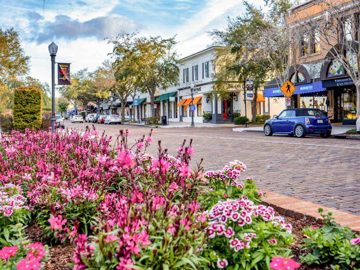
The city is not merely a single point on a map but a collection of distinct districts, each defined by its own geographic character. The most famous of these is the downtown core, which centers around the iconic Park Avenue. This area serves as the cultural and social epicenter of the city, where the geography of the streetscape was intentionally designed to mimic European villages.
Park Avenue and the Downtown Core
Park Avenue runs north to south and is bordered on its western side by Central Park, a lush 11-acre green space that hosts many of the region’s most prestigious festivals. This central artery is the primary destination for luxury shopping, fine dining, and cultural exploration. Just a few blocks away, the Charles Hosmer Morse Museum of American Art houses the world’s most comprehensive collection of works by Louis Comfort Tiffany, making it a major landmark in the city’s artistic geography.
To the southern end of the downtown core lies the campus of Rollins College, a liberal arts institution founded in 1885. The campus itself is a significant landmark, situated on the shores of Lake Virginia. Its Spanish-Mediterranean architecture and sprawling lakeside grounds contribute significantly to the aesthetic identity of the city’s southern boundary.
The West Side and Hannibal Square
Just west of the main downtown shopping district is Hannibal Square. Historically, this area served as the residential and commercial hub for the city’s African-American community during the late 19th and early 20th centuries. Today, it is a revitalized district known for its upscale restaurants, boutiques, and the Hannibal Square Heritage Center. Geographically, it provides a more relaxed, neighborhood-centric feel compared to the high-energy environment of the primary avenue, while remaining within easy walking distance.
Further west, the landscape transitions into the Winter Park Village, a large-scale lifestyle center that offers modern shopping and entertainment. This area represents the more contemporary geographic expansion of the city’s commercial interests, providing a contrast to the historic brick-paved streets of the older districts.
Navigating the Natural Landscape: The Chain of Lakes
Perhaps the most defining geographic feature of the area is the Winter Park Chain of Lakes. These navigable waterways have dictated the development of the city since its inception, as early settlers and later wealthy northerners sought to build homes along their scenic shores.
A System of Waterways
The chain consists of several primary lakes, including Lake Osceola, Lake Virginia, Lake Maitland, Lake Mizell, and Lake Minnehaha. These lakes are connected by a series of narrow, man-made canals that allow small boats to pass from one body of water to the next.
For travelers, the best way to experience this geography is via the Winter Park Scenic Boat Tour. This long-standing attraction operates out of a dock at the end of Morse Boulevard and takes visitors through the canals and across the major lakes. From the water, one can see the magnificent estates, many of which date back to the city’s founding as a winter resort for the social elite of the Northeast United States.
Parks and Green Spaces
The city’s location is also marked by an impressive commitment to public green space. Mead Garden is a 47-acre botanical garden located in the southern part of the city, offering trails, a butterfly garden, and a creek. Meanwhile, Kraft Azalea Garden is tucked away on the shores of Lake Maitland. Known as the “Secret Garden,” this five-acre park is famous for its massive cypress trees and the Exedra Monument. These locations provide a natural buffer between the residential areas and the commercial centers, reinforcing the city’s reputation as a “City of Culture and Heritage.”
Strategic Travel Logistics: Getting to and Around Winter Park
Because of its central location in the state, the city is remarkably easy to navigate for visitors. It is positioned at the intersection of several major transit routes that connect it to the rest of the Florida peninsula.
Roadways and Highway Access
The primary artery for reaching the city by car is Interstate 4, which runs just west of the city limits. Travelers heading north from Walt Disney World Resort, Universal Orlando Resort, or SeaWorld Orlando can reach the city in about 30 to 45 minutes, depending on the time of day. The Fairbanks Avenue and Lee Road exits are the two most common entry points from the interstate.
For those traveling from the Atlantic Ocean coast, such as Daytona Beach or New Smyrna Beach, the drive is approximately one hour westward. The city’s proximity to Florida State Road 417, also known as the Central Florida GreeneWay, provides an alternative toll-road route that bypasses much of the downtown traffic.

Public Transit and Rail Connectivity
One of the most unique aspects of the city’s location is its historic and modern rail connectivity. The Winter Park Train Station, located directly in Central Park, is a hub for both Amtrak and the SunRail commuter train system. This makes it one of the few places in Florida where a traveler can arrive by train and be immediately within walking distance of the city’s primary attractions, hotels, and restaurants.
The SunRail system connects the city to Downtown Orlando, Kissimmee, and Sanford. This rail line follows the same geographic path as the original South Florida Railroad that helped establish the town in the late 1800s. For visitors staying in the city, the rail system offers a stress-free way to explore the broader Central Florida region without the need for a rental car.
Whether exploring the shores of Lake Osceola, walking the galleries of the Albin Polasek Museum & Sculpture Gardens, or dining along the European-style storefronts of Park Avenue, the city’s location is its greatest asset. It manages to be at the center of everything while maintaining a secluded, historic charm that is rare in the modern Florida landscape. This strategic positioning—close to airports, theme parks, and beaches, yet firmly rooted in its own distinct cultural identity—makes it an essential stop for any traveler visiting the region.
LifeOutOfTheBox is a participant in the Amazon Services LLC Associates Program, an affiliate advertising program designed to provide a means for sites to earn advertising fees by advertising and linking to Amazon.com. Amazon, the Amazon logo, AmazonSupply, and the AmazonSupply logo are trademarks of Amazon.com, Inc. or its affiliates. As an Amazon Associate we earn affiliate commissions from qualifying purchases.