
Dierkes Lake, a picturesque reservoir nestled within the vast expanse of Shoshone Falls Park near Twin Falls, Idaho, is a popular destination for both locals and visitors seeking recreation and natural beauty. While its tranquil surface and surrounding landscapes draw many, a common question arises among those planning a visit or contemplating activities on its waters: “How deep is Dierkes Lake?” Understanding the lake’s depth is crucial for a variety of reasons, from safe boating and swimming to effective fishing. This exploration delves into the bathymetry of Dierkes Lake, offering insights relevant to its function as a recreational hub and a vital part of the Magic Valley region’s appeal.
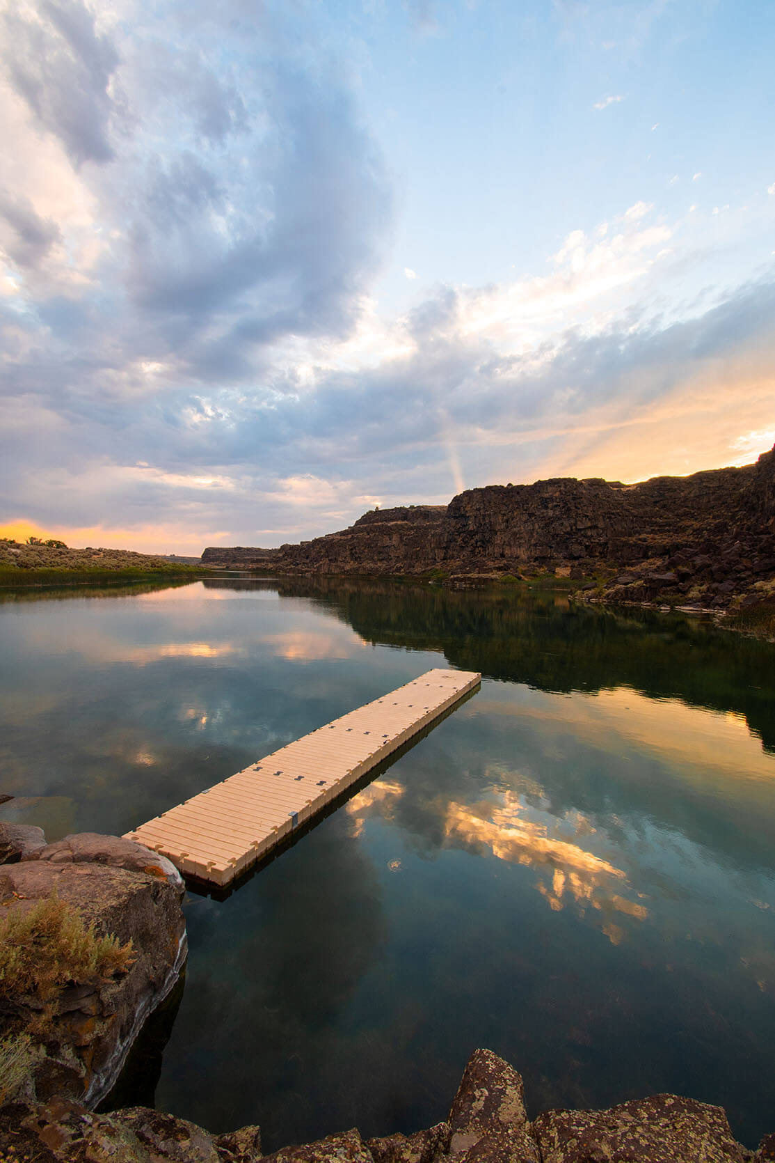
Understanding Dierkes Lake’s Bathymetry
The depth of any body of water is a fundamental characteristic that influences its ecology, recreational potential, and management. For Dierkes Lake, its depth profile is not uniform, reflecting its origins and the contours of the land it occupies. While precise, up-to-the-minute bathymetric charts for smaller, man-made reservoirs like Dierkes Lake are not always readily available to the public in the same way they might be for larger natural lakes, we can infer its general depth characteristics based on its known features and purpose.
Origins and Formation
Dierkes Lake was created by the construction of a dam on the Milner-Goodale Canal. This canal system, a significant piece of agricultural infrastructure in the Magic Valley, diverts water from the Snake River to irrigate vast tracts of farmland. The lake itself serves as a storage and distribution point within this system. Its depth is therefore a function of the engineers’ design and the topography of the valley floor where it was situated. Unlike naturally formed lakes that develop over millennia, Dierkes Lake’s dimensions were largely determined by human intervention. This artificial genesis means its depths are often engineered for specific purposes, such as holding a certain volume of water or facilitating access points.
General Depth Ranges
While exact figures can vary with water levels and specific points within the lake, Dierkes Lake is generally considered a relatively shallow to moderately deep body of water. Reports and observations from frequent users suggest that the average depth likely falls within the range of 15 to 30 feet (approximately 4.5 to 9 meters). However, it is crucial to understand that this is an average.
- Shallow Areas: The inlets and shorelines of Dierkes Lake, particularly where the Milner-Goodale Canal feeds into it, tend to be the shallowest. These areas may only be a few feet deep, making them ideal for wading, very young swimmers, and areas where aquatic vegetation might thrive.
- Moderate Depths: The majority of the lake’s surface area likely resides in these moderate depth zones, suitable for general boating, kayaking, and most swimming activities.
- Deepest Points: While not a deep lake by any means, there are undoubtedly deeper pockets, often found near the dam structure or in areas where the original valley floor was more deeply incised. These areas might reach depths approaching or even exceeding 40 feet (approximately 12 meters) in very specific spots, though such depths are not common across the entire lake.
The depth can also fluctuate based on seasonal water usage and rainfall. During drier periods or when irrigation demands are high, water levels might recede, consequently reducing the overall depth of the lake. Conversely, after significant snowmelt or heavy rains, the lake can reach its fullest capacity, potentially increasing the measured depths.
Implications for Recreation and Activities
Understanding the depth of Dierkes Lake has direct implications for how visitors can best enjoy its offerings. Whether you’re planning a fishing trip, a day of swimming, or a leisurely boat ride, knowing the underwater terrain is a significant advantage.
Boating and Water Sports
For boaters, knowing the depth is paramount for safety and navigation.
- Paddling (Kayaks and Canoes): The relatively shallow nature of Dierkes Lake makes it exceptionally well-suited for kayaking and canoeing. Paddlers can explore the extensive shoreline, access secluded coves, and enjoy the serene environment without the concern of navigating deep, uncharted waters. The shallow edges provide easy launch and landing points.
- Motorized Boats: While motorized boats are permitted on Dierkes Lake, their use often requires a degree of caution. The presence of submerged obstacles, particularly in shallower areas, necessitates slower speeds and careful observation of the water’s surface. The deeper channels are generally safe for most recreational boats, but avoiding areas known to be shallow or containing submerged debris is always advisable.
- Water Skiing and Wakeboarding: These activities are possible on Dierkes Lake, particularly in the more open and moderately deep sections. However, the lake’s size and potential for wind-driven chop might limit the ideal conditions compared to larger, more open bodies of water. The shallower depths can also influence wake characteristics.
Swimming and Beach Access
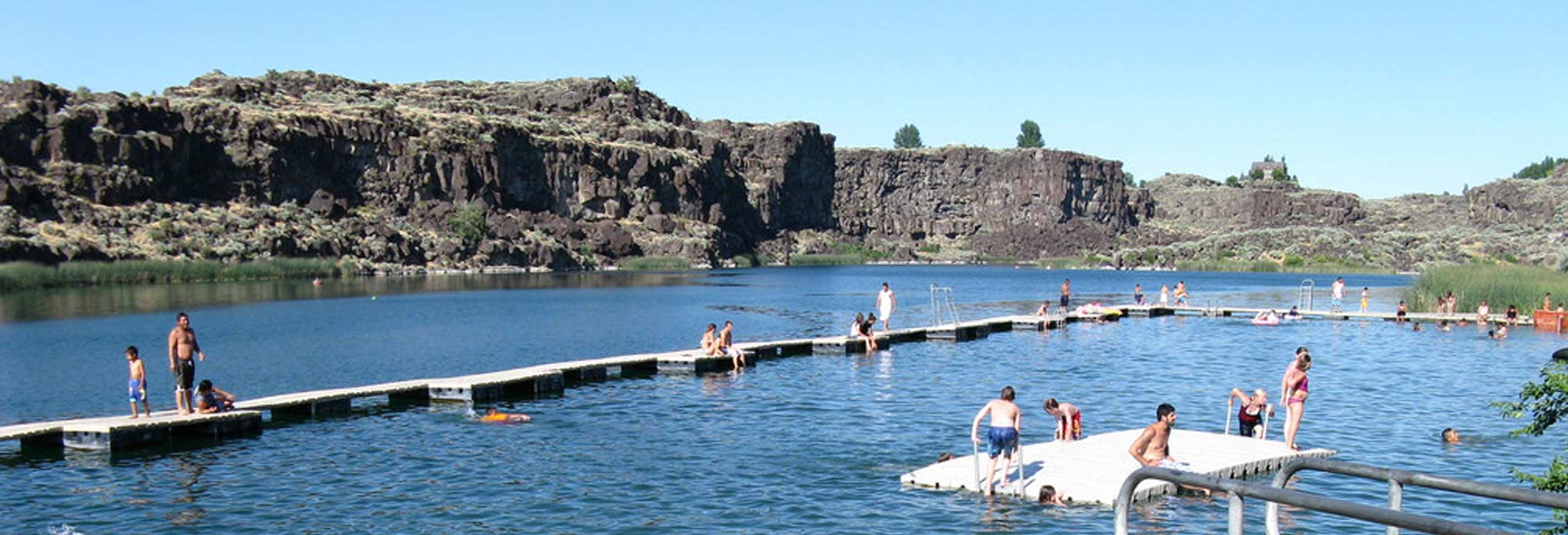
Dierkes Lake offers popular swimming areas, especially at the designated beach within Shoshone Falls Park. The depth profile here is particularly important.
- Designated Swim Areas: The beaches are typically graded to offer a gradual entry into the water. This means you will encounter very shallow water near the shore, which gradually deepens. Lifeguards, if present, will often delineate a safe swimming zone based on depth and distance from shore.
- Safety: Swimmers should always be aware of their surroundings and the decreasing visibility in the water. Even in areas that appear moderately deep, submerged objects or sudden drop-offs can pose a risk. It is advisable to swim within designated areas and to be aware of your own swimming capabilities. The average depths mentioned earlier (15-30 feet) suggest that beyond a certain distance from shore, the water can become too deep for novice swimmers.
Fishing
Dierkes Lake is a known fishing spot, attracting anglers seeking various species. The depth, structure, and temperature of the water are all critical factors for fish habitat and angler success.
- Fish Species: The lake is stocked with species like rainbow trout and bass, which have specific habitat preferences related to depth and temperature. Trout, for instance, often prefer cooler, deeper waters, especially during warmer months. Bass may be found in shallower areas around structure or in deeper weed beds.
- Structure: Anglers often target areas with submerged structure – fallen trees, rock piles, or changes in bottom contour – which can provide both cover and food for fish. Understanding the lake’s depth helps in identifying potential fishing hotspots. Deeper trenches or drop-offs are often prime locations for larger predatory fish.
- Seasonal Variations: As mentioned, water temperature changes with depth and season. In summer, the surface can become quite warm, driving fish to seek the cooler sanctuary of deeper water. During spring and fall, fish might be more dispersed, but deeper, more stable temperature zones can still be key.
- Techniques: Different fishing techniques are employed depending on the depth and the target species. For shallow water, casting lures or using topwater baits might be effective. For deeper areas, techniques like bottom fishing, trolling, or using jigs become more relevant. Knowing the approximate depth of different zones on the lake allows anglers to select the most appropriate gear and strategy.
Environmental Factors Influencing Depth
Beyond human management and recreational use, several environmental factors can influence the perceived and actual depth of Dierkes Lake.
Siltation and Sedimentation
Like many reservoirs, Dierkes Lake is subject to siltation – the gradual accumulation of sediment washed in from its watershed or carried by the inflowing canal water. Over time, this process can lead to a reduction in the lake’s maximum and average depths, particularly in the areas where water flow slows down, such as near the inlets. While not a rapid process, it is a natural phenomenon that contributes to the lake’s evolving bathymetry. This can also create shallower, marshier areas at the lake’s edges.
Aquatic Vegetation Growth
The shallower regions of Dierkes Lake, especially those with ample sunlight and nutrient availability, can support significant growth of aquatic vegetation. This plant life can give the appearance of shallower water and can also make navigation more challenging, particularly for boats. In some instances, dense weed beds can create areas that feel shallower than they actually are due to the vegetation extending towards the surface.
Water Level Fluctuations
As a component of an irrigation system, Dierkes Lake’s water levels are subject to management. During peak irrigation seasons, water may be drawn down to supply agricultural needs. Conversely, during periods of high inflow or reduced demand, the lake will fill. These natural fluctuations mean that the “depth” of Dierkes Lake is not a static measurement but one that can change significantly throughout the year, impacting accessible areas for recreation. It is always advisable for visitors to check current water levels if possible, especially if engaging in activities that are highly sensitive to water depth.
Planning Your Visit to Dierkes Lake
For those planning a visit to Dierkes Lake, understanding its depth is a key piece of information that enhances safety, enjoyment, and preparedness.
Safety First
- Know Your Limits: Whether swimming or boating, always be aware of your own abilities and the conditions of the water. Do not venture into areas that appear too deep for your comfort level or skill set.
- Observe Posted Signs: Shoshone Falls Park and the surrounding areas often have posted signs regarding water safety, depth, and regulations. Pay close attention to these advisories.
- Life Jackets: Always wear appropriate personal flotation devices (PFDs) when on or near the water, especially for children and non-swimmers.
Navigating the Lake
- Charts and Maps: While detailed bathymetric charts for Dierkes Lake are not widely published, local knowledge and careful observation can provide guidance. Online mapping services sometimes show contour lines for reservoirs, which can offer a general idea of depth variations.
- Observe Other Users: Watching experienced boaters and anglers can provide clues about navigating the lake safely.

Fishing and Recreation Tips
- Local Knowledge: If you’re a keen angler, consider visiting a local tackle shop in Twin Falls or consulting online fishing forums for up-to-date information on productive fishing spots, which often correlate with specific depths and structures.
- Adapt Your Gear: Be prepared to adapt your fishing tackle and boating equipment based on the expected depths and conditions. For example, longer fishing rods might be useful for reaching deeper areas, and shallower draft boats may be more maneuverable.
In conclusion, while Dierkes Lake may not be defined by extreme depths, its varied underwater topography plays a significant role in shaping its character as a recreational asset in Idaho. Understanding that it’s a moderately shallow lake, with depths ranging generally from 15 to 30 feet on average and reaching perhaps 40 feet in its deepest pockets, allows visitors to approach their activities with greater confidence and safety, ensuring a memorable and enjoyable experience amidst the natural beauty of the Magic Valley.
LifeOutOfTheBox is a participant in the Amazon Services LLC Associates Program, an affiliate advertising program designed to provide a means for sites to earn advertising fees by advertising and linking to Amazon.com. Amazon, the Amazon logo, AmazonSupply, and the AmazonSupply logo are trademarks of Amazon.com, Inc. or its affiliates. As an Amazon Associate we earn affiliate commissions from qualifying purchases.