
The question of distance between two major Californian cities is a common one for travelers, commuters, and residents alike. Understanding the spatial relationship between Bakersfield, CA and Los Angeles is crucial for planning road trips, business travel, or even just a weekend getaway. This exploration delves into the various distances and travel times, offering insights for anyone looking to traverse the approximately 110-mile stretch.
Understanding the Geographic Divide
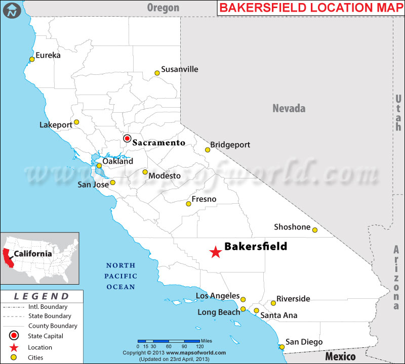
Bakersfield lies in the southern San Joaquin Valley, a fertile agricultural heartland of California. Los Angeles, on the other hand, sprawls across a vast coastal basin. The geography separating them is primarily flat, agricultural land and then the rising terrain of the Tehachapi Mountains. This mountainous range presents a natural, albeit navigable, barrier between the two urban centers. The journey typically involves traversing through scenic farmlands and then ascending and descending through mountain passes.
Direct Driving Distance
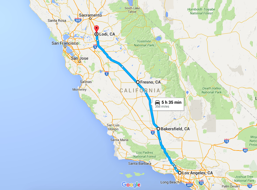
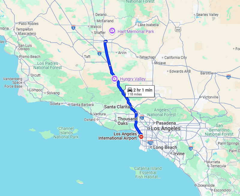
The most common way to measure the distance between Bakersfield and Los Angeles is by road. The direct driving distance, depending on the specific starting and ending points within each city, hovers around 110 to 120 miles. This figure can fluctuate slightly due to variations in GPS routing and the precise location of your destination. For instance, driving from downtown Bakersfield to downtown Los Angeles will yield a slightly different mileage than a trip from the northern edge of Bakersfield to the western outskirts of Los Angeles.
Route Variations and Their Impact
The primary highway connecting Bakersfield and Los Angeles is State Route 99 (SR 99), which eventually merges with Interstate 5 (I-5). Another common route involves taking State Route 58 (SR 58) eastward from Bakersfield to meet I-5 south of the Tehachapi Mountains, or continuing on SR 58 towards Mojave and then heading south. Each route offers a slightly different experience and mileage.
- SR 99/I-5 Route: This is arguably the most direct and heavily traveled route. It winds through the heart of the San Joaquin Valley before encountering the Tehachapi Pass on I-5. The mileage is generally consistent with the average direct distance.
- SR 58/I-5 Route: This route takes drivers east from Bakersfield before connecting to I-5. It offers a slightly more southerly path through the mountains. The mileage might be marginally different, and the scenery can vary, showcasing more desert-like landscapes as it approaches the Tehachapi Pass from the east.
- Scenic Routes: For those with more time, there are less direct, more scenic routes that might involve county roads and smaller state highways. These would significantly increase the mileage and travel time but could offer a more immersive experience of California’s diverse landscapes.
Travel Time Considerations
While mileage provides a static measure of distance, travel time is a dynamic factor influenced by traffic, time of day, and road conditions. The drive between Bakersfield and Los Angeles is a significant undertaking, and time estimates are crucial for planning.
Average Driving Times
Under ideal conditions – light traffic and clear weather – the drive can take approximately 1 hour and 45 minutes to 2 hours. However, this is a rare scenario, especially when entering or exiting the Los Angeles metropolitan area.
The Impact of Traffic Congestion
Los Angeles is notorious for its traffic. During peak commuting hours, typically weekday mornings (6 AM to 10 AM) and afternoons (3 PM to 7 PM), travel times can more than double. A drive that might take under two hours on a Sunday morning could easily extend to 3 to 4 hours or more during a Tuesday evening commute. This is a critical factor for anyone planning to drive, especially if they have time-sensitive appointments or wish to avoid the most stressful driving conditions.
Factors Affecting Travel Time:
- Time of Day: As mentioned, rush hour significantly impacts travel time.
- Day of the Week: Fridays and Sundays often see increased traffic as people travel for weekend getaways or return home.
- Holidays and Special Events: Major holidays and large events in Los Angeles can lead to unpredictable traffic surges.
- Weather Conditions: While the route is generally clear, heavy rain or fog in the mountain passes can slow down traffic.
- Construction: Road construction projects, which are common in California, can cause significant delays.
Alternative Modes of Transportation
While driving is the most common method, other transportation options exist for traveling between Bakersfield and Los Angeles, each with its own advantages and distance considerations.
Amtrak Rail Service
Amtrak offers a passenger rail service connecting Bakersfield and Los Angeles via the San Joaquin Route. This route provides a scenic and more relaxing alternative to driving, especially for those who dislike navigating heavy traffic.
- Route: The train typically departs from the Bakersfield Station and arrives at Union Station in Los Angeles. The journey covers a similar geographic area as the driving routes but on a different infrastructure.
- Travel Time: Train travel times are generally more consistent than driving, as they are not subject to road traffic. A typical Amtrak journey between these two cities can range from 3 to 4 hours. This duration allows passengers to relax, read, work, or simply enjoy the passing scenery without the stress of driving.
- Distance: While the actual rail track distance may differ from road mileage, the overall journey covers a comparable span, highlighting the accessibility between the two regions.
Bus Services
Several intercity bus services operate between Bakersfield and Los Angeles. Companies like FlixBus and Greyhound provide economical options for travelers.
- Stations: Bus departures and arrivals are typically from designated bus terminals in each city.
- Travel Time: Bus travel times are comparable to train travel, often ranging from 3 to 5 hours, depending on the number of stops and traffic conditions encountered en route. While generally more affordable than train travel, bus journeys can sometimes be longer due to frequent stops.
- Distance: The bus routes follow major highways, and the mileage is consistent with the driving distances, with the primary difference being the extended time due to service patterns.
Planning Your Journey
When planning a trip between Bakersfield and Los Angeles, it is essential to consider the distance and potential travel times based on your chosen mode of transportation and the time of day you plan to travel.
Key Considerations for Travelers:
- Purpose of Travel: Are you heading to Los Angeles for a day trip, a business meeting, a vacation, or to visit family? The purpose will dictate how much time you can afford to spend on travel and how critical punctuality is.
- Time of Day: If driving, avoid peak commute hours in Los Angeles. Consider leaving early in the morning or late in the evening, or traveling on weekends to minimize traffic delays.
- Mode of Transport: Evaluate the pros and cons of driving versus public transportation. Driving offers flexibility but comes with the risk of traffic. Amtrak and bus services offer a more predictable travel time and a chance to relax, but with fixed schedules.
- Destination within Los Angeles: The vastness of Los Angeles means that the final destination within the county can add significant time to your journey, especially if you are traveling from the east side of the city to the west, or vice versa, from Bakersfield.
Estimating Travel Time Accurately
To get the most accurate estimate for your specific trip, it is recommended to use real-time navigation apps like Google Maps or Waze. These apps factor in current traffic conditions, road closures, and construction to provide up-to-the-minute travel time estimates. For train and bus services, consult the official schedules of Amtrak or the respective bus companies.
By understanding the geographical distance, typical travel times, and available transportation options, travelers can effectively plan their journeys between Bakersfield and Los Angeles, ensuring a smoother and more enjoyable experience. The approximately 110-mile span offers a gateway between agricultural heartlands and a major metropolitan hub, a route well-traveled by millions each year.
LifeOutOfTheBox is a participant in the Amazon Services LLC Associates Program, an affiliate advertising program designed to provide a means for sites to earn advertising fees by advertising and linking to Amazon.com. Amazon, the Amazon logo, AmazonSupply, and the AmazonSupply logo are trademarks of Amazon.com, Inc. or its affiliates. As an Amazon Associate we earn affiliate commissions from qualifying purchases.