
The question of distance between two geographically proximate, yet distinct, locales is a common one for travelers, residents, and those planning excursions. For individuals contemplating a journey between Coral Springs and Miami, understanding the spatial relationship is key to efficient planning, whether for a day trip, a business engagement, or a transition to a new home. This exploration delves into the metrics of travel, the nuances of transit, and the strategic considerations that shape the perceived “distance” between these two South Florida communities.
Understanding the Direct Distance and Travel Time
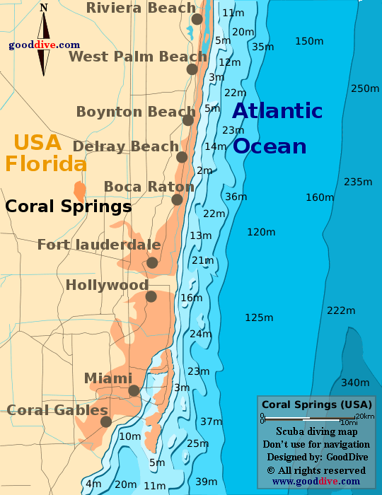
At its core, the distance between Coral Springs and Miami is a matter of miles, but the practical experience of traversing this segment of Florida is defined by more than just a numerical value. The direct, or “as the crow flies,” distance is relatively short, underscoring their proximity within the sprawling Miami metropolitan area. However, the reality of travel involves navigating road networks, traffic patterns, and the specific modes of transportation chosen.
Driving Distance and Estimated Travel Times
The most common method of travel between Coral Springs and Miami is by car. The driving distance typically ranges from approximately 25 to 35 miles, depending on the specific starting point in Coral Springs and the intended destination within the vast expanse of Miami. This geographical spread is crucial to consider, as Miami itself encompasses diverse neighborhoods, from the vibrant urban core of Downtown Miami to the coastal allure of Miami Beach and the affluent enclaves of Coral Gables.
The estimated travel time by car can fluctuate significantly. Under optimal conditions, with minimal traffic, the journey might take as little as 30 to 40 minutes. However, South Florida is notorious for its traffic congestion, particularly during peak commuting hours, which typically occur on weekday mornings (roughly 7:00 AM to 9:30 AM) and afternoons (approximately 4:00 PM to 6:30 PM). During these times, the travel time can easily extend to an hour, or even longer, especially if accidents or construction further impede the flow of vehicles. Major arteries such as the Sawgrass Expressway, the Florida Turnpike, and I-95 are primary routes, and their conditions directly impact the journey’s duration.
Public Transportation Options and Their Timings
For those who prefer to avoid driving or the potential stress of traffic, public transportation offers an alternative. The Broward County Transit (BCT) system provides bus services within Broward County, including routes that connect Coral Springs to areas that may then link to Miami-Dade Transit services. However, it’s important to note that direct, rapid transit from Coral Springs to the heart of Miami is less streamlined than driving. Journeys via public transit typically involve multiple transfers and can significantly extend the overall travel time, often exceeding 1.5 to 2 hours, depending on the specific routes and waiting times for connections. This option is generally more feasible for those with ample time and a destination in Miami that is conveniently located near a transit hub.
Navigating Between Cities: Key Routes and Considerations
The choice of route is paramount in determining both the travel time and the overall experience of moving between Coral Springs and Miami. Understanding the primary thoroughfares and potential bottlenecks can significantly aid in planning.
The [Florida Turnpike] and I-95 Corridor

The Florida Turnpike is a primary north-south toll road that serves as a crucial link for many travelers moving between Coral Springs and various parts of Miami. From Coral Springs, one might access the Turnpike via the Sawgrass Expressway, which itself is a toll road. Traveling south on the Turnpike will eventually lead into the Miami area.
Alternatively, drivers may opt for surface streets and eventually connect to I-95 South. I-95 is a major Interstate Highway that runs directly through Miami and is a vital artery for the region. However, I-95 is also known for its heavy traffic volume, particularly in the Miami-Dade portion. The choice between the Turnpike and I-95 often comes down to the specific destination in Miami and the current traffic conditions. Tolls are a factor to consider with both the Turnpike and the Sawgrass Expressway, and real-time traffic apps are invaluable for making informed decisions on the fly.
Utilizing Surface Streets and Local Roads
For shorter distances or when traffic on major highways becomes prohibitive, navigating via surface streets and local roads is an option. In Broward County, major east-west arteries like Sample Road and Atlantic Boulevard, and north-south routes such as University Drive and Nob Hill Road, provide access points to the highway system. As one moves south towards Miami, routes like U.S. 1 (Federal Highway) and Biscayne Boulevard become significant thoroughfares. While these routes can offer a more scenic journey and access to local businesses, they are also subject to local traffic lights and congestion, which can slow travel times considerably, especially in urbanized areas.
Strategic Travel Planning for a Smooth Journey
Beyond the mere distance, successful travel between Coral Springs and Miami hinges on strategic planning. This involves understanding the purpose of the trip, the desired arrival time, and the flexibility available.
Timing Your Departure to Avoid Peak Traffic
As mentioned, traffic is a defining characteristic of South Florida commuting. For those traveling between Coral Springs and Miami, departing outside of the morning and afternoon rush hours can make a significant difference. Traveling mid-day, on weekends, or very early in the morning (before 6:30 AM) or late in the evening (after 7:00 PM) can result in a much smoother and quicker journey. If an early morning arrival in Miami is necessary, departing from Coral Springs before dawn is often the most effective strategy.
Considering Destination and Mode of Transport
The specific destination within Miami also plays a role. If the destination is in northern Miami-Dade County, such as near Aventura, the proximity to Coral Springs is closer, and routes might be more direct. Conversely, venturing further south to Downtown Miami, Brickell, or Miami Beach will inherently increase the travel time. For events in the heart of Miami where parking is a concern, using rideshare services like Uber or Lyft, or even exploring the possibility of utilizing the Brightline train from a nearby station, might be more practical than driving and parking.
The Value of Real-Time Traffic Information
In an era of advanced technology, leveraging real-time traffic applications is no longer a luxury but a necessity for efficient travel in South Florida. Apps such as Google Maps, Waze, and Apple Maps provide up-to-the-minute information on traffic conditions, accident alerts, and road closures. These tools can dynamically reroute drivers to avoid congestion, significantly reducing travel times and stress. Regularly checking these applications before and during the journey between Coral Springs and Miami is a fundamental aspect of modern travel planning. By understanding the distances, routes, and traffic nuances, individuals can effectively plan their journeys, ensuring a seamless transition between these dynamic South Florida communities.
LifeOutOfTheBox is a participant in the Amazon Services LLC Associates Program, an affiliate advertising program designed to provide a means for sites to earn advertising fees by advertising and linking to Amazon.com. Amazon, the Amazon logo, AmazonSupply, and the AmazonSupply logo are trademarks of Amazon.com, Inc. or its affiliates. As an Amazon Associate we earn affiliate commissions from qualifying purchases.