
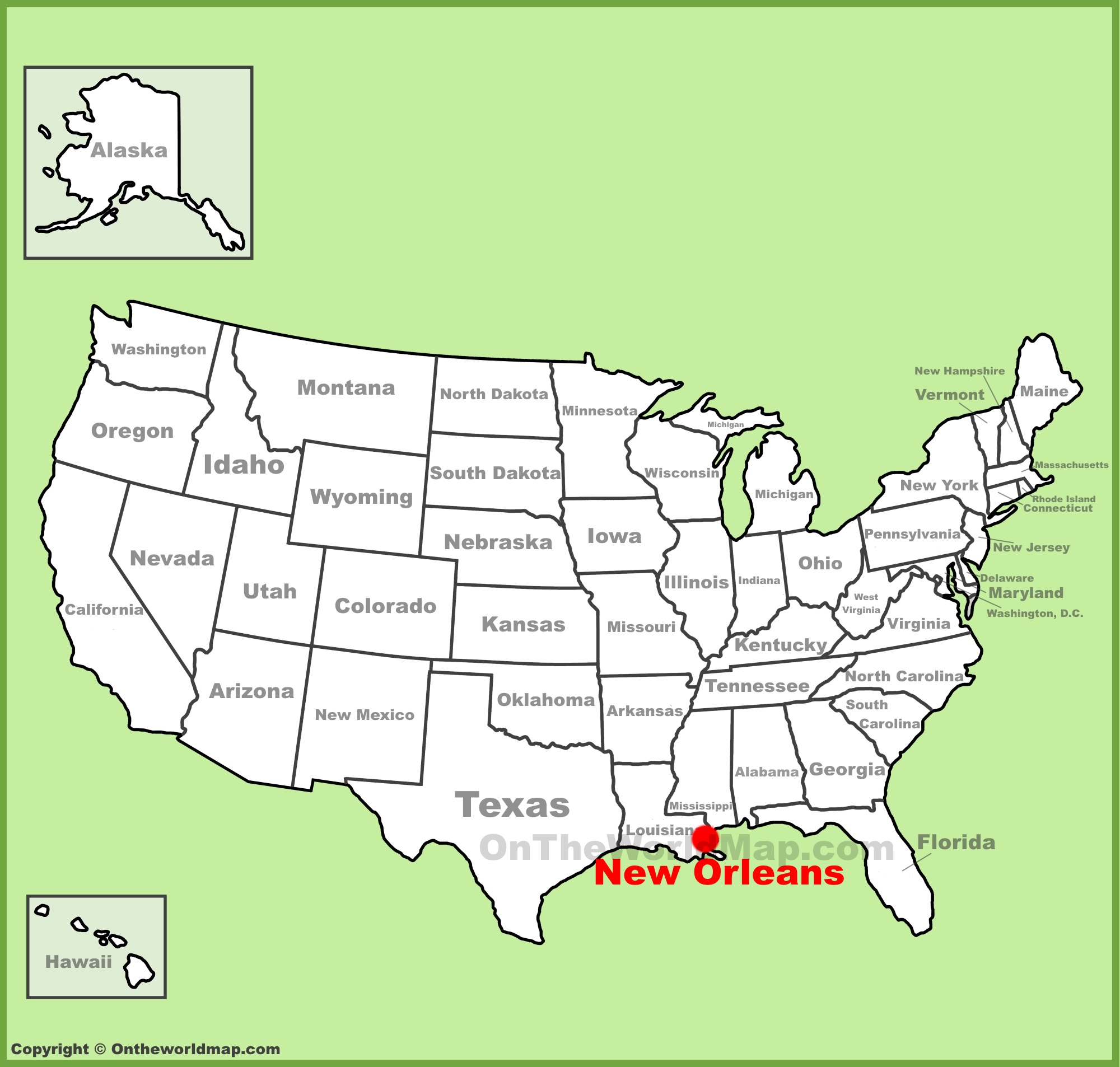
New Orleans, a city synonymous with vibrant culture, intoxicating music, and unparalleled culinary experiences, occupies a unique and geographically significant position within the United States. Nestled in the southeastern corner of Louisiana, it is a city deeply intertwined with its watery landscape, famously situated on the eastern bank of the Mississippi River, approximately 105 miles upstream from the Gulf of Mexico. Understanding its precise location is not merely an exercise in cartography; it’s a gateway to grasping the very essence of what makes New Orleans so captivating. Its position has shaped its history, its architecture, its people, and its enduring spirit.
The Crescent City’s Geographical Embrace
The nickname “The Crescent City” is instantly understandable when one visualizes New Orleans on a map. The city is cradled by a prominent westward bend of the Mississippi River, giving it a distinctive crescent shape. This curve is not just an aesthetic feature; it has played a crucial role in the city’s development as a vital port and a center of commerce for centuries. The river itself is a powerful presence, shaping the land, influencing weather patterns, and providing the lifeblood for the region’s rich ecosystems.
Proximity to the Gulf and Its Implications
New Orleans lies in close proximity to the Gulf of Mexico. This closeness means the city experiences a subtropical climate, characterized by hot, humid summers and mild winters. This climate contributes to the lush, verdant landscape that surrounds the city, often referred to as the Louisiana bayous and wetlands. However, this proximity also brings geographical challenges, most notably the city’s below-sea-level elevation in many areas, which necessitates extensive levee systems to protect it from flooding. This constant negotiation with water has profoundly influenced the city’s infrastructure, its resilience, and its unique way of life.
Parishes and Neighboring Territories
Administratively, New Orleans is located in Orleans Parish, one of the 64 parishes that make up the state of Louisiana. It shares borders with several other parishes, including Jefferson Parish to the west and south, and St. Bernard Parish to the east. To the north, across Lake Pontchartrain, lie the parishes of Tangipahoa, St. Tammany, and Washington. Understanding these neighboring territories helps to contextualize New Orleans within its regional setting, revealing a tapestry of interconnected communities and environments.
Navigating to the Heart of Southern Culture
When looking at a United States map, New Orleans is situated in the Deep South region, a cultural and historical heartland of America. Its strategic location at the mouth of the Mississippi River has historically made it a crucial gateway for trade and a melting pot of diverse cultures. This geographical advantage facilitated the influx of peoples from various backgrounds, including French, Spanish, African, Caribbean, and Irish, each contributing to the city’s rich cultural mosaic.
Key Highways and Transportation Hubs

Reaching New Orleans is facilitated by a network of major highways. The most prominent is Interstate 10 (I-10), which bisects the city, connecting it to Houston to the west and Florida to the east. Other significant routes include Interstate 55 (I-55), which connects New Orleans to Chicago via Jackson, Mississippi, and U.S. Route 90 (US-90), which runs along the coast. The city is also served by Louis Armstrong New Orleans International Airport (MSY), a major hub for domestic and international travel, further cementing its accessibility as a world-renowned destination. The presence of a robust public transportation system, including the historic streetcars, also makes navigating within the city a charming and practical experience.
Relationship with Nearby States
New Orleans shares borders with two significant states: Mississippi to its east and north, and Texas to its west. The influence of Mississippi is particularly pronounced, with its cultural and historical ties to the Mississippi Delta region. The proximity to Texas also impacts economic and social dynamics. Understanding New Orleans on a map means recognizing it not as an isolated entity, but as a vibrant node within a larger regional network, deeply influenced by and influencing its neighbors.
The Architectural and Environmental Landscape
The unique geographical setting of New Orleans has profoundly shaped its distinctive architecture and environment. The need to build on soft, alluvial soil and to contend with a high water table has led to a style of construction that is both resilient and aesthetically striking.
French Quarter and its Unique Foundations
The iconic French Quarter, one of the oldest and most beloved neighborhoods in the city, stands as a testament to this. Its colorful Creole townhouses, with their wrought-iron balconies and raised foundations, are designed to withstand the humid climate and potential for inundation. These architectural features are not merely decorative; they are functional adaptations to the environment. The narrow streets and dense urban fabric of the French Quarter are also a direct result of its historical development as a colonial settlement.
The Impact of Wetlands and Bayou Country
Surrounding New Orleans is a vast expanse of wetlands and bayou country. This environment, characterized by swamps, marshes, and cypress trees, is a crucial ecological buffer and a source of natural beauty. These wetlands play a vital role in protecting the city from storm surges, although their preservation is an ongoing concern due to factors like coastal erosion and development. Exploring these natural areas, perhaps via a swamp tour, offers a different perspective on the region’s geography and the delicate balance between human habitation and nature. The very air and scent of New Orleans are imbued with the essence of its watery surroundings.
A City Defined by its Position
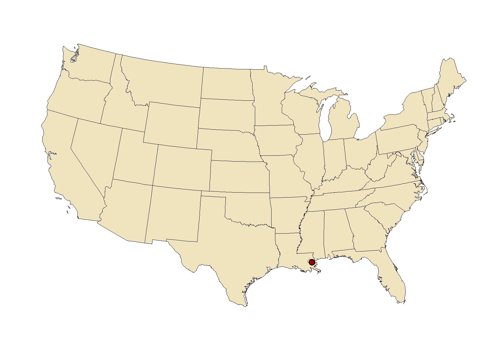
In conclusion, the question of “Where Is New Orleans On A US Map?” unlocks a deeper understanding of this extraordinary city. It is a place where the Mississippi River meets the Gulf of Mexico, where its crescent shape embraces a rich cultural heritage, and where its subtropical climate and unique topography have forged a resilient and vibrant community. Its position has not only determined its physical layout but has also been instrumental in shaping its history, its economy, and its inimitable soul. To locate New Orleans on a map is to begin an exploration of one of America’s most culturally significant and geographically fascinating cities.
LifeOutOfTheBox is a participant in the Amazon Services LLC Associates Program, an affiliate advertising program designed to provide a means for sites to earn advertising fees by advertising and linking to Amazon.com. Amazon, the Amazon logo, AmazonSupply, and the AmazonSupply logo are trademarks of Amazon.com, Inc. or its affiliates. As an Amazon Associate we earn affiliate commissions from qualifying purchases.