
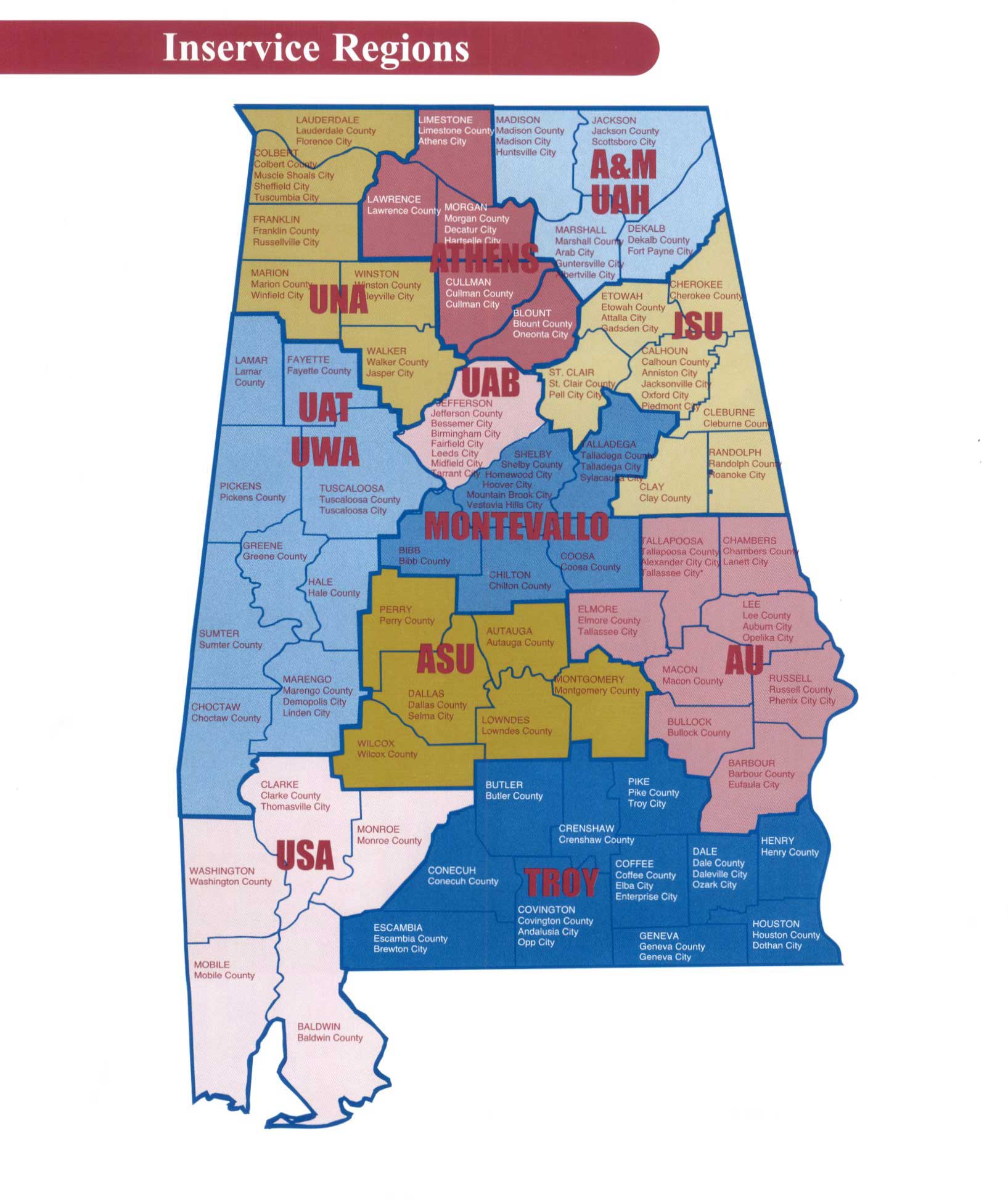
South Alabama, a region brimming with diverse landscapes, rich history, and vibrant culture, occupies the lower third of the state of Alabama, stretching from the pristine shores of the Gulf of Mexico northward to roughly the mid-state mark. This distinctive geographic area is not merely a collection of counties; it embodies a unique identity characterized by its coastal influences, fertile plains, and intricate river systems, offering a myriad of travel experiences for every kind of explorer. Understanding its location is the first step to unlocking the potential of a journey through this captivating part of the American South.

Pinpointing South Alabama on the Map
Geographically, South Alabama is defined by its position relative to the state’s major natural features and political divisions. While there isn’t a universally recognized, strict boundary line, common understanding places South Alabama as the region south of the state capital, Montgomery, extending all the way to the Gulf of Mexico.
Geographic Boundaries and Regional Identity
The most prominent natural boundary for South Alabama is the Gulf of Mexico to its south, forming the renowned Alabama Gulf Coast. To the west, the border is shared with the state of Mississippi, primarily defined by the Pascagoula River basin and inland county lines. To the east, South Alabama meets Georgia and the Florida Panhandle, with the Chattahoochee River serving as a significant eastern landmark.
The region encompasses a variety of physiographic provinces, from the flat, sandy coastal plains to rolling hills further inland. This topographical diversity contributes to the rich ecosystems and varied agricultural practices found throughout South Alabama, creating distinct travel segments. The regional identity is deeply intertwined with its history as a major port and agricultural hub, influencing its architecture, cuisine, and cultural traditions.
Key Waterways and Coastal Influence
Crucial to South Alabama’s identity and accessibility are its extensive waterways. The Mobile Bay, a massive estuary where the Mobile and Tensaw Rivers converge, dominates the western coastal area. This bay is a vital ecological and economic artery, leading out to the Gulf of Mexico. Further east, numerous smaller rivers and bayous feed into the Gulf, carving out picturesque landscapes and providing ample opportunities for water-based recreation.
The proximity to the Gulf profoundly shapes the climate, culture, and economy of South Alabama. It means a subtropical climate with mild winters and hot, humid summers, ideal for year-round outdoor activities. The coastal towns thrive on tourism, fishing, and maritime industries, contrasting with the agricultural focus of the inland areas.
Discovering South Alabama’s Diverse Landscapes and Major Hubs
South Alabama is a traveler’s delight due to its varied environments, from bustling port cities to tranquil barrier islands and sprawling rural expanses. Each segment offers a distinct flavor of Southern charm.
The Allure of the Alabama Gulf Coast
The southernmost stretch of South Alabama is defined by its stunning white-sand beaches, primarily centered around the popular destinations of Gulf Shores and Orange Beach. These coastal towns are magnets for beachgoers, offering a vibrant atmosphere with resorts, restaurants, and entertainment. Beyond the main hubs, Dauphin Island, a serene barrier island, provides a more laid-back experience with historic forts, bird sanctuaries, and pristine beaches. This region is a paradise for those seeking sun, sand, and water sports, from deep-sea fishing to paddleboarding. The Bon Secour National Wildlife Refuge near Gulf Shores showcases the natural, undeveloped beauty of the Gulf Coast ecosystem.
Inland Charms: From Historic Cities to Agricultural Heartland
Moving inland from the coast, South Alabama transitions into a blend of historic cities, small towns, and vast agricultural lands. Mobile, the region’s largest city, stands proudly on the western shore of Mobile Bay. As Alabama’s only saltwater port, Mobile boasts a rich and complex history, evident in its French, Spanish, and American influences, stunning antebellum architecture, and vibrant Mardi Gras traditions. It serves as a cultural and economic anchor for the entire southern part of the state.
Further east, the Wiregrass Region centers around Dothan, often called the “Peanut Capital of the World.” This area is characterized by its agricultural heritage, friendly communities, and a quieter, more rural pace of life. It offers travelers a glimpse into traditional Southern living, with local festivals and outdoor recreation opportunities in parks and lakes. Other notable towns like Fairhope in Baldwin County, known for its picturesque downtown and artistic community, offer unique charm and scenic views over Mobile Bay.
Navigating South Alabama: Accessibility and Travel Routes
Reaching and exploring South Alabama is straightforward, thanks to a well-developed network of highways and regional airports.
Major Airports and Road Networks
The primary gateway for air travelers to South Alabama is Mobile Regional Airport (MOB), located west of the city of Mobile. It offers connections to major hubs, facilitating easy access to the coast and western South Alabama. For the eastern part of the region, the Dothan Regional Airport (DHN) serves the Wiregrass Region. Travelers can also consider flying into nearby larger airports such as Pensacola International Airport (PNS) in Florida, which is often a convenient option for accessing the Alabama Gulf Coast due to its close proximity.
By road, Interstate 10 is the main east-west artery, connecting Mobile with Mississippi to the west and Florida to the east, running directly through the heart of the coastal region. Interstate 65 provides a crucial north-south route, linking Mobile to Montgomery and further north into Alabama. Other significant highways like US-98, US-31, and US-431 weave through the region, connecting smaller towns and offering scenic drives.
Regional Connections and Scenic Drives
Once in South Alabama, travelers will find a robust network of state routes and county roads that facilitate exploration. The Dauphin Island Parkway (County Road 193) offers a picturesque drive from Mobile to Dauphin Island, complete with views of Mobile Bay and the Gulf of Mexico. For those seeking to explore the vast Mobile-Tensaw Delta, numerous smaller roads and waterways provide access points for kayaking, fishing, and wildlife viewing. The scenic routes through Baldwin County, particularly around Fairhope and along the Eastern Shore of Mobile Bay, are perfect for leisurely drives, revealing stunning vistas and charming communities.
Experiencing South Alabama: A Traveler’s Guide to Regions and Attractions
South Alabama’s geographic location lends itself to distinct regional experiences, each offering unique attractions for travelers.
Coastal Escapes: Gulf Shores, Orange Beach, and Dauphin Island
The Alabama Gulf Coast is synonymous with beach vacations. Gulf Shores and Orange Beach provide extensive family-friendly attractions, from amusement parks and water parks to championship golf courses and deep-sea fishing charters. Visitors can relax on the soft sands, swim in the emerald waters, or explore the Gulf State Park, which offers hiking trails, zip-lining, and a pier extending well into the Gulf. Dauphin Island, accessible by bridge from Mobile or via the Mobile Bay Ferry from Fort Morgan on the Fort Morgan Peninsula, offers a more natural and historic coastal experience, featuring the Dauphin Island Sea Lab Estuarium and the historic Fort Gaines.
Historic Mobile Bay and Mobile
The city of Mobile is a treasure trove for history buffs and culture enthusiasts. Its historic districts, such as the Church Street East Historic District and Oakleigh Garden District, showcase stunning architecture ranging from Creole cottages to grand mansions. Attractions like the USS Alabama Battleship Memorial Park, the Mobile Carnival Museum, and the Mobile Museum of Art offer diverse insights into the city’s past and present. The vast Mobile-Tensaw Delta, a national natural landmark, is easily accessible from Mobile and provides unparalleled opportunities for ecotourism, including kayaking, bird watching, and airboat tours through its intricate network of bayous and wetlands.
The Wiregrass Region and its Unique Appeal (Dothan)
Further inland, the Wiregrass Region offers a different pace of travel. Dothan, its largest city, is known for its “peanut trail” of decorated peanut sculptures and the National Peanut Festival. Travelers can explore local history at the Landmark Park, a 19th-century living history farm and natural science museum, or enjoy outdoor activities at nearby state parks and lakes, such as Lake Eufaula, which is renowned for its bass fishing. The region embodies genuine Southern hospitality and provides a relaxing escape from urban hustle.
River Parishes and Nature Preserves (Tensaw Delta, Baldwin County)
Beyond the main cities, South Alabama is crisscrossed by numerous rivers and boasts extensive natural preserves. The Tensaw Delta, one of the largest river deltas in the United States, is a biodiversity hotspot offering unmatched opportunities for outdoor adventure and wildlife viewing. Baldwin County, east of Mobile Bay, hosts charming communities like Fairhope and Foley, which offer a blend of quaint small-town appeal, boutique shopping, and easy access to both the bay and the Gulf Coast. The Weeks Bay National Estuarine Research Reserve is another significant ecological site where visitors can explore wetlands and learn about coastal conservation efforts.
Preparing for Your South Alabama Adventure
A successful trip to South Alabama involves some practical considerations to ensure a comfortable and enjoyable experience.
Climate Considerations and Seasonal Travel
South Alabama experiences a humid subtropical climate. Summers (June to August) are hot and humid, with average temperatures often in the high 80s to low 90s Fahrenheit (30-35°C), accompanied by high humidity and occasional afternoon thunderstorms. This is peak season for beach destinations. Spring (March to May) and Fall (September to November) offer milder temperatures, less humidity, and fewer crowds, making them ideal for exploring historic sites, enjoying outdoor activities, and attending local festivals. Winters (December to February) are generally mild and pleasant, with average temperatures in the 50s and 60s Fahrenheit (10-20°C), perfect for snowbirds and those looking to escape colder climates. It’s important to be aware of hurricane season, which runs from June 1st to November 30th, particularly for coastal travel.

Local Resources for Visitors
Before or during your trip, utilize the wealth of information available through local tourism boards and visitor centers. The Mobile Bay Convention & Visitors Bureau and the Gulf Shores & Orange Beach Tourism websites are excellent resources for planning activities, finding accommodations, and discovering local events. Similarly, Dothan Area Convention & Visitors Bureau provides detailed guides for the Wiregrass Region. These resources offer maps, brochures, and expert advice to help travelers make the most of their visit to the diverse and inviting region of South Alabama.
LifeOutOfTheBox is a participant in the Amazon Services LLC Associates Program, an affiliate advertising program designed to provide a means for sites to earn advertising fees by advertising and linking to Amazon.com. Amazon, the Amazon logo, AmazonSupply, and the AmazonSupply logo are trademarks of Amazon.com, Inc. or its affiliates. As an Amazon Associate we earn affiliate commissions from qualifying purchases.