
Navigating Boston’s Public Transportation: The T
Understanding public transportation is paramount for efficiently exploring Boston. The Massachusetts Bay Transportation Authority, affectionately known as “The T,” provides a comprehensive network of subways, buses, commuter rail, and ferries, making it the backbone of urban transit. For visitors, the subway system, specifically, is often the most convenient and cost-effective way to reach major attractions and neighborhoods across the city. Its color-coded lines are relatively straightforward to navigate, connecting key points from the historic core to vibrant university campuses and sports venues. Mastering The T means unlocking Boston’s accessibility without the stress of driving and parking in a notoriously congested city.
Understanding the MBTA System
The MBTA operates five subway lines (Red, Green, Blue, Orange, and Silver), a vast bus network, a commuter rail serving greater Boston and surrounding towns, and ferry services. While the commuter rail and certain bus routes are invaluable for residents, tourists will primarily rely on the subway, or “The T.” Each subway line has distinct routes and serves different parts of the city, converging at central transfer points like Park Street and Downtown Crossing. The system is generally clean, safe, and efficient, though like any major city’s transit, it can experience delays, especially during peak hours or inclement weather. Utilizing real-time tracking apps is highly recommended to stay updated on service changes.
CharlieCard vs. CharlieTicket
To ride The T, you’ll need a fare medium. The two primary options are the CharlieCard and the CharlieTicket. A CharlieCard is a reusable, plastic card that offers a discounted fare per ride compared to a CharlieTicket or cash fare on buses. It’s ideal for visitors staying for several days or those planning to use public transit frequently. You can load stored value or multi-day passes (1-day, 7-day) onto a CharlieCard at most subway stations. A CharlieTicket is a paper ticket issued by vending machines, costing slightly more per ride. It’s suitable for infrequent travelers or those making just a couple of trips. Both can be purchased at vending machines located within subway stations, which accept cash and credit/debit cards.
Key Lines and Destinations
Knowing which lines serve your desired attractions is crucial. The Green Line is particularly useful, splitting into several branches that traverse the Back Bay area, leading to cultural institutions like the Museum of Fine Arts and the iconic Fenway Park. The Red Line connects bustling South Station with prestigious academic hubs like Harvard University and MIT across the Charles River in Cambridge. For arrivals at Logan International Airport, the Blue Line provides direct access to downtown and the Waterfront, putting you within walking distance of the New England Aquarium and the historic North End. Lastly, the Orange Line runs through the heart of downtown, serving districts like Chinatown and offering proximity to the TD Garden.
Tips for Riding The T
When planning your journey, be mindful of rush hour, typically from 7:00 AM to 9:00 AM and 4:00 PM to 6:00 PM on weekdays, when trains can be crowded. The MBTA provides accessibility features, with most subway stations having elevators or ramps, though it’s wise to check the MBTA website for specific station accessibility. Download an app like Transit or the official MBTA app for real-time tracking, schedules, and service alerts, which can significantly enhance your travel experience. Remember to tap your CharlieCard or CharlieTicket at the turnstiles when entering and exiting subway stations (only when exiting for certain Green Line surface stops).
Exploring Boston on Foot: The Walkable City
Boston is renowned as one of America’s most walkable cities, a characteristic deeply embedded in its historic layout and compact urban core. For many visitors, the most immersive and rewarding way to experience Boston is by lacing up comfortable shoes and setting out on foot. The city’s rich history unfolds with every block, from cobblestone streets to grand avenues, allowing for spontaneous discoveries and a deeper connection to its unique character. This pedestrian-friendly nature means that several of its most significant attractions are conveniently clustered, making it possible to link historical sites, vibrant markets, and charming neighborhoods through pleasant strolls.
The city’s historic core, particularly areas like Beacon Hill, the North End, and the Waterfront, are perfect for exploration by foot. The famed Freedom Trail, a 2.5-mile red-lined path, guides you past 16 historically significant sites, including the Massachusetts State House, Faneuil Hall Marketplace, and the Old North Church. This walking tour is an essential Boston experience, effortlessly combining education with exercise. Beyond the Freedom Trail, the narrow, gas-lit streets of Beacon Hill invite leisurely wanderings, while the aromatic alleys of the North End beg to be explored in search of the perfect cannoli.
Walking offers unparalleled benefits: it’s free, allows for unparalleled flexibility, and enables you to soak in the atmosphere at your own pace. You can stumble upon hidden courtyards, browse boutique shops, or pause for a coffee at a quaint café without the constraints of a transit schedule. Navigating Boston’s streets is generally straightforward, though an offline map can be helpful in the older districts where streets can be winding. Be prepared for occasional cobblestones, especially in historical areas, and always prioritize using designated pedestrian crossings.
While much of Boston’s charm lies in its walkability, it’s often best enjoyed by combining walking with public transportation. For instance, you might take The T to a starting point like Boston Common to begin your Freedom Trail journey, or ride the subway to the Museum of Fine Arts and then explore the surrounding Fenway area on foot. Neighborhoods like Back Bay with its elegant brownstones and upscale shopping on Newbury Street are also wonderfully walkable, offering a different architectural and cultural experience from the older parts of the city. Remember to wear comfortable shoes, especially if you plan on covering significant distances, and stay hydrated, particularly during the warmer months.
Ride-Sharing, Taxis, and Other Driving Options
While Boston’s public transit and pedestrian infrastructure are robust, there are times when ride-sharing services, traditional taxis, or even car rentals might be a more suitable choice for getting around. These options offer convenience, especially for specific routes, late-night travel, or trips outside the immediate urban core. Understanding their nuances can help you choose the most efficient and comfortable mode of transport for your needs.
Ride-Sharing Services
Services like Uber and Lyft are widely available and extremely popular in Boston. They provide on-demand private transportation accessible via smartphone apps, offering a comfortable and often quicker alternative to public transit, particularly when traveling with luggage or a group. These services are especially convenient for reaching destinations not directly served by The T, navigating the city late at night when public transit schedules are reduced, or when you simply prefer door-to-door service. However, it’s important to be aware of potential surge pricing during peak demand times, events, or inclement weather, which can significantly increase costs. At Logan International Airport, specific designated pick-up and drop-off zones are implemented for ride-sharing services, requiring a short walk or shuttle ride from the terminals. Confirming your pick-up location in the app is crucial to avoid confusion.

Taxis
Traditional taxis remain a viable option for transportation in Boston. They can be hailed on the street in busier areas, found at designated taxi stands outside major hotels, train stations like South Station, and at Logan Airport. Taxis offer the advantage of immediate availability without needing an app, and their drivers are typically very knowledgeable about city routes. While often slightly more expensive than ride-sharing services for the same distance (especially outside of surge pricing), taxis provide a reliable alternative, particularly for those who prefer not to use apps or carry cash. All licensed Boston taxis accept credit cards, making payment convenient.
Car Rentals
For most visitors focusing on downtown Boston and its immediate surroundings, renting a car is generally not recommended. The city’s narrow, winding streets, pervasive one-way systems, heavy traffic congestion, and notoriously expensive and scarce parking can make driving a significant hassle. Parking garages can charge upwards of $40-$50 per day, often an unnecessary expense given the city’s excellent public transportation and walkability. However, a car rental becomes highly advantageous if your itinerary includes day trips to destinations outside the city, such as the historic towns of Salem and Concord, the beaches of Cape Cod, or the scenic routes of New Hampshire and Maine. Rental agencies are available at Logan Airport and several downtown locations, providing flexibility for regional exploration.
Alternative and Scenic Transportation Methods
Beyond the conventional, Boston offers several unique and enjoyable ways to get around, many of which double as sightseeing experiences. These alternative modes of transportation not only serve a functional purpose but also provide different perspectives of the city’s iconic skyline, historic waterways, and charming neighborhoods. Incorporating them into your itinerary can add an extra layer of charm and adventure to your visit.
Ferries and Water Taxis
Boston is a coastal city, and its harbor plays a vital role in its identity and transportation network. Ferries and water taxis offer a refreshing way to travel across the Boston Harbor, bypassing land traffic and providing stunning views of the city skyline. The MBTA operates ferry services that connect downtown Boston (typically from Long Wharf or Rowes Wharf) to areas like Charlestown, home to the USS Constitution, and Logan International Airport. Water taxis provide a more direct, on-demand service, ideal for quickly crossing the harbor or accessing specific Waterfront attractions. They are an excellent option for a scenic transfer from the airport to downtown hotels or for exploring the Boston Harbor Islands National and State Park.
Biking in Boston
Cycling has become an increasingly popular way to navigate Boston, especially with the expansion of bike lanes and the city’s bike-share program, Bluebikes. With numerous docking stations scattered across Boston, Cambridge, Brookline, and Somerville, Bluebikes offers an accessible and affordable option for short rides. Biking along the Charles River Esplanade is particularly enjoyable, providing picturesque views of both cities and a flat, dedicated path away from vehicle traffic. While Boston’s urban core can be challenging for inexperienced city cyclists due to traffic and narrow streets, many areas are becoming more bike-friendly. Always wear a helmet and be aware of your surroundings and local traffic laws.
Sightseeing Trolleys and Buses
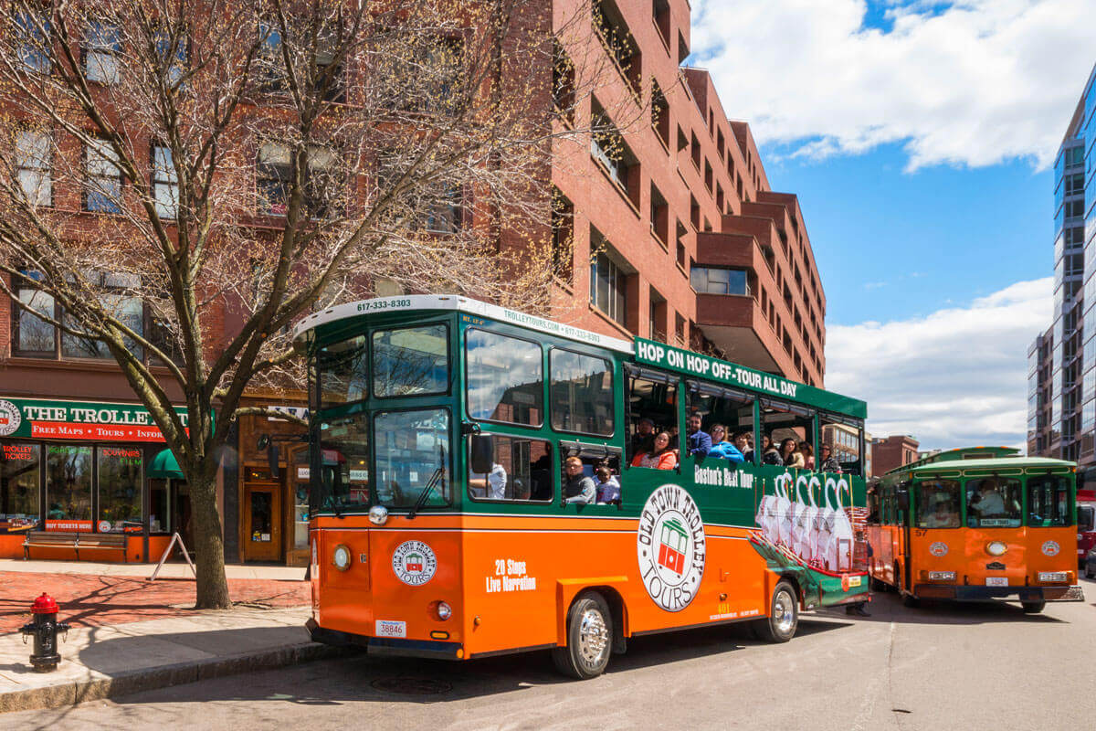
For first-time visitors or those seeking a comprehensive overview with minimal effort, hop-on, hop-off trolley and bus tours are an excellent choice. Companies like Old Town Trolley Tours and CityView Trolley Tours offer guided excursions that hit all the major landmarks, allowing you to alight at attractions that pique your interest and reboard at your leisure. These tours not only provide convenient transportation between key sites but also offer insightful narration about Boston’s history and culture. They are particularly useful for covering large distances and gaining a good sense of the city’s layout before diving deeper into specific neighborhoods. While not the most economical option for pure transportation, their added value as a guided tour can make them a worthwhile investment for a relaxed sightseeing experience.

Planning Your Routes and Essential Tips
Efficiently navigating Boston requires a little forethought and preparation. By leveraging available tools and keeping some key considerations in mind, you can ensure a smooth and enjoyable travel experience throughout your visit. Strategic planning will not only save you time and potential frustration but also allow you to maximize your exploration of this historic city.
Modern technology is your best friend when it comes to urban navigation. Utilize mapping applications such as Google Maps or Apple Maps, which provide real-time public transit directions, walking routes, and estimated travel times. Many of these apps also integrate ride-sharing options, allowing for easy comparison of travel modes. For public transit specifically, consider downloading the official MBTA app or third-party apps like Transit, which offer live tracking of buses and trains, service alerts, and schedule information, invaluable for avoiding unexpected delays.
When planning your daily itinerary, always factor in potential travel time during rush hour. As mentioned, morning and late afternoon weekdays see the heaviest traffic and most crowded public transit, which can extend journey durations. If possible, schedule your longest commutes outside these peak periods or opt for walking if the distance is manageable.
Accessibility is another important consideration. While the MBTA has made significant strides in improving access, not all stations or routes are fully accessible for those with mobility challenges. It’s advisable to check the MBTA’s website or use accessibility filters on mapping apps to identify accessible routes and stations in advance. For specific needs, calling the MBTA’s customer service line can provide personalized assistance.
Safety should always be a priority. While Boston is generally a safe city, especially in tourist areas, it’s prudent to remain aware of your surroundings, particularly when using public transport late at night or walking in less familiar neighborhoods. Travel in groups when possible, keep valuables secure, and trust your instincts.
For certain transportation methods, such as ferries or specific sightseeing tours, purchasing tickets in advance, especially during peak tourist season, can save time and guarantee your spot. This is particularly true for popular harbor cruises or timed entry attractions that may combine with unique transit options.
Finally, consider the time of year for your visit. Boston’s weather can significantly impact ease of getting around. Spring and fall offer pleasant temperatures ideal for walking and biking. Summers can be warm and humid, making public transit or air-conditioned ride-shares more appealing. Winters can bring snow and ice, potentially affecting walking conditions and causing public transit delays, making sturdy footwear and flexible planning essential. Regardless of the season, a well-thought-out transportation strategy is key to a memorable Boston adventure.
LifeOutOfTheBox is a participant in the Amazon Services LLC Associates Program, an affiliate advertising program designed to provide a means for sites to earn advertising fees by advertising and linking to Amazon.com. Amazon, the Amazon logo, AmazonSupply, and the AmazonSupply logo are trademarks of Amazon.com, Inc. or its affiliates. As an Amazon Associate we earn affiliate commissions from qualifying purchases.