
The dramatic imagery of raging wildfires has become an unsettling, yet recurring, feature of California’s landscape and news cycles. While the immediate, visceral impact of these infernos is undeniable, understanding their location, scale, and implications requires a deeper dive beyond the headlines. This exploration focuses on the current status of wildfires across the Golden State, examining not just the active blazes but also the contributing factors and the broader context for travelers and residents alike.
Understanding California’s Wildfire Landscape
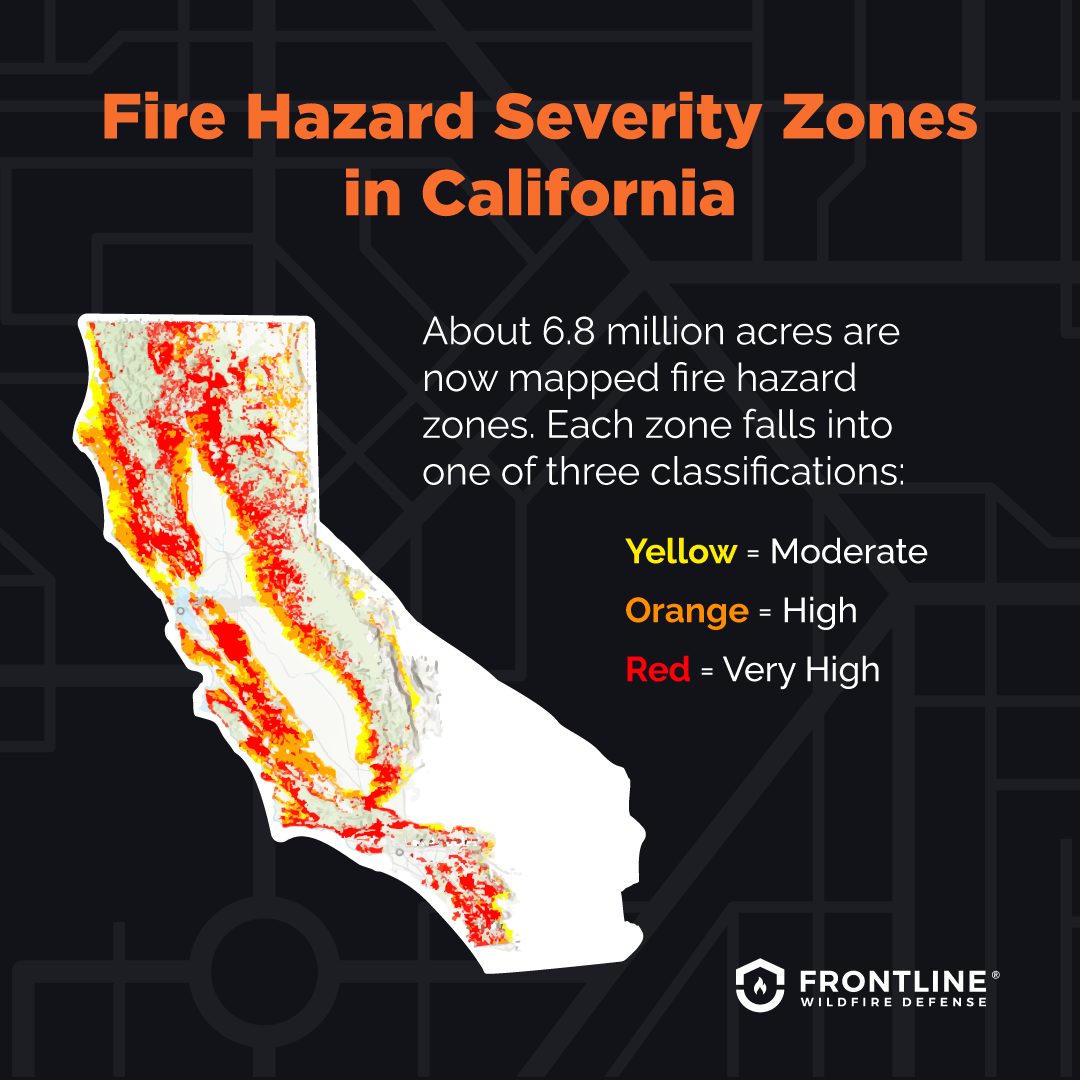
California’s propensity for wildfires is a complex interplay of natural conditions and human influence. The state’s Mediterranean climate, characterized by hot, dry summers and mild, wet winters, creates a naturally flammable environment. This is exacerbated by the accumulation of dry vegetation – chaparral, brush, and timber – which acts as fuel. Furthermore, prolonged droughts, increasingly common due to climate change, intensify these conditions, making vegetation more susceptible to ignition.
Climate Change and Fire Intensity
The scientific consensus points to a significant role for climate change in intensifying wildfire seasons. Rising global temperatures contribute to hotter, drier conditions across California. This leads to earlier snowmelt, longer dry spells, and increased stress on vegetation, making it more prone to burning. The phenomenon of “fire weather” – periods of extreme heat, low humidity, and strong winds – is becoming more frequent and severe. These conditions can cause fires to spread with unprecedented speed and intensity, overwhelming containment efforts. The increased energy in the atmosphere also fuels more erratic fire behavior, posing a greater threat to communities and natural landscapes.
Human Factors and Ignition Sources
While natural ignitions can occur, a significant percentage of wildfires in California are human-caused. These can range from accidental ignitions, such as downed power lines, equipment use, and unattended campfires, to intentional acts of arson. The expansion of development into wildland-urban interface areas (WUI) means that more communities are directly in the path of potential fire spread. This proximity increases the risk to lives, homes, and critical infrastructure. Understanding these ignition sources is crucial for developing effective prevention strategies and public awareness campaigns.
Current Wildfire Activity and Hotspots
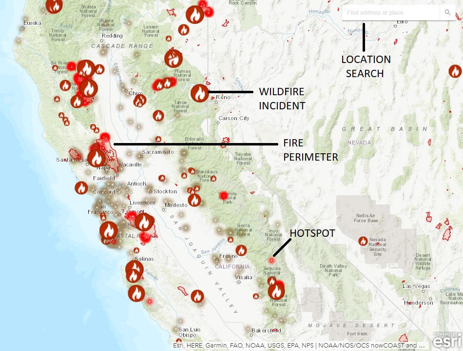
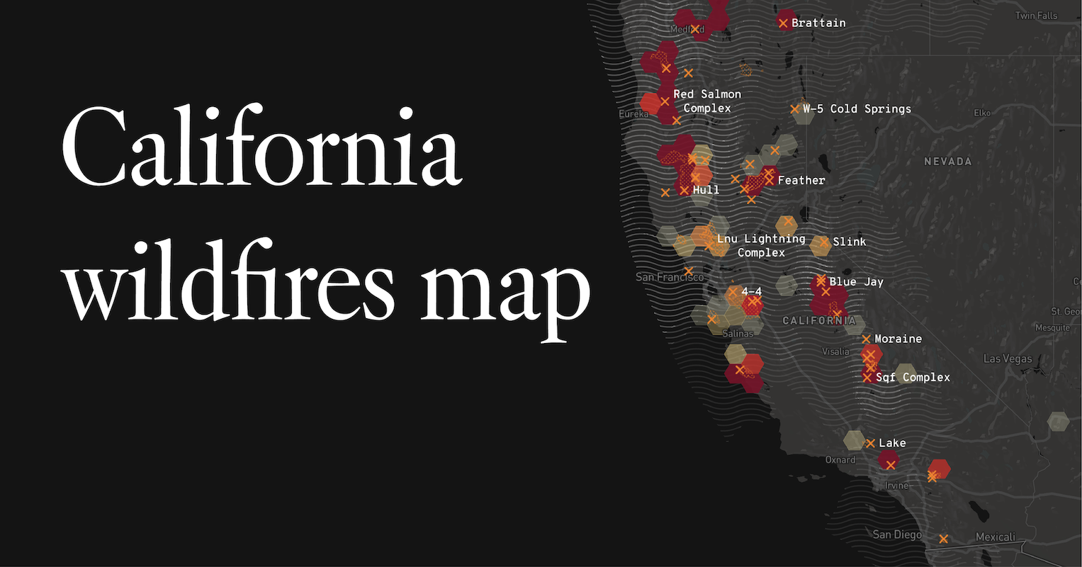
Pinpointing the exact location and intensity of every wildfire at any given moment is a dynamic process. Official sources, such as CAL FIRE and the National Interagency Fire Center (NIFC), provide real-time updates. However, the general patterns and areas most susceptible to significant fire activity can be identified based on current conditions and historical trends.
Seasonal Trends and Geographic Vulnerabilities
Wildfire season in California typically intensifies during the late spring and summer months, extending into the fall. This period sees higher temperatures and lower humidity levels. Certain regions are historically more prone to fires due to their vegetative cover and climatic conditions.
- Southern California: Areas like Los Angeles County, Orange County, and San Diego County often experience intense fires driven by Santa Ana winds, which are hot, dry, and gusty winds blowing from the interior deserts towards the coast. The chaparral ecosystems in these regions are highly flammable.
- Central Coast: Coastal mountain ranges and inland valleys in counties like Santa Barbara and Ventura are also susceptible, particularly during periods of high drought.
- Sierra Nevada Foothills and Mountains: These forested areas, including regions near Yosemite National Park and the Sierra National Forest, can experience large, destructive fires, especially when undergrowth is dry and combined with high winds.
- Northern California: Counties in the North Coast and the interior north, such as Shasta County and Humboldt County, with their mix of forests and brushlands, are also at risk, particularly during dry spells.
Real-Time Monitoring and Information Sources
For the most up-to-date information on active fires, travelers and residents should consult reliable sources:
- CAL FIRE: The official website of the California Department of Forestry and Fire Protection provides detailed incident maps, evacuation orders, and fire status updates.
- National Interagency Fire Center (NIFC): NIFC offers a national overview of wildfire activity, including data on large incidents across the United States.
- Local Emergency Services: County emergency management agencies often provide localized alerts and evacuation information.
- National Weather Service: For information on fire weather forecasts and Red Flag Warnings, which indicate critical fire weather conditions.
Impact on Travel and Tourism
Wildfires have a profound impact on travel and tourism in California. Road closures, air quality advisories, and evacuations can disrupt travel plans and alter the visitor experience. Understanding these impacts is essential for anyone planning a trip to the state.
Disruptions to Transportation and Access
Active wildfires can lead to the closure of major roadways, including highways and scenic byways. This can result in significant detours, travel delays, and the inability to access certain destinations. National parks and forests, popular tourist attractions, may temporarily close their gates due to fire activity or proximity to danger. This can affect access to iconic natural wonders and recreational areas.
Air Quality and Health Concerns
Smoke from wildfires can travel hundreds of miles, significantly degrading air quality in areas far from the fire’s origin. This can lead to unhealthy air conditions, characterized by elevated levels of fine particulate matter. For travelers, this can mean canceled outdoor activities, the need to stay indoors, and potential respiratory issues. Individuals with pre-existing respiratory conditions, such as asthma, are particularly vulnerable. Travelers are advised to check air quality indexes (AQI) before and during their trips and to take precautions, such as wearing N95 masks, when air quality is poor.
Economic Repercussions for Tourist Destinations
The perception of wildfire risk can deter tourism, leading to decreased visitor numbers and economic losses for communities that rely on the tourism industry. Hotels, restaurants, tour operators, and local businesses can all experience a downturn. However, it’s important to note that many areas of California remain unaffected by active fires, and tourism continues to be a vital economic driver for the state. Planning trips around current fire conditions and staying informed through official channels can help travelers make informed decisions.
Preparedness, Prevention, and Future Outlook
Addressing California’s wildfire challenge requires a multi-faceted approach involving government agencies, communities, and individuals. The focus is increasingly shifting towards proactive measures and long-term strategies.
Fire Management and Suppression Strategies
Fire agencies employ a range of strategies to combat wildfires, including:
- Early Detection: Utilizing watchtowers, aerial patrols, and satellite imagery to detect fires quickly.
- Ground Crews and Air Support: Deploying trained firefighters, bulldozers, and aerial resources like water-dropping planes and helicopters to suppress fires.
- Strategic Firebreaks: Creating cleared areas to slow or stop fire spread.
- Prescribed Burns: Controlled burns conducted under specific conditions to reduce fuel loads and mitigate the risk of larger, uncontrolled fires. This is a crucial tool for ecosystem health and wildfire prevention.
Community Wildfire Protection Plans (CWPPs)
Many communities in the wildland-urban interface are developing and implementing Community Wildfire Protection Plans. These plans involve collaboration between local residents, fire departments, and land management agencies to identify wildfire risks and outline strategies for mitigation, including defensible space around homes, vegetation management, and evacuation preparedness.
The Role of Climate Adaptation and Mitigation
Ultimately, addressing the root causes of increasing wildfire intensity requires tackling climate change. This involves global efforts to reduce greenhouse gas emissions and local initiatives focused on climate adaptation. For California, this includes promoting renewable energy, improving water management, and adopting land-use policies that account for increased wildfire risk. The future of wildfire management hinges on a combination of immediate response and long-term resilience strategies.
LifeOutOfTheBox is a participant in the Amazon Services LLC Associates Program, an affiliate advertising program designed to provide a means for sites to earn advertising fees by advertising and linking to Amazon.com. Amazon, the Amazon logo, AmazonSupply, and the AmazonSupply logo are trademarks of Amazon.com, Inc. or its affiliates. As an Amazon Associate we earn affiliate commissions from qualifying purchases.