
Naples, Florida, often lauded as a jewel on Florida’s Southwest coast, beckons travelers with its pristine beaches, upscale boutiques, and refined dining experiences. But for many planning a visit, the initial question revolves around its accessibility: “How far is Naples, Florida?” This inquiry is not merely about mileage; it delves into understanding the logistical tapestry that connects this desirable destination to the wider world. Whether you’re arriving by air, road, or even sea, Naples offers a surprisingly accessible gateway to a sophisticated coastal paradise.
Navigating to Naples: Air Travel Considerations
For most long-distance travelers, the primary route to Naples, Florida, is through air travel. The proximity to major airports significantly influences travel time and convenience, making it a crucial factor in trip planning. Understanding these options allows for strategic booking and a smoother transition from transit to relaxation.

Southwest Florida International Airport (RSW)
The most convenient airport for reaching Naples is Southwest Florida International Airport (RSW), located in Fort Myers. RSW serves as the primary air gateway for Southwest Florida and is approximately a 45-minute to one-hour drive from downtown Naples, depending on traffic conditions. This airport hosts a variety of major airlines, offering direct flights from numerous cities across the United States. This makes it an exceptionally accessible hub for both domestic and international visitors looking to experience the charm of Naples. Upon arrival at RSW, travelers have several options for onward transportation to Naples, including rental cars, ride-sharing services like Uber and Lyft, and dedicated shuttle services. The drive south on I-75 is straightforward, transitioning onto local roadways for the final approach into Naples.
Punta Gorda Airport (PGD)
Another option, though slightly further afield, is Punta Gorda Airport (PGD). This airport is often favored by budget airlines and typically serves a more limited range of routes compared to RSW. The drive from Punta Gorda to Naples is approximately 1.5 to 2 hours. While this adds extra travel time, it can sometimes present cost-saving opportunities for flights, making it a viable alternative for budget-conscious travelers or those originating from specific regions served by airlines operating at PGD.
Fort Lauderdale-Hollywood International Airport (FLL) and Miami International Airport (MIA)
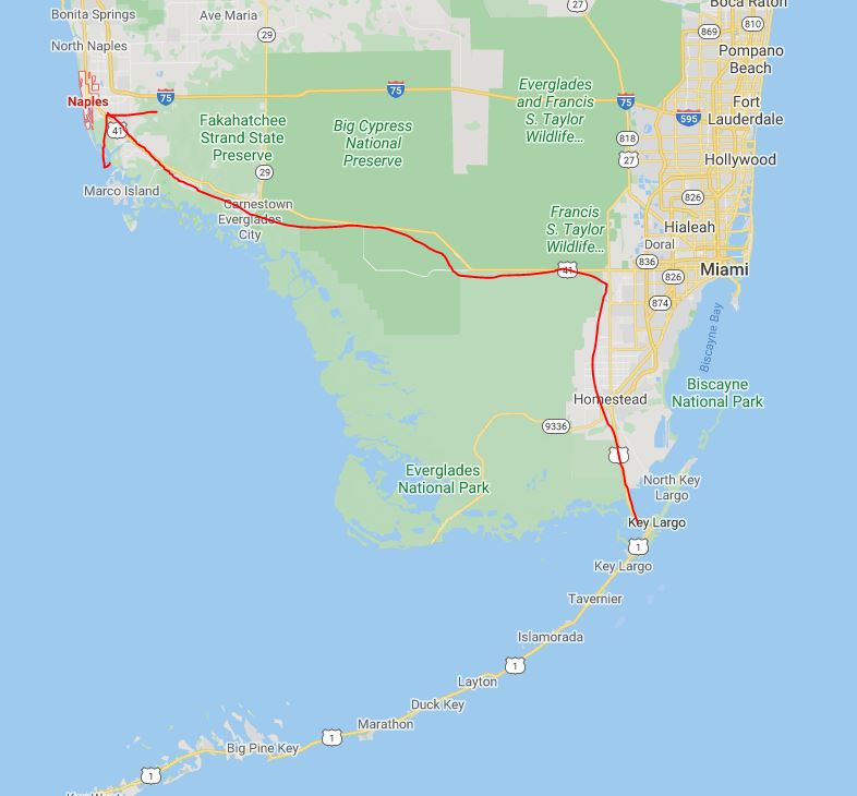
For international travelers or those flying into Florida from farther distances, Fort Lauderdale-Hollywood International Airport (FLL) and Miami International Airport (MIA) are significant international hubs. These airports are located on the opposite coast of Florida, roughly a 2-hour to 2.5-hour drive from Naples. The journey from either FLL or MIA involves crossing the state, typically via Alligator Alley (part of I-75) or Tamiami Trail (US 41). While these airports offer a wider array of international flight options and often competitive pricing, the extended drive necessitates accounting for additional travel time and potential traffic congestion, especially when departing from the major metropolitan areas of South Florida.
The Open Road: Driving Distances to Naples, Florida
For many, the allure of a road trip is part of the vacation experience. Driving to Naples, Florida, offers flexibility and the opportunity to explore the diverse landscapes of the Sunshine State. The distance from major cities and points of interest across the United States paints a picture of Naples’ geographical position within the national travel network.
From Major Florida Cities
- Miami: Approximately 165 miles (about 2.5 to 3 hours driving time). The most direct route is via I-75 North, known as Alligator Alley, which traverses the Everglades.
- Orlando: Approximately 200 miles (about 3 to 3.5 hours driving time). Travelers typically take the Florida Turnpike South to connect with I-75 South.
- Tampa: Approximately 170 miles (about 2.5 to 3 hours driving time). The most common route involves taking I-75 South.
- Fort Myers: A mere 30 miles (about 30-45 minutes driving time). This makes Fort Myers a convenient staging point or a place to stay for those who prefer to drive a shorter distance to Naples.
From Key Eastern U.S. Cities
- Atlanta, Georgia: Approximately 640 miles (about 9.5 to 11 hours driving time). This is a substantial drive, often broken up with an overnight stay. The route primarily involves I-75 South.
- Charlotte, North Carolina: Approximately 600 miles (about 9 to 10 hours driving time). Travelers typically head south on I-77 and then connect to I-75 South.
- Washington, D.C.: Approximately 1,000 miles (about 15 to 17 hours driving time). This journey usually requires at least one overnight stop. The route often involves I-95 South for a significant portion before transitioning to other interstates heading towards Florida.
- New York City, New York: Approximately 1,250 miles (about 18 to 20 hours driving time). This is a multi-day road trip, typically broken into two or three days of driving, utilizing major East Coast interstates like I-95 South.
The drive to Naples, Florida, is a journey that can be tailored to individual preferences, whether seeking a swift arrival or a scenic exploration of the American Southeast.
Understanding Travel Time: Factors Beyond Distance
While the mileage to Naples, Florida, is a quantifiable metric, actual travel time can fluctuate significantly due to a variety of external factors. Awareness of these elements is key to setting realistic expectations and planning a stress-free journey.
Traffic Congestion
Traffic is a ubiquitous challenge in many travel scenarios, and Naples is no exception, particularly during peak tourist seasons or weekend travel. The I-75 corridor, a primary artery for reaching Southwest Florida, can experience substantial slowdowns, especially around metropolitan areas like Fort Myers and during the approach to Naples itself. Rush hour in surrounding cities can also impact the drive from airports like RSW. Planning travel during off-peak hours or factoring in buffer time is advisable.
Time of Year and Seasonality
Florida’s tourism calendar profoundly influences travel times. The peak season, generally from November through April, sees higher volumes of visitors, leading to increased traffic on highways and at airports. Conversely, the “off-season” or shoulder months might offer more fluid travel conditions. Hurricanes and tropical storms during the Atlantic hurricane season (June 1 to November 30) can also cause travel disruptions, rerouting, or flight cancellations.
Road Construction and Detours
As with any growing region, ongoing road construction projects are common in and around Naples and its connecting routes. These projects, while necessary for infrastructure improvement, can lead to temporary lane closures, detours, and delays. Checking local traffic reports or using navigation apps that provide real-time updates can help mitigate the impact of these unforeseen circumstances.
Mode of Transportation
The chosen mode of transport inherently dictates the travel time. A direct flight to RSW will, by nature, be faster than a multi-day road trip from the Northeast. Similarly, the choice between driving a personal vehicle versus utilizing public transportation or shuttle services will affect the overall journey duration and convenience.

Border Crossings (for International Travelers)
For travelers coming from Canada or Mexico, border crossings can add a variable amount of time to their journey. While not directly affecting the distance to Naples, Florida, these checkpoints introduce an element of unpredictability into the overall travel plan.
By considering these factors in conjunction with the physical distance, travelers can more accurately gauge how far Naples, Florida, truly is for their specific travel plans, ensuring a more informed and enjoyable arrival.
LifeOutOfTheBox is a participant in the Amazon Services LLC Associates Program, an affiliate advertising program designed to provide a means for sites to earn advertising fees by advertising and linking to Amazon.com. Amazon, the Amazon logo, AmazonSupply, and the AmazonSupply logo are trademarks of Amazon.com, Inc. or its affiliates. As an Amazon Associate we earn affiliate commissions from qualifying purchases.