
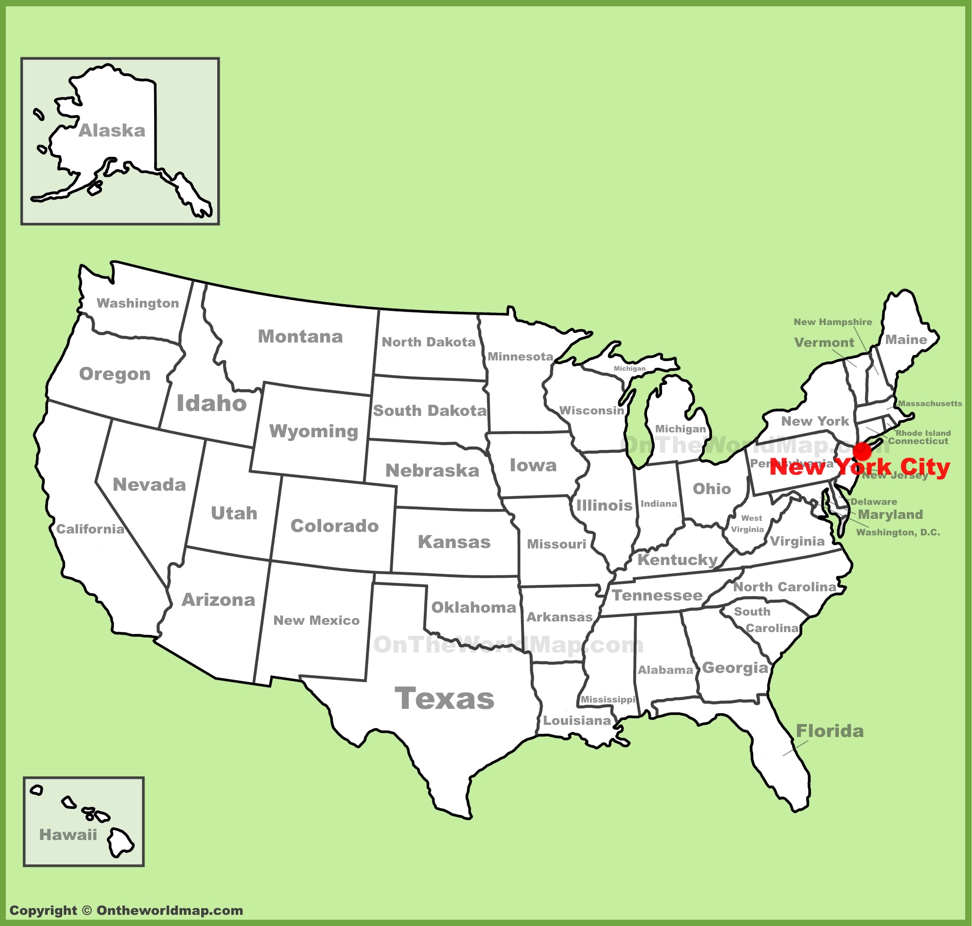
Navigating the bustling landscape of the United States requires a clear understanding of its most iconic urban center. When you look at a globe or a digital map, finding New York City is a fundamental skill for any traveler. Located on the northeastern coast of the country, this metropolis sits at the intersection of the Hudson River and the Atlantic Ocean. It serves as the primary gateway to the region, anchoring the Northeast Megalopolis that stretches down to Washington, D.C.
Understanding its geographical placement is more than just a coordinate exercise; it is the first step in planning a journey through one of the world’s most significant cultural and financial hubs.
The Geography of the Five Boroughs
New York City is not a monolith; it is an archipelago of islands and a slice of the mainland. Its unique topography is shaped by the water that surrounds it, which has historically defined its development as a premier port city.
Manhattan: The Heart of the City
Often the first stop for visitors, Manhattan is the narrow island at the center of the city’s geography. It is bordered by the East River to the east and the Hudson River to the west. This layout creates the iconic “grid” system that makes navigation relatively intuitive for tourists. From the southern tip known as Battery Park to the northern reaches of Inwood, the island is the primary axis around which the city’s map revolves.
The Outer Boroughs
Across the bridges and tunnels lie the other four boroughs, each with its own distinct place on the map:
- Brooklyn: Situated to the southeast of Manhattan, Brooklyn is geographically part of Long Island. It offers a sprawling landscape that transitions from the waterfront views of DUMBO to the residential expanses of Flatbush.
- Queens: To the northeast of Brooklyn, Queens is the largest borough by area. It is home to both JFK International Airport and LaGuardia Airport, making it the literal point of entry for millions of international travelers.
- The Bronx: Located north of Manhattan, this is the only borough physically connected to the North American mainland. It serves as the geographical bridge between the city and the northern suburbs of New York State.
- Staten Island: Found to the southwest, this borough is separated from the rest of the city by the Upper New York Bay. It is most famously accessed via the Staten Island Ferry, which provides a unique perspective of the city’s maritime geography.
Regional Connectivity and Proximity
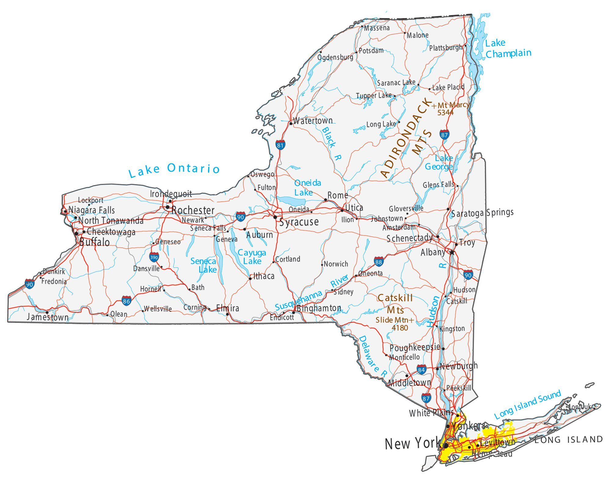
New York City occupies a strategic position within the Mid-Atlantic region. Its location on a map reveals why it became the nation’s premier transit hub. To the north lie the states of Connecticut, Massachusetts, and the rest of New England, while to the west, travelers can quickly reach New Jersey and Pennsylvania.
Transit Arteries
The city’s map is defined by its transit veins. Grand Central Terminal and Penn Station act as the primary nodes for regional rail travel. Understanding these two locations is vital for anyone planning to venture beyond the city limits. Whether you are catching an Amtrak train to Boston or a commuter train to the Hudson Valley, the city serves as the central anchor for all major transportation routes in the region.
Navigating by Landmarks
When you are on the ground, the physical map of the city is best understood through its architectural markers. These landmarks serve as informal compasses for both locals and tourists.
The Mid-Island Orientation
If you find yourself in the center of the island, Midtown Manhattan is your reference point. Landmarks like the Empire State Building and Rockefeller Center provide vertical orientation, helping you determine your location relative to the north-south axis of Fifth Avenue.
Green Spaces as Anchors
Central Park is perhaps the most critical feature on the city map. Stretching from 59th Street to 110th Street, it effectively splits the Upper East Side from the Upper West Side. Whenever you feel turned around, finding the edge of this massive green space is the quickest way to reorient yourself within the urban grid.
Waterfront Navigation
For those exploring the perimeter, the High Line provides a linear path along the western edge of the city, offering a bird’s-eye view of the Chelsea neighborhood and the river. Similarly, Brooklyn Bridge Park offers a panoramic map-like view of the Manhattan Skyline, allowing you to see exactly where the city ends and the water begins.

Tips for Map Reading in the Big Apple
While digital GPS has revolutionized travel, the map of New York City is best understood through a combination of traditional and modern methods.
- Understand the Grid: Remember that in Manhattan, avenues run north to south, while streets run east to west. If the street numbers are increasing, you are moving away from the southern tip of the island.
- Use the Subway Map: The New York City Subway map is a schematic representation rather than a geographically accurate one, but it is the most useful tool for understanding how the neighborhoods connect. It simplifies the sprawling city into manageable lines and transfer points.
- Identify the Water: Whenever you are confused, look for the water. The East River is always to the east, and the Hudson River is always to the west. This simple rule of thumb works in almost every part of Manhattan and is the fastest way to confirm your cardinal direction.
By keeping these geographical markers in mind, you can transition from a passive tourist to an informed navigator. New York City may be vast, but once you understand how its pieces fit together—from the Financial District in the south to the historic Harlem in the north—you will find that it is a city designed to be explored. Whether you are crossing the Brooklyn Bridge on foot or taking the subway to Times Square, having a mental map of where you stand is the foundation for an unforgettable trip.
LifeOutOfTheBox is a participant in the Amazon Services LLC Associates Program, an affiliate advertising program designed to provide a means for sites to earn advertising fees by advertising and linking to Amazon.com. Amazon, the Amazon logo, AmazonSupply, and the AmazonSupply logo are trademarks of Amazon.com, Inc. or its affiliates. As an Amazon Associate we earn affiliate commissions from qualifying purchases.