
Watsonville, California, stands as a significant, albeit often overlooked, gem nestled within the state’s picturesque Central Coast region. For travelers planning an exploration of California, understanding the precise geographic coordinates and regional context of Watsonville is crucial for unlocking its potential as a vibrant destination. This article delves into Watsonville’s location, illustrating why its position is not just a point on a map, but a strategic gateway to a wealth of diverse travel experiences, from sun-drenched beaches and fertile agricultural lands to towering redwood forests and bustling urban centers.
Unveiling Watsonville’s Geographic Significance
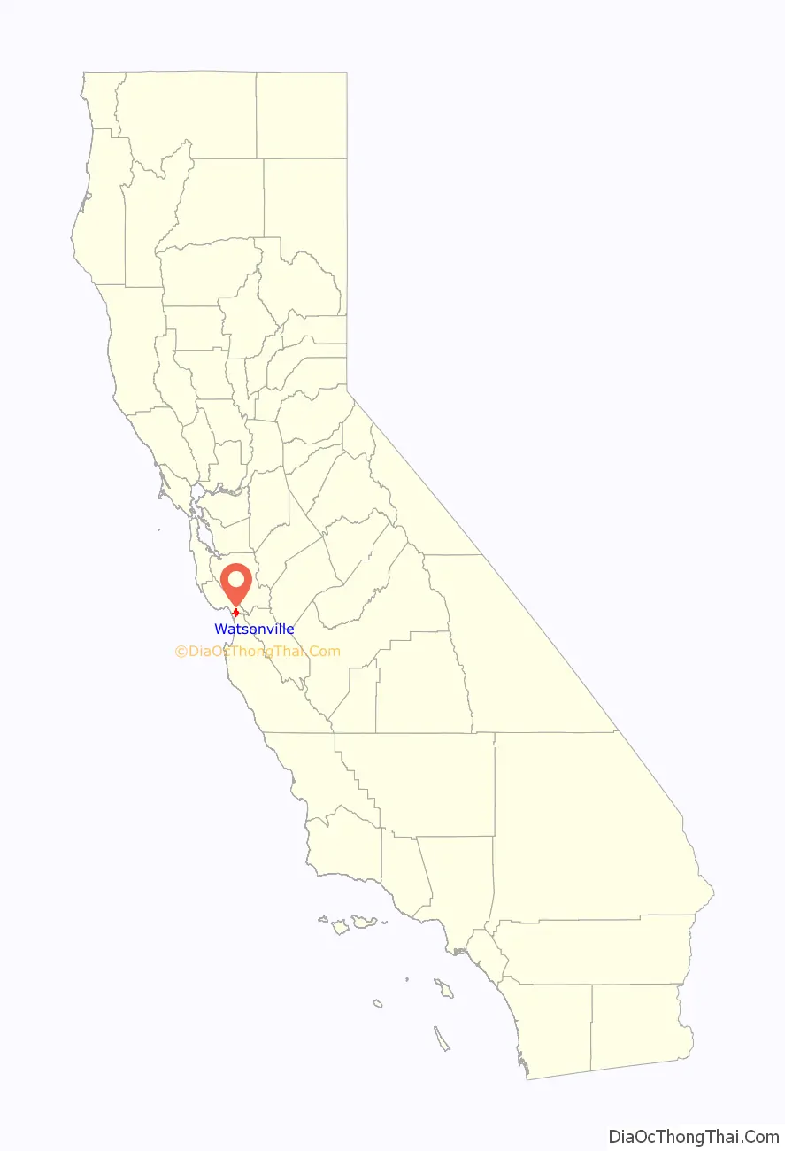
At its core, Watsonville’s location is defined by its placement within Santa Cruz County and its intimate relationship with the broader Monterey Bay area. This positioning affords it a unique blend of natural beauty, agricultural productivity, and convenient access to some of California’s most iconic attractions. Understanding this geographical framework is the first step in appreciating Watsonville’s multifaceted appeal to travelers.
A Jewel in Santa Cruz County
Watsonville is situated in the southernmost part of Santa Cruz County, an area renowned for its breathtaking coastline, redwood forests, and laid-back surf culture. Unlike its more famous northern neighbor, the city of Santa Cruz, Watsonville lies slightly inland from the immediate coastline, though it remains mere minutes away from the shores of Monterey Bay. This slight inland positioning protects it from some of the coastal fog, often resulting in warmer, sunnier days, particularly during the summer months, making it an attractive alternative for those seeking a less crowded, yet equally engaging, California experience. The city serves as a vital agricultural hub, contrasting with the tourist-heavy beaches and bohemian vibe of other parts of the county, offering visitors a glimpse into the working heart of the region. Its diverse community and rich cultural tapestry are direct reflections of its history as an agricultural center, adding layers of authenticity to its travel profile.
Proximity to Major California Hubs
One of Watsonville’s greatest assets for travelers is its strategic proximity to several of California’s major metropolitan areas and tourist destinations. It is approximately 15 miles south of Santa Cruz, placing world-class surfing, boardwalk attractions, and university town charm within easy reach. To the south, the famed Monterey Peninsula, home to the Monterey Bay Aquarium, Cannery Row, and the dramatic coastline of Carmel-by-the-Sea, is just a 30-minute drive away. This makes Watsonville an excellent base for exploring the entire bay area without the higher accommodation costs often associated with Monterey or Carmel.
Further afield, Watsonville is conveniently located about an hour’s drive south of San Jose, the heart of Silicon Valley, and roughly 1.5 to 2 hours south of San Francisco. This positions it perfectly for travelers who wish to combine urban exploration and tech-industry insights with coastal relaxation and agricultural immersion. Its accessibility via major routes like U.S. Route 101 and California State Route 1 underscores its connectivity, making it a feasible stop or base for longer road trips traversing the California coast.
The Pajaro Valley: Watsonville’s Heart
The geographical identity of Watsonville is inextricably linked to the Pajaro Valley, a vast and fertile agricultural region that cradles the city. This valley is not merely a backdrop but an active participant in shaping Watsonville’s character, economy, and unique appeal as a travel destination. Its rich soil, abundant water, and temperate climate create ideal conditions for farming, making it one of California’s most productive agricultural areas.
Agricultural Richness and Economic Impact
The Pajaro Valley is famous for its prolific production of strawberries, raspberries, blackberries, and a wide array of other fruits and vegetables. Traveling through the valley, visitors are greeted by endless fields of crops, often tended by a vibrant agricultural workforce that reflects the area’s diverse demographics. This agricultural heritage offers a unique “agri-tourism” experience for visitors, who can explore local farm stands, participate in U-pick opportunities during harvest seasons, and savor farm-to-table cuisine at local eateries. The Pajaro River, which flows through the valley, plays a critical role in irrigating these fertile lands, sustaining the agricultural ecosystem that defines the region. For those interested in sustainable food systems or simply enjoying fresh produce, Watsonville’s location at the heart of the Pajaro Valley provides an unparalleled opportunity to connect with the source of California’s bounty. The economic vitality derived from this agriculture also ensures a stable, authentic community experience, distinct from purely tourist-driven economies.
Natural Beauty and Outdoor Pursuits
Beyond its agricultural significance, the Pajaro Valley and its surroundings boast remarkable natural beauty, offering numerous opportunities for outdoor recreation. The proximity to the Pacific Ocean means that pristine beaches like Manresa State Beach and Sunset State Beach are just a short drive away, perfect for sunbathing, picnicking, fishing, or watching the sunset. These beaches are typically less crowded than those further north in Santa Cruz or south in Monterey, offering a more tranquil coastal experience.

Moreover, the Pajaro Valley is adjacent to the Elkhorn Slough National Estuarine Research Reserve, a critical wetland habitat and one of California’s most important ecological sites. This estuary, part of the larger Monterey Bay National Marine Sanctuary, is a paradise for birdwatchers, kayakers, and wildlife enthusiasts. Visitors can observe sea otters, harbor seals, and hundreds of species of migratory birds in their natural environment, providing an immersive experience into the region’s rich biodiversity. The contrasting landscapes of lush farmlands, serene wetlands, and expansive coastline make Watsonville’s setting remarkably diverse for nature lovers.
Watsonville’s Strategic Position for Travelers
Watsonville’s geographic location is not merely a descriptor but a strategic advantage for travelers seeking a multifaceted California experience. Its position allows visitors to effortlessly transition between coastal activities, inland explorations, and urban adventures, all while enjoying the charm of a community that retains its authentic character.
Gateway to Coastal Adventures
As mentioned, Watsonville serves as an excellent starting point for coastal exploration. Its easy access to California State Route 1 means that iconic stretches of the California coastline are just a short drive away. To the south, travelers can embark on one of the world’s most scenic drives towards Big Sur, experiencing dramatic cliffs, redwood groves, and breathtaking ocean vistas. To the north, the famed beaches of Santa Cruz beckon, offering opportunities for surfing, paddleboarding, or simply relaxing on the sand. Beyond the immediate coastline, the deeper waters of Monterey Bay are renowned for whale watching, with various species of whales, dolphins, and other marine life frequenting the nutrient-rich waters year-round. Several tour operators based in Monterey or Santa Cruz offer excursions, easily accessible from Watsonville.
Exploring the Monterey Bay Area
Watsonville’s central position within the Monterey Bay region makes it an ideal launchpad for discovering all that this world-class destination has to offer. The historic Cannery Row and the acclaimed Monterey Bay Aquarium in Monterey are must-visit attractions, offering insights into marine conservation and engaging exhibits. The charming village of Carmel-by-the-Sea with its unique shops, art galleries, and scenic beaches, is also easily reachable. For golf enthusiasts, the championship courses of Pebble Beach are within a short drive. By staying in Watsonville, travelers can spread their exploration of the Monterey Bay area over several days, reducing travel time between key sights and enjoying a more relaxed pace.
Inland Wonders and Day Trips
The geographic blessings of Watsonville extend inland, too. The towering redwood forests of the Santa Cruz Mountains are just a short drive away, offering shaded hiking trails and a sense of awe amidst ancient giants at places like Henry Cowell Redwoods State Park. For those willing to venture a bit further, the dramatic landscapes and unique rock formations of Pinnacles National Park lie to the southeast, presenting an excellent opportunity for hiking, rock climbing, and wildlife viewing, especially for condors. This diverse range of natural attractions, from ocean to mountains, underscores Watsonville’s incredible potential as a base for varied day trips, catering to different interests and activity levels.
Planning Your Visit to Watsonville
Leveraging Watsonville’s prime location requires a bit of planning to maximize your travel experience. Considering accessibility and the optimal time to visit will ensure a smooth and enjoyable journey through this vibrant part of California.
Accessibility and Transportation
Reaching Watsonville is straightforward, primarily by car, which is also the recommended mode of transport for exploring the surrounding Central Coast region. Major thoroughfares like U.S. Route 101 and California State Route 1 provide direct access. For air travelers, the closest major airports are San Jose International Airport (SJC), approximately an hour’s drive north, and Monterey Regional Airport (MRY), about 30 minutes south. San Francisco International Airport (SFO) is also a viable option, though it entails a longer drive. Watsonville itself has a Municipal Airport (Watsonville Municipal Airport – WVI) that primarily serves general aviation, offering scenic flights and parachute jumping, which adds another dimension to the local travel experience. Public transportation options within Santa Cruz County are available but a car offers the most flexibility for exploring the diverse attractions around Watsonville.

Best Times to Experience Watsonville
Watsonville enjoys a Mediterranean climate, characterized by mild, wet winters and warm, dry summers. The shoulder seasons—spring (April to May) and fall (September to October)—are often considered the best times to visit. During these months, the weather is pleasantly mild, ideal for outdoor activities, and the crowds are generally smaller than during the peak summer months. Spring brings lush landscapes and blooming wildflowers, while fall offers comfortable temperatures and the bounty of the harvest season. Summer (June to August) is popular for beach activities and whale watching, though coastal fog can sometimes be present in the mornings, burning off to clear afternoons. Winter (November to March) is cooler and wetter, but still offers opportunities for storm watching, exploring cozy local spots, and enjoying the tranquility of the off-season. The agricultural cycles in the Pajaro Valley also influence the experience; visiting during the spring and summer allows for the freshest produce and direct farm experiences.
In conclusion, Watsonville, California, is more than just a dot on the map; it’s a strategically located destination offering a unique blend of agricultural charm, natural beauty, and unparalleled access to the wider Monterey Bay region and beyond. Its position in the fertile Pajaro Valley, coupled with its proximity to bustling cities, pristine beaches, and ancient redwood forests, makes it an ideal choice for travelers seeking a diverse and authentic California experience away from the most heavily trodden tourist paths. For those who prioritize insightful exploration and engaging experiences, discovering Watsonville means uncovering a true Central Coast treasure.
LifeOutOfTheBox is a participant in the Amazon Services LLC Associates Program, an affiliate advertising program designed to provide a means for sites to earn advertising fees by advertising and linking to Amazon.com. Amazon, the Amazon logo, AmazonSupply, and the AmazonSupply logo are trademarks of Amazon.com, Inc. or its affiliates. As an Amazon Associate we earn affiliate commissions from qualifying purchases.