
Sarasota, Florida, a gem on the state’s southwestern Gulf Coast, consistently captivates visitors with its pristine beaches, vibrant arts scene, and lush natural beauty. For those planning a trip to this enchanting destination, one of the first and most crucial questions that arises is often, “How far is Sarasota?” The answer isn’t a simple mileage figure, but rather a journey that encompasses geographical context, various transportation methods, and an understanding of its proximity to other major Florida cities and travel hubs. This comprehensive guide aims to unravel the distances and travel considerations, equipping you with the insights needed to plan your seamless escape to Sarasota.
Understanding Sarasota’s Geographical Positioning
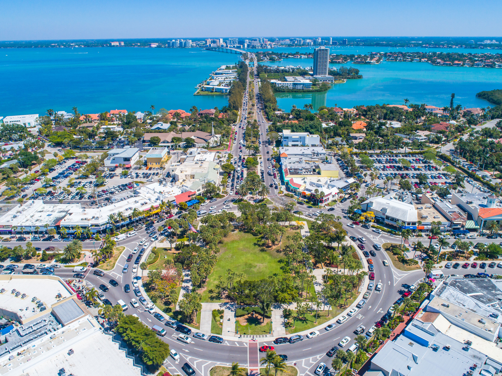
Sarasota’s appeal is deeply intertwined with its prime location on the Florida Gulf Coast. Situated directly on Sarasota Bay and shielded from the open Gulf of Mexico by a string of barrier islands, including the world-renowned Siesta Key Beach, Lido Key, and Longboat Key, it offers a unique blend of coastal charm and urban sophistication. Its position makes it accessible yet distinct, offering a tranquil reprieve while remaining within reach of larger metropolitan areas.
Sarasota’s Regional Context
Sarasota is nestled in the heart of the “Sunshine State,” roughly midway down the Florida peninsula’s western side. This central Gulf Coast location means it benefits from strong connectivity to the state’s major highway systems, including Interstate 75 (I-75), which serves as a primary north-south artery. This strategic placement allows for relatively easy access from both northern and southern Florida regions, as well as from neighboring states. Understanding this context is the first step in calculating travel times and distances.
Proximity to Major Florida Cities
One of the most common questions for travelers is Sarasota’s distance from Florida’s major population centers and tourist destinations. Its relationship with these cities defines much of the travel logistics:
- Tampa: As the nearest major city, Sarasota is approximately 60 miles south of downtown Tampa. This proximity makes Tampa International Airport (TPA) a popular gateway for visitors.
- Orlando: Home to world-famous theme parks, Orlando is about 120-130 miles northeast of Sarasota. While a longer drive, many combine a visit to the attractions of Orlando with the relaxed beaches of Sarasota.
- Miami: For travelers coming from South Florida, Sarasota is roughly 220 miles northwest of Miami, representing a longer but still manageable drive.
- Fort Myers: Directly south on the Gulf Coast, Fort Myers is approximately 80 miles away, making for an easy drive up Interstate 75 (I-75).
These distances are crucial for planning drive times, considering alternative airports, and understanding the overall journey to this beautiful Gulf Coast destination.
Distance and Travel Times from Key Travel Hubs
The actual “how far” to Sarasota often translates into “how long will it take to get there?” This largely depends on your starting point and chosen mode of transportation. Whether you’re flying into a major airport or driving from another Florida city, understanding the typical travel times is essential for efficient trip planning.
From Florida’s Major Airports
Air travel is often the quickest way to cover significant distances. Sarasota is well-served by its own regional airport and several larger international hubs within a reasonable drive.
- Sarasota-Bradenton International Airport (SRQ): This is the most convenient option, located just 3-7 miles north of downtown Sarasota and 6 miles south of downtown Bradenton. Travel time from SRQ to most Sarasota attractions, including Siesta Key and St. Armands Circle, is typically 15-30 minutes, depending on traffic and exact destination.
- Tampa International Airport (TPA): As a major international hub, TPA offers more flight options and often more competitive pricing. The drive from TPA to Sarasota is approximately 60 miles and takes about 1 hour to 1 hour 30 minutes, primarily via Interstate 275 (I-275) and Interstate 75 (I-75).
- Southwest Florida International Airport (RSW) – Fort Myers: Located south of Sarasota, RSW is another viable option, especially for those who might find better deals. The drive is about 80 miles and takes approximately 1 hour 15 minutes to 1 hour 45 minutes, generally straight up Interstate 75 (I-75).
- Orlando International Airport (MCO): While further, MCO is a global gateway. The drive from MCO to Sarasota covers around 120-130 miles and typically takes 2 to 2.5 hours, depending on traffic, primarily using Interstate 4 (I-4) and Interstate 75 (I-75).
Driving from Other Major Florida Cities
For those on a Florida road trip or residents driving to Sarasota, here are estimated driving times:
- From Jacksonville: Approximately 230 miles, 3.5 to 4 hours via Interstate 75 (I-75) South.
- From Tallahassee: Around 210 miles, 3 to 3.5 hours via Interstate 75 (I-75) South.
- From Miami: Roughly 220 miles, 3.5 to 4 hours via Interstate 75 (I-75) North.
- From Naples: Approximately 90 miles, 1.5 to 2 hours via Interstate 75 (I-75) North.
These estimates are for ideal conditions and can vary significantly based on traffic, especially during peak travel seasons or around major holidays.
Getting to Sarasota: Transportation Options
Beyond just understanding distances, knowing the various transportation options available to reach Sarasota is key to a well-planned journey. Each method offers a unique balance of cost, convenience, and travel experience.
Driving: The Most Common Method
For many, driving is the preferred way to reach Sarasota, offering flexibility and the opportunity to explore at one’s own pace. The region is well-connected by highways.
- Highways: Interstate 75 (I-75) is the primary route for north-south travel, directly connecting Sarasota to Tampa, Fort Myers, and points beyond. U.S. Route 41 (Tamiami Trail) runs parallel to Interstate 75 (I-75) through downtown Sarasota, offering a scenic, albeit slower, alternative.
- Rental Cars: Available at all major Florida airports, rental cars provide excellent flexibility for exploring Sarasota and its surrounding keys and towns like Venice or Bradenton.
Flying: Direct Access and Convenient Connections

For long-distance travelers, flying remains the fastest option. Choosing the right airport can significantly impact your overall travel time and cost.
- Sarasota-Bradenton International Airport (SRQ): As mentioned, SRQ is exceptionally close to Sarasota and offers direct flights from many major cities across the U.S. While it might sometimes be pricier than larger airports, the convenience is often worth it.
- Alternative Airports: TPA and RSW are excellent alternatives for those seeking more flight options or lower fares, provided you are prepared for the additional drive.
Bus and Train Services
While less direct for many, bus and train services offer economical and often scenic ways to travel.
- Bus Services: Companies like Greyhound and FlixBus offer routes to Sarasota from various cities. The Sarasota station is centrally located, making it a convenient arrival point for those without a car.
- Train Travel: Amtrak does not have a direct station in Sarasota. The closest Amtrak stations are in Tampa or Palmetto (just north of Bradenton). From there, travelers would need to arrange alternative transportation, such as a bus or ride-share, to complete the journey to Sarasota.
Navigating Sarasota and Nearby Areas
Once you’ve arrived, understanding how to get around Sarasota itself and explore its adjacent attractions like Siesta Key, Longboat Key, and St. Armands Circle is crucial for a fulfilling experience. The “far” in “how far” now shifts to intra-city distances and local transit options.
Local Public Transportation
Sarasota County Area Transit (SCAT) provides bus services throughout Sarasota and into Bradenton.
- Bus Routes: SCAT offers routes that connect downtown Sarasota with major areas like Siesta Key Beach, St. Armands Circle, and the local shopping districts. Fares are affordable, making it a good option for budget-conscious travelers, though service frequency can vary.
- Siesta Key Breeze Trolley: This free, open-air trolley operates on Siesta Key, providing convenient transportation between Siesta Key Village and the public beach access points, eliminating the need for parking once you’re on the island.
Ride-Sharing and Taxis
For greater flexibility and door-to-door service, ride-sharing apps like Uber and Lyft are readily available in Sarasota, as are traditional taxi services. These are ideal for airport transfers, evening outings, or reaching destinations not easily accessible by public transport. The cost will, of course, depend on the distance.
Walkability and Cycling
Certain areas within Sarasota are highly walkable or bike-friendly, allowing you to cover distances on foot or by renting a bicycle.
- St. Armands Circle: This upscale shopping and dining district is designed for pedestrians, making it easy to stroll between boutiques and restaurants.
- Siesta Key Village: A charming area with shops, cafes, and restaurants, perfect for walking and enjoying the relaxed beach atmosphere.
- Waterfront & Parks: Downtown Sarasota boasts beautiful waterfront parks and pathways, such as those near Bayfront Park and The Ringling Museum, inviting leisurely walks or bike rides. Areas like Legacy Trail and Causeway Park also offer dedicated paths for cycling.
Planning Your Trip: Essential Considerations for Sarasota
Understanding “how far” goes beyond mere mileage; it involves planning for the journey itself. A few key considerations can ensure your travel to and within Sarasota is as smooth as possible.
Best Time to Visit and Traffic Patterns
Sarasota’s peak season runs from roughly November to April when the weather is cooler and drier, attracting snowbirds and vacationers. During these months, expect heavier traffic, particularly on weekends and around popular attractions like Siesta Key Beach and St. Armands Circle. This can significantly extend travel times, especially on Interstate 75 (I-75) and causeway bridges. Off-season travel (May-October) often means less traffic, but also hotter, more humid weather and the possibility of afternoon thunderstorms or hurricanes.
Budgeting for Travel
When factoring in the distance to Sarasota, remember to budget for:
- Fuel/Airfare: These will be your primary costs for covering the distance. Booking flights in advance and comparing prices across different airports can yield savings.
- Tolls: While Interstate 75 (I-75) is largely toll-free in the immediate Sarasota area, some bridges or express lanes in Tampa or Orlando might have tolls. Consider an E-ZPass or SunPass transponder if you plan extensive driving in Florida.
- Ground Transportation: Costs for rental cars, ride-shares, or public transport should be included in your budget.

Pre-Trip Checklist
To ensure a hassle-free journey to Sarasota, consider these steps:
- Book flights and accommodation: Especially during peak season.
- Plan your route: Use GPS apps with real-time traffic updates.
- Check weather forecasts: Pack accordingly.
- Download useful apps: For navigation, ride-sharing, and local information.
- Consider travel insurance: For unexpected delays or cancellations.
In conclusion, “How far is Sarasota, Florida?” is a question best answered with a blend of geographical understanding, transportation knowledge, and meticulous planning. Whether you’re driving down Interstate 75 (I-75) from a neighboring state or flying into SRQ from afar, the journey to this enchanting Gulf Coast city is an integral part of the travel experience. With its diverse attractions ranging from the pristine sands of Siesta Key Beach to cultural landmarks like The Ringling Museum and Marie Selby Botanical Gardens, Sarasota is well worth the distance.
LifeOutOfTheBox is a participant in the Amazon Services LLC Associates Program, an affiliate advertising program designed to provide a means for sites to earn advertising fees by advertising and linking to Amazon.com. Amazon, the Amazon logo, AmazonSupply, and the AmazonSupply logo are trademarks of Amazon.com, Inc. or its affiliates. As an Amazon Associate we earn affiliate commissions from qualifying purchases.