
California’s Dynamic Geology: A Land Defined by Movement
California, a land of unparalleled natural beauty and diverse landscapes, is also a region defined by its dynamic geology. Situated along the seismically active Pacific Ring of Fire, the state is a colossal natural landmark in itself, constantly being reshaped by the relentless forces of plate tectonics. Understanding where the earthquake fault lines lie is not merely a matter of geological curiosity, but a deep dive into the very fabric of California’s natural history, its dramatic mountain ranges, sprawling valleys, and even its vibrant ecosystems. These fault lines are, in essence, the scars and seams of a land in perpetual motion, creating visible landmarks that tell a story of immense power and ongoing transformation.

The Pacific Plate and the North American Plate
At the heart of California’s seismic activity is the boundary between two colossal tectonic plates: the Pacific Plate and the North American Plate. Unlike boundaries where plates collide (subduction zones forming volcanoes and deep trenches) or pull apart (mid-ocean ridges), the primary interaction along much of California’s length is a transform boundary. Here, the Pacific Plate is grinding horizontally past the North American Plate in a predominantly northwest-southeast direction. This immense shearing force generates the vast network of fault lines that crisscross the state, accumulating stress that is periodically released as earthquakes. These geological engines have carved out some of California’s most iconic natural landmarks, from the linear valleys that trace fault paths to the uplifted mountain ranges that border them.
The Iconic San Andreas Fault System
The undisputed monarch of California’s fault lines is the San Andreas Fault System. Stretching for approximately 800 miles (1,300 km) through California, it is one of the longest and most active faults in the world, a truly monumental natural landmark. This right-lateral strike-slip fault is where the Pacific Plate is moving northwest relative to the North American Plate, causing significant displacement over geological time. Its presence has fundamentally shaped the topography, hydrology, and even the very history of human settlement in the state.
Tracing the San Andreas North to South
The San Andreas Fault makes its grand entrance into California from beneath the Pacific Ocean north of Point Arena in Mendocino County. It comes ashore near Point Delgada in Humboldt County, carving a distinct linear valley south towards the San Francisco Bay Area. In this northern segment, it was responsible for the devastating 1906 San Francisco earthquake.
South of the Bay Area, the San Andreas continues its relentless path through central California. One of the most striking and accessible places to observe the fault’s geomorphological impact is the Carrizo Plain National Monument in San Luis Obispo County. Here, the fault appears as a dramatic, almost perfectly straight linear trough, often referred to as the “Big One’s” signature. The offset stream beds and sag ponds visible across the Carrizo Plain are compelling, tangible evidence of the fault’s movements over millennia, offering a unique opportunity to witness geological processes firsthand. Further south, it runs alongside the eastern flank of the Temblor Range, defining its sharp, uplifted relief.
As it enters Southern California, the San Andreas makes a significant bend, often referred to as the “Big Bend.” This segment, particularly in the Mojave Desert and through the Tehachapi Mountains and San Gabriel Mountains north of Los Angeles, is considered locked and has accumulated immense stress. The fault then continues southeast, passing near the communities of Wrightwood and Palmdale, before terminating beneath the Salton Sea in the Imperial Valley. Each segment presents unique characteristics, but all are part of this defining natural landmark.
Major Branches and Associated Faults
The San Andreas Fault is not a singular line but the principal strand of a complex fault system. Many other significant faults branch off or run parallel to it, especially in densely populated areas, creating an intricate web of natural landmarks.
- Hayward Fault and Calaveras Fault: In the San Francisco Bay Area, these two major strike-slip faults run parallel to the San Andreas on its eastern side, passing directly through urban centers like Oakland, Fremont, and San Jose. The Hayward Fault is particularly notable for its creep, a slow, continuous movement that can be seen damaging sidewalks and buildings in places like Hollister and Fremont – an active, visible natural landmark.
- Rogers Creek Fault: A northern extension of the Hayward Fault system, further extending the network of active faults in Northern California.
- Garlock Fault: Located in Southern California, this is one of the state’s few major left-lateral strike-slip faults. It runs roughly perpendicular to the San Andreas, intersecting it in the Mojave Desert. This intersection point is a geological hotbed, influencing seismic activity in the surrounding region.
- San Jacinto Fault and Elsinore Fault: These are major right-lateral strike-slip faults that splay off the San Andreas in Southern California, running through densely populated areas of Riverside and San Diego Counties. They accommodate a significant portion of the plate motion and have historically been highly active, shaping the landscape of the Peninsular Ranges.
Beyond the San Andreas: Other Significant Fault Zones

While the San Andreas is paramount, California’s geological tapestry includes many other critical fault zones, each contributing to the state’s remarkable and often dramatic landscape. These features, though sometimes less famous than the San Andreas, are equally significant natural landmarks.
Northern California Faults
Northern California is a region of complex tectonic interactions. Off the coast of Cape Mendocino lies the Mendocino Triple Junction, a point where three tectonic plates—the Pacific, North American, and Gorda Plates—meet. This is one of the most seismically active regions in the contiguous United States.
Further offshore, and extending north into Oregon and Washington, is the Cascadia Subduction Zone. Although the primary subduction zone is outside California’s immediate landmass, its southern terminus influences the crustal stresses and faulting in far Northern California, particularly in regions like Humboldt County. This zone is capable of generating mega-thrust earthquakes, which could send tsunamis crashing onto the California coast.
Southern California’s Complex Network
Southern California hosts an incredibly dense and intricate network of active faults, many of which run directly beneath major urban areas, acting as unseen yet powerful natural landmarks.
- Puente Hills Thrust Fault: This blind thrust fault, located beneath metropolitan Los Angeles, is particularly concerning. Being “blind” means it does not reach the surface, making its presence less obvious but its potential impact severe. It was responsible for the 1987 Whittier Narrows earthquake.
- Whittier Fault: A companion to the Puente Hills Thrust, this fault is a significant active structure in the eastern Los Angeles basin, contributing to the uplift of the Puente Hills.
- Newport-Inglewood Fault: Running along the coastline of Southern California from Culver City down to Newport Beach, this strike-slip fault was responsible for the destructive 1933 Long Beach earthquake. Its proximity to heavily populated coastal areas makes it a critical area of study.
- Eastern California Shear Zone: This broad zone of faulting east of the Sierra Nevada Mountains accommodates some of the plate motion that would otherwise be taken up by the San Andreas. It includes significant faults like the Owens Valley Fault, which ruptured in 1872 in one of California’s largest historical earthquakes, and the Death Valley Fault Zone. The unique geology of the Eastern California Shear Zone has created dramatic landscapes, including the sheer escarpments of the Sierra Nevada and the basin-and-range topography to its east, all enduring natural landmarks.
Geological Landmarks and Their Impact
The earthquake fault lines of California are far more than abstract geological concepts; they are powerful, tangible forces that have sculpted the state’s terrain into an extraordinary collection of natural landmarks. These features bear witness to millions of years of tectonic activity, offering insights into the planet’s dynamic processes.
Visible Evidence: Scars on the Landscape
Many fault lines, especially the San Andreas and its major offshoots, leave indelible marks on the landscape. These visible features serve as geological pointers, guiding geologists and nature enthusiasts alike to areas of intense tectonic activity.
- Linear Valleys and Ridges: The most common and widespread indicators are linear valleys (like the Carrizo Plain) or narrow ridges that precisely follow the fault trace. These are formed as softer rock erodes along the shattered fault zone, or as differential uplift creates distinct topographic highs. The Temblor Range and Diablo Range are prime examples of mountain ranges shaped by active faulting.
- Offset Streams and Drainages: Rivers and streams crossing active strike-slip faults are often visibly “jogged” or offset over time, reflecting the cumulative horizontal movement of the land. This is starkly evident along the San Andreas in the Carrizo Plain.
- Sag Ponds and Springs: Depressions formed along fault lines can collect water, creating sag ponds, small, often ephemeral lakes. The fracturing of rock along faults can also create pathways for groundwater to reach the surface, leading to springs, including hot springs, which are particularly prevalent in areas like the Salton Sea region and parts of the Eastern California Shear Zone.
- Fault Scarps: These are small cliffs or steps in the land surface created by vertical movement along a fault. While major scarps from large earthquakes are rare, smaller ones can be found, particularly in areas like the Owens Valley or where thrust faults uplift terrain.
- Fault Creep Features: In certain segments, like the Hayward Fault, the fault moves slowly and continuously without major earthquakes. This “creep” can be observed in misaligned curbs, walls, and roads, particularly in communities like Hollister and Fremont within the Bay Area. These subtle, active deformations are unique natural landmarks, offering direct evidence of ongoing geological processes.
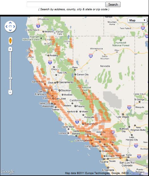
Shaping Human Interaction and Development
The locations of California’s fault lines have profoundly influenced human settlement, infrastructure, and even cultural perceptions. Early settlers often unknowingly built along linear valleys created by faults, drawn to flat land and water sources. Today, the detailed mapping of these fault lines is crucial for urban planning, building codes, and emergency preparedness. Major infrastructure, from highways and pipelines to dams, must be designed to withstand movement along these active zones.
Furthermore, the fault lines have given rise to unique ecological niches, with certain plant and animal communities thriving in the altered landscapes. Hot springs, formed by geothermal activity along faults, have become recreational and tourist attractions, integrating these powerful natural forces into human leisure and wellness.
In essence, the earthquake fault lines are central to California’s identity as a land of dynamic natural landmarks. They are the grand architects of its dramatic scenery, from the rugged mountains to the fertile valleys, and a constant reminder of the profound, powerful geological processes that continue to shape one of the world’s most captivating regions.
LifeOutOfTheBox is a participant in the Amazon Services LLC Associates Program, an affiliate advertising program designed to provide a means for sites to earn advertising fees by advertising and linking to Amazon.com. Amazon, the Amazon logo, AmazonSupply, and the AmazonSupply logo are trademarks of Amazon.com, Inc. or its affiliates. As an Amazon Associate we earn affiliate commissions from qualifying purchases.