
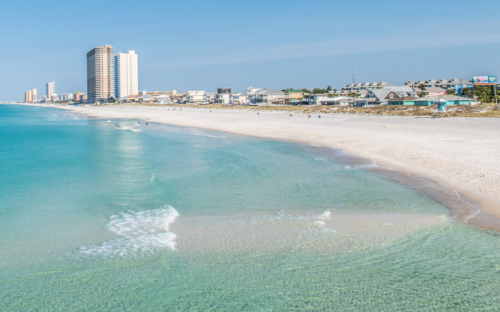
Panama City Beach, Florida, stands as a shimmering jewel on the Emerald Coast, renowned for its sugar-white sands and emerald-green waters. For countless travelers, the allure of this vibrant destination begins with a fundamental question: “How far is it?” Understanding the distance to Panama City Beach is the crucial first step in planning an unforgettable journey, impacting everything from travel time and budget to the choice of transportation. This guide delves into the geographical placement of Panama City Beach and outlines key distances from major population centers, providing an essential framework for your travel preparations.

Understanding the Appeal and Location of Panama City Beach
Before calculating the miles, it’s worth appreciating what makes Panama City Beach such a magnetic draw. Situated in the Florida Panhandle, it benefits from a unique blend of pristine natural beauty and lively entertainment options. Its coastal position places it conveniently accessible from a broad swathe of the United States, particularly the Southeast and Midwest, making it a popular choice for both quick getaways and extended vacations. The destination boasts over 27 miles of beaches, two state parks—St. Andrews State Park and Camp Helen State Park—and a bustling pier, contributing to its reputation as a multifaceted travel hub. The city’s geographical coordinates place it strategically, making it a viable driving destination for millions, while its modern airport ensures connectivity for those flying in.
Key Distances and Estimated Travel Times to Panama City Beach
The distance to Panama City Beach varies significantly depending on your starting point. Below, we’ve outlined approximate distances and driving times from several major U.S. cities, assuming average driving conditions and minimal stops. These estimates are designed to give you a clear picture of the journey ahead.
From the Southeast
The Southeast is Panama City Beach’s primary feeder market, with many travelers opting for scenic road trips.
- Atlanta, Georgia: Approximately 290-300 miles. A direct drive typically takes around 5 to 6 hours. The route generally involves taking I-85 South to Columbus, then US-280 West and US-231 South through Alabama into Florida. This is a popular weekend getaway route.
- Nashville, Tennessee: Roughly 450-460 miles. Expect a drive of about 7.5 to 8.5 hours. The most common path is via I-65 South to Montgomery, Alabama, then transitioning to US-231 South.
- New Orleans, Louisiana: About 270-280 miles. The drive is typically 4.5 to 5 hours. Travelers often take I-10 East across Mississippi and Alabama into Florida, then connect to US-98 East or Highway 79 South.
- Birmingham, Alabama: Around 260-270 miles. The journey usually takes 4.5 to 5 hours, often utilizing US-280 East or US-331 South.
- Orlando, Florida: Approximately 300-310 miles. Expect a drive of about 5 to 6 hours. The most straightforward route is typically Florida’s Turnpike North to I-75 North, then I-10 West to US-231 South or Highway 79 South.
From the Midwest
Travelers from the Midwest often embark on longer road trips, making strategic stops along the way.
- Chicago, Illinois: A significant distance, roughly 950-970 miles. This is a multi-day drive, requiring 15-16 hours of driving time. Common routes involve I-57 South and I-65 South through Kentucky, Tennessee, and Alabama before reaching Florida.
- St. Louis, Missouri: Approximately 750-760 miles. This journey would take around 12-13 hours of driving. Routes often utilize I-55 South and I-65 South.
- Indianapolis, Indiana: About 750-760 miles, with a driving time of 12-13 hours. Similar to St. Louis, routes usually involve I-65 South.
From Other Regions
For travelers coming from more distant locations, flying often becomes the more practical option, though dedicated road-trippers still make the trek.
- Dallas, Texas: Roughly 800-820 miles. This is a substantial drive of 12-14 hours, often involving I-20 East through Louisiana, Mississippi, and Alabama, then connecting to I-10 East.
- Miami, Florida: A longer intrastate journey of about 500-510 miles. This drive typically takes 8 to 9 hours, generally following Florida’s Turnpike North and then I-75 North before connecting to I-10 West and local routes.
Navigating Your Journey: Driving, Flying, and Other Options
The “how far” question inevitably leads to the “how to get there” decision. Panama City Beach is well-equipped to receive travelers by various means, each offering distinct advantages.
Driving to Panama City Beach
For many, a road trip to Panama City Beach is part of the vacation experience. The journey itself can be an adventure, with opportunities for scenic detours and stops.
- Routes and Interstates: Major interstates like I-10, I-65, and I-75 provide primary arteries connecting to the Panhandle. From I-10, travelers typically take exits for US-231 South (from the east) or Highway 79 South (from the west) which lead directly into Panama City Beach.
- Scenic Drives: Consider routes along US-98 once you’re closer to the coast for beautiful Gulf views, though this can add time compared to inland routes.
- Considerations: Factor in potential traffic, especially during peak season (spring break, summer holidays), and allow for rest stops, fuel, and meals. Driving offers flexibility with luggage and the convenience of having your own vehicle for local exploration.
Flying into Panama City
For those coming from greater distances or preferring to minimize travel time, flying is an efficient option.
- Northwest Florida Beaches International Airport (ECP): This is the closest and most convenient airport for Panama City Beach. Located approximately 15-20 miles northwest of the city, ECP offers direct flights from several major U.S. cities via airlines such as Southwest Airlines, Delta, American Airlines, and United.
- Connecting Flights: Depending on your origin, you might have a connecting flight through hubs like Atlanta, Dallas, or Houston.
- Onward Travel from ECP: Once you land at ECP, you can easily access rental cars, taxis, or ride-sharing services to complete the short journey to your accommodation in Panama City Beach.
Alternative Transportation
While less common, some travelers might consider other options.
- Bus Services: Several national bus lines offer routes to Panama City, which is adjacent to Panama City Beach. This is generally a more budget-friendly but time-intensive option.
- Private Shuttles/Car Services: For groups or those seeking a more luxurious or hassle-free transfer from a distant airport (like Pensacola or Destin-Fort Walton Beach), private shuttle services can be arranged, though at a higher cost.
Planning Your Panama City Beach Travel Experience
Beyond the sheer mileage, optimizing your travel to Panama City Beach involves a few strategic considerations that can significantly enhance your experience.
Best Time to Visit
The season you choose to travel will influence the driving conditions, flight availability, and overall atmosphere.
- Spring (March-May): Popular for spring break, expect higher traffic volume and potentially higher airfares. The weather is typically ideal.
- Summer (June-August): Peak family vacation season, leading to congested roads and fully booked flights and accommodations. Booking well in advance is crucial.
- Fall (September-November): Often considered the “secret season,” with pleasant weather, fewer crowds, and potentially lower travel costs.
- Winter (December-February): Quieter, with cooler temperatures, appealing to snowbirds and those seeking a peaceful escape. Travel is generally easier during this time.
What to Pack for the Journey
Regardless of your mode of transport, thinking about what you’ll need for the journey itself is key. For long drives, snacks, entertainment, and comfortable clothing are essential. For flights, ensuring your carry-on meets airline requirements and has essentials is important. Don’t forget travel documents, chargers, and any necessary medications.

On Arrival and Getting Around
Once you’ve successfully navigated the distance and arrived in Panama City Beach, having a plan for local transportation is beneficial. Most visitors rely on personal vehicles (rental or their own), but ride-sharing services, taxis, and limited public transportation options are available. The layout of Panama City Beach, with many attractions spread along Front Beach Road, often makes a car the most convenient way to explore.
In conclusion, understanding “how far” Panama City Beach is truly unlocks the planning potential for your trip. Whether you’re embarking on an epic road trip from the Midwest or a quick flight from a nearby Southeastern city, the journey to this Florida gem is a fundamental part of the travel experience. By considering distances, travel times, and transportation options, you can ensure a smooth and enjoyable arrival at this sought-after Emerald Coast destination.
LifeOutOfTheBox is a participant in the Amazon Services LLC Associates Program, an affiliate advertising program designed to provide a means for sites to earn advertising fees by advertising and linking to Amazon.com. Amazon, the Amazon logo, AmazonSupply, and the AmazonSupply logo are trademarks of Amazon.com, Inc. or its affiliates. As an Amazon Associate we earn affiliate commissions from qualifying purchases.