
Lighthouse Point is a distinguished and serene enclave situated in the heart of the “Gold Coast” in South Florida. Located within the northeastern reaches of Broward County, this small but affluent city serves as a tranquil sanctuary for those who appreciate a nautical lifestyle combined with suburban refinement. To understand exactly where Lighthouse Point is, one must look at its specific placement between two of the region’s most prominent urban centers: Fort Lauderdale to the south and Boca Raton to the north.
The city is geographically defined by its relationship with the water. Tucked away from the frantic pace of major metropolitan highways, it occupies a prime piece of real estate bounded by the Intracoastal Waterway and the Federal Highway. While it does not sit directly on the Atlantic Ocean beach—that distinction belongs to its neighbor, Hillsboro Beach—it is essentially a peninsula city characterized by miles of man-made canals that provide direct deep-water access to the sea.
The Geographic Heart of the Gold Coast
When pinpointing the location of Lighthouse Point on a map of Florida, it is helpful to use the surrounding municipalities as markers. To the immediate south lies Pompano Beach, a vibrant coastal city known for its fishing pier and sprawling beachfront. To the north, the city is bordered by Deerfield Beach, which offers a more laid-back, surf-centric atmosphere. This positioning places Lighthouse Point in a unique transition zone where the energy of Miami begins to give way to the more manicured landscapes of Palm Beach County.
Bordering the Atlantic and the Intracoastal
While Lighthouse Point is often associated with the ocean, its eastern boundary is actually formed by the Intracoastal Waterway. Across this narrow stretch of water lies the exclusive town of Hillsboro Beach, which serves as a barrier island protecting the mainland from the direct swells of the Atlantic Ocean. The interaction between these two bodies of water is most evident at the Hillsboro Inlet, a natural opening that allows boaters to transition from the calm inner canals directly into the open sea.
This specific geography has shaped the city’s development. Unlike many Florida towns that grew around a central downtown or agricultural hub, Lighthouse Point was designed with the mariner in mind. The city features over 18 miles of waterways, meaning that nearly every residential street ends in a cul-de-sac or leads to a waterfront property. This intricate network of canals creates a “finger” layout that maximizes the amount of shoreline available for private docks and maritime activity.
Proximity to Major South Florida Hubs
For travelers and residents alike, the location of Lighthouse Point is strategically advantageous. It sits approximately 15 miles north of Fort Lauderdale and about 20 miles south of West Palm Beach. This makes it a quiet residential retreat that remains within easy commuting distance of major business districts and entertainment venues.
The city is largely bounded to the west by Federal Highway, also known as US-1, which serves as the primary commercial artery for the area. Just a few miles further west is Interstate 95, the main transit spine of the United States East Coast. This proximity ensures that while the interior of the city feels like a secluded island community, the practicalities of modern life—shopping, dining, and healthcare—are never more than a few minutes away.
Navigating the Waterways and Natural Boundaries
The identity of Lighthouse Point is inextricably linked to its aquatic boundaries. To the north, the city is framed by the Hillsboro Canal, which serves as the dividing line between Broward County and Palm Beach County. This canal is a significant waterway that connects the coastal regions to the interior of Florida, eventually leading toward the Everglades.
The Hillsboro Inlet: A Gateway to the Ocean
The most significant landmark defining the “where” of this city is the Hillsboro Inlet. Located at the southeastern tip of the community, this inlet is one of the few reliable passages for vessels to enter the Atlantic Ocean from the Intracoastal Waterway. The currents here are strong, and the water is remarkably clear, often taking on a turquoise hue that rivals the Caribbean Sea.
Boaters from all over South Florida use this inlet to reach the productive fishing grounds of the Gulf Stream. The proximity to the Gulf Stream—a powerful, warm ocean current—is why Lighthouse Point is such a prestigious location for sport fishing enthusiasts. Within minutes of leaving a private dock in the city, a fisherman can be in deep blue water, hunting for sailfish, mahi-mahi, or wahoo.
Parks and Green Spaces Along the Shore
While much of the city is residential, its location is punctuated by several beautifully maintained parks that highlight the local ecosystem. Exchange Club Park, situated along the Intracoastal Waterway, offers visitors a chance to observe the natural mangroves and local bird populations. This park acts as a green lung for the city, providing a contrast to the manicured lawns of the surrounding estates.
Further inland, Dan Witt Park serves as the community’s athletic and social center, while DeGroff Park provides a more contemplative space with views of the water. These parks are strategically placed to ensure that even those without a waterfront home can enjoy the breezes and vistas that define the Sunshine State lifestyle. The city’s commitment to preserving these pockets of nature amidst high-value real estate is a testament to its dedication to a high quality of life.
Historical Landmarks and Architectural Heritage
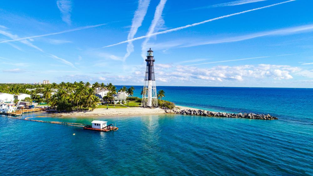
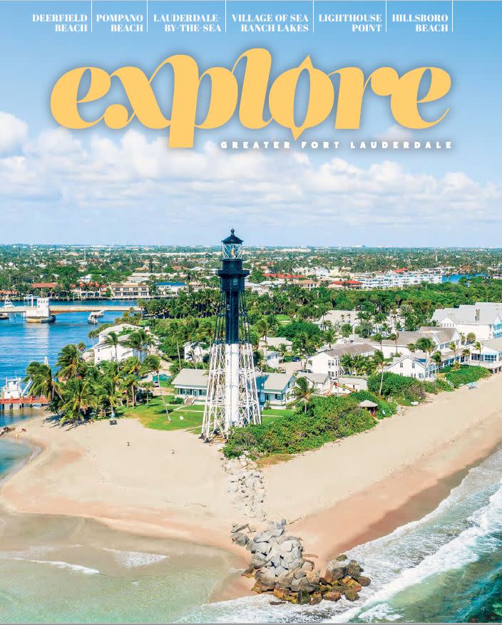
To truly find Lighthouse Point, one must look toward the horizon for the structure that gave the city its name. The Hillsboro Inlet Lighthouse is the visual and spiritual anchor of the community. Although the lighthouse itself is technically located on the northern point of the inlet within the boundaries of Hillsboro Beach, it has been the defining landmark for the Lighthouse Point community since its inception.
The Iconic Hillsboro Inlet Lighthouse
Completed in 1907, the Hillsboro Inlet Lighthouse is one of the most powerful lighthouses in the United States. Its “iron pile” skeleton design was a marvel of early 20th-century engineering, designed to withstand the hurricane-force winds that occasionally sweep through North America. The lighthouse serves as a beacon for mariners navigating the treacherous reefs that lie just offshore.
The presence of the lighthouse has dictated the architectural aesthetic of the city. While newer builds often lean toward modern coastal or Mediterranean revival styles, there is a deep-seated respect for the nautical heritage of the area. Many homes are built to maximize views of the lighthouse’s beam as it sweeps across the night sky, creating a unique atmosphere that feels both historic and timeless.
The Development of a Waterfront Community
The city of Lighthouse Point was not officially incorporated until 1956. Before its development, the land was largely a mix of pineapple fields and mangrove swamps. The transformation into a premier residential destination was a deliberate act of urban planning. Developers recognized that the location’s proximity to both the Hillsboro Inlet and the Intracoastal Waterway made it an ideal spot for a “Venice of America” style community.
Unlike the high-rise dominated skylines of Miami Beach or Sunny Isles Beach, Lighthouse Point has resisted the urge to build vertically. The city is characterized by low-slung, sprawling estates and single-family homes. This preserves the “small town” feel and ensures that the landscape is dominated by palm trees and masts rather than concrete and glass.
Planning Your Arrival: Transportation and Accessibility
Understanding where Lighthouse Point is located also involves knowing how to get there. Because it is a largely residential enclave, it does not have the massive transit infrastructure of its larger neighbors, but it is exceptionally well-connected to the broader South Florida region.
Driving Routes and Nearby Airports
For those arriving by car, the city is most easily accessed via Sample Road or Copans Road from Interstate 95. Traveling north or south on Federal Highway will also bring you directly to the city’s western gates. The drive from Fort Lauderdale-Hollywood International Airport takes approximately 25 to 30 minutes, depending on traffic, making it a convenient destination for international travelers.
Alternatively, Palm Beach International Airport to the north is roughly a 40-minute drive, while Miami International Airport is about an hour away. This central positioning between three major airports offers unparalleled flexibility for residents and visitors traveling from different parts of the globe.

Navigating by Boat
In Lighthouse Point, “where” you are is often measured in nautical miles rather than minutes on the road. For many, the preferred way to arrive is by water. The city is a major waypoint for those traveling the Intracoastal Waterway between the Florida Keys and the Chesapeake Bay.
The Lighthouse Point Marina serves as a primary hub for transient boaters and local residents. From here, it is a short, scenic cruise to the Hillsboro Inlet. The ease of access to the ocean is perhaps the city’s greatest geographic asset. Whether you are heading east to the Bahamas or simply cruising the shoreline of Pompano Beach, Lighthouse Point provides a sophisticated and practical home base for all maritime adventures.
LifeOutOfTheBox is a participant in the Amazon Services LLC Associates Program, an affiliate advertising program designed to provide a means for sites to earn advertising fees by advertising and linking to Amazon.com. Amazon, the Amazon logo, AmazonSupply, and the AmazonSupply logo are trademarks of Amazon.com, Inc. or its affiliates. As an Amazon Associate we earn affiliate commissions from qualifying purchases.