
Navigating the Crescent City’s Geographic Identity
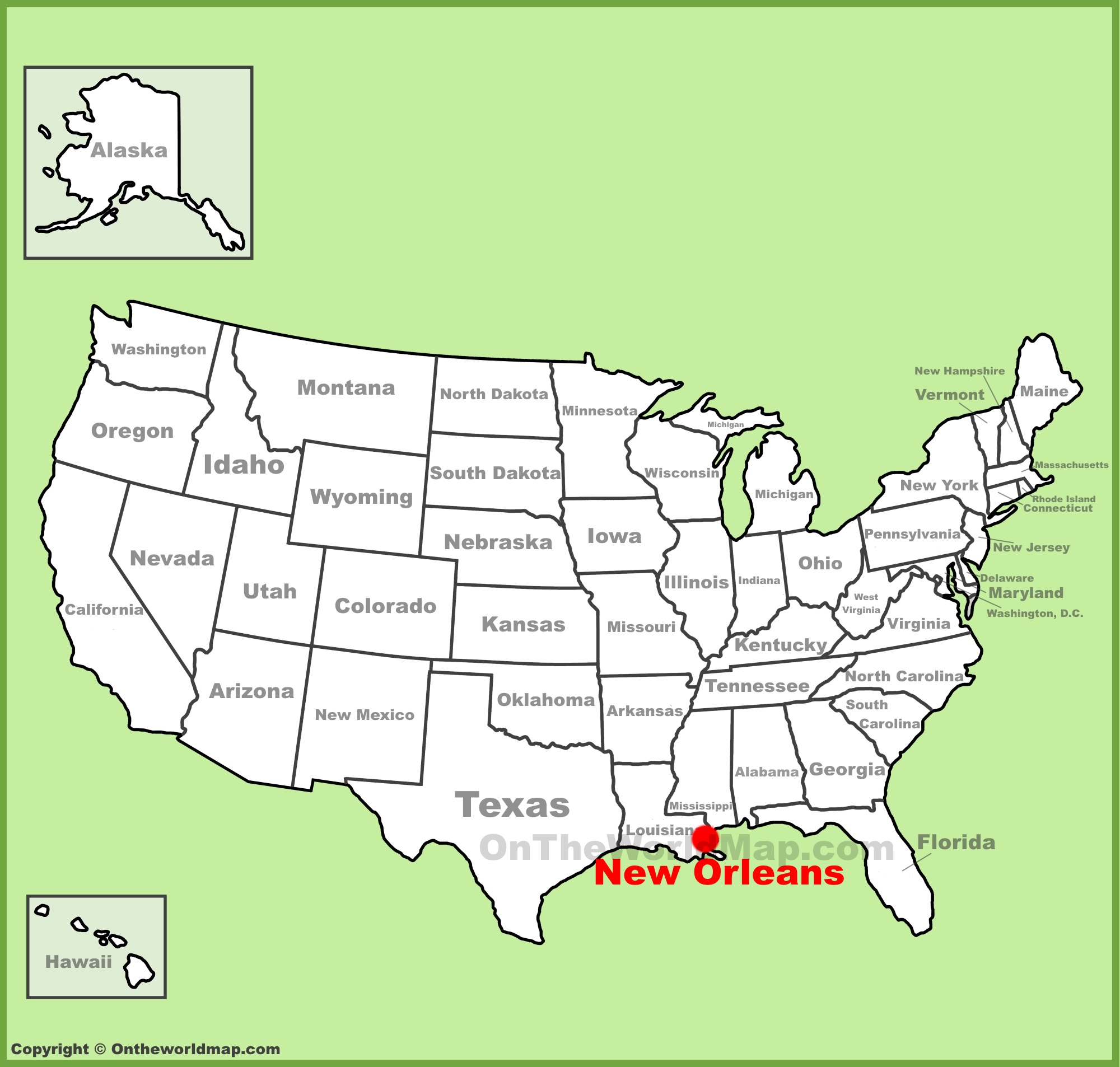
Understanding the precise location of New Orleans on the United States map is fundamental for any traveler or enthusiast seeking to grasp its unique cultural and historical significance. This vibrant metropolis, often referred to as the “Crescent City” due to its distinctive shape along a bend in the Mississippi River, is situated in the southeastern part of Louisiana. Its strategic position at the mouth of the Mississippi River, where it empties into the Gulf of Mexico, has profoundly shaped its history, economy, and culture.
Southeastern Louisiana’s Strategic Position
Geographically, New Orleans is nestled within the delta region of the Mississippi River, a low-lying area characterized by wetlands, bayous, and a complex network of waterways. This unique setting places it at a critical juncture for trade and transportation, a role it has played since its founding. The city is one of the principal port cities in the United States, with the Port of New Orleans being one of the busiest in terms of tonnage handled. This proximity to the Gulf of Mexico also influences its climate, making it a subtropical region with hot, humid summers and mild winters.
The city’s location within Louisiana is specific: it lies primarily in Orleans Parish, though its metropolitan area extends into neighboring parishes such as Jefferson Parish and St. Tammany Parish. The topography of the region, being predominantly flat and below sea level in many areas, has necessitated extensive engineering and flood control measures, most notably the levee system designed to protect the city from the formidable Mississippi River and storm surges from the Gulf of Mexico.
Proximity to Key Waterways and Bodies of Water
The relationship of New Orleans to water is its defining geographical characteristic. The Mississippi River forms its western and northern boundary, a majestic artery that has historically facilitated exploration, commerce, and cultural exchange. To the east and south, the city is bordered by the vast expanse of Lake Pontchartrain, a large brackish estuary that offers recreational opportunities and influences the local weather patterns. Beyond Lake Pontchartrain, the landscape transitions into the Gulf of Mexico, the gateway to international trade routes and a source of bounty for the region’s renowned seafood industry.
This intricate web of waterways has not only been crucial for economic development but has also played a significant role in the city’s unique cultural tapestry. The accessibility provided by these natural channels fostered the diverse influences that have shaped New Orleans, from its French and Spanish colonial roots to its Creole heritage and the vibrant African American communities that have contributed so much to its music, food, and traditions.
Connections to the Wider United States
Positioned at the southern end of the Mississippi River, New Orleans serves as a crucial gateway to the heartland of the United States. Its port facilitates the movement of goods from inland states to global markets and vice-versa. The city is also a hub for various transportation networks, including major interstate highways like Interstate 10, which connects it to cities across the southern U.S., and a significant Amtrak rail service. Louis Armstrong New Orleans International Airport further solidifies its role as a major travel destination and a point of connection for visitors from across the nation and the world.
Understanding New Orleans’ Place on the Map
To visualize New Orleans on a United States map, one should locate the southeastern corner of the country, specifically the state of Louisiana. Within Louisiana, the city is found on the eastern bank of the lower Mississippi River, just upstream from where it meets the Gulf of Mexico. It is situated south of the state capital, Baton Rouge, and west of the Florida panhandle. Its distinctive crescent shape is easily identifiable on detailed maps, a visual cue that often distinguishes it from other urban centers. This geographical placement is not merely an academic detail; it is the very foundation upon which the city’s rich history, resilient spirit, and captivating culture have been built, making it an unparalleled destination for exploration and discovery.
The Mississippi River’s Embrace: A Defining Geographical Feature
The Mississippi River is more than just a geographical marker for New Orleans; it is the lifeblood of the city, shaping its past, present, and future in profound ways. From its earliest days as a colonial trading post to its current status as a major international port, the river has dictated the city’s growth, its economy, and its very identity.
A Gateway to the Interior
The Mississippi River is the longest river in North America and the fourth longest in the world. Its vast drainage basin encompasses much of the central United States, making the location of New Orleans at its mouth strategically vital. For centuries, this natural waterway served as the primary highway for goods and people moving between the interior of the continent and the wider world. Early explorers, traders, and settlers utilized the river to transport agricultural products, raw materials, and manufactured goods. This constant flow of commerce established New Orleans as a pivotal economic hub, attracting diverse populations and fostering a cosmopolitan atmosphere.
The development of steamboat technology in the 19th century further amplified the river’s importance, transforming New Orleans into a bustling center of trade and a gateway to the burgeoning American West. The city’s port facilities grew to accommodate the immense volume of traffic, solidifying its position as a critical node in the national and international trade network. Even today, the Mississippi River remains a vital artery for freight transportation, supporting industries such as agriculture, manufacturing, and energy.
The Crescent Bend and Its Implications
The distinctive “crescent bend” of the Mississippi River around which New Orleans is situated is not merely an aesthetic feature; it has significant geographical and historical implications. This bend concentrates the river’s flow and contributes to the city’s unique topography. The very shape of the city is a direct consequence of its curvilinear relationship with the river. Early settlements naturally gravitated to the slightly higher ground along the riverbanks, forming the nucleus of what would become the French Quarter.
However, this proximity to the river also presents challenges. The river’s tendency to flood, especially during periods of heavy rainfall and hurricanes, has historically posed a significant threat to the city. The constant struggle against the water has led to the development of an extensive system of levees, floodwalls, and pumping stations. The iconic levee system, which stands as a testament to human ingenuity and perseverance, is a direct response to the river’s powerful presence. Understanding the dynamics of the Mississippi River, its natural ebb and flow, and the engineering marvels designed to control it, is essential to understanding New Orleans.
A Canvas for Culture and Commerce
The Mississippi River has served as a conduit for cultural exchange, bringing diverse peoples, ideas, and traditions to New Orleans. From the French and Spanish colonizers to enslaved Africans and later European immigrants, each group arrived via the river, leaving their indelible mark on the city’s culture. This confluence of influences is evident in the city’s music, cuisine, architecture, and language, creating a unique Creole culture that is celebrated worldwide.

Furthermore, the riverfront has historically been the heart of commerce and social life. The bustling wharves, the grand riverboats, and the vibrant street life along the riverbanks have always been integral to the city’s character. Today, the riverfront continues to be a significant area, with attractions like the Audubon Aquarium of the Americas and the Woldenberg Riverfront Park drawing visitors and locals alike. The enduring presence of the Mississippi River is a constant reminder of New Orleans’ deep connection to nature, its rich history, and its dynamic cultural heritage.
The Gulf Coast Connection: A Maritime Hub
New Orleans’ location on the map is inextricably linked to the Gulf of Mexico, a vast body of water that has profoundly influenced its economic, environmental, and cultural landscape. Its position at the river’s mouth makes it a vital gateway to maritime trade and a region characterized by its unique coastal environment.
Gateway to the Ocean
The Mississippi River acts as a crucial conduit, carrying goods from the interior of the United States to the Gulf of Mexico, and from there, to the broader global marketplace. The Port of New Orleans, situated on the river just before it empties into the gulf, is one of the largest and busiest ports in the country. This strategic advantage allows New Orleans to serve as a vital link in international trade, facilitating the import and export of a wide array of commodities, from grain and chemicals to manufactured goods and automobiles. The presence of this major port has historically attracted businesses and industries that rely on maritime transportation, contributing significantly to the region’s economic prosperity.
The gulf also provides access to vital energy resources, with offshore oil and gas production being a significant industry in the region. This has further cemented New Orleans as a key center for the maritime and energy sectors, attracting specialized labor and supporting a robust service economy. The interconnectedness of the river, the gulf, and the global shipping routes underscores the city’s importance as a maritime hub.
The Coastal Environment and Its Influence
The proximity to the Gulf of Mexico defines the environmental characteristics of New Orleans. The region is characterized by a subtropical climate, with high humidity, mild winters, and hot, humid summers. The area is part of a vast delta system, with numerous bayous, marshes, and wetlands that are ecologically rich and vital to the region’s biodiversity. This unique environment influences everything from the local flora and fauna to the city’s cuisine, which prominently features fresh seafood from the gulf waters.
However, this coastal location also makes New Orleans particularly vulnerable to the impacts of climate change, including rising sea levels and increasingly severe hurricanes. The experience of Hurricane Katrina in 2005 starkly illustrated the challenges posed by the city’s geography, highlighting the critical importance of robust coastal protection and adaptation strategies. Understanding the delicate balance between the urban environment and the surrounding coastal ecosystem is paramount to the city’s long-term sustainability and resilience.
A Hub for Seafood and Coastal Culture
The bounty of the Gulf of Mexico is a cornerstone of New Orleans’ culinary identity. From shrimp and oysters to crabs and various species of fish, the seafood caught in the gulf and its adjacent waters forms the basis of many iconic dishes, such as gumbo, jambalaya, and crawfish étouffée. This direct connection to the sea not only provides sustenance but also fosters a distinct coastal culture characterized by a deep appreciation for the region’s natural resources and a vibrant tradition of fishing and seafood preparation.
The relationship with the Gulf of Mexico extends beyond cuisine to encompass recreational activities. Boating, fishing, and exploring the coastal wetlands are popular pastimes that connect residents and visitors to the natural beauty of the region. The gulf’s influence is a palpable force in New Orleans, shaping its economy, its environment, and its unique cultural heritage, making it an integral part of the city’s geographical identity.
Navigating the Atlas: Precise Placement and Travel Considerations
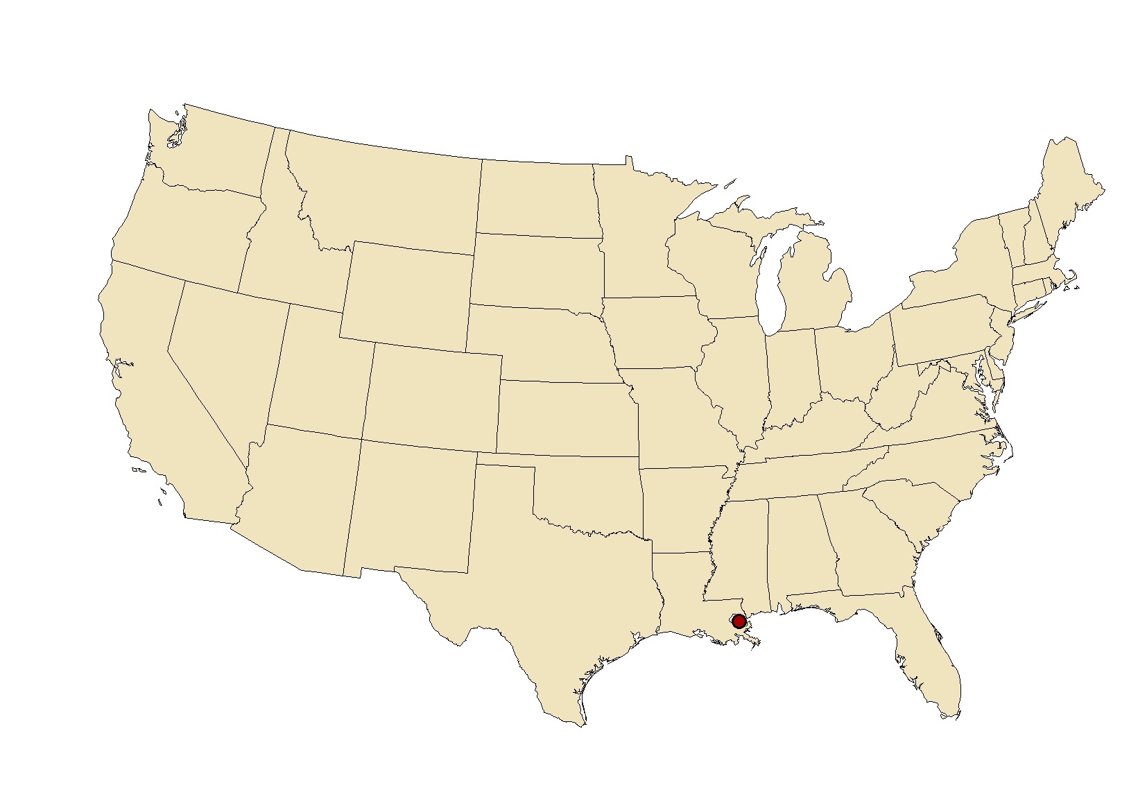
Pinpointing New Orleans on a United States map reveals its strategic position within the southeastern United States, a placement that informs its accessibility and appeal as a travel destination. Understanding its coordinates and relative location to other major cities provides a practical context for planning a visit.
Coordinates and Relative Location
Geographically, New Orleans is situated at approximately 29.95 degrees North latitude and 90.07 degrees West longitude. This places it firmly within the subtropical zone of the Northern Hemisphere. On a national map, it is located in the southeastern quadrant of the country, in the state of Louisiana. It is the principal city of the New Orleans metropolitan area, which is part of the larger Gulf Coast region.
To orient oneself further, New Orleans is roughly 500 miles east of Houston, Texas, 350 miles west of Mobile, Alabama, and approximately 475 miles south of Nashville, Tennessee. Its southern orientation means it is a relatively short flight or drive from many major East Coast and Midwestern cities, making it an accessible destination for a broad segment of the U.S. population.
Transportation Hubs and Accessibility
The geographical placement of New Orleans has fostered its development as a significant transportation hub. Louis Armstrong New Orleans International Airport (MSY) serves as a major gateway, with direct flights connecting the city to numerous domestic and international destinations. This makes arriving by air a convenient option for most travelers.
For those who prefer land travel, New Orleans is well-connected by a network of highways. Interstate 10 is the primary east-west artery, linking the city to Florida to the east and Texas to the west. Additionally, Interstate 59 connects it to the north. The city is also served by Amtrak passenger rail service, providing a scenic and comfortable alternative for travel from various parts of the country. The presence of the Mississippi River also means that cruise ships regularly dock in New Orleans, offering another popular mode of arrival and departure.
The Traveler’s Perspective: Why Location Matters
For travelers, understanding New Orleans’ location is crucial for practical planning. Knowing its position relative to other cities can influence travel choices and itineraries. For instance, a traveler journeying from the West Coast might choose to drive through Texas and stop in cities like Austin or San Antonio before reaching New Orleans, while someone from the East Coast might opt for a direct flight or a drive through the scenic Southern states.
Furthermore, its location on the Gulf Coast means that weather patterns can be a significant consideration. Travelers should be aware of the potential for heat and humidity during the summer months and the possibility of hurricanes during the Atlantic hurricane season, which runs from June 1 to November 30. Planning travel outside of these peak periods, or being prepared for such conditions, is advisable. The unique geography, with its proximity to water bodies like Lake Pontchartrain and the Gulf of Mexico, also contributes to the city’s distinct atmosphere and the prevalence of water-based activities. Ultimately, appreciating where New Orleans sits on the U.S. map is the first step in unlocking the myriad experiences this extraordinary city has to offer.
LifeOutOfTheBox is a participant in the Amazon Services LLC Associates Program, an affiliate advertising program designed to provide a means for sites to earn advertising fees by advertising and linking to Amazon.com. Amazon, the Amazon logo, AmazonSupply, and the AmazonSupply logo are trademarks of Amazon.com, Inc. or its affiliates. As an Amazon Associate we earn affiliate commissions from qualifying purchases.