
The Mississippi River is more than just a waterway; it’s a living, breathing artery that defines the landscape, economy, and very soul of New Orleans. Its immense scale and historical significance make it one of the most iconic natural landmarks in North America. While its breadth and power are immediately visible, a common question often arises about its hidden dimensions: how deep is the Mississippi River in New Orleans? The answer is not a simple fixed number, but rather a dynamic range influenced by a complex interplay of natural forces and human intervention. Understanding its depth unveils a fascinating story of geology, engineering, commerce, and the enduring spirit of the Crescent City.
Unveiling the Depths: The Mississippi River’s Secret
The depth of the Mississippi River in New Orleans is a multifaceted characteristic, constantly shifting and rarely static. It is a river of extremes, capable of immense power and surprising variability. Far from being a uniform channel, its bed is an intricate tapestry of deep scour holes, shallower sandbars, and engineered shipping lanes.
The General Answer: Averages and Variability
For those seeking a quick answer, the navigable channel of the Mississippi River in the immediate vicinity of New Orleans is typically maintained at a minimum depth of 45 to 50 feet (approximately 13.7 to 15.2 meters) below the lowest recorded water level. This is the crucial depth for shipping, allowing large ocean-going vessels to access the Port of New Orleans.
However, the actual natural depth of the river can vary dramatically. In some areas within the city limits, especially around bends or where the current has scoured the riverbed, depths can plummet to over 100 feet (30 meters), and in certain historical accounts or specific isolated scour holes, depths approaching 200 feet (60 meters) have been reported. These deeper sections are less about engineered navigation and more about the river’s raw power to carve out its own path. The deepest point ever recorded in the entire Mississippi River system, which includes the lower Mississippi River near New Orleans, is estimated to be around 200 feet. This profound depth is a testament to the colossal volume of water and sediment that has flowed through this channel for millennia.
It’s important to differentiate between the maintained navigation channel and the natural riverbed. While the channel provides a reliable pathway for commerce, the river’s true depths, with their dramatic undulations, speak to its untamed nature beneath the surface.
Factors Influencing Depth
Several critical factors contribute to the dynamic depth profile of the Mississippi River in New Orleans:
- River Stage: The most immediate and noticeable factor is the river’s “stage,” or its water level, which fluctuates significantly based on rainfall and snowmelt across its vast drainage basin. Heavy rains upstream in states like Missouri or along the Ohio River can cause the river level to rise dramatically in New Orleans, making the measured depth from the surface appear greater, even if the riverbed itself hasn’t changed. Conversely, during drought conditions, the water level drops, reducing the apparent depth.
- Sedimentation and Erosion: The Mississippi River is a powerful transporter of sediment, carrying millions of tons of sand, silt, and clay downstream annually. This sediment can build up in certain areas, particularly on the inside of bends or where the current slows, creating shallower spots. Conversely, the powerful currents on the outside of bends can cause significant erosion, scouring the riverbed and creating deeper sections. This constant process of deposition and erosion continually reshapes the river’s bottom.
- Dredging Efforts: To maintain the vital navigable channels for shipping, the US Army Corps of Engineers undertakes extensive and continuous dredging operations. This involves removing accumulated sediment from the riverbed to ensure the required minimum depth for large vessels. These engineering feats are crucial for the economic viability of the Port of New Orleans and are a testament to human efforts to control and manage this powerful natural force.
- Location Along the Stretch: Even within New Orleans, the depth varies. Areas directly adjacent to the Port of New Orleans facilities, where ships dock, are meticulously maintained. Other areas, such as shallower recreational spots or stretches away from the main channel, might not be as deep.
A Lifeline of Commerce: Why Depth Matters
The depth of the Mississippi River in New Orleans is not just a geological curiosity; it is the fundamental enabler of its commercial might and a critical component of the national economy. The river’s navigability is directly tied to the prosperity of the region and beyond.
The Port of New Orleans
The maintained depth of the river is paramount for the operation of the Port of New Orleans, one of the busiest and most important ports in the United States. Situated strategically near the mouth of the river, connecting to the Gulf of Mexico, the port is a crucial gateway for international trade.
- Accommodation of Large Vessels: Modern container ships, bulk carriers, tankers, and even large cruise ships require significant draft (the vertical distance between the waterline and the bottom of the hull). Without a consistently deep channel, these vessels would be unable to access the port, leading to severe economic disruption. The ability to accommodate “post-Panamax” vessels (those too large to fit through the original Panama Canal) is a competitive advantage that directly relies on river depth.
- Economic Impact: The Port of New Orleans handles millions of tons of cargo annually, including agricultural products (like grain from the Midwest), crude oil, chemicals, and manufactured goods. This massive flow of goods generates billions in economic activity, supporting countless jobs in shipping, logistics, manufacturing, and related industries throughout Louisiana and the broader nation. Any restriction on river depth would bottleneck this flow, causing ripple effects across the economy.
Engineering Marvels and Maintenance
Maintaining the critical depth of the Mississippi River is a continuous and monumental engineering challenge. The river’s natural inclination to deposit sediment means that human intervention is constantly required.
- Constant Dredging Operations: The US Army Corps of Engineers is the primary agency responsible for managing the navigability of the Mississippi River. Their dredging fleet works tirelessly to remove sand and silt that accumulates in the shipping channels, ensuring that the target depths are met. This is a perpetual battle against the forces of nature, as the river continuously brings new sediment from its enormous watershed, which stretches from the Rocky Mountains to the Appalachian Mountains.
- River System Management: Beyond local dredging, the management of the entire Mississippi River system impacts the flow and sediment load in New Orleans. Dams, levees, and control structures upstream (such as those along the Missouri River and Ohio River) play a role in regulating the river’s flow and, consequently, its ability to carry and deposit sediment. The ongoing efforts to deepen the navigation channel from Baton Rouge to the Gulf of Mexico to 50 feet further illustrate the dedication to optimizing the river for commerce.
The River’s Dynamic Nature: Beyond Just Depth
While depth is a crucial aspect, it’s merely one dimension of the Mississippi River‘s complex and ever-changing character. The river is a dynamic natural system, constantly evolving and influencing the land and life around it.
Geomorphology and Evolution
The Mississippi River is a geomorphological marvel, a prime example of a meandering river system.
- Meandering Nature: Upstream, the river exhibits dramatic bends and oxbow lakes, remnants of former river channels. In New Orleans, the river makes its famous “Crescent Bend,” which gave the city its nickname. These bends are not static; they slowly migrate over time through erosion on the outside curves and deposition on the inside.
- Historical Changes: The course of the Mississippi River has changed dramatically over geological timescales. The land upon which New Orleans sits is entirely a product of the river’s depositional processes, built from sediment carried down from the heart of the continent. The ongoing struggle with the river involves preventing it from naturally changing course, specifically shifting into the Atchafalaya Basin, a critical concern for the economic lifeblood tied to its current path.
- Delta Formation: Downstream from New Orleans, the river spreads into a vast delta, depositing its sediment load as it meets the Gulf of Mexico. This process continually builds new land while simultaneously contributing to land loss in other areas due to subsidence and erosion.
The Power and Peril
The sheer power of the Mississippi River is both a blessing and a constant threat. Its immense volume of water and sediment makes it a force to be reckoned with.
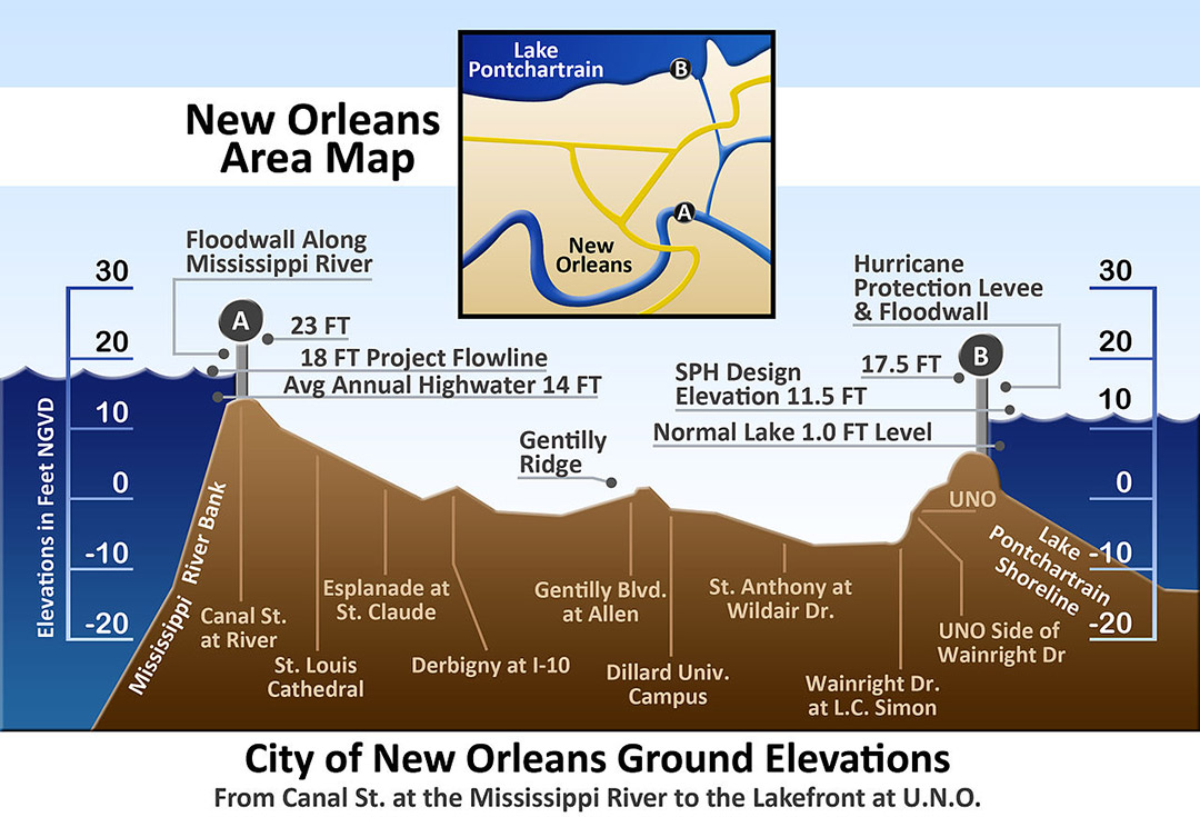
- Flood Control: The river is contained by an extensive system of levees, especially critical in a city like New Orleans, much of which lies below sea level. These levees, coupled with spillways like the Bonnet Carré Spillway (located upstream from the city and designed to divert floodwaters into Lake Pontchartrain), are essential for protecting the metropolitan area from catastrophic flooding during high river stages.
- Ecological Impact: The river’s flow, sediment, and nutrient load are crucial for the health of the downstream coastal wetlands and estuaries, which serve as vital nurseries for marine life and natural buffers against hurricanes. The management of the river’s depth and flow therefore has profound ecological implications for the entire Louisiana coastline.
Experiencing the Mississippi River as a Landmark
For visitors and locals alike, the Mississippi River in New Orleans is a profound presence, offering unique perspectives and connecting to the city’s rich cultural tapestry. Understanding its physical attributes, including its depth, only deepens the appreciation for this natural wonder.
Iconic Views and Waterfront Access
The riverfront in New Orleans provides numerous opportunities to connect with the majestic waterway:
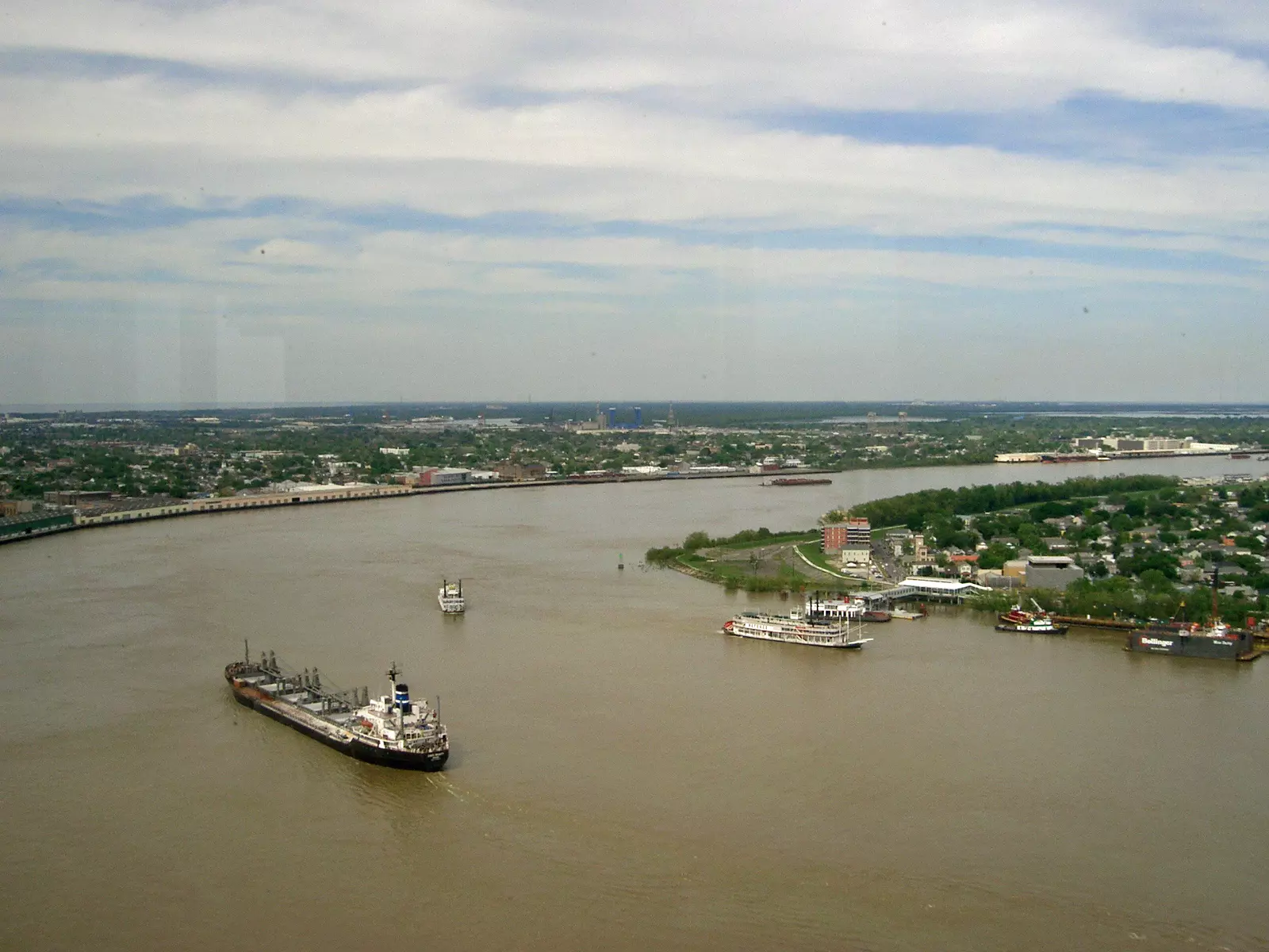
- Woldenberg Park and the French Quarter Promenade: Strolling along the pedestrian promenade in Woldenberg Park, adjacent to the historic French Quarter, offers breathtaking views of the massive cargo ships and classic steamboats navigating the river. It’s a prime spot to witness the river’s sheer scale and imagine its depths.
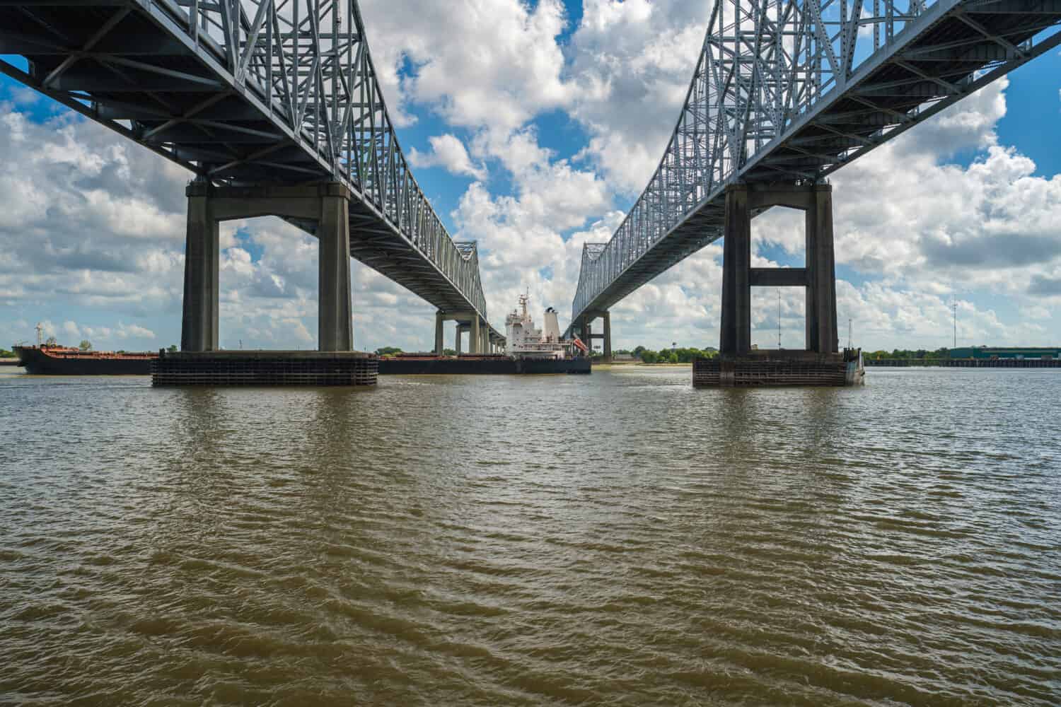
- Algiers Point Ferry: For a unique perspective, take the free Algiers Point ferry across the river. The short ride offers panoramic views of the New Orleans skyline, the iconic Crescent City Connection bridge, and the vast expanse of the river itself, giving a tangible sense of its impressive width and hidden depths.
- Jackson Square and Beyond: While not directly on the river, the proximity of landmarks like Jackson Square to the riverfront emphasizes how integrally the river is woven into the city’s urban fabric. Further afield, areas like Audubon Park and the Garden District are defined by the river’s crescent shape.
River Adventures and Cultural Significance
Beyond passive observation, the Mississippi River offers immersive experiences that highlight its role as a cultural and recreational landmark:
- Natchez Steamboat and Other Cruises: Taking a ride on the historic Natchez Steamboat or another riverboat cruise is an essential New Orleans experience. These cruises not only provide relaxing journeys with jazz music and local cuisine but also offer an on-the-water perspective of the river’s powerful currents, its commercial traffic, and the impressive infrastructure that manages its flow. From the deck, one can truly grasp the scale of the river and ponder the immense depths beneath.
- Fishing and Boating: While navigating the main channel requires expertise due to commercial traffic and strong currents, recreational boating and fishing are popular activities in designated areas, allowing for a more intimate connection with the waterway.
- A Symbol of Identity: The Mississippi River is more than just a physical feature; it is deeply embedded in the identity, music, literature, and history of New Orleans. From the steamboat era to its role in the Civil Rights Movement, the river has been a silent witness to centuries of American history, a continuous source of inspiration and challenge.
In conclusion, the question of “How deep is the Mississippi River in New Orleans?” opens a portal to understanding one of the world’s greatest rivers. While the maintained shipping channel provides a functional minimum depth for global commerce, the river’s natural depths can plunge far greater, reflecting its immense power and geological history. It is a living landmark, constantly shaped by natural forces and human ingenuity, serving as both a vital economic artery and an enduring symbol of New Orleans’s resilience and charm. Its profound depths are a testament to its grandeur, underpinning its role as a monumental natural landmark that continues to captivate and sustain the city it embraces.
LifeOutOfTheBox is a participant in the Amazon Services LLC Associates Program, an affiliate advertising program designed to provide a means for sites to earn advertising fees by advertising and linking to Amazon.com. Amazon, the Amazon logo, AmazonSupply, and the AmazonSupply logo are trademarks of Amazon.com, Inc. or its affiliates. As an Amazon Associate we earn affiliate commissions from qualifying purchases.