
Planning a journey between two of the United States’ most historically significant and culturally vibrant cities, Boston, Massachusetts and Washington, D.C., requires a clear understanding of the distance and the various travel options available. This route is a popular corridor for both leisure and business travelers, offering a spectrum of experiences, from rapid transit to scenic road trips. Understanding the precise mileage and the time commitment involved is the first step in crafting an itinerary that best suits your needs and preferences. The distance, while seemingly straightforward, unfolds into a complex interplay of transportation methods, traffic patterns, and potential detours that can significantly influence your overall travel time.
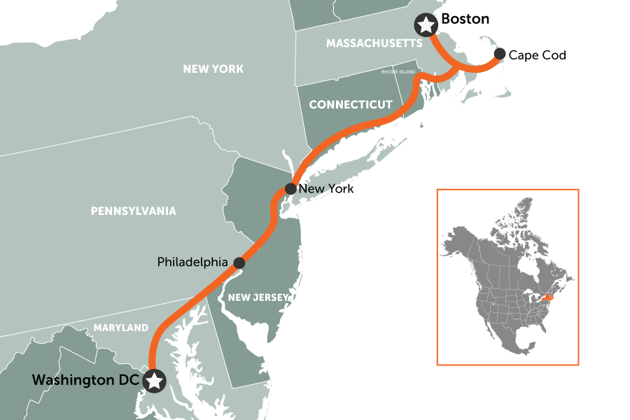
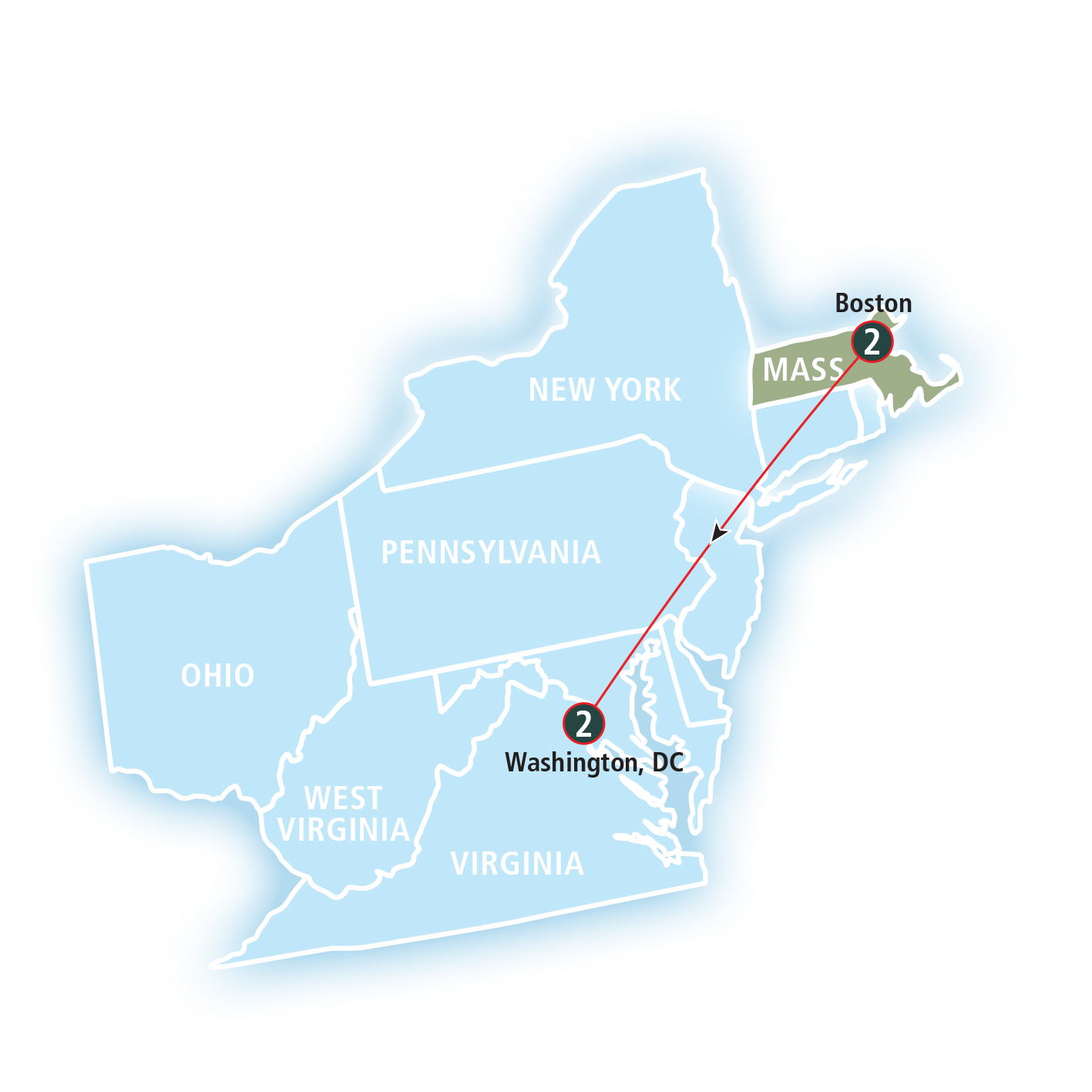
The direct, or “as the crow flies,” distance between Boston, Massachusetts and Washington, D.C. is approximately 370 miles (about 595 kilometers). However, this measurement is purely theoretical and does not reflect the actual journey undertaken by any mode of transportation. Road travel, for instance, inherently involves following established routes, which often deviate from a straight line, adding to the overall distance. Similarly, air travel, while direct in its path, still requires time for ground transportation to and from airports, security checks, and flight operations.
Understanding the Journey: Distance and Time
The actual travel distance and the time it takes to traverse the approximately 370 miles between Boston, Massachusetts and Washington, D.C. are highly dependent on the chosen mode of transport. Each option presents a unique balance of cost, speed, comfort, and the opportunity to experience the landscape along the way.
By Car: Navigating the Interstate
Driving between Boston, Massachusetts and Washington, D.C. is a common choice for those seeking flexibility and the ability to make spontaneous stops. The most direct route typically utilizes Interstate 95 (I-95) for a significant portion of the journey.
- Distance: The driving distance generally falls between 410 and 440 miles, depending on the specific start and end points within each city and the chosen route variations. This is a notable increase from the direct aerial distance due to the necessities of road networks.
- Estimated Driving Time: Without accounting for stops or significant traffic delays, the estimated driving time is around 6.5 to 8 hours. However, this is an optimistic projection.
- Factors Affecting Time:
- Traffic Congestion: Both Boston, Massachusetts and Washington, D.C. are major metropolitan areas, and their surrounding regions are prone to heavy traffic, especially during peak commuting hours. Navigating through cities like New York City, Philadelphia, and Baltimore along the [I-95] corridor can add considerable time.
- Tolls: The route is subject to numerous tolls, particularly on bridges, tunnels, and specific express lanes. Budgeting for these tolls is essential, and they can also contribute to delays at toll plazas, though electronic payment systems have largely mitigated this.
- Stops: For a journey of this length, most travelers will plan for at least one significant stop for meals, rest, or to break up the driving. Additional stops for sightseeing or personal needs will extend the total travel time.
- Road Conditions and Weather: Unforeseen road construction, accidents, or adverse weather conditions, especially during winter months, can drastically impact travel times and necessitate detours.
A practical approach for a road trip of this nature often involves planning for a full day of travel, potentially with an overnight stop, especially if one wishes to explore any of the cities along the way, such as Philadelphia or Baltimore.
By Air: The Fastest (Technically) Option
Flying between Boston, Massachusetts and Washington, D.C. is the quickest way to cover the distance in terms of pure flight time. Numerous airlines operate frequent flights between Boston Logan International Airport (BOS) and the various airports serving the Washington, D.C. metropolitan area, including Ronald Reagan Washington National Airport (DCA), Washington Dulles International Airport (IAD), and Baltimore/Washington International Thurgood Marshall Airport (BWI).
- Flight Time: Direct flights typically range from 1 hour 15 minutes to 1 hour 30 minutes.
- Total Travel Time: This is where the efficiency of air travel can be offset by other logistical factors.
- Getting to the Airport: Depending on your location in Boston, Massachusetts, travel to BOS can take anywhere from 30 minutes to over an hour.
- Airport Procedures: Arriving at the airport at least 1.5 to 2 hours before a domestic flight is recommended for check-in, security screening, and boarding.
- Deplaning and Baggage Claim: After landing, it takes time to exit the aircraft and, if applicable, retrieve checked luggage.
- Ground Transportation from Airport: Travel from the D.C. area airports to your final destination in the city can take an additional 30 minutes to over an hour, depending on the airport and traffic.
- Overall: While the flight itself is short, the total door-to-door travel time for flying can easily range from 4 to 6 hours, making it comparable to or even longer than driving for some travelers, especially when factoring in potential delays.
By Train: The Scenic and Relaxing Option
The train offers a comfortable and often scenic alternative for traveling between Boston, Massachusetts and Washington, D.C.. Amtrak operates the Acela Express and the Northeast Regional services along the popular Northeast Corridor.
- Route: Trains depart from Boston’s South Station and arrive at Washington Union Station. The route passes through several major cities, offering glimpses of diverse landscapes.
- Travel Time:
- Acela Express: This high-speed service is the fastest train option, with journey times typically ranging from 3.5 to 4 hours. It makes fewer stops and is designed for speed.
- Northeast Regional: This service makes more stops, resulting in a longer travel time, usually between 5.5 and 7 hours. It is generally a more affordable option.
- Advantages:
- Convenience: Train stations are often located in the heart of the cities, eliminating the need for extensive travel to and from airports.
- Comfort: Passengers can move around, use Wi-Fi, work, or simply relax and enjoy the scenery without the constraints of airplane seating or the stress of driving.
- Productivity: The ability to work from your seat with reliable Wi-Fi makes the train an attractive option for business travelers.
- Environmental Friendliness: Rail travel is generally considered more environmentally sustainable than air or car travel on a per-passenger basis.

Choosing the train can be an excellent compromise between the speed of flying and the flexibility of driving, offering a stress-free travel experience.
By Bus: The Budget-Conscious Choice
For travelers prioritizing cost savings, bus travel offers a viable, albeit typically longer, option between Boston, Massachusetts and Washington, D.C.. Several bus companies, including MegaBus and Greyhound, operate services on this route.
- Departure and Arrival Points: Bus services often depart from central bus terminals in Boston, Massachusetts and arrive at designated stops or terminals in Washington, D.C..
- Travel Time: Bus journeys are generally the longest, often ranging from 7 to 10 hours, or even more, depending on the number of stops, traffic conditions, and the specific route taken.
- Considerations:
- Cost: Bus tickets are frequently the most economical choice, especially when booked in advance.
- Comfort: While modern buses offer amenities like Wi-Fi and power outlets, the longer travel times can be less comfortable than train or air travel for some.
- Stops: Bus routes typically include multiple stops in various cities along the way, which contribute to the extended travel duration.
Bus travel is best suited for those with ample time and a strict budget, willing to trade speed for affordability.
Planning Your Trip: Considerations and Tips
When planning your travel from Boston, Massachusetts to Washington, D.C., several factors should guide your decision-making process to ensure a smooth and enjoyable journey.
Choosing the Right Mode of Transport
The “best” way to travel depends entirely on your priorities:
- Speed: For the absolute fastest journey, flying is the optimal choice, provided airport procedures don’t add excessive time.
- Cost: Buses are typically the cheapest, followed by trains (especially the Northeast Regional) and then driving (which can be cost-effective for groups). Flying costs can vary widely based on booking time and airline.
- Comfort and Experience: Train travel often provides the best balance of comfort, scenery, and the ability to be productive. Driving offers the most flexibility for exploration along the route.
- Flexibility: Driving offers unparalleled flexibility to set your own schedule, make stops, and deviate from the planned route.
Booking and Timing
- Book in Advance: For flights and trains, booking several weeks or even months in advance can lead to significant savings. Bus tickets can also be cheaper when purchased early.
- Consider Off-Peak Travel: Traveling mid-week or during non-holiday periods can result in lower fares and less crowded conditions for all modes of transportation.
- Be Aware of Peak Times: If driving, avoid starting your journey during typical rush hours in either city or major metropolitan areas in between.
Packing and Preparation
- Comfortable Clothing: Regardless of the mode of transport, wearing comfortable clothing is crucial for longer journeys.
- Entertainment: Bring books, downloaded movies, podcasts, or games to pass the time, especially for driving and bus travel.
- Snacks and Drinks: While not always essential, having your own refreshments can save money and time, particularly on longer drives or bus trips.
- Travel Adapters and Chargers: Ensure you have necessary chargers for electronic devices, especially if you plan to work or stay connected.
- Navigation Tools: For driving, reliable GPS or mapping apps are essential, along with physical maps as a backup.
By carefully considering the distance, travel times, and various transportation options, you can select the most suitable method to journey between the historic charm of Boston, Massachusetts and the political heart of Washington, D.C., ensuring your trip is as efficient and enjoyable as possible.
LifeOutOfTheBox is a participant in the Amazon Services LLC Associates Program, an affiliate advertising program designed to provide a means for sites to earn advertising fees by advertising and linking to Amazon.com. Amazon, the Amazon logo, AmazonSupply, and the AmazonSupply logo are trademarks of Amazon.com, Inc. or its affiliates. As an Amazon Associate we earn affiliate commissions from qualifying purchases.