
The question of distance between two neighboring entities, especially when they are as significant as New York and New Jersey, often sparks curiosity for travelers, commuters, and even residents. While geographically adjacent, the actual “far” can vary dramatically depending on the specific points of origin and destination within these vast states. This exploration delves into the nuances of measuring this proximity, considering various modes of transport and the diverse landscapes that define the border between the bustling metropolis of New York City and the Garden State.
Understanding the Geographic Proximity
New York and New Jersey share a substantial border, primarily defined by the Hudson River and the Arthur Kill. This shared boundary means that many areas of New Jersey are, in essence, on the doorstep of New York City, and vice versa. The perceived distance is heavily influenced by the traffic conditions, the chosen route, and the specific destinations within each state. For instance, traveling from a southern tip of New Jersey, like Cape May, to the northern reaches of New York, such as Plattsburgh, represents a considerably longer journey than a short hop from, say, Hoboken, New Jersey, to Manhattan.
The Shared Border and Key Crossing Points
The contiguous nature of the border between New York and New Jersey is a testament to their intertwined development. Major crossing points are vital arteries of commerce and daily life for millions.
-
The George Washington Bridge: This iconic suspension bridge, a marvel of engineering, connects Washington Heights in Manhattan to Fort Lee, New Jersey. It’s a critical link for commuters and travelers alike, experiencing significant traffic volume, especially during peak hours. The distance across the bridge itself is relatively short, but the journey to and from its approaches can add considerably to the travel time.
-
The Lincoln Tunnel: Another vital conduit, the Lincoln Tunnel links Midtown Manhattan to Weehawken and Union City in New Jersey. This underwater passage is crucial for those heading to or from the heart of the city.
-
The Holland Tunnel: This historic tunnel, the first of its kind under the Hudson River, connects Lower Manhattan to Jersey City, New Jersey. It offers another direct route for vehicular traffic, albeit one that is also subject to considerable delays.
-
The Outerbridge Crossing and Goethals Bridge: These bridges connect Staten Island in New York to Perth Amboy and Elizabeth in New Jersey, respectively. They serve as important connectors for the southern parts of the metropolitan area.
Aerial vs. Ground Distance
When considering the “far,” it’s important to distinguish between the straight-line aerial distance and the actual travel distance by road or rail. For instance, the aerial distance between New York City Hall and the New Jersey State House in Trenton is roughly 50 miles. However, a car journey between these two points can easily take over an hour and a half, sometimes significantly more, depending on traffic. The perception of distance is thus deeply rooted in the practicalities of movement.
Modes of Transportation and Their Impact on Distance
The way one travels between New York and New Jersey profoundly influences the perceived and actual distance. Each mode of transport offers unique perspectives on proximity and travel time.
Driving: The Variable Measure
Driving is arguably the most common way to traverse the state lines, but it’s also the most variable. The distance from Times Square in Manhattan to, for example, the center of Newark, New Jersey, is approximately 15 miles. However, a trip that might take 30 minutes in off-peak hours can easily stretch to over an hour during rush hour due to congestion on the New Jersey Turnpike or the G.S. Parkway.
- Key Routes and Their Distances:
- Manhattan to Northern New Jersey (e.g., Hackensack): Approximately 10-20 miles.
- Manhattan to Central New Jersey (e.g., Metuchen): Approximately 30-50 miles.
- Manhattan to Southern New Jersey (e.g., Princeton): Approximately 60-70 miles.
Public Transportation: Predictable Yet Still Time-Bound
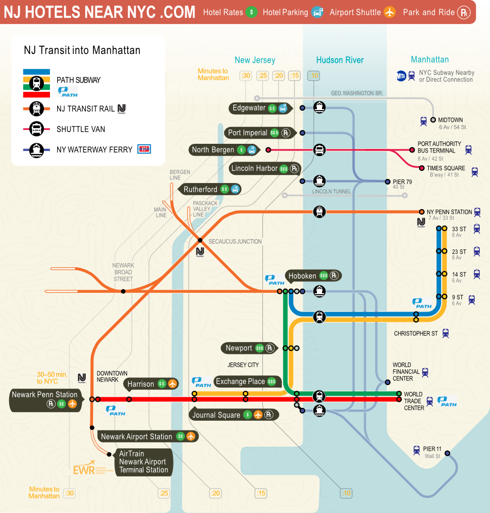
For many, public transportation offers a more predictable, though not always faster, way to bridge the gap. The PATH train system is a lifeline for commuters, connecting various points in New Jersey, such as Hoboken, Jersey City, and Newark, directly to stations in Lower Manhattan and Midtown Manhattan. The travel time via PATH is generally consistent, ranging from about 10 minutes between Hoboken and World Trade Center to around 30 minutes between Newark Penn Station and 33rd Street in Manhattan.
-
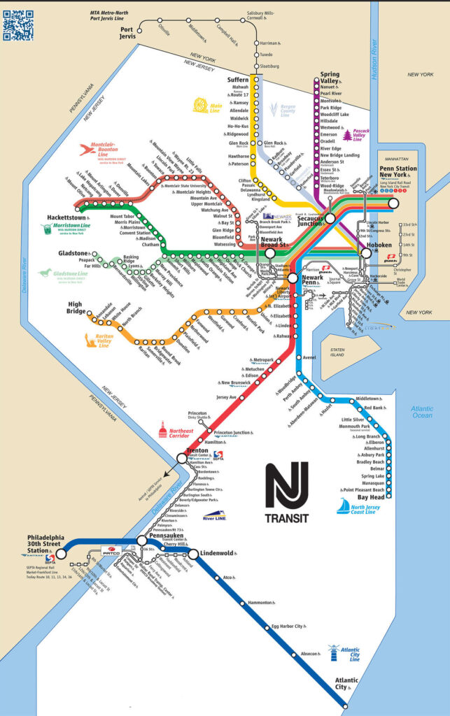
NJ Transit Rail: NJ Transit offers extensive rail service from various New Jersey towns into New York Penn Station in Manhattan. This includes lines from Trenton, Princeton Junction, and Asbury Park. Travel times can range from under an hour for closer towns to nearly two hours for those further south or west.
-
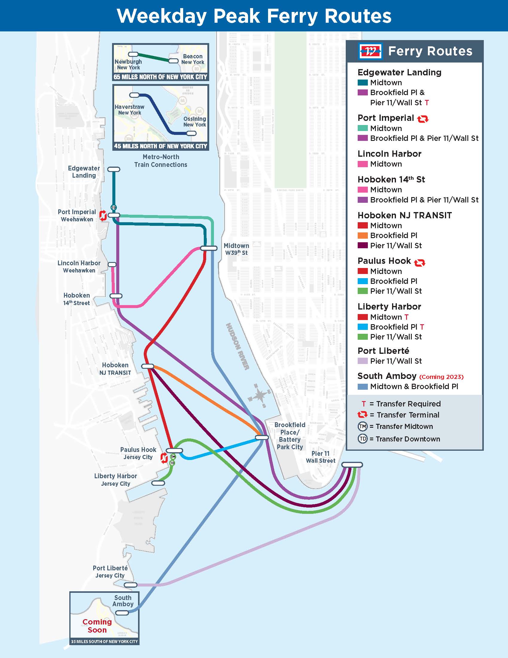
Ferries: While less common for daily commuting, ferry services offer scenic routes and direct access between certain points, such as the Hudson River ferry connecting towns like Hoboken and Weehawken to Midtown Manhattan and the Financial District.
Air Travel: Bridging the States in Minutes
For longer distances within the broader New York and New Jersey region, or for those connecting to further destinations, air travel offers the quickest transit. While the direct flight between, say, Newark Liberty International Airport and LaGuardia Airport is measured in minutes of flight time, the overall journey, including travel to and from airports and security, can be significant. However, for journeys that would otherwise take many hours by car or train, such as traveling from the southern tip of New Jersey to Upstate New York, air travel presents a compelling option.
The Traveler’s Perspective: Defining “Far”
Ultimately, “how far” is a subjective measure for travelers. It encompasses not just the mileage but also the time, cost, and effort involved in the journey. The proximity of New Jersey to New York City is a defining characteristic of the region, creating a dynamic interplay between urban and suburban life, business, and leisure.
Commuting and Daily Life
For millions of people, the distance between their home in New Jersey and their workplace in New York, or vice versa, is a daily reality. This constant movement highlights the seamless integration of these two states, despite their distinct identities. What might seem like a significant distance on a map is, in practice, a navigable segment for those who traverse it regularly. The efficiency of public transport infrastructure, such as the PATH train and NJ Transit, plays a crucial role in making these commutes feasible.
Tourism and Leisure
From a tourist’s perspective, the “distance” can dictate the feasibility of day trips or weekend getaways. A resident of Philadelphia, for example, might consider a trip to the beaches of Seaside Heights, New Jersey, or the museums of New York City as accessible excursions. The ease of access through major highways like the New Jersey Turnpike and the Garden State Parkway contributes to this perception of accessibility. Conversely, a tourist visiting Niagara Falls, on the northern border of New York, would perceive that location as being “far” from the immediate vicinity of New Jersey.
The Psychological Distance
Beyond the physical miles, there’s a psychological distance that also plays a role. New York and New Jersey have distinct cultures and identities, yet they are inextricably linked. The perception of “how far” can also be influenced by the perceived differences in culture, pace of life, and atmosphere. However, the frequent intermingling through travel, commerce, and shared entertainment venues continually blurs these lines, making the journey between them feel shorter and more familiar than mere statistics might suggest.
The question of “how far is New York to New Jersey?” is not a simple one with a single numerical answer. It’s a dynamic query that depends on the traveler’s starting point, destination, chosen mode of transport, and even their personal definition of distance. What remains constant is the profound connection between these two states, a proximity that shapes the lives of millions and defines the vibrant tapestry of the Northeastern United States.
LifeOutOfTheBox is a participant in the Amazon Services LLC Associates Program, an affiliate advertising program designed to provide a means for sites to earn advertising fees by advertising and linking to Amazon.com. Amazon, the Amazon logo, AmazonSupply, and the AmazonSupply logo are trademarks of Amazon.com, Inc. or its affiliates. As an Amazon Associate we earn affiliate commissions from qualifying purchases.