
The sprawling metropolis of Los Angeles and the high desert city of Palmdale are geographically distinct, yet increasingly interconnected. Understanding the distance and travel time between these two locations is crucial for anyone planning a visit, a move, or simply exploring the diverse landscapes of Southern California. While the precise mileage can vary depending on the starting and ending points within each city and the chosen route, a general overview provides valuable insight for travelers and residents alike.
Understanding the Geographic Relationship
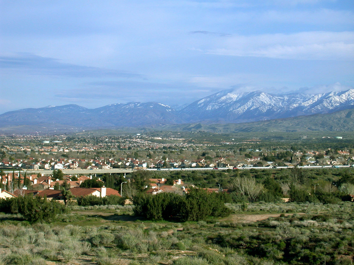
Palmdale is situated in the Antelope Valley, a large desert valley located north of the San Gabriel Mountains. This geographic positioning places it at a significant remove from the coastal and central areas of Los Angeles. The primary natural barrier between the two is the formidable San Gabriel Mountains, which necessitate specific routes for vehicular travel.

The Antelope Valley Connection
The Antelope Valley is a region known for its wide-open spaces, agricultural significance (particularly in the past), and a burgeoning population that has seen substantial growth in recent decades. Palmdale, along with its neighbor Lancaster, forms the core of this high desert community. Its development has been fueled in part by its relative affordability compared to more established areas of Los Angeles County and its role in aerospace and advanced manufacturing industries.
Navigating the San Gabriel Mountains
The San Gabriel Mountains present a significant topographical challenge, dictating the primary pathways for travel. The most common and efficient routes involve traversing mountain passes. These passes, while engineered for modern traffic, can still influence travel times, especially during periods of heavy congestion or adverse weather conditions. The presence of these mountains also contributes to the distinct climate and ecological zones experienced in Palmdale compared to the more Mediterranean climate of coastal Los Angeles.
Distance and Travel Time Estimates
The distance between Palmdale and Los Angeles is not a single, fixed number but rather a range that depends on the specific origin and destination points and the chosen mode of transport. However, providing average figures offers a practical understanding for planning purposes.
Driving Distance
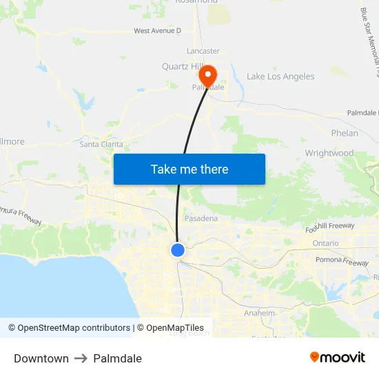
In terms of driving distance, the most direct routes typically range from approximately 60 to 75 miles (about 97 to 120 kilometers). This variation accounts for starting in, for example, the heart of Downtown Los Angeles and heading to the center of Palmdale, versus starting in a western part of Los Angeles and reaching the eastern edge of Palmdale. The route often involves major freeways such as the Antelope Valley Freeway (State Route 14) and connections to the Golden State Freeway (Interstate 5) or the Ventura Freeway (State Route 134) depending on the starting point within Los Angeles.
Estimated Driving Time
The estimated driving time is perhaps a more critical metric for travelers. Under ideal traffic conditions, the journey can take as little as 1 hour and 15 minutes to 1 hour and 45 minutes. However, this is a highly optimistic scenario. Los Angeles is notorious for its traffic congestion, and this often significantly impacts travel times, particularly during peak commuting hours (typically weekday mornings and evenings).
Factors influencing driving time include:
- Time of Day: Traveling during rush hour can easily add 30 minutes to over an hour to the journey.
- Day of the Week: Weekends, especially Friday afternoons and Sunday evenings, can also experience heavy traffic as people travel in and out of the region.
- Road Conditions and Construction: Unexpected roadwork or accidents can cause significant delays.
- Weather: While the high desert can experience extreme heat, occasional rain or fog, particularly in the mountain passes, can slow down traffic.
- Specific Route: Different freeway choices and the specific start and end points within each city will also influence the duration. For instance, traveling from Santa Monica to Palmdale will take longer than from the San Fernando Valley.
Exploring Travel Options
While driving is the most common method of travel between Palmdale and Los Angeles, other options exist, offering different perspectives and potentially different travel times.
Driving and Vehicle Rental
For most visitors, driving a personal vehicle or renting a car provides the greatest flexibility. This allows for direct travel and the ability to explore both Palmdale and Los Angeles at one’s own pace. Car rental agencies are readily available at Los Angeles International Airport (LAX) and at various locations throughout the city. It is advisable to have a reliable vehicle, especially for the longer drive, and to be prepared for varying road conditions.
Public Transportation
Public transportation options are more limited for this specific intercity route. There isn’t a direct, high-speed rail link that efficiently connects the two. However, bus services do operate.
- Antelope Valley Transit Authority (AVTA): While primarily serving the Palmdale and Lancaster area, AVTA routes connect to regional transit hubs.
- Los Angeles County Metropolitan Transportation Authority (Metro): Metro operates bus lines that can eventually lead from Los Angeles towards the Antelope Valley. However, this often involves multiple transfers and can be a very time-consuming option, often taking upwards of 3 to 4 hours or more, making it less practical for a quick trip.
For those seeking a more comfortable or faster public transit experience, exploring intercity bus companies that might service this route (though less common than major corridors) or considering ride-sharing services could be alternatives, though the latter’s cost can quickly rival car rental for this distance.
Air Travel
Direct air travel between Palmdale and Los Angeles is not a viable option as there are no scheduled commercial passenger flights connecting the two cities directly. Palmdale does have the Palmdale Regional Airport (PMD), which primarily serves general aviation and some cargo operations. Travelers flying into Los Angeles would typically arrive at LAX or other regional airports, and then proceed to drive or arrange ground transportation to Palmdale.
Planning Your Trip
When planning a trip from Los Angeles to Palmdale, or vice versa, careful consideration of the travel time and mode of transport is essential to ensure a smooth and enjoyable experience.
Leveraging Navigation Apps
Modern navigation applications are invaluable tools for estimating travel times. Apps like Google Maps, Waze, and Apple Maps provide real-time traffic updates, suggest the fastest routes, and can offer alternative options if significant delays are detected. It is highly recommended to check these apps just before departing and periodically during the journey.
Considering Off-Peak Travel
To minimize the impact of traffic, planning your travel during off-peak hours is strongly advised. This generally means avoiding the morning (6:00 AM to 9:30 AM) and evening (3:00 PM to 7:00 PM) commute periods on weekdays. Traveling mid-day, late at night, or early in the morning can significantly reduce your travel time.
Understanding the Destination
Palmdale offers a different experience from the urban intensity of Los Angeles. It is a gateway to the high desert, known for its clear skies, stargazing opportunities, and proximity to natural attractions such as the Devil’s Punchbowl Natural Area and the Mojave National Preserve. While the drive may be significant, the unique landscape and activities available in the Antelope Valley make the journey worthwhile for many.
Accommodation and Logistics
For those planning an extended stay, understanding the accommodation options in and around Palmdale is also important. While it offers a growing range of hotels and rental properties, it is a different lodging landscape compared to the vast array of options in Los Angeles. Planning accommodation in advance is always a prudent step, regardless of the travel distance.
Ultimately, the distance between Palmdale and Los Angeles is more than just a number of miles; it represents a transition between distinct environments and lifestyles within Southern California. By understanding the geography, travel times, and available transportation methods, individuals can effectively plan their journeys and make the most of their experiences in both regions.
LifeOutOfTheBox is a participant in the Amazon Services LLC Associates Program, an affiliate advertising program designed to provide a means for sites to earn advertising fees by advertising and linking to Amazon.com. Amazon, the Amazon logo, AmazonSupply, and the AmazonSupply logo are trademarks of Amazon.com, Inc. or its affiliates. As an Amazon Associate we earn affiliate commissions from qualifying purchases.