
The Pacific Coast Highway (PCH) is one of the most iconic and breathtaking road trips in the world, synonymous with the golden state of California. Travelers often envision an endless ribbon of asphalt clinging to dramatic cliffs, offering sweeping ocean vistas and access to charming seaside towns. But precisely how long is this legendary stretch of road? The answer, while seemingly straightforward, carries nuances that are crucial for any discerning traveler planning to embark on this epic journey.
The common understanding of the Pacific Coast Highway primarily refers to State Route 1 (SR-1), a significant north-south state highway that runs along most of the Pacific coastline of California. When considering SR-1 as the definitive PCH, its length is approximately 655 miles (1,055 kilometers). This encompasses the segment from its southern terminus near Dana Point in Orange County to its northern end at Leggett in Mendocino County, where it merges with U.S. Route 101.
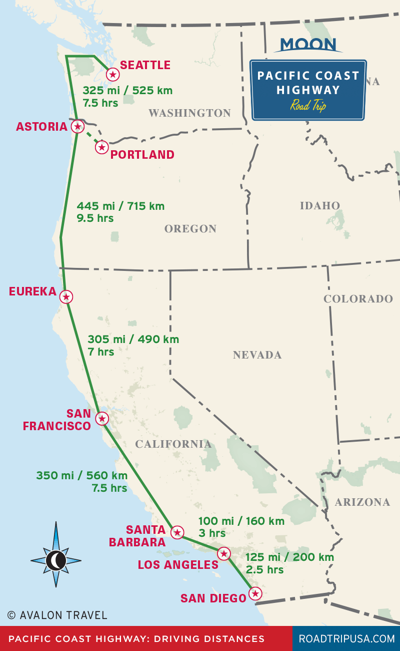
However, the designation “Pacific Coast Highway” itself is sometimes applied more broadly or locally to segments of U.S. Route 101 or other coastal roads that, while not officially SR-1, offer similar coastal experiences. For the purpose of planning the quintessential PCH road trip, focusing on the approximate 655 miles of State Route 1 is the most accurate and widely accepted approach.
Tracing the Legendary Route: Key Segments and Distances
Understanding the full length of the Pacific Coast Highway is just the beginning; appreciating its diverse segments is key to planning a fulfilling travel experience. The highway carves through distinct regions, each offering unique landscapes and attractions, influencing how long a traveler might choose to linger.
Southern California’s Coastal Charm (Dana Point to Santa Barbara)
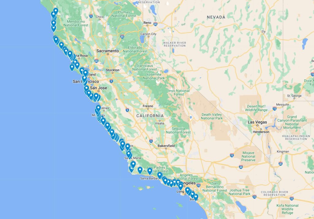
The southernmost leg of SR-1 begins in Dana Point, winding through a series of affluent coastal communities. This section, often referred to as PCH in local parlance, passes through iconic beach towns like Laguna Beach and Newport Beach before heading towards the bustling metropolis of Los Angeles. Around Los Angeles, SR-1 often shares alignments with other major roads, including U.S. Route 101, making its direct continuity somewhat fragmented.
A significant and picturesque portion resumes north of Los Angeles, particularly as it traverses the stunning cliffs and beaches of Malibu. This segment offers classic Southern California coastal scenery before reaching the vibrant city of Santa Barbara. This initial approximately 150-mile stretch is characterized by wide sandy beaches, surf culture, and upscale communities.
The Central Coast’s Majestic Beauty (Santa Barbara to Monterey)
North of Santa Barbara, the PCH transitions into what many consider its most breathtaking and challenging section. After passing through areas like San Simeon (home to Hearst Castle), the highway enters the legendary Big Sur region. This approximately 90-mile stretch is world-renowned for its dramatic, untamed coastline, where redwood forests meet the crashing waves of the Pacific. Hairpin turns, narrow roads, and steep drop-offs are common, demanding a slower pace but rewarding travelers with unparalleled vistas, including the iconic Bixby Bridge.
This segment from Santa Barbara through Big Sur to Monterey and Carmel-by-the-Sea is arguably the highlight for many, spanning about 200 miles of diverse and unforgettable scenery. It’s here that the PCH truly earns its reputation as one of the world’s most scenic drives.
Northern California’s Rugged Grandeur (Monterey to Leggett)
Beyond the picturesque Monterey Peninsula, the PCH continues its northward journey, offering a different kind of coastal beauty. After passing through the charming town of Santa Cruz and some agricultural lands, SR-1 eventually steers towards San Francisco. Within the Bay Area, the highway navigates urban and suburban environments, sometimes merging with U.S. Route 101 or other state routes before resuming its distinct coastal path north of the city.

North of San Francisco, the character of the PCH changes once more. This approximately 250-mile section winds through rugged, less-populated areas, characterized by towering redwood forests, foggy bluffs, and wild beaches. Towns like Point Reyes Station, Mendocino, and Fort Bragg offer quaint stops, but the emphasis shifts to pristine nature and dramatic, often isolated, landscapes. The journey culminates at Leggett, nestled among ancient redwoods, where SR-1 officially ends by connecting back to U.S. Route 101.
Planning Your Pacific Coast Highway Adventure: Time and Logistics
Knowing the 655-mile length of the Pacific Coast Highway is fundamental for trip planning, as it directly impacts the time required and the overall travel experience. While it’s technically possible to drive the entire route in a couple of very long days, such a hurried pace would completely miss the essence of the journey.
Recommended Duration
For a truly immersive and enjoyable experience, most travel experts recommend dedicating at least 5 to 7 days to drive the entire 655 miles, allowing for comfortable daily drives of 3-5 hours and ample time to stop, explore, and soak in the scenery. Many travelers choose to focus on key segments, particularly the Central Coast and Big Sur, which can be explored in 2-4 days.
- Minimum Drive (Not Recommended): 2-3 days (10-12 hours driving per day, very few stops).
- Recommended Relaxed Pace: 5-7 days (4-6 hours driving, plenty of stops and overnight stays).
- Extended Exploration: 10+ days (allowing for deeper dives into specific towns, hikes, and attractions).
Best Time to Travel
The optimal time to drive the Pacific Coast Highway is typically spring (April-May) or fall (September-October). During these seasons, the weather is generally mild, with fewer crowds than in summer. Summer (June-August) brings warmer temperatures but also denser fog, especially in the northern and central sections, and significantly more tourists, leading to higher prices and crowded attractions. Winter (November-March) can offer dramatic storm-watching opportunities but also carries the risk of road closures due to landslides, particularly in Big Sur.
Direction of Travel
Most seasoned travelers recommend driving the PCH from north to south. This places your vehicle on the ocean side of the highway for the majority of the journey, offering unobstructed views and easier access to scenic pull-offs and vista points. While driving south to north is certainly possible, navigating across traffic lanes to access viewpoints can be less convenient and detract from the seamless flow of the drive.
Beyond the Miles: The Unforgettable Experience
The “how long” of the Pacific Coast Highway is merely a logistical detail that unlocks a treasure trove of travel experiences. Its 655 miles represent a journey through diverse ecosystems, historical sites, vibrant cities, and tranquil natural wonders. It is a route that allows travelers to connect with the raw beauty of the California coast in a profound way.
From the sun-drenched beaches of Southern California, ideal for surfing and people-watching, to the dramatic, fog-shrouded cliffs of Big Sur that inspire awe, and further north to the majestic redwood forests that offer a sense of ancient grandeur, the PCH is a microcosm of California’s natural diversity. The journey is interspersed with opportunities to visit world-class wineries in the Central Coast, explore the historic charm of Monterey, marvel at the architecture of Hearst Castle, or hike through state parks teeming with wildlife.
The true length of the Pacific Coast Highway isn’t measured solely in miles, but in the memories made, the breathtaking photographs taken, and the sense of freedom and discovery it imparts. It’s a journey that encourages travelers to slow down, embrace the unexpected, and savor every moment of California’s unparalleled coastal splendor.
LifeOutOfTheBox is a participant in the Amazon Services LLC Associates Program, an affiliate advertising program designed to provide a means for sites to earn advertising fees by advertising and linking to Amazon.com. Amazon, the Amazon logo, AmazonSupply, and the AmazonSupply logo are trademarks of Amazon.com, Inc. or its affiliates. As an Amazon Associate we earn affiliate commissions from qualifying purchases.