
Navigating the sprawling urban landscape of New York City requires more than just a map; it demands an understanding of the complex logistical grid that keeps the metropolis moving. For travelers, logistics experts, and those simply curious about the administrative architecture of the “Big Apple,” the question of how many zip codes exist here is more than just a number—it is a key to unlocking the regional identity of the five boroughs.
The Mathematical Complexity of New York City Zoning
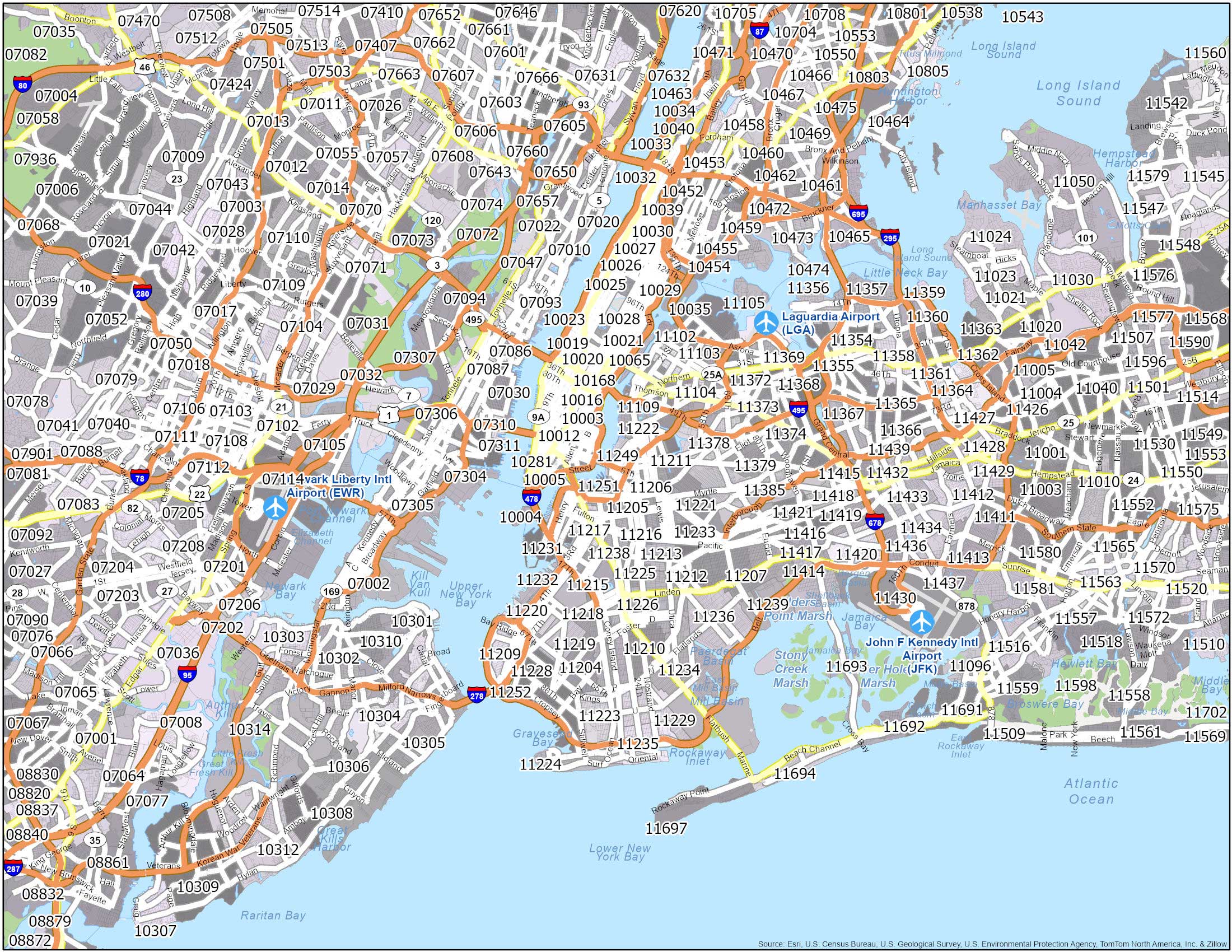
At present, there are approximately 178 to 180 unique zip codes assigned to New York City. However, defining an exact number is famously difficult because postal zones do not always align perfectly with municipal borders. The United States Postal Service manages these codes primarily for the efficiency of mail delivery, meaning boundaries are subject to change based on population growth, infrastructure development, and logistical shifts.

Why Zip Codes Shift
Unlike static neighborhood boundaries, which are culturally and historically rooted, zip codes are functional tools. When a skyscraper like the Empire State Building or a massive residential development in Long Island City grows to a size that requires dedicated mail sorting, the postal service may carve out a new code. Conversely, if delivery routes are consolidated, numbers may be retired or reassigned.
Borough Distribution
The distribution of these codes is inherently uneven, reflecting the varying population densities of the boroughs:
- Manhattan: Boasts the highest concentration of zip codes due to its dense commercial and residential skyscraper culture.
- Brooklyn: Spans a vast area with codes that trace the historical evolution of its diverse neighborhoods, from Williamsburg to Bay Ridge.
- Queens: Represents the largest geographic borough, requiring a sprawling network of zip codes to manage its suburban-style layouts and urban centers.
- The Bronx: Features a tightly knit grid of postal codes that reflect its historic residential development and industrial zones.
- Staten Island: While more residential and lower in density than its counterparts, it maintains a distinct set of codes that separate its varying coastal and inland communities.
Navigating by Neighborhood: A Traveler’s Guide
For those visiting New York City, zip codes can serve as a rudimentary guide to the city’s character. While they were never intended to be “neighborhood maps,” they often correlate with the socio-economic and cultural vibes of specific areas. Understanding the zip code of your hotel or destination can provide context for what you might expect in terms of dining, nightlife, and local atmosphere.
The Prestige of Manhattan Codes
In Manhattan, certain zip codes carry a level of prestige that defines the luxury market. For instance, the zip codes encompassing the Upper East Side and Tribeca are among the most recognizable in the world. Visitors staying in these areas will find themselves surrounded by high-end shopping, world-class museums like the Metropolitan Museum of Art, and exclusive dining experiences.
The Cultural Melting Pot of Queens
Conversely, if you find yourself wandering through the zip codes of Queens, you are likely to experience the most diverse culinary scene on the planet. From the authentic flavors of Flushing to the vibrant food markets of Jackson Heights, the postal zones here act as a bridge between cultures. A visitor checking a map might notice that these zip codes cover vast expanses, encouraging exploration beyond the typical tourist tracks.
Logistical Challenges for Visitors and Businesses
The complexity of New York City zip codes can create minor headaches for tourists. When booking accommodations, verifying the correct zip code is essential for delivery services, ride-sharing apps, and even navigating through GPS. A mistake of a single digit in this labyrinthine system can sometimes lead a traveler to the wrong end of a massive neighborhood.
The Impact of High-Rise Living
One of the most unique aspects of the New York City postal system is the use of “unique zip codes.” These are codes assigned exclusively to high-occupancy buildings or institutions. Major landmarks like Rockefeller Center or the Chrysler Building may have their own distinct zip codes to manage the sheer volume of mail processed daily. For a tourist, this means that even if you are standing on a street corner, your exact building might technically be in a different “postal world” than the one next to it.
Digital Navigation in the Modern Era
Modern travel apps have mitigated many of the traditional risks associated with miscalculating location data. However, the legacy of the zip code remains vital for local commerce. Whether you are ordering a delivery to a Brooklyn boutique hotel or shipping a souvenir home from Central Park, knowing the correct postal code ensures that your experience is seamless.
Understanding the Urban Fabric
Beyond the utility of mail delivery, the study of zip codes allows one to appreciate the sheer scale of New York City. It is a city of millions, packed into a relatively small geographic footprint. The fact that nearly 180 zip codes are required to segment this population speaks volumes about the density and complexity of the urban fabric.
The Future of Postal Zoning
As New York City continues to evolve, the postal system will undoubtedly adapt. New developments in areas like Hudson Yards or the ongoing revitalization of the Seaport District demonstrate that the geography of the city is never truly “finished.” Each new development brings the potential for new infrastructure, including the possible addition of future zip codes to support the growing demands of both residents and the millions of visitors who flock to the United States every year.

Final Thoughts for the Curious Explorer
While the exact number of zip codes may fluctuate, the spirit of each neighborhood remains constant. Whether you are navigating the historic brownstones of Brooklyn Heights or the bustling corridors of Times Square, remember that these postal designations are more than just numbers on an envelope. They are markers of a living, breathing, and constantly expanding city.
By taking the time to understand the nuances of the local geography—including the postal divisions—visitors can gain a deeper appreciation for the structured chaos that makes New York City the most vibrant travel destination in the world. Next time you look up a location on your phone or drop a postcard into a blue mailbox, take a moment to consider the intricate grid that connects every corner of this remarkable city.
LifeOutOfTheBox is a participant in the Amazon Services LLC Associates Program, an affiliate advertising program designed to provide a means for sites to earn advertising fees by advertising and linking to Amazon.com. Amazon, the Amazon logo, AmazonSupply, and the AmazonSupply logo are trademarks of Amazon.com, Inc. or its affiliates. As an Amazon Associate we earn affiliate commissions from qualifying purchases.