
When planning a wilderness excursion to the southwestern corner of Yellowstone National Park, specifically targeting the magnificent Cave Falls, the journey is often just as significant as the destination. For many travelers, the primary concern when venturing into the rugged landscapes of Idaho is the quality of the access roads. The route leading to these falls is a storied path that transitions from the well-maintained thoroughfares of Ashton into the quieter, more untamed corridors of the Caribou-Targhee National Forest. Understanding the nuance of this road—its surface, its seasonal variations, and its navigational requirements—is essential for any visitor hoping to enjoy the spectacular cascades without the headache of vehicle damage or navigation mishaps.

Navigating the Terrain: What to Expect on Cave Falls Road
The path to the falls is not a high-speed interstate, nor is it a paved boulevard. Instead, it is a quintessential forest road that demands a measured pace and an appreciation for the journey.
The Transition from Pavement to Gravel
The journey typically begins in the town of Ashton, Idaho. As you head east, you are initially met with standard asphalt roads that provide a comfortable driving experience. However, as you move deeper into the forest, the road transitions into a gravel surface. This is not necessarily a “rough” road in the off-roading sense, but it does require a transition in driving mindset. The gravel is generally well-maintained by the United States Forest Service, but like any rural route, its “smoothness” is subjective and dependent on recent weather events and the timing of grading schedules.
Seasonal Impacts on Road Conditions
The condition of the road is heavily dictated by the seasons. In early summer, following the spring thaw, the road can be prone to “washboarding”—a phenomenon where small, parallel ridges form on the gravel surface, creating a bumpy ride that can vibrate a vehicle’s suspension if not managed correctly. By late summer, the road is often dustier but may be smoother if a recent grading has taken place. During the shoulder seasons, particularly spring and late autumn, moisture can turn the road into a soft, muddy track in low-lying areas. While most standard passenger vehicles can handle the road under dry, favorable conditions, the presence of significant ruts or deep mud after heavy rainfall may necessitate a higher clearance vehicle.
Mapping Your Route: Precision in the Wilderness
Relying on digital maps in the backcountry can be a risky endeavor. While satellite-guided navigation tools are excellent for the initial portion of your trip through Fremont County, they may fail or become inaccurate once you enter the remote sections of the Greater Yellowstone Ecosystem.
Why Digital Maps Can Be Deceptive
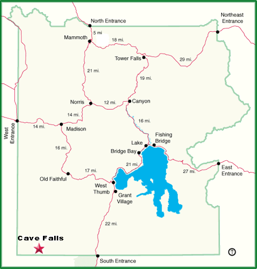
When you search for the “Cave Falls Road Idaho map,” you will likely find digital overlays that suggest a clear, direct path. However, these maps often lack the granularity to indicate current road hazards, such as fallen trees, localized flooding, or construction. It is highly recommended to supplement your digital GPS with a physical National Forest Service map. A printed map provides a reliable fallback and helps you understand the topography surrounding Falls River, ensuring you don’t take an accidental turn onto a logging road or an unmarked, private track.
Identifying Key Landmarks for Navigation
Navigation is best achieved by identifying physical landmarks rather than relying solely on turn-by-turn prompts. As you travel closer to the Wyoming border, pay close attention to signage. You are looking for the Cave Falls Road markers that denote your entry into the Targhee National Forest. Because cell service is notoriously spotty—or completely non-existent—in these parts, downloading an offline map of the Ashton-Island Park Ranger District is a strategic move for any modern traveler.
Best Practices for a Smooth Journey
A successful trip to see the water plunge over the lava flows at Cave Falls is less about having a heavy-duty off-road vehicle and more about preparation and vehicle maintenance.
Vehicle Readiness and Safety
Before departing, ensure your tire pressure is at the manufacturer’s recommended level for gravel driving. It is also wise to check your spare tire and ensure your jack is functional. Even if the road is perfectly graded, sharp rocks on the shoulder can lead to tire punctures. Furthermore, consider the dust; if you are driving in a convoy, increase your following distance significantly. Dust plumes can obscure the view of the road surface, hiding potholes or large stones that could damage your vehicle’s undercarriage.
Managing Expectations and Timing
The speed limit on Cave Falls Road is generally low, often between 25 and 35 miles per hour. Attempting to drive faster is not only a safety risk due to potential wildlife crossings—including moose and elk—but it also makes for a jarring, unpleasant experience. Embrace the “slow travel” philosophy. The surrounding landscape, filled with lodgepole pine forests and lush meadow clearings, is part of the allure. If you treat the drive as a scenic cruise rather than a transit requirement, the gravel and bumps become secondary to the experience of immersing yourself in the Rocky Mountains.
Wildlife and Respecting the Forest
Because this road acts as a corridor for local wildlife, the condition of the road is also a matter of ecological consideration. Driving at moderate speeds helps prevent collisions with small mammals and keeps dust levels down, which is beneficial for the nearby flora of the Yellowstone National Park border region. Always remain aware that you are a visitor in a fragile ecosystem. Do not create new tracks by driving off the established gravel path, as this causes long-term damage to the high-altitude soil and vegetation.
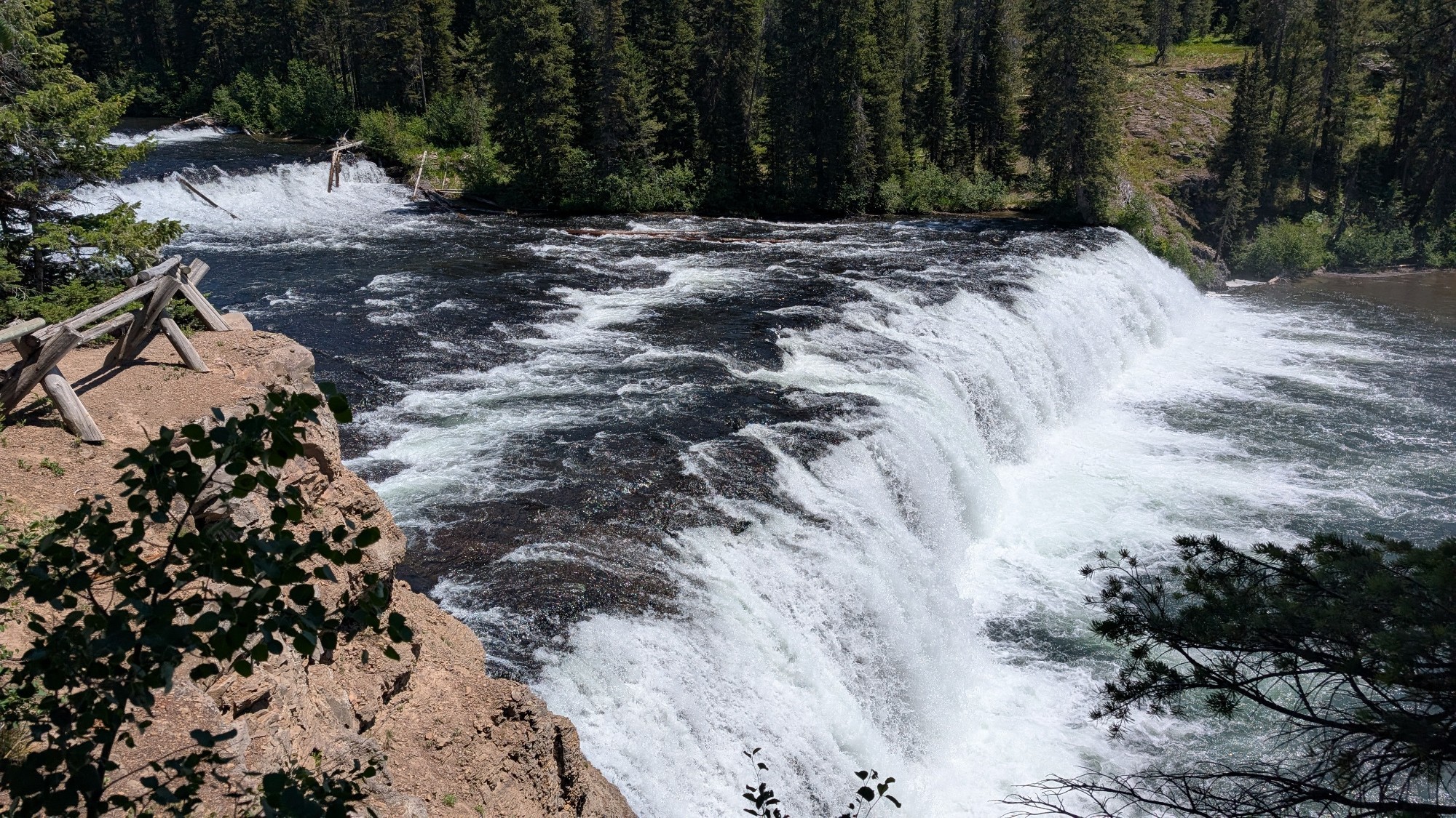
Ultimately, the answer to how smooth the Cave Falls Road is lies in your preparation. If you respect the road for what it is—a gateway to one of the most serene and underrated gems in the Western United States—you will find that the gravel journey is a small price to pay. The sight of the massive, mist-filled waterfall, accessible via a short and easy trail from the parking area, provides an immediate reward that far outweighs any minor bumps encountered along the way. With a reliable map, a sensible pace, and a spirit of adventure, the road to Cave Falls is not just navigable; it is a highlight of the Idaho wilderness experience.
LifeOutOfTheBox is a participant in the Amazon Services LLC Associates Program, an affiliate advertising program designed to provide a means for sites to earn advertising fees by advertising and linking to Amazon.com. Amazon, the Amazon logo, AmazonSupply, and the AmazonSupply logo are trademarks of Amazon.com, Inc. or its affiliates. As an Amazon Associate we earn affiliate commissions from qualifying purchases.