
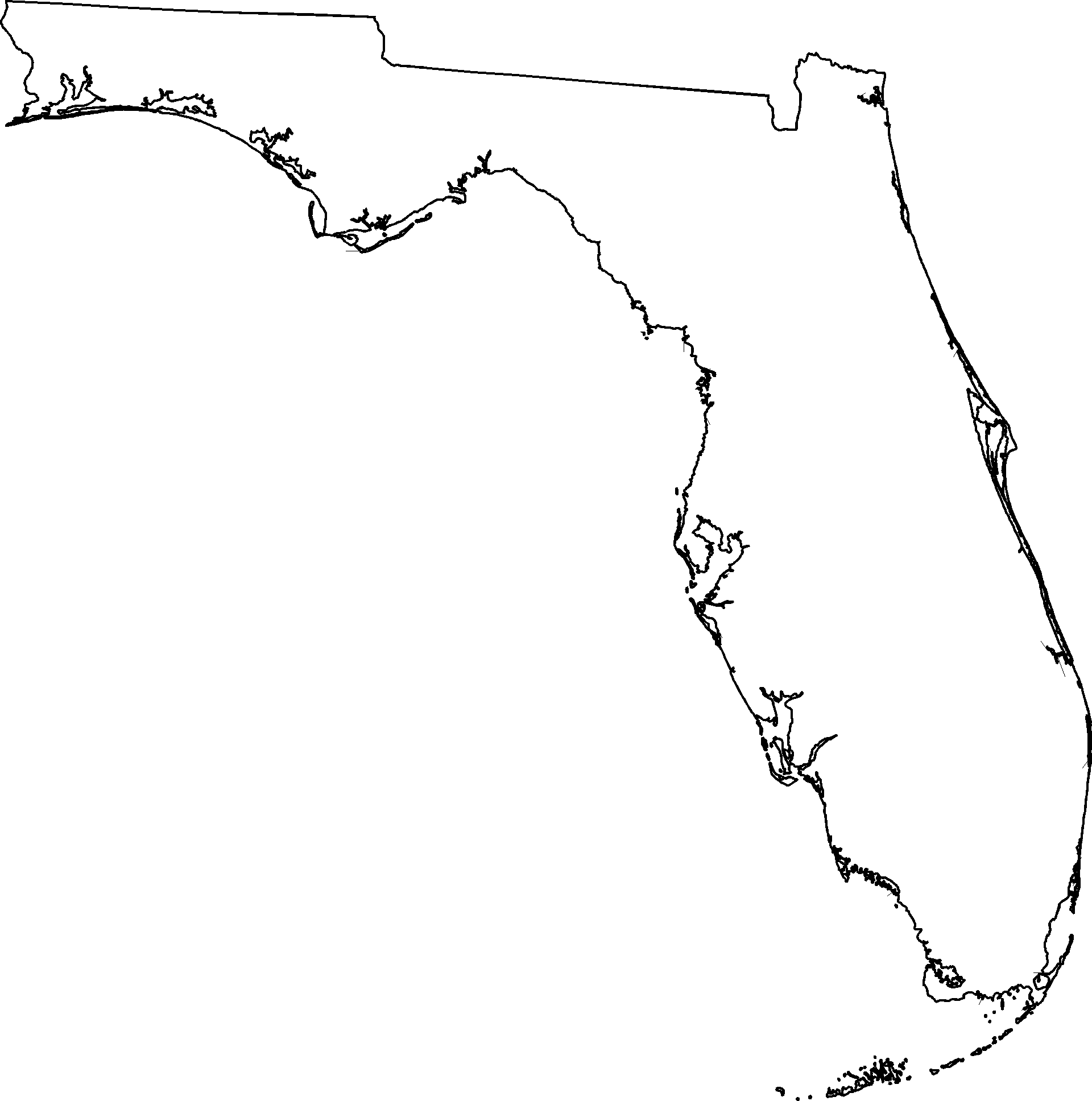
The outline of Florida, with its distinctive peninsular shape, is more than just a cartographic boundary; it is a globally recognized landmark, instantly evocative of sunshine, sandy beaches, and vibrant culture. To “draw” Florida is not merely an artistic exercise but an act of understanding its unique geography, its historical formation, and the natural elements that define its iconic silhouette. This exploration delves into the geographical nuances and symbolic significance embedded within Florida’s contours, revealing how each curve and indentation contributes to its identity as a truly unique state.
The Iconic Silhouette: A Peninsula Defined
Florida’s most striking characteristic is its status as a prominent peninsula, extending gracefully southward from the North American continent, separating the Atlantic Ocean from the Gulf of Mexico. This geographical prominence is the first and most crucial element to grasp when conceptualizing its form. The entire state is essentially a vast, low-lying limestone plateau, which has shaped its gentle slopes and extensive coastlines.

Geographical Uniqueness
The primary feature that defines Florida is its elongated shape, tapering towards the south. Imagine a large, slightly curved finger pointing towards the Caribbean Sea. This unique geological formation, primarily consisting of sedimentary rock and ancient coral reefs, dictates its flat topography and the absence of towering mountain ranges. Instead, the landscape is characterized by extensive wetlands, such as the Everglades, vast pine forests, and thousands of freshwater lakes, including the prominent Lake Okeechobee in the south-central part of the peninsula. These internal features, while not part of the external outline, profoundly influence the state’s environmental character and its historical development, making it distinct from its continental neighbors.
The Panhandle’s Distinctive Shape
While the peninsula dominates Florida’s image, the northwestern Panhandle adds another crucial dimension to its shape. This narrow strip of land, bordering Alabama and Georgia, provides a contrasting horizontal linearity to the otherwise vertical orientation of the main peninsula. Its northern border is notably straight, a testament to historical land surveys, while its southern edge along the Gulf of Mexico exhibits the gentle undulations of barrier islands and bays characteristic of the Gulf Coast. Cities like Pensacola and the state capital, Tallahassee, are situated within this region, imbuing it with a distinct cultural and historical identity that differentiates it from the rest of the state. When depicting Florida, accurately rendering this “handle” is essential for a complete and recognizable representation.
Key Features and Coastlines
Understanding the interplay of Florida’s two extensive coastlines — one facing the Atlantic Ocean and the other the Gulf of Mexico — is fundamental to appreciating its unique form. Each coastline possesses distinct characteristics that contribute to the overall recognizable shape.
The Atlantic Arc
The Atlantic Ocean coast of Florida presents a long, relatively smooth curve, stretching from the state’s northeastern border near Jacksonville down to Miami at its southeastern tip. This coastline is famous for its broad, sandy beaches and the historical significance of cities like St. Augustine, the oldest continuously inhabited European-established settlement in the United States. Key indentations along this coast include the inlets and estuaries of numerous rivers, along with the distinct protrusion of Cape Canaveral, a launchpad for space exploration that serves as a notable landmark on the eastern seaboard. The generally consistent arc of the Atlantic side contrasts sharply with the more intricate features of the Gulf Coast.
Gulf Coast Serenity
In stark contrast, the Gulf of Mexico coastline, particularly along the main peninsula, is characterized by a shallower, often more convoluted shoreline, marked by numerous barrier islands, expansive bays, and intricate marshlands. The vast expanse of Tampa Bay, for instance, forms a significant indentation, influencing the shape of the western side of the state. Further south, the coastline becomes a complex tapestry of mangroves and estuaries leading into the Everglades National Park, an ecologically vital and visually intricate region. The western side of the Panhandle also features these characteristic barrier islands and tranquil bays, creating a continuity of coastal character along the Gulf.

The Florida Keys: A Dotted Extension
Perhaps the most unique and intricate feature of Florida’s outline is the chain of islands known as the Florida Keys. Extending southwestward from the tip of the peninsula, these coral and limestone islands form a delicate, curved arc that gradually diminishes in size and eventually merges into the remote outposts of Dry Tortugas National Park. These islands, connected by the Overseas Highway, are a geographical marvel. To truly “draw” Florida, one must convey this sense of a fragmented, yet continuous, extension of the landmass, like a pearl necklace draped into the sea. Their unique position makes them a pivotal landmark, culturally rich and ecologically distinct.
Beyond the Outline: What Makes Florida Recognizable
While the physical outline is the immediate visual cue, the recognizability of Florida as a landmark is also deeply intertwined with its internal characteristics and the narrative it conveys.
Cultural and Historical Significance
The shape of Florida tells a story of exploration, settlement, and adaptation. Its position as a gateway between the Americas has made it a crossroads of cultures, from indigenous tribes to Spanish conquistadors, British colonists, and American pioneers. The historical significance of St. Augustine, the architectural styles of Miami, and the agricultural heartland around Lake Okeechobee all contribute to the identity associated with this shape. When one visualizes Florida, it’s not just the lines but the history they encompass that brings the image to life.
Natural Wonders within the Shape
The outline of Florida encloses a diverse array of natural wonders. The Everglades National Park, a UNESCO World Heritage Site, is a vast wetland ecosystem unlike any other, teeming with unique wildlife. The pristine springs scattered across the northern and central parts of the state provide crystal-clear waters and unique aquatic habitats. The sandy beaches, both on the Atlantic and Gulf coasts, are globally famous for their beauty and biodiversity. Even the interior, away from the coastal allure, boasts vast forests and agricultural lands that contribute to the state’s economic and ecological fabric. These internal natural landmarks give depth to the mere outline, turning a simple shape into a vibrant, living entity.
Interpreting the Florida Map: A Visual Language
To effectively “draw” or interpret the state of Florida as a landmark means to appreciate it as a form of visual language, conveying information beyond just geographical coordinates.
From Cartography to Iconography
The map of Florida has transitioned from a mere cartographic representation to an iconic symbol. It is often stylized and simplified in logos, artwork, and marketing materials, yet its essence remains unmistakable. The challenge in “drawing” it accurately lies in capturing this essence – the gentle curve of the Atlantic, the more serrated Gulf edge, the decisive northward bend of the Panhandle, and the delicate string of the Florida Keys. Each element is critical. The state’s central location for attractions like Walt Disney World in Orlando further cements its image as a destination, embedding its shape in the minds of millions globally.
The Educational and Symbolic Value
The act of rendering Florida’s outline serves an educational purpose, reinforcing geographical literacy and an appreciation for unique landforms. Symbolically, the shape of Florida represents resilience, a testament to land rising from the sea, constantly shaped by water and time. It evokes notions of escape, natural beauty, and a perpetual summer. For many, its outline is synonymous with a particular lifestyle, a specific climate, and a unique blend of natural and man-made attractions. Thus, drawing Florida is not just about tracing lines; it’s about invoking a recognizable landmark that holds a significant place in the collective imagination.
LifeOutOfTheBox is a participant in the Amazon Services LLC Associates Program, an affiliate advertising program designed to provide a means for sites to earn advertising fees by advertising and linking to Amazon.com. Amazon, the Amazon logo, AmazonSupply, and the AmazonSupply logo are trademarks of Amazon.com, Inc. or its affiliates. As an Amazon Associate we earn affiliate commissions from qualifying purchases.