
Navigating California’s Iconic Coastal Route
For many intrepid travelers, a journey along California’s fabled Highway 1 represents the pinnacle of American road trips. This legendary route, snaking along the rugged Pacific coastline, offers unparalleled vistas, charming seaside towns, and a profound connection with nature’s grandeur. However, the very forces that sculpted its dramatic beauty—geological instability, dynamic weather patterns, and the relentless power of the ocean—also contribute to its mercurial nature. A common concern for anyone planning this iconic drive is the perennial question: “Is Highway 1 closed?” The simple answer is often complex, as closures can be localized, temporary, and subject to rapid change. Understanding the nuances of these closures is paramount for a successful and stress-free travel experience.

The Allure of Highway 1
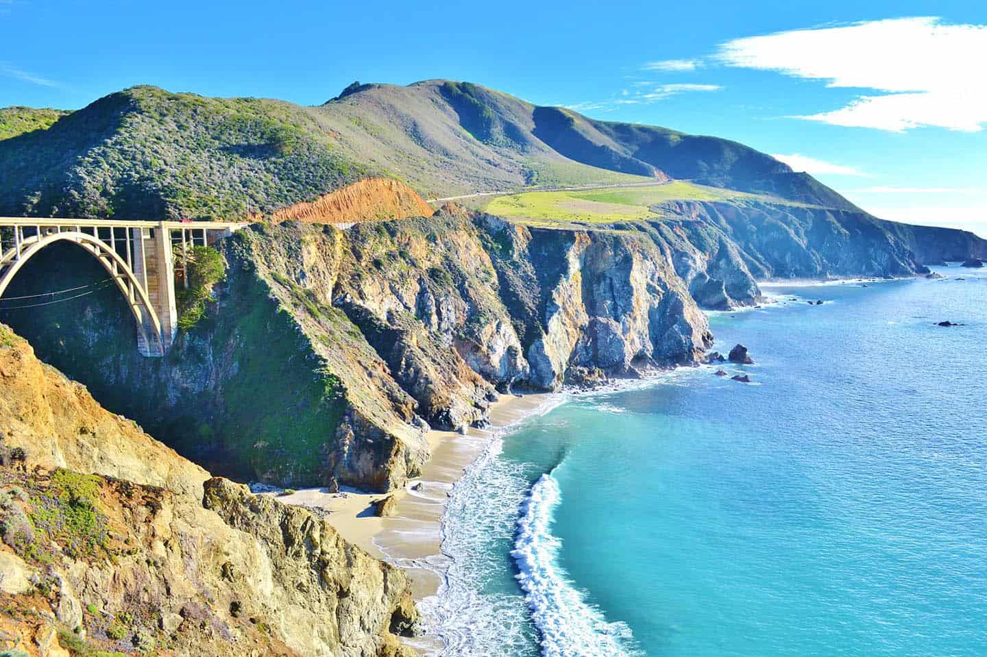
Beyond its status as a critical transportation artery, Highway 1 is a destination in itself. It connects a mosaic of diverse landscapes, from the sun-drenched beaches of Southern California to the Redwood forests of the north. Travelers embark on this journey to witness the majestic cliffs of Big Sur, the historic charm of Monterey and Carmel-by-the-Sea, the vibrant energy of Santa Cruz, and the serene beauty of places like Point Reyes National Seashore. The road is dotted with countless scenic overlooks, state parks, and hidden coves, inviting travelers to pause, explore, and immerse themselves in the coastal environment. The anticipation of driving over the engineering marvel that is Bixby Bridge or catching the elusive glimpse of McWay Falls cascading directly onto the beach fuels the wanderlust of millions.
Understanding Road Closures
Highway 1’s proximity to steep cliffs, active fault lines, and the ocean makes it particularly susceptible to natural events. The primary culprits for closures are landslides, mudslides, and rockfalls, often triggered by heavy rainfall, especially during the winter months. Earthquakes, though less frequent, can also cause significant damage. Beyond natural phenomena, routine maintenance and construction projects are regularly undertaken to preserve the road’s integrity and enhance safety. While frustrating for travelers, these closures are implemented for public safety and are typically temporary. In many cases, only specific segments are affected, meaning large portions of the highway remain open and accessible, allowing travelers to still experience significant sections of the famed route.
Current Status and Essential Planning for Your Highway 1 Journey
Planning a trip along Highway 1 requires a proactive approach, especially regarding real-time road conditions. Given the dynamic nature of the California coast, what might be open today could be impacted tomorrow. Travelers must prioritize checking official sources for the most accurate and up-to-date information, both in the lead-up to their trip and continuously while on the road.
Real-Time Road Conditions and Resources
The definitive source for road condition information in California is Caltrans, the state’s department of transportation. Their website provides an interactive map and detailed reports on all state routes, including Highway 1. Key resources include:
- Caltrans QuickMap: An invaluable online tool offering real-time updates on closures, construction, and traffic. Users can filter by highway and region to pinpoint specific issues.
- Caltrans District Social Media: Many districts, particularly those covering the coastal regions, post immediate updates on Twitter and other platforms.
- Local Tourism Boards: Websites for regions like Big Sur, Monterey County, or San Luis Obispo County often aggregate Caltrans information and provide local insights.
- Navigation Apps: While useful for general navigation, apps like Google Maps or Waze may not always have the most immediate updates for sudden closures on Highway 1, so cross-referencing with Caltrans is crucial.
It is highly recommended to check these resources the day before departure, the morning of your drive, and even periodically during your journey, especially if traveling through historically volatile areas or during periods of inclement weather.
Identifying Common Closure Hotspots
While closures can occur anywhere along Highway 1, certain segments are notoriously prone to issues. The Big Sur region, between Carmel-by-the-Sea and San Simeon, is the most frequent area of concern. This stretch is characterized by steep cliffs, deep canyons, and a geologically active environment. Past major closures have involved significant landslides, such as the infamous Mud Creek slide which closed a 1.5-mile segment for over a year, and the structural failure of the Pfeiffer Canyon Bridge after intense storms. While repairs are typically swift by engineering standards, they can still take months or even years for major events. Travelers should pay particular attention to reports concerning the central Big Sur corridor.
Alternative Routes and Detours
Should a significant section of Highway 1 be closed, especially through Big Sur, travelers will often need to utilize Highway 101 as an alternative. Highway 101 runs inland, roughly parallel to Highway 1, and serves as the primary bypass. While less scenic than the coastal route, Highway 101 is a well-maintained freeway that offers faster transit between major coastal cities. Travelers can still access portions of Highway 1 on either side of a closure, dipping onto the scenic route where it’s open and rejoining Highway 101 to bypass the impassable section. For instance, if Big Sur is closed, you can still drive Highway 1 south from Monterey to the closure point, then turn back and take Highway 101 south, rejoining Highway 1 from San Simeon if that southern section is open. This strategy allows for maximum coastal enjoyment even with detours.

Must-See Destinations Along the Open Sections of Highway 1
Even if portions of Highway 1 are temporarily closed, the vast majority of its length offers incredible travel experiences. Focus on the accessible segments and build an itinerary that maximizes your time enjoying California’s diverse coastal beauty.
Southern California Coastal Gems
Starting from the south, Highway 1 (often known as Pacific Coast Highway or PCH here) winds through iconic Southern California beach towns. Explore the vibrant piers and beaches of Santa Monica, marvel at the celebrity homes in Malibu, and immerse yourself in the Spanish colonial architecture and relaxed elegance of Santa Barbara. These areas rarely experience prolonged closures and offer a fantastic start or end to your coastal adventure.
The Central Coast’s Charms
Moving north from Santa Barbara, the Central Coast unfolds with its unique blend of history, natural beauty, and agricultural richness. Visit the opulent Hearst Castle in San Simeon, a sprawling estate that offers a glimpse into a bygone era of grandeur. Explore the charming artist community of Cambria, known for its moonstone beach and boutique shops. Discover the iconic Morro Rock guarding Morro Bay, a haven for sea otters and birdwatchers. Inland slightly, San Luis Obispo offers a lively downtown, historic mission, and a burgeoning wine region.
Iconic Big Sur Experiences (When Accessible)
The roughly 90-mile stretch of Highway 1 through Big Sur is the crown jewel for many, famous for its dramatic cliffs, redwood forests, and breathtaking ocean views. When open, travelers can drive across the engineering marvel of Bixby Bridge, hike through the majestic redwoods of Pfeiffer Big Sur State Park, or witness the iconic cascade of McWay Falls into the Pacific within Julia Pfeiffer Burns State Park. Always confirm the status of this particular section before venturing in, as detours are lengthy and cell service is often non-existent.
Northern California Wonders
North of Big Sur, the coast transforms again, offering different yet equally compelling attractions. The Monterey Peninsula boasts the world-renowned Monterey Bay Aquarium, Cannery Row, and the scenic 17-Mile Drive. Just south, Carmel-by-the-Sea enchants with its fairy-tale cottages and pristine beach. Further north, Santa Cruz offers a classic boardwalk amusement park and a vibrant surf culture. As you approach San Francisco, Highway 1 becomes more urban, leading to the Golden Gate Bridge and the city’s myriad attractions. Beyond San Francisco, the road continues north through quaint towns like Stinson Beach and leads to the dramatic landscapes of Point Reyes National Seashore, famous for its lighthouse, elephant seals, and Tule elk.
Maximizing Your Highway 1 Adventure: Tips for Travelers
A journey along Highway 1 promises an unforgettable experience, but a little preparation and flexibility can transform a good trip into an exceptional one.
Best Time to Visit
The “best” time to visit Highway 1 largely depends on your priorities.
- Spring (April-May): Offers pleasant temperatures, lush green landscapes, and fewer crowds than summer. Wildflowers are often in bloom. This is generally considered one of the best times.
- Summer (June-August): Popular but crowded. Expect warmer weather, but also the infamous “June Gloom” or “Fogust” in coastal areas, which can obscure views. Book accommodations well in advance.
- Fall (September-October): Often provides some of the clearest skies and warmest temperatures, especially after the summer fog lifts. Crowds begin to thin out.
- Winter (November-March): Offers dramatic, stormy skies and fewer tourists. However, this is when rain is most likely, increasing the risk of landslides and closures, particularly in Big Sur. Whale watching season peaks during winter and early spring.
Essential Packing and Preparation
- Offline Maps: Cell service is notoriously spotty along much of Highway 1, especially in Big Sur. Download maps for offline use before you go.
- Fuel: Gas stations can be scarce and expensive in remote sections. Fill up your tank whenever you have the opportunity.
- Snacks and Water: Long stretches between services mean you should pack plenty of provisions.
- Layers of Clothing: Coastal weather can change rapidly from sunny to foggy to windy, often within minutes. Dress in layers.
- Emergency Kit: Jumper cables, a first-aid kit, a flashlight, and extra blankets are always good to have.
- Binoculars: Essential for spotting wildlife, from migrating whales to sea otters and diverse bird species.
Embrace Flexibility
The most important advice for any Highway 1 traveler is to embrace flexibility. Road closures are a part of the experience, not an insurmountable obstacle. Have a mental (or written) backup plan that incorporates Highway 101 for detours. If a section is closed, view it as an opportunity to explore nearby towns, inland attractions, or other coastal segments that remain open. The beauty of California’s coast is vast and varied, and a minor rerouting often leads to unexpected discoveries and equally memorable experiences. By staying informed and maintaining an adventurous spirit, your Highway 1 journey will be nothing short of spectacular.
LifeOutOfTheBox is a participant in the Amazon Services LLC Associates Program, an affiliate advertising program designed to provide a means for sites to earn advertising fees by advertising and linking to Amazon.com. Amazon, the Amazon logo, AmazonSupply, and the AmazonSupply logo are trademarks of Amazon.com, Inc. or its affiliates. As an Amazon Associate we earn affiliate commissions from qualifying purchases.