
For travelers planning a journey across the Sunshine State’s northern reaches, the question “Is I-10 closed in Florida?” is often paramount. Interstate 10 is a critical east-west artery, traversing the entire Florida Panhandle from the Alabama border near Pensacola to Jacksonville on the Atlantic coast. Its operational status can significantly impact travel times, logistics, and overall trip experiences for millions of drivers each year. While full, prolonged closures are infrequent, temporary disruptions are a common reality, necessitating proactive planning and real-time awareness for any traveler. Understanding the typical causes of these disruptions and knowing how to access up-to-the-minute information is essential for a smooth journey through North Florida.

Understanding I-10’s Critical Role in Florida Travel
Interstate 10 isn’t just a road; it’s a vital economic and recreational corridor for Florida and the broader southeastern United States. Spanning approximately 360 miles within the state, it serves as the primary route for both residents and visitors navigating between the Florida Panhandle’s pristine beaches, such as those in Destin and Panama City Beach, and the major metropolitan hubs of Tallahassee and Jacksonville. Its connectivity extends beyond the state’s borders, linking Florida to other Gulf Coast states like Louisiana, Mississippi, and Texas, making it indispensable for long-haul travel and commercial freight.
The Lifeline of the Panhandle: Interstate 10 in Florida
For those traversing the Florida Panhandle, I-10 is often the fastest and most direct route. It bypasses smaller towns, offering a consistent flow of traffic at highway speeds. From Pensacola, it charts an easterly course, passing through major cities like Milton, Crestview, and DeFuniak Springs, before reaching Tallahassee, the state capital. Beyond Tallahassee, it continues through agricultural and forested lands, connecting smaller communities like Lake City where it famously intersects with Interstate 75, a primary north-south corridor for Florida. Finally, it merges with Interstate 95 in Jacksonville, completing its journey and providing seamless access to the East Coast. This intricate network underscores why any closure, partial or full, on I-10 can ripple through the entire state’s travel system, affecting personal vacations, business logistics, and emergency response times.
Common Reasons for I-10 Closures in Florida
While I-10 is meticulously maintained by the Florida Department of Transportation (FDOT), its vulnerability to various external factors means closures, though often temporary, are a recurring possibility. Travelers should be aware of the most common causes to anticipate potential disruptions.
Weather-Related Disruptions
Florida’s climate, while appealing for tourism, also brings its share of challenging weather that can significantly impact road conditions.
- Hurricanes and Tropical Storms: This is arguably the most significant cause of widespread and prolonged closures. During hurricane season, which typically runs from June to November, direct hits or even near-misses can lead to mandatory evacuations, which often utilize I-10 as a primary route away from coastal areas. Post-storm, closures can result from downed trees, power lines, flooding (especially in low-lying sections or near major rivers), bridge damage, or storm surge inundation. These closures can last for days or even weeks depending on the severity of the damage and the complexity of repairs.
- Heavy Rain and Flash Flooding: Even outside of tropical systems, Florida experiences intense thunderstorms that can quickly dump significant amounts of rain. This can lead to localized flash flooding, particularly under overpasses or in areas with poor drainage, making sections of I-10 impassable. While typically shorter-lived than hurricane-related closures, they can still cause considerable delays and require detours.
- Dense Fog: Less common for full closures but certainly a hazard, patches of dense fog, particularly during early morning hours or near wetlands, can drastically reduce visibility. While not usually leading to a complete shutdown, it often results in severe speed restrictions and can contribute to multi-vehicle accidents that then necessitate closures for investigation and cleanup.
Accidents and Emergency Incidents
As a high-volume interstate, I-10 is unfortunately susceptible to traffic accidents and other emergency situations.
- Major Collisions: Multi-vehicle pile-ups, especially those involving commercial trucks, can block multiple lanes or even the entire roadway. The subsequent investigation, clearing of wreckage, and spill cleanup can take several hours, leading to significant delays and closures.
- Hazardous Material Spills: Accidents involving vehicles carrying hazardous materials pose a unique and severe risk. Such incidents often require complete closures of the affected section of I-10 to allow emergency responders to safely contain the spill, evacuate nearby areas if necessary, and decontaminate the roadway. These closures can be lengthy, prioritizing public safety.
- Roadside Emergencies: While less common for full closures, emergencies like vehicle fires, downed utility poles, or even police activity can necessitate temporary lane closures or full stops to ensure the safety of responders and the public.
Construction and Maintenance
The continuous upkeep and improvement of such a vital artery are essential, but they inevitably lead to planned disruptions.
- Major Infrastructure Projects: FDOT frequently undertakes large-scale projects, such as widening sections of the interstate, rebuilding interchanges, or repairing and replacing bridges. While much of this work is often scheduled for off-peak hours or nighttime to minimize impact, certain phases might require temporary full closures for critical operations like setting bridge girders or shifting traffic patterns.
- Scheduled Maintenance: Routine maintenance, including resurfacing, guardrail repairs, or landscaping, typically involves lane closures rather than full road closures. However, in specific, high-impact scenarios, a brief full closure might be necessary for the safety of workers and motorists, often communicated well in advance.
Navigating Potential Disruptions: Resources for Travelers
For any traveler on I-10 in Florida, access to accurate, real-time information is invaluable. Several reliable resources can help you stay informed and make informed decisions about your route.
Official State Resources
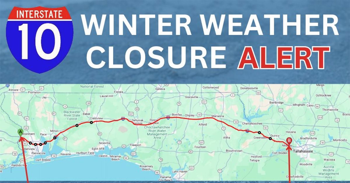
The Florida Department of Transportation (FDOT) is the primary authority for road conditions and provides comprehensive information.
- FL511 System: This is the most crucial resource. Florida’s 511 traveler information system offers real-time traffic updates, including details on closures, accidents, and construction.
- Website: Visit FL511.com for an interactive map showing current traffic speeds, incidents, and road closures. You can filter by specific interstates, including I-10.
- Mobile App: Download the Florida 511 app for iOS and Android for on-the-go updates.
- Phone: Dial 511 from any phone in Florida to access recorded information or speak with a live operator in some cases.
- FDOT Press Releases and Social Media: FDOT frequently issues press releases for major road projects or anticipated closures. Their official social media accounts (e.g., Twitter) often provide immediate updates on significant incidents.
- Emergency Management Agency Websites: During severe weather events like hurricanes, the Florida Division of Emergency Management website and county-level emergency management sites will provide critical information on evacuations, shelter locations, and road conditions, including I-10 closures.
Real-Time Traffic Applications
Beyond official channels, several widely used navigation apps leverage crowdsourced data and official feeds to provide real-time traffic conditions.
- Waze: Known for its user-generated reports, Waze can offer incredibly timely updates on accidents, police presence, and road hazards, often flagging issues before official systems. It can also suggest alternative routes to avoid congestion.
- Google Maps: Google Maps provides excellent real-time traffic overlays, identifying slowdowns and suggesting alternative routes based on current conditions. Its predictive traffic feature can also help anticipate delays.
- Apple Maps: Similar to Google Maps, Apple Maps offers real-time traffic data and route adjustments.
While these apps are highly useful, it’s always wise to cross-reference their information with official state resources, especially for significant closures, as official channels will have the definitive word on actual road openings and closures.
Local News and Social Media
Local television and radio stations, particularly in major cities along I-10 like Pensacola, Tallahassee, and Jacksonville, will often provide immediate coverage of major traffic incidents or weather-related closures. Following their social media accounts can also be beneficial, particularly during unfolding events.
Planning Ahead: Minimizing Travel Headaches on I-10
Proactive planning is the best defense against unexpected I-10 closures or delays. A little preparation can save hours of frustration and potentially enhance your entire travel experience.
Pre-Trip Preparation
Before you even hit the road, there are several steps you can take to mitigate risks.
- Check Weather Forecasts Thoroughly: This is especially crucial during Florida’s hurricane season (June to November). Monitor tropical weather outlooks and local forecasts for the entire stretch of your journey along I-10. If severe weather is predicted, consider postponing your trip or rerouting entirely.
- Consult Official Traffic Resources: Days before your trip, check FL511.com for any planned construction closures or long-term projects that might affect your travel date.
- Identify Alternative Routes: While I-10 is often the fastest, having a backup plan is wise. US-90 runs roughly parallel to I-10 for much of its length in Florida and can serve as an alternative, albeit slower, route through many towns. Familiarize yourself with major state roads that cross or parallel I-10 to navigate around localized issues.
- Ensure Vehicle Readiness: Before any long journey, confirm your vehicle is in good working order. Check tire pressure, fluid levels, and ensure you have a full tank of gas. An emergency kit with water, snacks, a first-aid kit, and a phone charger is always advisable, especially if you get stranded in a remote area.
During Your Journey
Staying alert and informed while on the road can help you react effectively to sudden changes.
- Monitor Dynamic Message Boards: FDOT places electronic message boards along I-10 that provide real-time updates on incidents, construction, and traffic delays. Pay close attention to these.
- Utilize Real-Time Navigation Apps: Keep Waze or Google Maps running, even if you know the route, to receive immediate alerts about slowdowns or closures and get suggested detours.
- Stay Charged: Ensure your mobile phone and any other navigation devices are fully charged or connected to a charger.
- Consider Strategic Stops: If you encounter significant delays, look for opportunities to exit the interstate safely. Consider stopping in a town for a meal, coffee, or even an overnight stay if the closure is extensive.
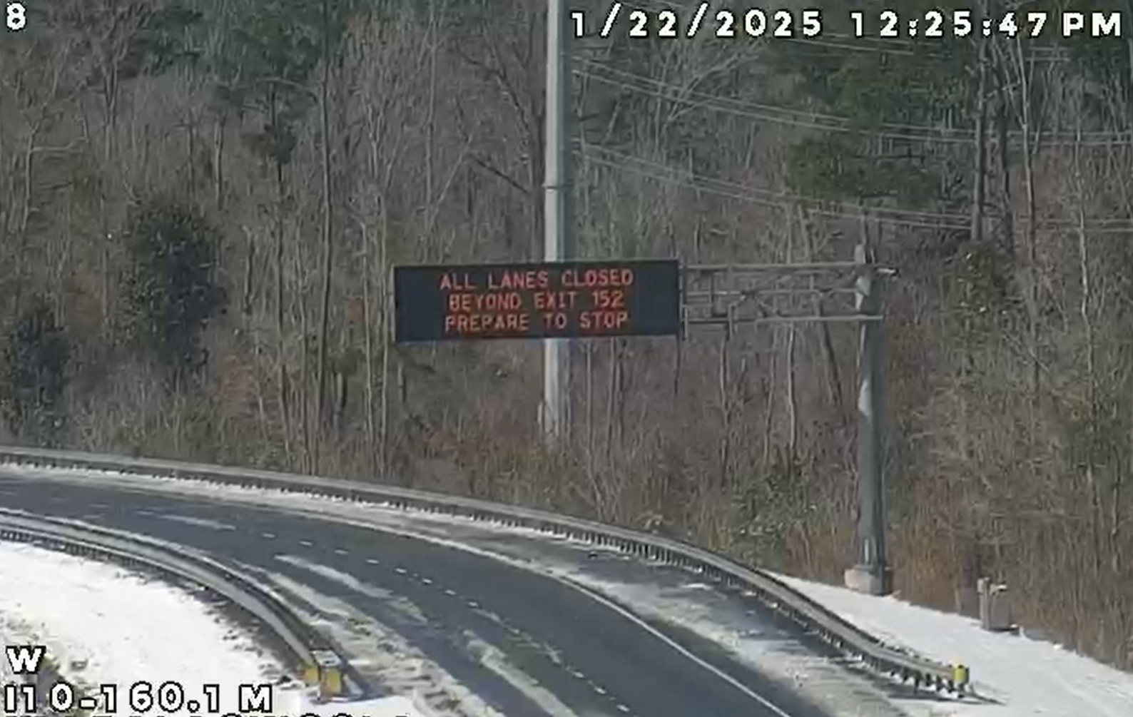
Understanding the Impact on Travel Plans
A closure on I-10 can have far-reaching effects on your travel itinerary.
- Time Delays: Even short closures can lead to hours of delays, especially if traffic diverts onto smaller local roads that quickly become overwhelmed. This can impact hotel check-in times, appointments, or connecting flights.
- Overnight Stays: In the event of a long-term closure, you might be forced to find an unexpected overnight accommodation. Being flexible with your budget and prepared to search for hotels in unfamiliar areas is beneficial.
- Route Changes: Detours can add significant mileage to your trip, increasing fuel costs and driving time.
- Flexibility is Key: The best approach is to remain flexible. While a rigid itinerary might be appealing, the realities of interstate travel, especially in a state like Florida prone to weather events, demand adaptability. Be prepared to adjust your plans, extend your trip, or explore unexpected detours.
By being informed, prepared, and flexible, travelers can navigate potential I-10 closures in Florida with minimal stress and continue to enjoy their journey through the state.
LifeOutOfTheBox is a participant in the Amazon Services LLC Associates Program, an affiliate advertising program designed to provide a means for sites to earn advertising fees by advertising and linking to Amazon.com. Amazon, the Amazon logo, AmazonSupply, and the AmazonSupply logo are trademarks of Amazon.com, Inc. or its affiliates. As an Amazon Associate we earn affiliate commissions from qualifying purchases.