
Navigating the prospect of travel, especially to coastal regions like those surrounding Parrish, Florida, often involves considerations beyond the allure of pristine beaches and vibrant local culture. One paramount concern for any prospective visitor, or indeed a resident, is the potential for natural disasters, particularly hurricanes and tropical storms. Understanding evacuation zones is not just a matter of safety; it’s an integral part of responsible travel planning, ensuring peace of mind and preparedness. This article delves into the critical aspect of evacuation zones in and around Parrish, Florida, providing insight for those considering a visit or looking for information on the safety of this charming area.

The geographic location of Parrish, nestled inland from the immediate coastline of the Gulf of Mexico, offers certain advantages regarding storm surge vulnerability. However, “evacuation zone” is a broad term, and understanding the nuances is crucial. These zones are designated by local and state authorities based on a comprehensive risk assessment, primarily focusing on the potential impact of storm surge. While Parrish itself may not be on the direct beachfront, its proximity to coastal communities and the interconnectedness of infrastructure mean that understanding broader evacuation mandates is essential.
Understanding Florida’s Evacuation Zones
Florida’s approach to evacuation zones is a carefully orchestrated system designed to protect its large population from the devastating impacts of hurricanes. These zones are not arbitrary; they are meticulously mapped by the Florida Division of Emergency Management and local county emergency management agencies. The primary driver for zone designation is the predicted storm surge, a dangerous rise in sea level that accompanies hurricanes. The higher the category of the hurricane and the closer its projected path to the coast, the greater the potential for significant storm surge.
The Science Behind Zone Designation
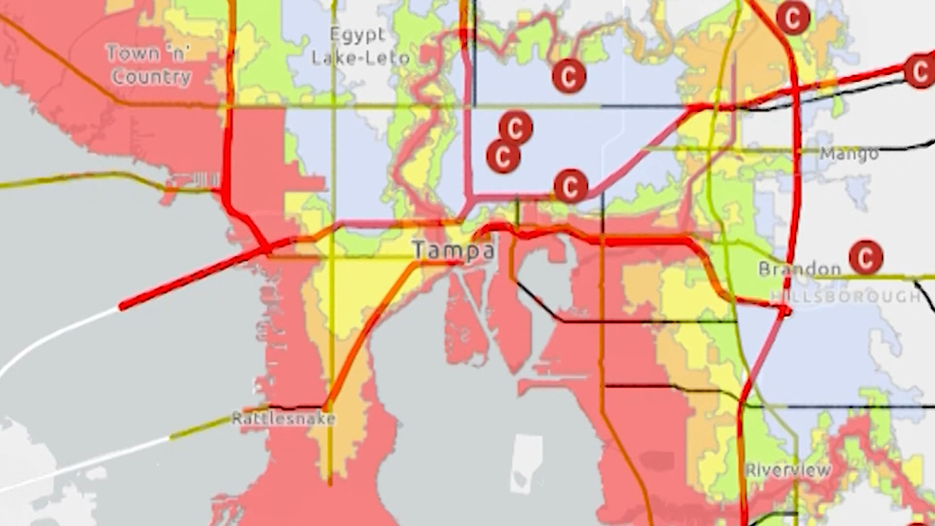
Evacuation zones are typically defined by categories, often labeled as Zone A, Zone B, Zone C, and so on, with Zone A being the most vulnerable to storm surge and thus the first to be ordered to evacuate. These zones are superimposed on detailed maps that show elevation, proximity to the coast, and the potential inundation areas during various hurricane intensities. Factors considered include:
- Elevation: Lower-lying areas are inherently more susceptible to flooding from storm surge.
- Distance from the Coast: Proximity to the Gulf of Mexico or bays significantly increases the risk of direct storm surge impact.
- Inland Waterways: Rivers and canals can also contribute to flooding, especially in conjunction with heavy rainfall and surge pushed inland.
- Building Structures: The type and construction of buildings can influence their resilience, though evacuation orders are generally based on broader geographical risks.
Understanding these factors helps paint a clearer picture of why certain areas are designated for evacuation and others are not. It’s a proactive measure to ensure that residents and visitors have sufficient time to move to safer locations before conditions become perilous.
Parrish, Florida: Location and Evacuation Zone Status
Parrish, Florida, is located in Manatee County. While it is situated inland from the immediate Gulf coast, this does not automatically exempt it from potential evacuation orders. The designation of evacuation zones is a dynamic process, influenced by the specific threat posed by an approaching storm. Even areas not directly facing the ocean can be affected by widespread flooding, infrastructure disruption, and mandatory evacuations ordered for neighboring coastal communities.
Assessing Parrish’s Position
To determine if Parrish is in an evacuation zone today, one must consult official sources. The Manatee County Emergency Management Agency is the primary authority for evacuation orders within the county. Their website, along with statewide emergency management resources, provides real-time updates and interactive maps.

Generally, areas further inland and at higher elevations, like much of Parrish, tend to be in lower-risk evacuation zones (e.g., Zone C or D) or not in a designated zone at all, relative to the immediate coastal areas (often Zone A). However, it is crucial to emphasize that this status can change depending on the severity and projected path of a storm. A powerful hurricane can push surge further inland than expected, and widespread rainfall can cause significant freshwater flooding, necessitating broader evacuation measures.
Where to Find Real-Time Information
The most reliable way to ascertain the current evacuation status for Parrish, Florida, is to check official channels. These include:
- Manatee County Emergency Management: Their official website is the definitive source for local evacuation orders, shelter information, and emergency preparedness guidelines. They often utilize interactive maps where residents and visitors can enter their address to determine their specific zone.
- Florida Division of Emergency Management: This state agency provides overarching information and links to county-specific resources. They also issue statewide alerts and advisories.
- Local News Outlets: Reputable local news channels and radio stations in the Tampa Bay area are typically very responsive during emergencies and will broadcast official evacuation orders and updates.
- NOAA Weather Radio: This is a crucial tool for receiving continuous weather information, including hurricane watches, warnings, and evacuation orders, directly from the National Oceanic and Atmospheric Administration.
It is always advisable to have a plan in place regardless of current evacuation zone status. Familiarize yourself with the designated zones for your specific location in Parrish or any planned accommodation, and understand the different phases of hurricane preparedness.
Planning Your Trip Around Potential Evacuations
For travelers, the possibility of an evacuation order, even if it doesn’t directly impact your immediate location, can affect your travel plans. Understanding how to prepare and what to do if an evacuation is ordered is paramount to a safe and enjoyable trip.
Pre-Trip Preparedness
Before you even book your accommodation in Parrish or the surrounding Bradenton area, consider the hurricane season, which runs from June 1st to November 30th. While travel during this period can offer advantages like fewer crowds and lower prices, it’s essential to be aware of potential weather disruptions.
- Travel Insurance: Investing in comprehensive travel insurance that covers weather-related cancellations or interruptions is highly recommended for any travel during hurricane season.
- Accommodation Flexibility: When booking hotels or vacation rentals, look for properties with flexible cancellation policies. This provides a safety net if a storm threatens your travel dates.
- Research Local Emergency Plans: Familiarize yourself with the emergency plans of your chosen destination. Know where the local shelters are located, what routes are designated for evacuation, and where to find official updates.
During Your Stay
If you are already in Parrish and an evacuation order is issued:
- Heed Official Warnings: Do not delay. If an evacuation order is issued for your zone, or if authorities recommend leaving the area, do so immediately.
- Follow Designated Routes: Evacuation routes are established to move traffic efficiently and safely away from danger. Stick to these marked routes.
- Secure Your Property: If time permits, take steps to secure your accommodation. This may include boarding up windows, securing outdoor furniture, and turning off utilities if instructed.
- Stay Informed: Continue to monitor official news sources and emergency management updates for information on when it is safe to return.
Even if Parrish is not in a mandatory evacuation zone, neighboring coastal areas might be. This can lead to significant traffic congestion on major roadways, impacting your ability to travel within the region or depart. Therefore, proactive monitoring of the situation and having a flexible itinerary are key. The beauty of the Florida Gulf Coast is undeniable, and with proper planning and awareness of safety protocols, visitors can experience all that Parrish and its surroundings have to offer while remaining secure.
LifeOutOfTheBox is a participant in the Amazon Services LLC Associates Program, an affiliate advertising program designed to provide a means for sites to earn advertising fees by advertising and linking to Amazon.com. Amazon, the Amazon logo, AmazonSupply, and the AmazonSupply logo are trademarks of Amazon.com, Inc. or its affiliates. As an Amazon Associate we earn affiliate commissions from qualifying purchases.