
The Mississippi River stands as the lifeblood of the United States, a colossal waterway that defines the geography, commerce, and natural history of the continent. For travelers and nature enthusiasts, the river is more than just a body of water; it is a legendary landmark that offers breathtaking vistas and a gateway to the heartland. However, because of its immense scale and complex drainage basin, the river is subject to dramatic seasonal fluctuations. Understanding the current status of the river is essential for anyone planning a trip to its banks, whether you are visiting the bustling streets of New Orleans or the scenic bluffs near Minneapolis.
The Seasonal Dynamics of the Mississippi River
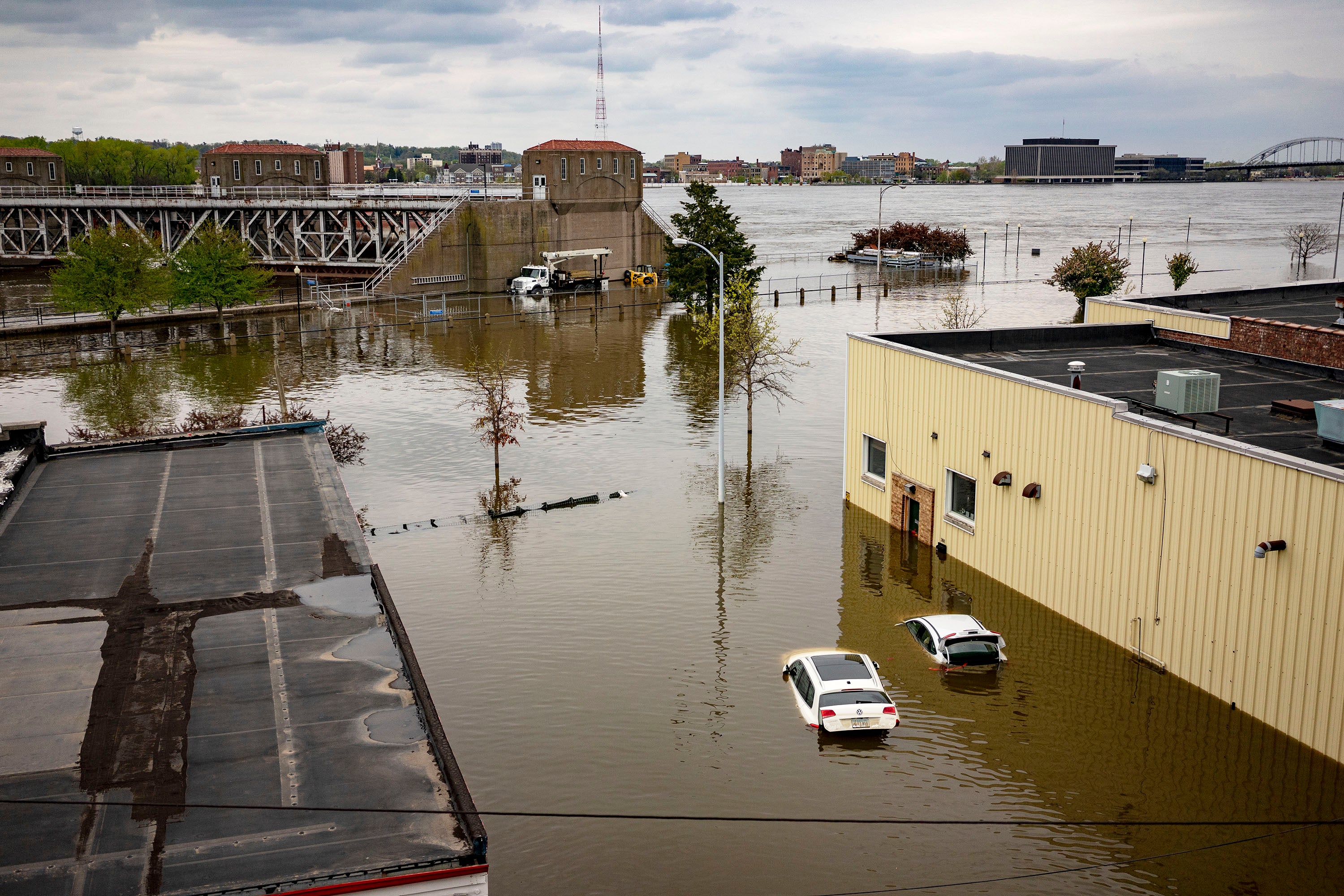
To answer whether the Mississippi River is flooding, one must first understand that “flooding” is a relative term for this massive waterway. The river is fed by a vast network of tributaries, including the Missouri River and the Ohio River. Because these tributaries span such a diverse climate range, the river experiences natural cycles of high water during the spring thaw and following periods of heavy regional rainfall.
Understanding Flood Stages and Gauging
The National Weather Service monitors the river using a precise system of gauges. When experts discuss flooding, they are referring to specific levels that exceed the natural banks. In many cases, “minor flooding” simply means that low-lying areas—often parks or recreational pathways—are temporarily submerged. These are managed events that are part of the river’s natural pulse. For those traveling to cities like St. Louis or Memphis, it is common to see high water levels that do not impact the primary urban infrastructure or tourism activities.
The Role of Locks and Dams
The United States Army Corps of Engineers manages an intricate system of locks and dams, particularly on the Upper Mississippi River. This infrastructure was designed not only to facilitate commercial navigation but also to regulate water flow. Consequently, even when the river appears high, the major tourist hubs and historic riverfront districts are generally protected by sophisticated levee systems and floodwalls.
Traveling Along the River During High Water Periods
If you are planning an excursion, high water levels are rarely a reason to cancel your trip. In fact, many travelers find that the river at a high stage is a magnificent sight to behold. The sheer power and speed of the current provide a unique perspective on the forces of nature that have shaped the American Midwest for millennia.
Impact on River Cruises and Boat Tours
Riverboats, such as the iconic vessels found in Natchez or Vicksburg, are highly adaptable to changing river conditions. While extreme flood events might occasionally necessitate the rescheduling of specific excursions, operators are experts at navigating the ebb and flow of the tides. When water levels rise, some docking areas may be moved temporarily, but the overall schedule of historic river cruises usually remains intact.

Exploring the Riverfront Parks
Many cities have invested heavily in beautiful riverfront parks. When the river level is exceptionally high, these parks may experience brief closures of lower-tier trails. However, the upper embankments, viewing platforms, and surrounding historical districts typically remain fully open and accessible. Visiting during these times offers an excellent opportunity to witness the engineering feats that allow civilization to thrive alongside such a dynamic natural landmark.
Monitoring Conditions for a Safe Visit
Safety and informed planning are the cornerstones of responsible tourism. If you are preparing for a trip that involves close proximity to the river, utilizing official resources will provide you with the peace of mind needed to enjoy your visit to the fullest.
Digital Resources for Real-Time Updates
Before heading out, consult the Advanced Hydrologic Prediction Service. This tool allows you to select specific locations along the river to view hydrographs and flood forecasts. Whether you are traveling to the headwaters in Itasca State Park or the delta near Baton Rouge, you can check the status of local gauges with ease.
Engaging with Local Tourism Boards
Local tourism offices in towns like Davenport or Dubuque are perhaps the most reliable sources for information regarding specific visitor attractions. If there is a localized issue involving high water, these organizations are the first to know and the best at communicating how it might—or might not—affect your specific itinerary. They often provide helpful tips on alternative routes or modified experiences that allow you to continue enjoying the history and culture of the region despite the river’s fluctuating state.
Celebrating the Majesty of the Mississippi
The Mississippi River is a dynamic, living entity. Rather than fearing the prospect of high water, consider it part of the authentic experience of visiting one of the world’s greatest landmarks. The history of the river is a history of adaptation, from the early indigenous settlements to the vibrant modern cities that define its banks today.
The Beauty of a Flooding Landscape
Photographers and nature lovers often seek out the river during high water periods to capture its raw, unfiltered power. The way the water reflects the sky, the volume of the current, and the sheer scale of the landscape become amplified when the river is full. It is a reminder of the awe-inspiring nature of the North American environment.

Final Travel Tips
- Stay Informed: Bookmark local gauge pages for your specific destinations.
- Be Flexible: Keep an open mind regarding riverfront activities; if a trail is closed, visit one of the many inland museums or historical sites nearby.
- Respect the Power: Always adhere to posted safety signs near the banks. Regardless of the water level, the river’s current is strong and should be respected by boaters and pedestrians alike.
- Support Local: Regardless of the river’s stage, the local businesses, restaurants, and hotels along the riverfront are eager to welcome travelers. Your presence supports the communities that keep the spirit of the river alive.
Ultimately, asking “Is the Mississippi River flooding?” is a sign of a prepared and thoughtful traveler. Whether the river is at a low, moderate, or high stage, it remains a majestic, awe-inspiring landmark that is always worth the visit. Its history, its culture, and its physical beauty remain constant, serving as the heartbeat of the regions it flows through. From the northern reaches of Minnesota to the southern reaches of Louisiana, the river awaits those who appreciate the grandeur of nature and the resilience of the communities that call its banks home.
LifeOutOfTheBox is a participant in the Amazon Services LLC Associates Program, an affiliate advertising program designed to provide a means for sites to earn advertising fees by advertising and linking to Amazon.com. Amazon, the Amazon logo, AmazonSupply, and the AmazonSupply logo are trademarks of Amazon.com, Inc. or its affiliates. As an Amazon Associate we earn affiliate commissions from qualifying purchases.