
The devastating impact of Hurricane Katrina on New Orleans in August 2005 remains a stark reminder of nature’s fury and the critical importance of understanding meteorological phenomena. Beyond the sheer destruction, a common question arises when recalling this catastrophic event: “What category was Katrina when it hit New Orleans?” The answer, while seemingly straightforward, involves understanding the Saffir-Simpson Hurricane Wind Scale and the dynamic nature of hurricanes. When Katrina made landfall, its intensity was a significant factor in the catastrophic flooding and widespread damage that crippled the city and surrounding regions of Louisiana.

Understanding Hurricane Intensity: The Saffir-Simpson Scale
To properly answer what category Katrina was, we must first define the Saffir-Simpson Hurricane Wind Scale. This scale categorizes hurricanes from 1 to 5 based on their sustained wind speeds. It’s a crucial tool for forecasters and the public alike, providing a standardized measure of a hurricane’s potential to cause damage.
Category 1: Minimal
A Category 1 hurricane boasts sustained winds of 74-95 miles per hour (119-153 kilometers per hour). At this level, damage is typically minimal, primarily affecting unanchored objects, trees, and signs. Power outages are possible, especially in coastal areas.
Category 2: Moderate
Category 2 hurricanes exhibit sustained winds of 96-110 mph (154-177 km/h). These storms can cause more significant damage, including extensive tree damage, power outages lasting several days, and damage to some buildings.
Category 3: Extensive
This is where a hurricane transitions into a major storm. Category 3 hurricanes have sustained winds of 111-129 mph (178-208 km/h). Expect “extensive” damage. This includes major damage to well-constructed homes, mobile homes destroyed, and power outages lasting weeks. Flooding is a serious concern.
Category 4: Extreme
Category 4 hurricanes are characterized by sustained winds of 130-156 mph (209-251 km/h). The damage is “extreme.” Homes can sustain severe damage, with the possibility of total roof failure and wall collapse. Widespread power outages are expected, and the affected areas can be uninhabitable for extended periods.
Category 5: Catastrophic
The most severe category, Category 5 hurricanes, have sustained winds of 157 mph (252 km/h) or higher. These storms are considered “catastrophic.” Complete roof failure on many well-constructed homes is possible. Power outages will last for weeks or months. Vast areas will be uninhabitable for a long time.
The Path and Intensity of Hurricane Katrina
Hurricane Katrina formed over the Bahamas on August 23, 2005, and initially strengthened rapidly. Its track took it across southern Florida as a Category 1 hurricane before it entered the warm waters of the Gulf of Mexico. These warm waters provided the fuel for Katrina to undergo explosive intensification.
Pre-Landfall Buildup
As Katrina moved across the Gulf of Mexico, its intensity surged. Satellite imagery and reconnaissance aircraft revealed a rapidly strengthening storm. The National Hurricane Center issued increasingly dire warnings. The storm’s structure became well-defined, with a clear eye and intense eyewall, indicating a powerful system. By the time it approached the coast of Louisiana, Katrina had reached its peak intensity.
The Moment of Impact
When Hurricane Katrina made its final landfall on the morning of August 29, 2005, it was classified as a Category 3 hurricane on the Saffir-Simpson Hurricane Wind Scale. The eye of the storm crossed the coast near Burrwood, Louisiana, before making a second landfall near Triumph, Louisiana, not far from Grand Isle. The sustained wind speeds at this point were estimated to be in the range of 100-125 mph (160-205 km/h).
However, the classification as a Category 3 hurricane at landfall significantly understates the catastrophic damage that ensued. Several factors contributed to this:
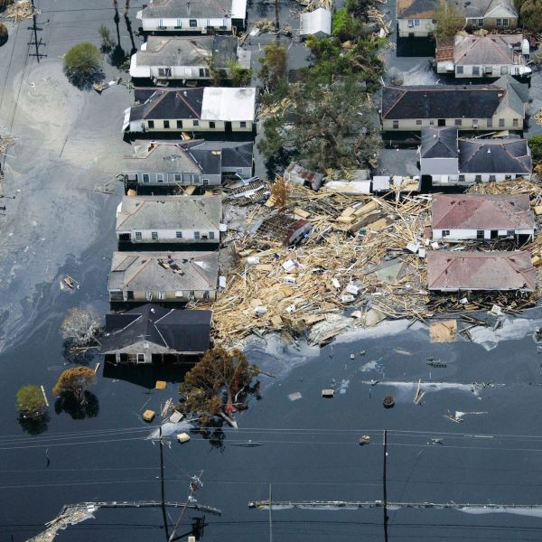
- Storm Surge: While wind speed is the primary determinant of the Saffir-Simpson scale, the storm surge generated by Katrina was immense. This wall of water, reaching heights of 25-28 feet in some areas, was the primary cause of the devastating flooding in New Orleans. The levees, designed to protect the city, were overwhelmed and breached in numerous locations.
- Landfall Location: The storm made landfall directly to the east of New Orleans, putting the city on the “wet” side of the hurricane. This meant the strongest winds and the most dangerous storm surge were directed towards the metropolitan area.
- Size of the Storm: Katrina was a large hurricane, meaning its destructive winds and surge extended over a wide area, impacting not only New Orleans but also coastal communities in Mississippi like Biloxi, Gulfport, and Pascagoula.
- Rainfall: The sheer volume of rainfall associated with Katrina further exacerbated flooding issues, particularly in a city that lies below sea level and relies heavily on its pump system.
Post-Landfall Weakening and Continued Impact
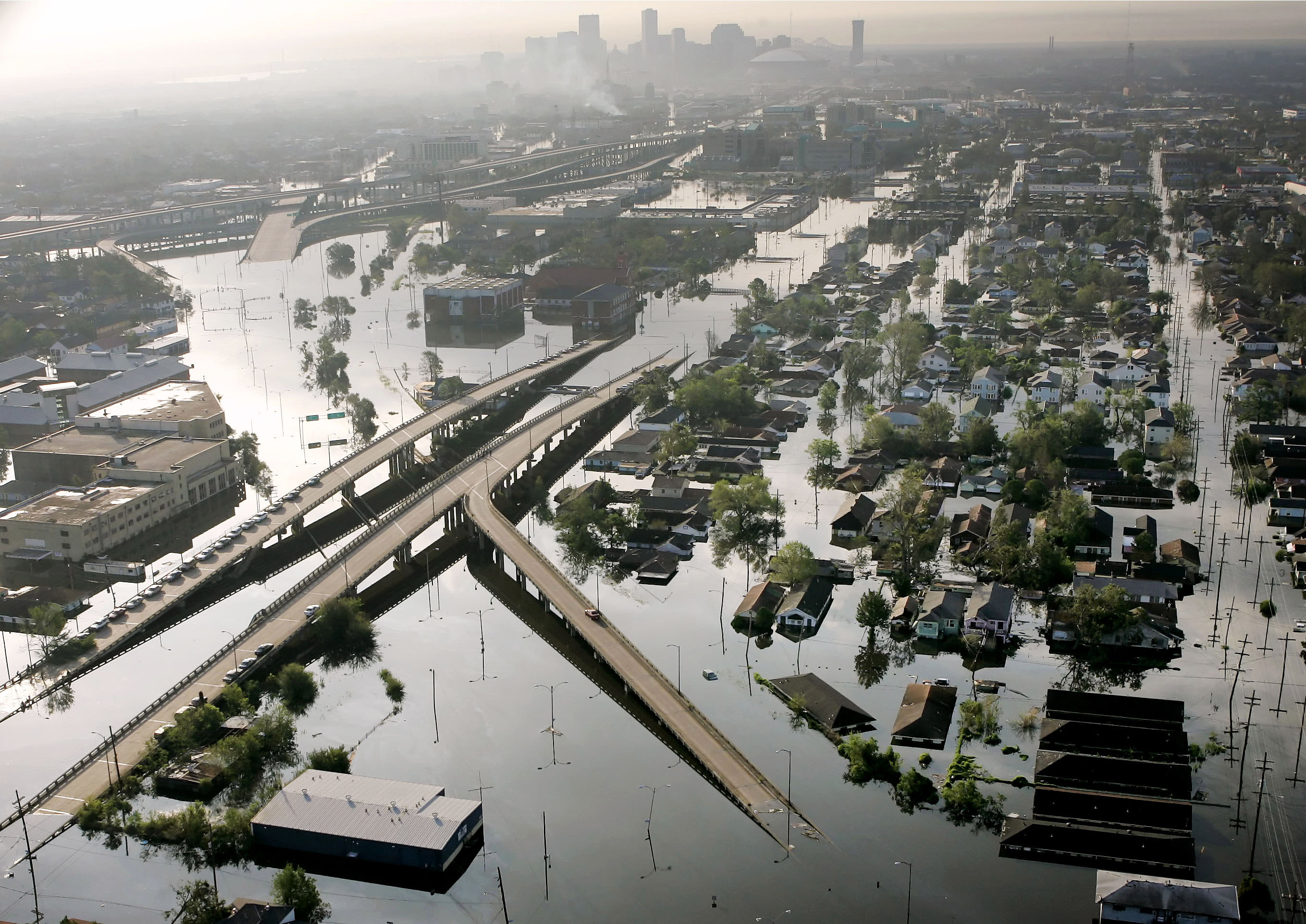
After making landfall, Katrina weakened as it moved inland. It was downgraded to a Category 1 hurricane over Mississippi and then a tropical storm. However, the damage had already been done. The breaching of the New Orleans levees led to widespread inundation, with approximately 80% of the city underwater for weeks. The catastrophic flooding, far more so than the wind, inflicted the most severe and long-lasting damage on the city’s infrastructure, homes, and the lives of its residents. The recovery process for New Orleans and the broader Gulf Coast region was arduous and protracted, a testament to the profound and multifaceted impact of this natural disaster.
The question of Katrina’s category at landfall often leads to discussions about the limitations of the Saffir-Simpson scale when dealing with other destructive aspects of a hurricane, such as storm surge and rainfall. While it provides a vital measure of wind intensity, it doesn’t fully capture the totality of a hurricane’s destructive potential. The legacy of Hurricane Katrina underscores the importance of comprehensive preparedness, robust infrastructure, and understanding that a hurricane’s impact is a complex interplay of wind, water, and the specific vulnerabilities of the affected region. The memories of the city submerged, the resilience of its people, and the lessons learned continue to shape disaster preparedness and response strategies across the United States.
LifeOutOfTheBox is a participant in the Amazon Services LLC Associates Program, an affiliate advertising program designed to provide a means for sites to earn advertising fees by advertising and linking to Amazon.com. Amazon, the Amazon logo, AmazonSupply, and the AmazonSupply logo are trademarks of Amazon.com, Inc. or its affiliates. As an Amazon Associate we earn affiliate commissions from qualifying purchases.