
Navigating the Sunflower State: An Introduction to Kansas Districts
Understanding the intricate web of political and administrative boundaries in Kansas is essential for residents, business owners, and engaged citizens alike. Whether you are casting a ballot in a local municipal election, registering your vehicle, or trying to determine which elected official represents your specific neighborhood, knowing your district is paramount. The state’s geography is divided into numerous overlapping jurisdictions, including congressional districts, state legislative districts, county commissioner districts, and school board regions. Each of these boundaries serves a distinct purpose in shaping the governance and community life of the region.
For newcomers and long-term residents alike, the question of “What district am I in?” often arises during election season or when a local policy issue sparks public interest. Because boundary lines are periodically redrawn based on census data to ensure equal representation, keeping track of your current district requires modern tools and an understanding of how local government is structured. From the bustling urban centers of Wichita and Overland Park to the rolling agricultural plains of western Kansas, every square inch of the state falls within a precise combination of legislative zones. Navigating this system may seem daunting at first, but with the right resources, identifying your specific district becomes a straightforward and empowering process.
The Importance of Knowing Your Political Boundaries
Every vote matters, but understanding where your vote counts and who it elects is the foundation of a representative democracy. Your congressional district determines which member of the United States House of Representatives champions your community’s federal interests in Washington, D.C. Meanwhile, your state senate and house districts dictate who crafts legislation concerning state taxes, infrastructure funding, and public education right here at home. When residents understand their districts, they can hold their representatives accountable, advocate for policy changes, and participate meaningfully in town halls and public forums.
How to Find Your Congressional and State Legislative Districts
Finding your exact legislative district in Kansas relies heavily on geographic data and official state resources. The most efficient and accurate method for residents to discover their districts is through the official online tools provided by the state government. By entering your residential address, these systems cross-reference geographic information systems (GIS) data to instantly display your federal, state, and local districts.
Official State Tools and Resources
The Kansas Secretary of State office maintains a comprehensive voter portal designed specifically to help citizens navigate their voting districts. By visiting the official voter view website, you can input your street address, city, and zip code to retrieve a detailed breakdown of your representation. This portal not only reveals your congressional and legislative districts but also provides information on your current polling place, sample ballots, and elected officials.
- Voter View Portal: The primary digital tool for checking voter registration and district assignments.
- County Election Offices: Local county clerk offices offer personalized assistance for residents who prefer phone inquiries or in-person visits.
- Interactive GIS Maps: Advanced mapping tools provided by the Kansas Legislative Research Department allow users to visualize district borders down to the street level.
Utilizing County Clerk Offices
While digital tools are convenient, technology occasionally presents hurdles. For residents who encounter issues with online address lookups, reaching out directly to your local county election office is a reliable alternative. Counties such as Johnson County, Sedgwick County, and Shawnee County employ dedicated staff whose daily work involves maintaining accurate voter rolls and district mappings. A quick phone call or a visit to your county courthouse can quickly clear up any confusion regarding your precise voting precinct and legislative boundaries.
Understanding the Different Types of Districts in Kansas
When asking “What district am I in?”, it is crucial to recognize that Kansas is divided into several entirely different categories of districts. A single residential address will belong to multiple districts simultaneously, each serving a completely different tier of government. Conflating these districts is a common source of confusion for voters, making it helpful to break down the primary categories.
Federal Congressional Districts
Kansas is apportioned four seats in the United States House of Representatives, which means the state is divided into four massive congressional districts. These districts are designated numerically:
- The 1st Congressional District: Often referred to as the “Big First,” this district covers a vast expanse of western and northern Kansas, encompassing major agricultural hubs like Salina, Hays, and Manhattan.
- The 2nd Congressional District: Stretching from the Nebraska border down to the Oklahoma border in the eastern half of the state, this district includes the capital city of Topeka, as well as Lawrence.
- The 3rd Congressional District: Geographically the smallest but densely populated, this district primarily covers the Kansas City metropolitan area within Kansas, including Overland Park, Olathe, and parts of Kansas City.
- The 4th Congressional District: Centered around Wichita and the south-central plains, this district captures a dynamic blend of urban industry and rural communities.
State Legislature and Local Governance Districts
Beyond federal representation, your daily life is heavily influenced by state and local districts. The Kansas Legislature is bicameral, consisting of 40 State Senate districts and 125 State House districts. These districts are nested, meaning multiple House districts fit neatly within a single Senate district.
Furthermore, residents must contend with hyper-local districts:
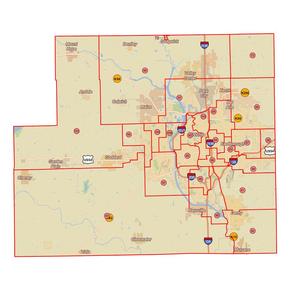
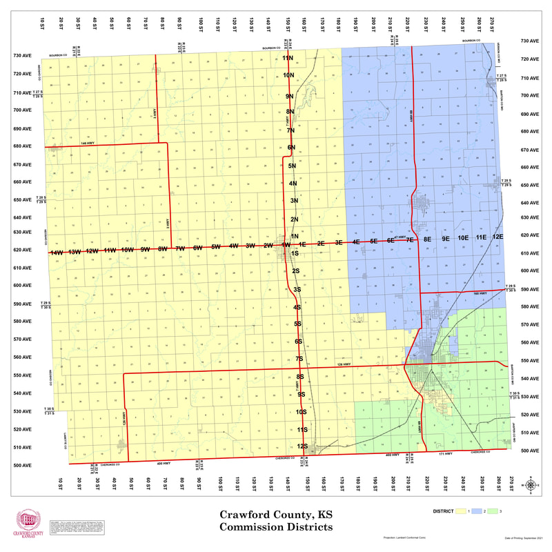
- County Commissioner Districts: Typically numbering three to five per county, these districts ensure that different geographic sections of a county have a voice on the board of county commissioners.
- School Board Districts: These boundaries dictate which members of the local unified school district (USD) board of education you vote for, directly impacting local education policy and property tax allocation.
- Municipal Wards: In cities with council-manager forms of government, the city is frequently divided into wards or districts to ensure geographic diversity among city council members.
The Redistricting Process and Why Boundaries Change
If you feel like your district boundaries have shifted over the years, your observation is entirely correct. Every ten years, following the completion of the United States Census, states undergo a process known as redistricting. Because populations grow, shrink, and shift over a decade, legislative maps must be redrawn to ensure that each district contains an equal number of residents, adhering to the constitutional principle of “one person, one vote.”
How Maps Are Redrawn in the Sunflower State
In Kansas, the task of redrawing congressional, state senate, and state house districts falls primarily upon the Kansas Legislature. Lawmakers draft, debate, and pass maps that dictate political boundaries for the coming decade. This process is often a subject of intense public debate and scrutiny, as the drawing of lines can significantly influence the political dynamics of future elections.
Once the maps are approved by the legislature and signed by the governor, local election officials must update their databases, assign voters to their new precincts, and issue updated voter registration cards. This monumental logistical shift is precisely why checking your district status ahead of every major election cycle is a smart habit for any active citizen. Changes in street names, newly developed housing additions, and municipal annexations can also trigger localized precinct adjustments outside of the standard decennial redistricting timeline.

Empowering Your Civic Participation
Armed with the knowledge of how districts are structured and the tools available to locate your specific boundaries, you are fully equipped to engage with your government. Knowing your district in Kansas transcends mere administrative trivia; it is the key to effective civic participation. When you understand who represents you at every level—from federal congressmen to local county commissioners—you can direct your concerns, policy ideas, and support to the individuals directly responsible for your community’s well-being.
Take a few moments today to visit the official state voter portals, verify your address, and discover the unique network of districts that define your place in the Sunflower State. By staying informed and engaged, you ensure that your voice resonates clearly within the halls of power, strengthening the democratic fabric of Kansas for generations to come.
LifeOutOfTheBox is a participant in the Amazon Services LLC Associates Program, an affiliate advertising program designed to provide a means for sites to earn advertising fees by advertising and linking to Amazon.com. Amazon, the Amazon logo, AmazonSupply, and the AmazonSupply logo are trademarks of Amazon.com, Inc. or its affiliates. As an Amazon Associate we earn affiliate commissions from qualifying purchases.