
For travelers planning a trip to the capital of Idaho, understanding the local geography is more than just a matter of curiosity; it is a vital part of preparing for the physical demands of the region. If you have ever asked, “What elevation is Boise?” the short answer is that the city sits at approximately 2,730 feet above sea level. However, this number only tells part of the story. Nestled at the base of the Rocky Mountains and flanking the high desert plateaus of the Pacific Northwest, the city’s terrain is as varied as the adventures it offers.
Understanding the Topography of the Treasure Valley
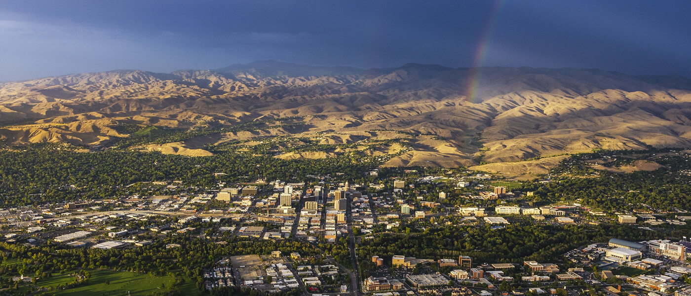
The city does not sit on a flat plane; rather, it is anchored within the Treasure Valley, a unique geographical basin that dictates everything from the local climate to the types of outdoor recreation available to visitors.
The Valley Floor vs. The Foothills
While the official elevation is often cited at the airport—which sits on a bench overlooking the downtown area—the elevation within the city limits actually fluctuates significantly. The downtown core sits at a slightly lower elevation, while the Boise Foothills rise sharply to the north and east. These foothills quickly gain thousands of feet in elevation, transforming from urban parkland into rugged mountain trails.
This rapid change in altitude is what gives the region its distinct character. Residents and tourists alike can travel from a bustling downtown sidewalk to a mountain peak in under twenty minutes. This vertical gain is a defining feature of the local landscape, creating microclimates where the temperature can shift noticeably as you move toward the Bogus Basin ski area.
Geological Significance
The valley itself was shaped by ancient volcanic activity and the historic Bonneville Flood, which carved the landscape into the series of terraces and benches seen today. When you walk along the Boise River Greenbelt, you are essentially traversing the base of a canyon that has been weathered over millennia. Understanding this elevation is essential for those planning to hike, bike, or run, as the thinness of the air and the intensity of the high-desert sun can surprise visitors coming from sea level.
How Elevation Impacts Your Visit
Traveling to a city at nearly 3,000 feet requires a few adjustments for those accustomed to lower altitudes. Whether you are coming from Los Angeles or New York City, the physical environment of Ada County will react differently with your body.
Hydration and Physical Exertion
At this elevation, the air is significantly drier than in coastal regions. Dehydration is the most common issue for travelers visiting the Mountain West. Even if you do not feel thirsty, the humidity levels in the valley are often quite low, leading to rapid fluid loss. It is recommended that visitors increase their water intake by at least thirty percent compared to their daily habits back home.

Furthermore, physical exertion feels more intense here. Activities like mountain biking at Camel’s Back Park or jogging along the river will cause your heart rate to climb faster than it would at sea level. Listen to your body, take breaks, and allow yourself a day or two of acclimatization before attempting strenuous hikes in the higher elevations of the Sawtooth National Forest.
The High Desert Climate
The elevation plays a major role in the temperature swings found in the region. Because of the relatively high altitude and the arid climate, the area experiences significant “diurnal temperature variation.” This means that even during a hot summer day, the temperature can drop by thirty or forty degrees once the sun sets behind the mountains. Packing layers is not just a suggestion for travelers here; it is a necessity. A light jacket that feels unnecessary at noon will become your best friend by 9:00 PM.
Exploring the Vertical Landscape
The proximity to varying elevations makes this city an exceptional destination for those who love the outdoors. The transition from the high-desert valley floor to the alpine terrain is the primary draw for many adventure-seeking travelers.
The Boise River Greenbelt Experience
The Boise River acts as the spine of the city. As it flows through the heart of the capital, the elevation remains relatively steady, providing a lush, shaded corridor that contrasts sharply with the arid benches above. Many of the city’s most popular attractions, such as Julia Davis Park and the Boise Art Museum, are located along this river corridor. Exploring these areas requires minimal physical strain, making them perfect for all age groups.
Scaling the Foothills
For those seeking a more rigorous experience, the Hulls Gulch Trailhead offers an immediate ascent into the higher elevations. As you climb, the view of the valley opens up, allowing you to see the true scale of the Great Basin influence on the area. The higher you go, the more the vegetation shifts from sagebrush and grasses to scrub oak and eventually coniferous trees. This change is a direct result of the cooling temperatures associated with increased elevation.
Winter Sports and Altitude
If you are visiting during the winter, the elevation becomes an asset rather than a hurdle. The local ski resort, located high in the foothills, relies on the altitude to provide a consistent snowpack. While the city streets may be clear and sunny, the top of the nearby peaks can be buried in snow, offering world-class skiing and snowboarding. It is this unique vertical proximity that defines the lifestyle of the region—you can literally trade your hiking boots for skis within a half-hour drive.

Practical Tips for High-Altitude Travelers
To make the most of your stay, consider these tips regarding the local environment and the unique geography of North America.
- Sun Protection: At 2,700 feet and above, the atmosphere is thinner, meaning the UV rays are significantly more intense. Even on cloudy days, sunscreen is essential to avoid severe sunburns, especially if you are spending the day at the Idaho Botanical Garden.
- Alcohol Sensitivity: Many visitors find that they feel the effects of alcohol more quickly at this elevation. If you plan to visit the local breweries or wineries, pace yourself and ensure you are pairing your beverages with plenty of water.
- Monitor Energy Levels: If you are planning a trip to higher-altitude locations like Sun Valley or the Salmon River Mountains after visiting the capital, remember that those locations will be even higher, often exceeding 6,000 feet. Your body will need extra recovery time if you are moving quickly between these different zones.
The elevation of Boise is the silent partner in every experience you have here. Whether you are sipping coffee at a café near the State Capitol Building or watching the sunset from the top of the foothills, the altitude influences the light, the air, and the pace of life. By respecting the geography and preparing accordingly, you can ensure that your visit to this high-desert gem is both comfortable and exhilarating. The beauty of this region lies in its height and its reach, offering travelers a unique vantage point from which to enjoy the vast, sprawling landscapes of the American West.
LifeOutOfTheBox is a participant in the Amazon Services LLC Associates Program, an affiliate advertising program designed to provide a means for sites to earn advertising fees by advertising and linking to Amazon.com. Amazon, the Amazon logo, AmazonSupply, and the AmazonSupply logo are trademarks of Amazon.com, Inc. or its affiliates. As an Amazon Associate we earn affiliate commissions from qualifying purchases.