
The question “What is the zip code for California?” is a common one, often posed by travelers, newcomers, or those simply unfamiliar with the vastness of the Golden State. However, the premise itself is a slight misconception. Unlike a single building or a small town, California does not possess a singular zip code. As one of the largest and most populous states in the United States, California is a sprawling tapestry of diverse landscapes, vibrant cities, quaint towns, and remote natural wonders, each meticulously segmented by a complex system of postal codes. Understanding California’s zip code system is not just about postal logistics; it’s an invaluable tool for any traveler seeking to navigate, explore, and truly experience the myriad destinations within this iconic state. From planning the perfect road trip through its varied terrains to pinpointing the ideal neighborhood for accommodation, zip codes serve as a foundational element in mastering California’s immense geographical scope.

Unraveling the Myth: No Single Zip Code for California
The notion of a single zip code for an entire state as expansive as California is an understandable but incorrect simplification. Just as no single address can encompass all its residents or businesses, no single five-digit code can define its immense geographical and demographic diversity. Instead, California is home to thousands of distinct zip codes, each assigned to specific cities, towns, neighborhoods, and even rural routes.
The Vastness of the Golden State
California stretches over 1,000 miles from north to south, encompassing nearly 164,000 square miles. Its topography ranges from pristine Pacific coastlines and towering mountain ranges like the Sierra Nevada to fertile agricultural valleys, arid deserts, and bustling metropolitan areas. This incredible diversity necessitates a highly granular system for mail delivery and, by extension, for geographical identification. A zip code for a coastal town in Southern California will be vastly different from one in the Sierra foothills or the northern redwood forests, reflecting distinct communities and operational postal hubs.
The Purpose of Zip Codes in a Travel Context
Originally introduced by the U.S. Post Office Department in 1963 as the Zone Improvement Plan (ZIP), these codes were designed to streamline mail sorting and delivery. However, their utility extends far beyond postal services, becoming an indispensable geographical identifier in the digital age. For travelers, zip codes act as a precise navigational tool, a way to define localized areas, and a means to understand the geographical relationships between different points of interest. They help in narrowing down searches for accommodations, finding specific attractions, understanding local demographics, and even getting a sense of the “vibe” of a particular neighborhood within a larger city. In essence, while they don’t delineate state borders, they intricately map the destinations within those borders.
Deciphering the California Zip Code System
Understanding the structure of a zip code provides a deeper appreciation for its function, particularly when navigating a diverse state like California. Each digit carries specific geographical significance, allowing for efficient organization and accurate pinpointing of locations.
Understanding the Five-Digit Structure
The standard five-digit zip code is a hierarchical system that progressively narrows down a location:
- The First Digit: This digit represents a broad geographical area within the United States. For most of California, this digit is 9. This prefix also covers neighboring states such as Nevada, Oregon, Washington, Alaska, and Hawaii, indicating a regional postal service hub.
- The Second and Third Digits: These two digits, in conjunction with the first, represent a Sectional Center Facility (SCF) or a major processing and distribution center. These centers typically serve a large metropolitan area or a significant portion of a state. For instance, within California, the numbers following ‘9’ will indicate major regions.
- The Fourth and Fifth Digits: The final two digits define a specific post office or a very precise delivery area within the SCF’s jurisdiction. This could be a small town, a particular neighborhood within a large city, a university campus, or even a large commercial building with its own dedicated mail processing.
The “9” Prefix: A California Identifier
The prevalence of the “9” prefix across California’s zip codes is the most immediate indicator that one is dealing with a location in the western United States. This shared initial digit for multiple western states highlights the vast scale of postal operations at a national level. However, for a traveler specifically focused on California, understanding the subsequent digits becomes critical. For example, a zip code starting with “90” will almost invariably place you in the Los Angeles metropolitan area, while “94” often indicates the San Francisco Bay Area. This initial digit acts as a broad brushstroke, setting the stage for more detailed geographical understanding.
Zip Codes as an Indispensable Travel Planning Tool
For the discerning traveler, zip codes are far more than just administrative numbers; they are powerful tools for enhancing every stage of a California journey, from initial planning to on-the-ground exploration.
Pinpointing Destinations and Attractions
When planning a trip, broad city names can be deceiving. Los Angeles, for example, is immense. Searching for “attractions in Los Angeles” might yield thousands of results spread across hundreds of miles. However, specifying a zip code like 90028 for Hollywood or 90210 for Beverly Hills immediately narrows down the search to a manageable, walkable, or easily commutable area. This precision allows travelers to create more focused itineraries, minimize transit time, and discover hidden gems within specific districts. Whether you’re looking for art galleries, unique restaurants, or historical sites, knowing the local zip code streamlines the process of discovery.
Navigating California’s Diverse Landscapes
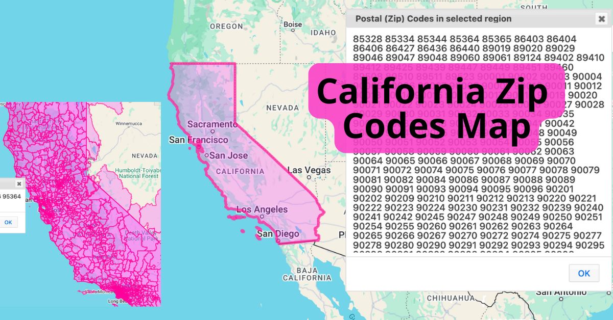
California’s varied terrain presents unique navigational challenges. While modern GPS systems are invaluable, understanding the underlying zip code structure helps in conceptualizing distances and regional transitions. For instance, knowing the zip code for Yosemite Valley (e.g., 95389) gives a precise starting point for exploring Yosemite National Park’s vast wilderness, helping travelers understand its proximity to nearby towns or other park entrances. Similarly, distinguishing between a San Francisco zip code (like 941xx) and an Oakland zip code (like 946xx) not only clarifies their physical separation across San Francisco Bay but also informs decisions about ferry schedules or bridge tolls. Zip codes can implicitly guide expectations about local climate, topography, and the type of experiences available.
Enhancing Accommodation Searches
One of the most practical applications of zip codes for travelers is in booking accommodation. Online travel agencies and hotel websites invariably allow filtering by zip code. This feature is crucial for finding hotels not just in a city, but in a specific neighborhood that aligns with a traveler’s interests or budget. If you wish to stay close to the beaches of Santa Monica (904xx) or within walking distance of Disneyland in Anaheim (928xx), entering the precise zip code will yield far more relevant results than a general city search. It helps travelers assess proximity to public transport, dining options, and local attractions, ultimately leading to a more satisfying and convenient stay.
Exploring California’s Regions Through Their Zip Codes
To truly appreciate the geographical tapestry of California, a brief tour of its major regions, defined by their characteristic zip code ranges, offers an illuminating perspective.
Southern California (90000s – 93500s)
This region is arguably the most recognizable, with zip codes often beginning with 90, 91, 92, and 93.
- The Los Angeles area predominantly uses zip codes from 900xx to 908xx. Iconic neighborhoods like Beverly Hills (90210) and Hollywood (90028) are immediately identifiable. These codes lead travelers to world-class entertainment, shopping on Rodeo Drive, and the sprawling Universal Studios Hollywood.
- Further south, Orange County is characterized by zip codes like 926xx, 927xx, and 928xx. For example, Anaheim (92802), home to Disneyland Resort, is a prime example. This area draws visitors to theme parks, beautiful beaches like Laguna Beach, and coastal resorts.
- San Diego County typically falls within 919xx and 920xx-921xx. These codes guide tourists to the vibrant Gaslamp Quarter, the San Diego Zoo, and the stunning beaches of La Jolla.
These ranges encapsulate a diverse array of experiences, from urban exploration to beachside relaxation.
Central California (93600s – 94000s, generally)
Bridging the gap between the north and south, Central California offers a mix of agricultural heartlands and stunning coastlines.
- The Central Valley, a major agricultural region, features zip codes in the 936xx and 937xx range, with cities like Fresno (93721) serving as key hubs. While not primary tourist destinations, they are gateways to national parks.
- Along the central coast, popular tourist destinations like Santa Barbara are within the 931xx range, and San Luis Obispo uses codes like 934xx. These areas are celebrated for their charming towns, vineyards, and scenic drives along Highway 1.
- Further inland, the majestic Yosemite National Park has several associated zip codes, such as 95389 for Yosemite Valley, guiding adventurers to iconic granite cliffs and ancient sequoia groves.
Northern California (94000s – 96100s)
The northern reaches of the state are defined by a cooler climate, rugged coastlines, and a thriving tech industry.
- The San Francisco Bay Area is a dense cluster of distinctive zip codes. San Francisco itself uses 941xx, leading visitors to the Golden Gate Bridge, Alcatraz Island, and diverse neighborhoods. Across the bay, Oakland is typically 946xx, and San Jose, the heart of Silicon Valley, uses 951xx. These codes direct travelers to cultural landmarks, technological innovation hubs, and diverse culinary scenes.
- The state capital, Sacramento, is found in the 958xx range, offering historical insights into the Gold Rush era and access to the Gold Country.
- Further north, areas around Redding fall within the 960xx range, providing a gateway to volcanic landscapes like Mount Shasta and the vast wilderness of the Cascade Range.
These zip code patterns are not just random numbers; they are a geographical shorthand, enabling travelers to quickly orient themselves within California’s magnificent diversity.
Leveraging Technology for Zip Code-Powered Travel
In the modern travel landscape, technology has amplified the utility of zip codes, transforming them from mere postal identifiers into dynamic tools for exploration and personalization.
Digital Mapping and GPS Integration
Contemporary digital mapping applications, such as Google Maps or Apple Maps, leverage zip code data extensively. When you search for a destination, enter a zip code, or simply use your current location, these platforms use underlying geographical data, often tied to zip code boundaries, to provide accurate directions, estimated travel times, and points of interest. This integration makes planning routes across California’s diverse regions seamless, helping travelers navigate from the urban sprawl of Los Angeles to the serene forests of the north with precision.
Online Travel Agencies and Location-Based Searches
Online travel agencies (OTAs) and accommodation booking platforms heavily rely on zip codes to offer refined search capabilities. Travelers can filter hotels, vacation rentals, and even local experiences by entering a specific zip code, ensuring their choices are perfectly aligned with desired neighborhoods, attractions, or amenities. This granular control allows for highly personalized travel planning, ensuring visitors stay exactly where they want to be, whether it’s a boutique hotel in Napa Valley (94558) or a budget-friendly option near Downtown San Diego (92101).

Exploring Local Communities
Beyond major attractions, zip codes are invaluable for discovering the true essence of California’s local communities. Many local event calendars, community forums, and small business directories allow searches by zip code, helping travelers uncover neighborhood farmers’ markets, local festivals, unique eateries, or independent shops that might otherwise remain hidden. This localized approach allows for a deeper, more authentic travel experience, moving beyond generic tourist traps to engage with the genuine culture and daily life of California’s diverse populace.
In conclusion, while there isn’t a single “zip code for California”, understanding the state’s intricate system of postal codes is an empowering asset for any traveler. From deciphering regional divisions to fine-tuning accommodation searches and leveraging digital tools, zip codes offer a professional and insightful lens through which to explore the vast and varied wonders of the Golden State. They transform the abstract concept of a large state into a series of precisely locatable, explorable, and memorable destinations.
LifeOutOfTheBox is a participant in the Amazon Services LLC Associates Program, an affiliate advertising program designed to provide a means for sites to earn advertising fees by advertising and linking to Amazon.com. Amazon, the Amazon logo, AmazonSupply, and the AmazonSupply logo are trademarks of Amazon.com, Inc. or its affiliates. As an Amazon Associate we earn affiliate commissions from qualifying purchases.