
The geography of the United States is defined by its mighty waterways, but few junctions hold as much historical and physical significance as the meeting point of the Ohio River and the Mississippi River. This confluence, located at the southernmost tip of Illinois, stands as a testament to the power of nature and the expansion of a young nation. Understanding where these two giants collide requires a journey to the heart of the American Midwest, where the landscape transitions from rolling hills to vast, river-fed floodplains.
The Geographic Confluence at Cairo
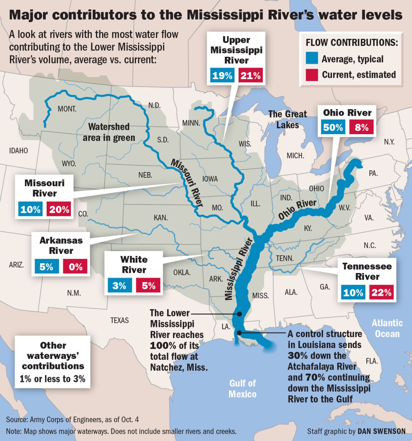
The exact spot where the Ohio and Mississippi rivers converge is situated at Cairo, a city that has long been defined by its proximity to these aquatic highways. As the Ohio River—having traveled over 980 miles from its headwaters in Pittsburgh—nears its end, it creates a stark visual contrast with the Mississippi.
The Visual Convergence
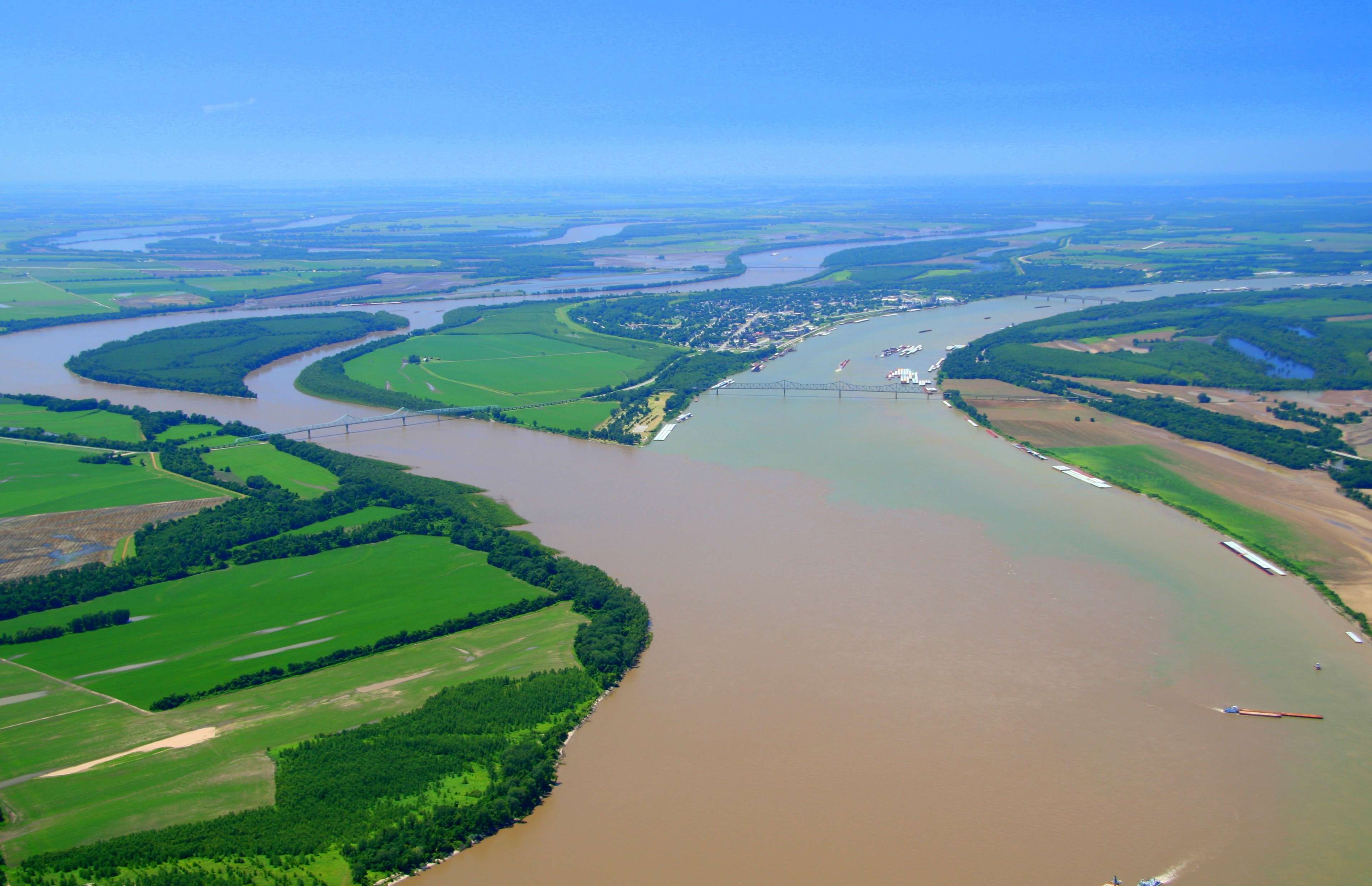
Visitors often find the visual phenomenon at the confluence to be the most striking aspect of the site. Because the two rivers carry different types of sediment and originate from distinct geographic regions, they do not mix immediately. For a significant stretch, the darker, mineral-heavy waters of the Ohio run parallel to the sediment-rich, brownish currents of the Mississippi. This “line in the water” persists for some distance, creating a natural wonder that highlights the distinct identities of the two river systems.
The Strategic Importance of Cairo
Historically, the location of Cairo, Illinois was considered one of the most strategic points in the interior of the continent. During the 19th century, this area was viewed as a potential rival to cities like St. Louis or New Orleans. The ability to control the flow of commerce coming from the Appalachian Mountains and the Great Plains made this confluence a focal point for steamboat navigation and early industrial trade.
Historical Significance and Development
The confluence has been a witness to centuries of history, serving as a gateway for exploration, warfare, and economic migration. Before the arrival of European settlers, indigenous nations recognized the immense value of this intersection, utilizing the river corridors for trade and travel across the vast continent.
The Civil War Era
During the American Civil War, the strategic importance of this juncture could not be overstated. Control of the rivers meant control of the interior of the country. Fort Defiance was established at the very tip of the confluence to guard the entry points to both rivers. From this location, the Union Army could monitor traffic and secure supplies flowing down from the north toward the Confederate strongholds further down the Mississippi.

Shaping the Landscape
The development of the region around the confluence was heavily influenced by the necessity of managing these massive bodies of water. The construction of massive levees, floodwalls, and locks has attempted to tame the rivers, though the landscape remains wild at its core. Visiting the site today allows one to observe the remnants of this era, including historical markers that detail how the river shaped the growth of the nearby states of Kentucky and Missouri, both of which border the rivers near the confluence point.
Nature and Ecology of the Confluence
Beyond its history, the meeting place of these rivers is a critical ecological hub. The bottomland forests, wetlands, and riparian zones surrounding the confluence provide a sanctuary for migratory birds and diverse aquatic life.
A Haven for Birdwatchers
The confluence is a vital stopover on the Mississippi Flyway, one of the most significant bird migration routes in the world. Each year, thousands of species, including the Bald Eagle, congregate near the water to feed and rest. The lack of heavy industrialization in the immediate vicinity of the confluence allows nature to reclaim the riverbanks, providing a quiet, contemplative atmosphere for those seeking to observe wildlife in its natural habitat.
Riparian Habitats
The seasonal flooding of the Mississippi and Ohio rivers creates unique wetlands that support species found nowhere else. The interplay of water and land creates a dynamic environment where the ecosystem is constantly evolving. From the dense stands of cottonwood and willow trees to the hidden marshes that harbor rare amphibians, the geography of the confluence serves as a living laboratory for environmental scientists and nature enthusiasts alike.
Visiting the Confluence Today
For those traveling through the Midwest, a trip to the confluence is a pilgrimage to the “veins of America.” While the city of Cairo has seen significant changes in its economic prominence over the decades, the natural beauty of the river junction remains as powerful as ever.
Experiencing the View
The best way to experience the confluence is by visiting the park areas that overlook the water. Fort Defiance State Park provides the most direct vantage point. From here, visitors can stand on the narrow strip of land that separates the two rivers and watch as the massive volume of water flows southward toward the Gulf of Mexico.
Practical Travel Tips
- Best Time to Visit: The late spring and early autumn months offer the most pleasant weather for exploring the park and surrounding riverbanks.
- Preparation: Because the confluence is located in a rural area, it is advisable to bring binoculars, comfortable walking shoes, and adequate supplies. The terrain can be uneven, and the proximity to the water means that mosquitoes and other insects can be prevalent in warmer months.
- Cultural Context: While visiting, take the time to explore the Illinois River Road or nearby historical museums that provide deeper context into how these rivers influenced the development of the Midwestern United States.
The meeting of the Ohio and the Mississippi is more than just a geographic coordinate on a map; it is a profound intersection of history, ecology, and human ambition. Whether you are a history buff interested in the fortifications of the 1800s, a birdwatcher looking for the next rare sighting, or a traveler simply captivated by the sheer scale of American nature, this confluence offers a perspective on the world that is both humbling and awe-inspiring. Standing at the water’s edge, one cannot help but feel the weight of the millions of gallons of water rushing past, carrying the legacy of a nation through the heart of the continent.
LifeOutOfTheBox is a participant in the Amazon Services LLC Associates Program, an affiliate advertising program designed to provide a means for sites to earn advertising fees by advertising and linking to Amazon.com. Amazon, the Amazon logo, AmazonSupply, and the AmazonSupply logo are trademarks of Amazon.com, Inc. or its affiliates. As an Amazon Associate we earn affiliate commissions from qualifying purchases.