
As the dry season approaches, discussions about wildfires in California inevitably arise. For many travelers, the concern is not just about the environmental impact, but also about how these natural events might affect their planned excursions. Understanding the current and potential wildfire situation is crucial for making informed decisions about travel destinations, activities, and safety within the Golden State. While the immediate thought might be of widespread destruction, the reality is that California’s vast landscape means that wildfires are often localized, impacting specific regions rather than the entire state. This article aims to provide insight into understanding the presence and impact of California wildfires from a travel perspective, focusing on how to navigate these events to ensure a safe and enjoyable trip.
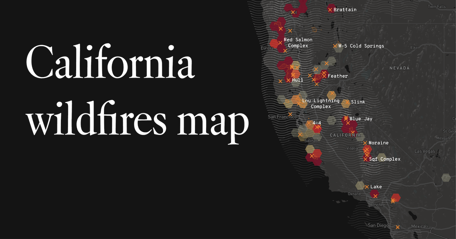
Understanding Wildfire Dynamics in California
California’s geography, climate, and vegetation create a unique environment prone to wildfires, especially during the warmer, drier months. These fires are not static events; they are dynamic, influenced by a multitude of factors that determine their ignition, spread, and eventual containment. For travelers, grasping these dynamics can help demystify the seemingly constant news cycle surrounding them.
The Contributing Factors
Several key elements contribute to California’s wildfire risk:
- Climate and Weather: The state experiences a Mediterranean climate characterized by hot, dry summers and mild, wet winters. This extended dry period desiccates vegetation, turning it into highly combustible fuel. Santa Ana winds, a phenomenon in Southern California, further exacerbate this by drying out vegetation and fanning flames, leading to rapid fire spread.
- Vegetation Types: California boasts diverse ecosystems, many of which are adapted to fire. However, dense chaparral, dry grasses, and extensive conifer forests in mountainous regions all serve as ample fuel sources. Overgrowth and accumulation of dead plant material can significantly increase fire intensity.
- Human Activity: While lightning is a natural igniter, a significant percentage of wildfires are human-caused. These can range from unattended campfires and discarded cigarettes to faulty power lines and arson. Understanding this can inform personal responsibility when visiting natural areas.
- Topography: Steep canyons and mountainous terrain can accelerate fire spread as flames move uphill more easily. Wind patterns can also be channeled through valleys, intensifying fire behavior.
Seasonal Patterns and Trends
Wildfire season in California has historically been most active from late spring through fall. However, in recent years, the season has begun to extend, with significant fires occurring in late autumn and even early winter due to prolonged drought conditions. This trend underscores the need for vigilance throughout the year, not just during the peak summer months. Monitoring historical data and current forecasts from agencies like the California Department of Forestry and Fire Protection (CAL FIRE) can provide valuable context for travel planning.
Locating and Monitoring Current Wildfires
When planning a trip to California, it’s essential to have access to reliable, up-to-date information on active wildfires and their potential impact on travel routes and destinations. Fortunately, numerous resources are available to help travelers stay informed.
Official Fire Incident Websites
Government agencies provide the most authoritative and detailed information:
- CAL FIRE: The CAL FIRE incident page offers a real-time map and list of active wildfires, including details on containment status, acres burned, and associated risks. This is an invaluable resource for checking specific regions.
- InciWeb: For incidents on federal lands, InciWeb is another critical portal, providing comprehensive information on fires managed by agencies like the U.S. Forest Service and the National Park Service.
Real-Time Mapping Tools
Beyond official government sites, several interactive mapping tools offer a visual representation of fire activity:
- Google Crisis Response: Google provides a dedicated crisis map that consolidates information from various sources, including official fire maps, making it easy to see active fires and evacuations in a familiar map interface.
- Satellite Imagery: Services like NASA’s FIRMS (Fire Information for Resource Management System) use satellite data to detect and map active fires globally, offering a broader perspective on fire occurrences.
Air Quality Monitoring
Wildfires significantly impact air quality, even hundreds of miles from the flames. Smoke can cause respiratory problems and obscure visibility. Travelers should monitor air quality indices (AQI) through resources like AirNow.gov to understand the conditions in their destination and along their travel routes. Many local news outlets and weather apps also provide real-time AQI readings.
Planning Your California Travel Amidst Wildfire Concerns
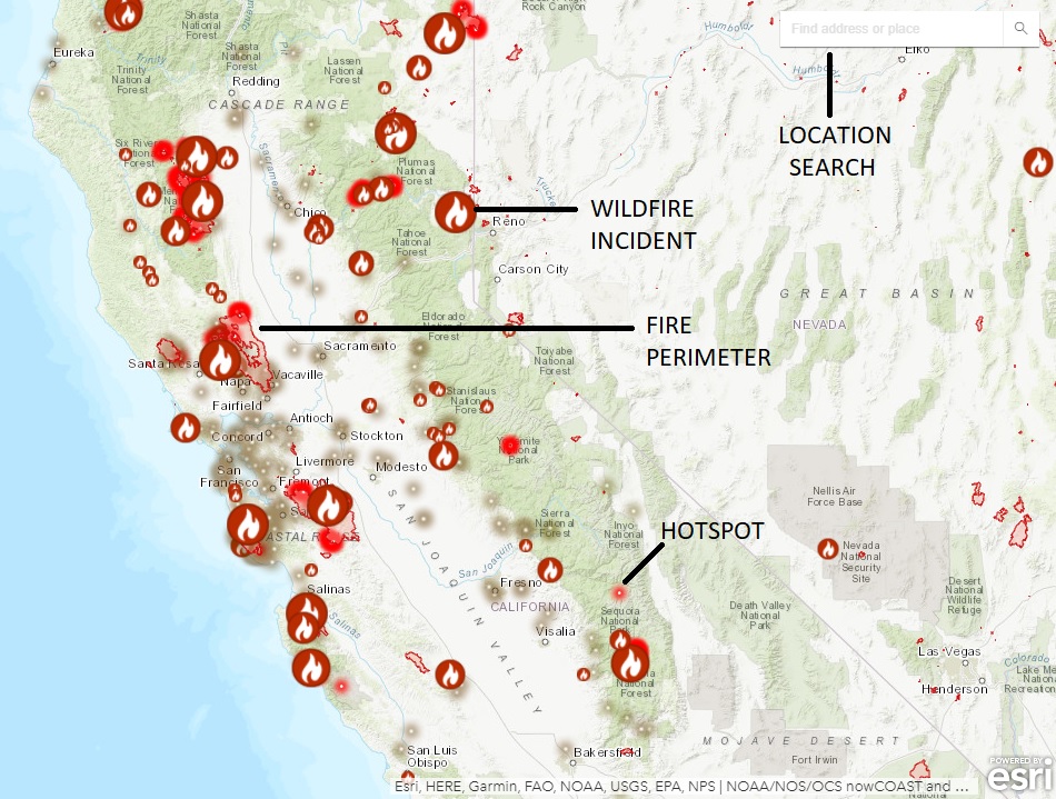
The presence of wildfires doesn’t necessarily mean canceling your California adventure. With careful planning and flexibility, it’s often possible to enjoy your trip while prioritizing safety. The key lies in understanding which areas are affected and adjusting your itinerary accordingly.
Choosing Your Destinations Wisely
California is a large and diverse state, and wildfires are typically localized. A fire in the Sierra Nevada might have no impact on your beach vacation in San Diego or your wine-tasting tour in Napa Valley.
- Coastal vs. Inland: Coastal regions are generally less prone to large-scale wildfires compared to inland forests and grasslands, though smoke can still drift.
- Urban vs. Rural: Major urban centers are less likely to be directly impacted by wildfires, though evacuations can sometimes strain resources and affect travel in surrounding areas.
- National and State Parks: Parks, especially those with extensive forested areas like Yosemite National Park or Sequoia National Park, are more susceptible. Always check park websites for closures, advisories, and fire activity before visiting. For example, during severe fire seasons, access to parts of Yosemite might be restricted or closed.
Travel Routes and Transportation
Wildfires can lead to significant disruptions in travel, particularly for road trips and flights.
- Road Closures: Major highways and local roads can be closed without notice due to fire activity, smoke, or evacuation orders. Always check real-time traffic information from Caltrans or your preferred navigation app before departing.
- Air Travel: While airports are typically designed to operate safely, smoke can cause flight delays or cancellations due to reduced visibility. Airlines will usually provide updates on any disruptions. Consider purchasing flexible flight tickets if possible.
- Alternative Plans: Have backup routes and modes of transportation in mind. If a road is closed, knowing alternative ways to reach your destination or a different region altogether can save significant stress.
Accommodation Considerations
When booking accommodations, especially in areas known to be at higher risk or near active fires, consider these points:
- Cancellation Policies: Understand the cancellation and rebooking policies of your hotel or rental property. Inquire about their procedures in case of wildfire-related emergencies or advisories.
- Proximity to Fire Zones: While booking, check the location of your accommodation relative to any known fire incidents or high-risk areas. Web-based mapping tools can be helpful here.
- Emergency Preparedness: For resorts or larger hotel complexes, inquire about their emergency evacuation plans and communication procedures.
Safety Tips for Travelers
When traveling in California, particularly during wildfire season, maintaining awareness and adhering to safety guidelines is paramount.
Staying Informed and Prepared
- Pre-Trip Research: Before departing, research the current wildfire situation and forecasts for your intended destinations. Utilize the resources mentioned earlier.
- During Your Trip: Make it a habit to check local news and official fire information daily. Many hotels provide local news channels, or you can use your mobile device.
- Sign Up for Alerts: Register for local emergency alerts in the areas you are visiting. Many counties offer alert systems via text message or email.
On-the-Ground Precautions
- Respect Evacuation Orders: If evacuation orders are issued for your area, leave immediately. Do not attempt to gather belongings or wait for further instructions. Your safety is the absolute priority.
- Be Aware of Air Quality: If smoke is present, limit outdoor activities, especially strenuous ones. Consider wearing an N95 mask if you need to be outdoors for extended periods. Individuals with respiratory conditions should take extra precautions.
- Driving Safety: When driving through areas affected by smoke or fire, reduce your speed, turn on your headlights, and be prepared for sudden stops or detours. Follow instructions from emergency personnel and law enforcement.
- Campfire Safety: If you are camping, always follow strict campfire regulations. Ensure fires are completely extinguished before leaving them unattended. Many areas have fire bans during dry periods, which must be respected.

Emergency Preparedness Kits
While not specific to wildfire travel, having a basic emergency kit in your vehicle can be beneficial:
- Water and non-perishable food
- First-aid supplies
- Flashlight and extra batteries
- Charged portable power bank for your phone
- Local maps (in case GPS is unavailable)
- Essential medications
By understanding the nature of California wildfires and utilizing the available resources, travelers can confidently plan and enjoy their journeys, remaining safe and informed throughout their visit to the Golden State. The key is proactive research, constant vigilance, and flexibility in itinerary planning.
LifeOutOfTheBox is a participant in the Amazon Services LLC Associates Program, an affiliate advertising program designed to provide a means for sites to earn advertising fees by advertising and linking to Amazon.com. Amazon, the Amazon logo, AmazonSupply, and the AmazonSupply logo are trademarks of Amazon.com, Inc. or its affiliates. As an Amazon Associate we earn affiliate commissions from qualifying purchases.