
Nestled in the sun-drenched Southwestern region of the United States, New Mexico occupies a distinct and storied place on the map. Known as the “Land of Enchantment,” this state is characterized by its high-desert plateaus, jagged mountain ranges, and a cultural tapestry woven from Native American, Spanish, and Anglo influences. To locate it on a map of the country, one must look toward the southern border, where it serves as a gateway between the American West and the northern reaches of Mexico.
Geographic Coordinates and Regional Positioning
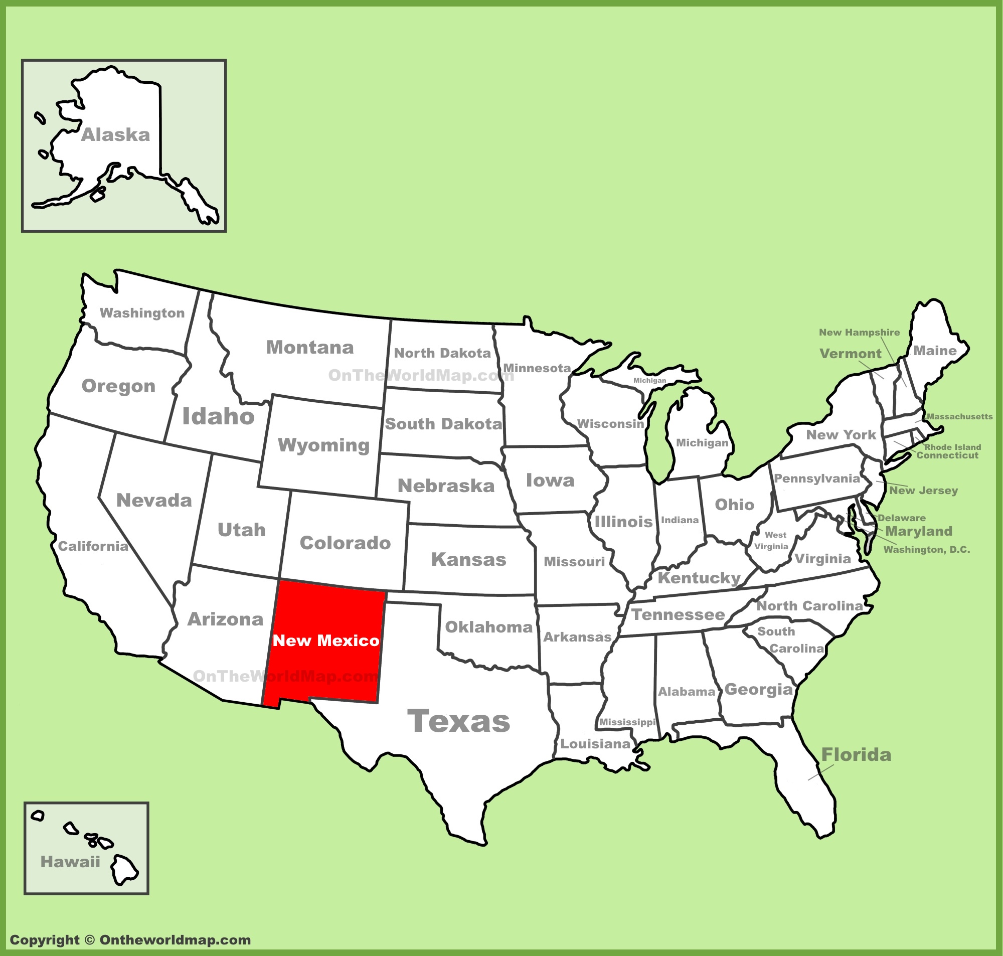
New Mexico is geographically situated in the southwestern quadrant of the country. It is a landlocked state that shares its borders with four other American states: Colorado to the north, Oklahoma and Texas to the east, and Arizona to the west. To the south, it shares a significant international border with the Mexican states of Chihuahua and Sonora.
The Four Corners Monument
One of the most unique geographic features involving New Mexico is the Four Corners Monument. This is the only point in the United States where four states meet at a single location. Standing at the intersection of New Mexico, Arizona, Colorado, and Utah, visitors can physically place their hands and feet in four states simultaneously. This site serves as a vital anchor point for travelers navigating the rugged terrain of the American Southwest.
Terrain and Elevation
While many outsiders associate the state primarily with arid deserts, the geography of New Mexico is incredibly diverse. The northern portion of the state is dominated by the southern reaches of the Rocky Mountains, featuring high-altitude peaks and lush, alpine forests. As one moves south, the landscape transitions into the vast Chihuahuan Desert, punctuated by dramatic lava flows, white gypsum dunes, and subterranean cave systems.
Major Urban Centers and Strategic Location
Understanding New Mexico on the map requires identifying its primary hubs, which often serve as the starting points for regional exploration. These cities are not just administrative centers but are deeply rooted in the history of the region.
Albuquerque: The Heart of the State
Albuquerque is centrally located within the state, acting as the primary transportation hub. Situated along the Rio Grande, it is the most populous city in the state. Travelers frequently use Albuquerque as a base camp to explore nearby attractions such as Petroglyph National Monument or to journey north toward the mountains. Its location at the intersection of major interstates makes it the logical “middle” of the state map.
Santa Fe: The Cultural Epicenter
Located roughly an hour’s drive north of Albuquerque, Santa Fe sits at the foothills of the Sangre de Cristo Mountains. As the capital city, it represents the heart of New Mexico’s cultural and artistic identity. The city’s unique position, nestled between the arid lowlands and the high peaks, creates a microclimate that has attracted artists and visionaries for over a century.
Southern Gateways
In the southern part of the state, Las Cruces serves as a vital economic center near the border. This area is defined by the Organ Mountains, which loom over the landscape. Further east, cities like Carlsbad provide access to some of the most profound natural wonders in the country, specifically Carlsbad Caverns National Park.
Navigating the Land of Enchantment
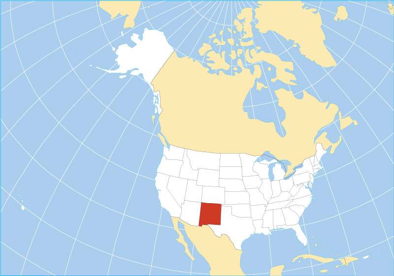
Traveling through New Mexico requires an appreciation for scale. Because it is the fifth-largest state by area in the United States, the distance between landmarks can be substantial. Understanding the layout of the state map is essential for anyone planning an itinerary that spans from the northern alpine regions to the southern desert plains.
The Influence of the Rio Grande
The Rio Grande acts as the state’s primary north-south artery. Historically, this river provided the lifeblood for civilizations, including the various Pueblo communities that have inhabited the valley for centuries. Today, most of the state’s population density remains clustered along this fertile corridor, making the river a defining feature on any physical map.
Routes to Remember
When traversing the state, travelers rely on key routes that slice through its diverse ecosystems. Interstate 25 runs vertically, connecting the northern mountain towns to the southern borderlands. Interstate 40 cuts horizontally, tracing the historic path of Route 66, which remains a nostalgic and significant cultural route for those traveling across the American Southwest.
Natural Landmarks and Protected Lands
The map of New Mexico is dotted with iconic locations that draw millions of visitors annually. These landmarks are spread across the state’s various bioregions, emphasizing why its geography is so globally renowned.
White Sands National Park
Situated in the Tularosa Basin, White Sands National Park is one of the most recognizable points on the map. The vast field of white gypsum sand dunes is a surreal sight that contrasts sharply with the surrounding Sacramento Mountains. It serves as a stark reminder of the geological violence and beauty that shaped this part of the country.
Taos and the Northern Highlands
Heading north, Taos sits in a high-desert plateau known for its spiritual resonance and the historic Taos Pueblo. This area is also famous for the Rio Grande Gorge Bridge, which offers a vertigo-inducing look into the deep fissures carved by the river over millennia.
Gila Wilderness
In the southwestern corner of the state lies the Gila Wilderness, the first designated wilderness area in the world. This rugged, mountainous terrain remains largely untouched, offering a glimpse into what New Mexico looked like before widespread settlement. It is a critical region for those interested in the wild, untamed nature that the United States works hard to preserve.
Conclusion: A State Defined by Its Position
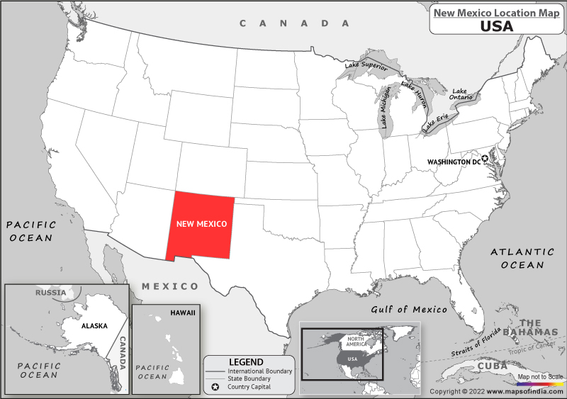
New Mexico holds a position on the map that is as complex as its history. It is a place where lines on a map—state borders and national boundaries—seem to blur against the vast, open horizon. Whether you are navigating the high-altitude trails near Santa Fe, exploring the cavernous depths of Carlsbad Caverns National Park, or standing at the intersection of the Four Corners Monument, you are engaging with a landscape that defines the essence of the American Southwest. By understanding where the state sits in relation to its neighbors and its own unique geography, travelers can better appreciate the depth, scale, and enduring beauty of this exceptional part of the United States.
LifeOutOfTheBox is a participant in the Amazon Services LLC Associates Program, an affiliate advertising program designed to provide a means for sites to earn advertising fees by advertising and linking to Amazon.com. Amazon, the Amazon logo, AmazonSupply, and the AmazonSupply logo are trademarks of Amazon.com, Inc. or its affiliates. As an Amazon Associate we earn affiliate commissions from qualifying purchases.